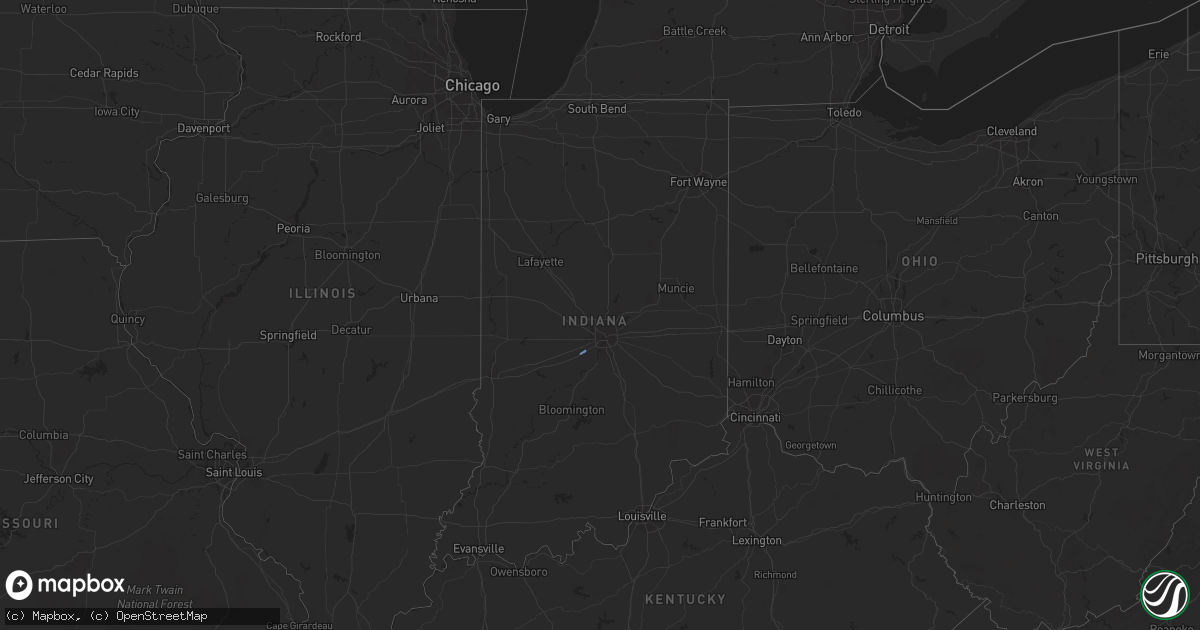
Hail Map in Indiana on April 11, 2022
Get this storm
April 11 map
$229
one time, instant access
Download today. No call, no setup
Keep the $229
Bought the map and want the full workflow? Apply the entire $229 to a subscription within 7 days. None of it is wasted.
Every map, not just this one
This buys you this map. Subscription and you get every map we run, in the markets you choose from a few cities to whole states to nationwide. Plus real-time alerts the moment a storm fires.
Contact data
Name, contact info, occupancy, even credit band for addresses in the footprint. You go from where it hit to who to call.
Become the source they trust
Unlimited branding weather history reports on demand. You already have the documented answer ready for the property owner, and you are the one who showed up with it.
Property data and RoofTrace estimates
Pull up any address you have got, its value and the exact code rules for that jurisdiction, straight from One Click Code. Then RoofTrace estimates the squares, pitch, and roof value, priced the way you price.
Storm reports in Indiana
Indiana
| Date | Description |
|---|---|
| 04/11/20229:54 AM CDT | Asos station kind indianapolis. |
| 04/11/20225:55 AM CDT | At 1054 AM EDT, a severe thunderstorm was located near Southport, or near Indianapolis, moving northeast at 40 mph. HAZARD...60 mph wind gusts. SOURCE...Radar indicated. IMPACT...Expect damage to roofs, siding, and trees. This severe thunderstorm will be near... Southport and Monument Circle around 1100 AM EDT. Beech Grove, Rocky Ripple, Wynnedale, Spring Hill and Indiana State Fairgrounds around 1105 AM EDT. Warren Park and Broad Ripple around 1110 AM EDT.Other locations in the path of this severe thunderstorm includeCastleton, Cumberland, New Palestine, Geist Reservoir, Indianapolis,Lawrence, McCordsville, Spring Lake, Greenfield, Fortville andIngalls. |
All States Impacted by Hail Map on April 11, 2022
Cities Impacted by Hail Map on April 11, 2022
- Atoka, OK
- Ashland, MS
- Ripley, MS
- Charleston, AR
- Red Banks, MS
- McCrory, AR
- Augusta, AR
- Fort Smith, AR
- Beebe, AR
- Coalgate, OK
- Lane, OK
- Branch, AR
- Lavaca, AR
- Moro, AR
- Marianna, AR
- Judsonia, AR
- Vidor, TX
- Beaumont, TX
- Searcy, AR
- Bald Knob, AR
- Des Arc, AR
- Springfield, AR
- Hot Springs National Park, AR
- Royal, AR
- Benton, AR
- Lonsdale, AR
- Mountain Pine, AR
- Mabelvale, AR
- Hot Springs Village, AR
- Alexander, AR
- Bryant, AR
- Poteau, OK
- Wister, OK
- Hodgen, OK
- Heavener, OK
- Talihina, OK
- Conway, AR
- Mayflower, AR
- Barling, AR
- Lamar, AR
- Subiaco, AR
- Dardanelle, AR
- Spiro, OK
- Paris, AR
- Delaware, AR
- Muldrow, OK
- Alma, AR
- Ratcliff, AR
- Van Buren, AR
- New Blaine, AR
- Russellville, AR
- Pocola, OK
- Ozark, AR
- Scranton, AR
- Arkoma, OK
- Knoxville, AR
- Plumerville, AR
- Solgohachia, AR
- Garner, AR
- Morrilton, AR
- Lonoke, AR
- North Little Rock, AR
- Rose Bud, AR
- Austin, AR
- Damascus, AR
- Bee Branch, AR
- Carlisle, AR
- El Paso, AR
- Adona, AR
- Higginson, AR
- Mount Vernon, AR
- Enola, AR
- Clinton, AR
- Houston, AR
- Vilonia, AR
- Romance, AR
- McRae, AR
- Wooster, AR
- Center Ridge, AR
- Kensett, AR
- Jacksonville, AR
- Casa, AR
- Quitman, AR
- Bigelow, AR
- Hattieville, AR
- Palestine, AR
- Cleveland, AR
- Perry, AR
- Griffithville, AR
- Brinkley, AR
- Colt, AR
- Cabot, AR
- Atkins, AR
- Hazen, AR
- Sherwood, AR
- Wheatley, AR
- Ward, AR
- Perryville, AR
- Cotton Plant, AR
- Greenbrier, AR
- Biscoe, AR
- Forrest City, AR
- Hickory Plains, AR
- McCaskill, AR
- Lamar, MS
- Holly Springs, MS
- Wilburton, OK
- Shady Point, OK
- Trezevant, TN
- Huntingdon, TN
- McKenzie, TN
- Tupelo, OK
- Stringtown, OK
- Antlers, OK
- Daisy, OK
- Clayton, OK
- Snow, OK
- Mccurtain, OK
- Widener, AR
- Dover, AR
- London, AR
- Keota, OK
- Hartman, AR
- Pottsville, AR
- Roland, OK
- Bokoshe, OK
- Milburn, OK
- Wapanucka, OK
- Pittsburg, OK
- Fairland, OK
- Tishomingo, OK
- Centrahoma, OK
- Stonewall, OK
- Hector, AR
- Pelsor, AR
- Bragg City, MO
- Kennett, MO
- Wardell, MO
- Senath, MO
- Hayti, MO
- Portageville, MO
- Union City, TN
- Hickman, KY
- McEwen, TN
- Waverly, TN
- Hughes, AR
- Rudy, AR
- Byhalia, MS
- Falkner, MS
- Walnut, MS
- Corinth, MS
- Rienzi, MS
- Bauxite, AR
- Wardville, OK
- Pierce City, MO
- Robinsonville, MS
- New Johnsonville, TN
- Altus, AR
- Little Rock, AR
- Holcomb, MO
- Hurricane Mills, TN
- Monett, MO
- Brickeys, AR
- Clarksville, AR
- Orange, TX
- Michigan City, MS
- Tiplersville, MS
- Booneville, MS
- Cameron, OK
- Hernando, MS
- Stanton, TN
- Somerville, TN
- Heth, AR
- Wynne, AR
- Olive Branch, MS
- Lake Cormorant, MS
- Hollow Rock, TN
- Bruceton, TN
- Nesbit, MS
- Indianapolis, IN
- Plainfield, IN
- Mooresville, IN
- Little Rock Air Force Base, AR
- Cecil, AR
- Coal Hill, AR
- Mountainburg, AR
- Paron, AR
- Jerusalem, AR
- Aubrey, AR
- Afton, OK
- Wyandotte, OK
- Howe, OK
- Stilwell, OK


