Hail Map in Bartlesville, OK on April 9, 2012
Get this storm
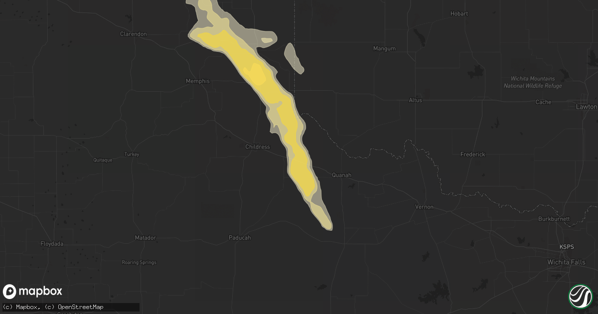
April 9 map
$229
one time, instant access
Download today. No call, no setup
Keep the $229
Bought the map and want the full workflow? Apply the entire $229 to a subscription within 7 days. None of it is wasted.
Every map, not just this one
This buys you this map. Subscription and you get every map we run, in the markets you choose from a few cities to whole states to nationwide. Plus real-time alerts the moment a storm fires.
Contact data
Name, contact info, occupancy, even credit band for addresses in the footprint. You go from where it hit to who to call.
Become the source they trust
Unlimited branding weather history reports on demand. You already have the documented answer ready for the property owner, and you are the one who showed up with it.
Property data and RoofTrace estimates
Pull up any address you have got, its value and the exact code rules for that jurisdiction, straight from One Click Code. Then RoofTrace estimates the squares, pitch, and roof value, priced the way you price.
Storm reports in Bartlesville, OK
Bartlesville, OK
| Date | Description |
|---|---|
| 04/08/20129:00 PM CDT | Greater than golf ball size hail reported on the grounds at woolaroc. Public report retrieved via washington county emergency management social media. Time estimated vi |
| 04/08/20128:50 PM CDT | Large hail likely greater than a quarter caused significant damage to home windows and to a vehicle in okesa. Public report retrieved via washington county emergency ma |
| 04/08/20128:40 PM CDT | Nine miles due west of bartlesville. |
All States Impacted by Hail Map on April 9, 2012
All Cities Impacted by Hail Map on April 9, 2012
- Lovington, NM
- Hobbs, NM
- Littlefield, TX
- Headrick, OK
- Lubbock, TX
- Morton, TX
- Milnesand, NM
- Tatum, NM
- Plains, TX
- Burden, KS
- Woodward, OK
- Fort Davis, TX
- Quanah, TX
- Dodson, TX
- Crowell, TX
- Hedley, TX
- Childress, TX
- Hollis, OK
- Lelia Lake, TX
- Quail, TX
- Wellington, TX
- Mclean, TX
- Coffeyville, KS
- S Coffeyville, OK
- Welch, OK
- Edna, KS
- Liberty, KS
- Cherryvale, KS
- Ochelata, OK
- Ramona, OK
- Mentone, TX
- Pecos, TX
- Seminole, TX
- Fort Supply, OK
- Sharon, OK
- Fort Stockton, TX
- Sierra Blanca, TX
- Sudan, TX
- Vici, OK
- Camargo, OK
- Cedar Vale, KS
- Amarillo, TX
- Floydada, TX
- Pampa, TX
- Mobeetie, TX
- Barnsdall, OK
- Pawhuska, OK
- Bartlesville, OK
- Collinsville, OK
- Vera, OK
- Balmorhea, TX
- Eldorado, OK
- Pyote, TX
- Barstow, TX
- Arkansas City, KS
- Channing, TX
- Seiling, OK
- Mutual, OK
- Buffalo, OK
- Valley View, TX
- Gainesville, TX
- Muenster, TX
- Lindsay, TX
- Ackerly, TX
- Lamesa, TX
- El Dorado, KS
- Jal, NM
- Rock, KS
- Atlanta, KS
- Custer City, OK
- Arapaho, OK
- Clinton, OK
- Mooreland, OK
- Butler, OK
- Arnett, OK
- Leedey, OK
- Taloga, OK
- Corn, OK
- Gould, OK
- Denver City, TX
- Laverne, OK
- Cambridge, KS
- Oologah, OK
- Dexter, KS
- Douglass, KS
- Sedan, KS
- Skiatook, OK
- Winfield, KS
- Amherst, TX
- Earth, TX
- Slaton, TX
- Pep, NM
- Paducah, TX
- Piedmont, KS
- Altus, OK
- Mountain Park, OK
- Salt Flat, TX
- Ransom Canyon, TX
- Wheeler, TX
- Independence, KS
- Mound Valley, KS
- Rosston, OK
- Bluejacket, OK
- Panhandle, TX
- Gail, TX
- Winston, NM
- Marathon, TX
- Alpine, TX
- Shamrock, TX
- Carlsbad, NM
- Borger, TX
- Brownfield, TX
- Kress, TX
- Henrietta, TX
- Coyanosa, TX
- Fredonia, KS
- Waurika, OK
- Talala, OK
- Meadow, TX
- May, OK
- Tahoka, TX
- Cloudcroft, NM
- Fargo, OK
- Lockney, TX
- Eureka, KS
- Blair, OK
- Anton, TX
- Gate, OK
- Elida, NM
- Fort Hancock, TX
- Byers, TX
- Petrolia, TX
- Miami, TX


