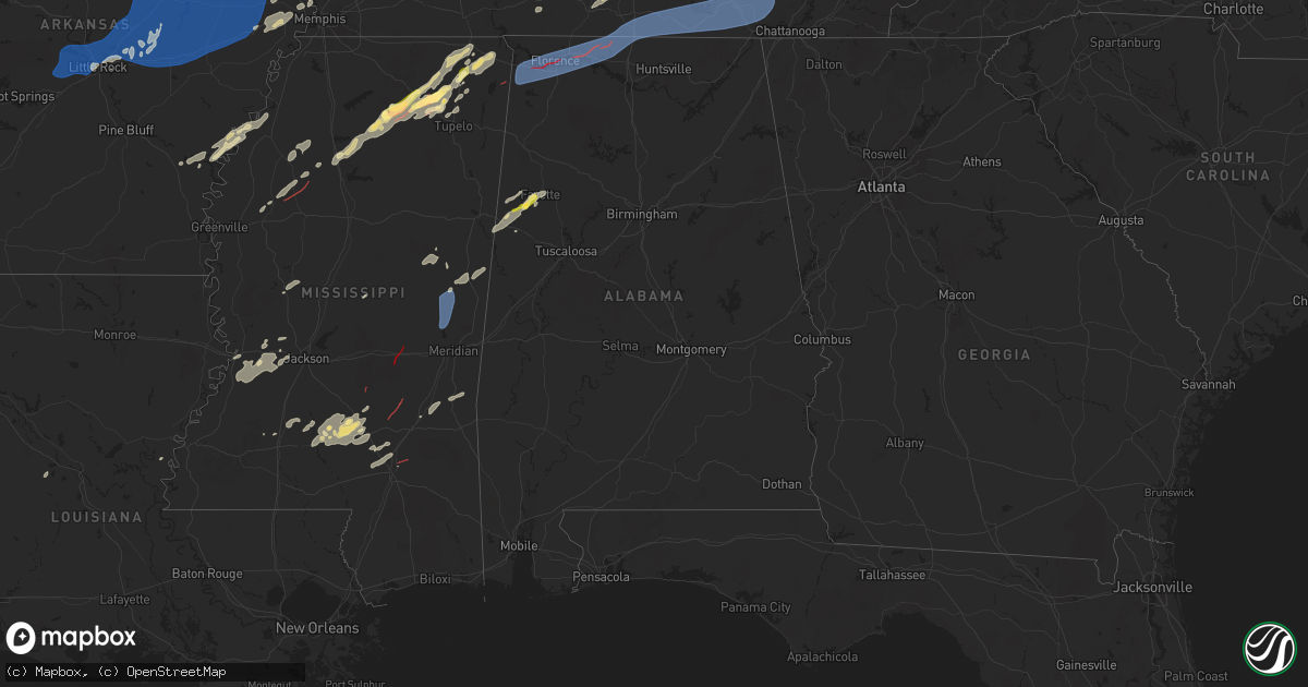
Hail Map in Alabama on April 5, 2025
Get this storm
April 5 map
$229
one time, instant access
Download today. No call, no setup
Keep the $229
Bought the map and want the full workflow? Apply the entire $229 to a subscription within 7 days. None of it is wasted.
Every map, not just this one
This buys you this map. Subscription and you get every map we run, in the markets you choose from a few cities to whole states to nationwide. Plus real-time alerts the moment a storm fires.
Contact data
Name, contact info, occupancy, even credit band for addresses in the footprint. You go from where it hit to who to call.
Become the source they trust
Unlimited branding weather history reports on demand. You already have the documented answer ready for the property owner, and you are the one who showed up with it.
Property data and RoofTrace estimates
Pull up any address you have got, its value and the exact code rules for that jurisdiction, straight from One Click Code. Then RoofTrace estimates the squares, pitch, and roof value, priced the way you price.
Storm reports in Alabama
Alabama
| Date | Description |
|---|---|
| 04/05/20251:58 AM CDT | Quarter size hail reported in millport. |
| 04/05/20251:40 AM CDT | Numerous trees downed and structure damage - time estimated from radar. |
| 04/05/202512:54 AM CDT | Tree and powerline downed. |
| 04/05/202512:52 AM CDT | Power line snapped in half. |
| 04/04/202511:15 PM CDT | A tree was reported down at the intersection of lester road and highway 99. |
| 04/04/202511:13 PM CDT | A tree was reported down near the intersection of cotton belt road and hardaway loop. |
| 04/04/202511:06 PM CDT | Tree down blocking westbound lane near cr 52 / cr 156. |
| 04/04/202511:06 PM CDT | Trees down along cr 207. |
| 04/04/202511:06 PM CDT | Tree down blocking roadway along cr 52. |
| 04/04/202511:06 PM CDT | Tree down in the roadway at this location. |
| 04/04/202511:00 PM CDT | Tree down in roadway on tracey lane. |
| 04/04/202511:00 PM CDT | Tree down in roadway near highway 72/ cr 113. |
| 04/04/202511:00 PM CDT | Trees were reported down in the anderson community on social media platform. |
| 04/04/202510:58 PM CDT | Tree down block both lanes at cr 107/cr 31. |
| 04/04/202510:55 PM CDT | Power lines down over roadway along cr 92. |
| 04/04/202510:54 PM CDT | Trees were reported down at this location on cr 110. |
| 04/04/202510:48 PM CDT | Tree down across both lanes at this location. |
| 04/04/202510:48 PM CDT | Tree downed - 2600 block avalon ave. |
| 04/04/202510:47 PM CDT | Multiple trees down along cr 33. |
| 04/04/202510:47 PM CDT | Multiple trees were reported down at this location on cr 33. |
| 04/04/202510:46 PM CDT | Tree downed - 900 block frankfort rd. |
| 04/04/202510:46 PM CDT | A tree was reported down across the road at this location on river road. |
| 04/04/202510:46 PM CDT | A large tree was reported down at this location at the intersection of cr 33 and malibu lane blocking the highway. |
| 04/04/202510:44 PM CDT | Three trees down across both lanes of traffic near the intersection of aqua vista drive and cr 171. |
| 04/04/202510:44 PM CDT | Tree down at this location along cr 111. |
| 04/04/202510:43 PM CDT | Trees down along cr 33. |
| 04/04/202510:43 PM CDT | Tree down in roadway and at residence along malibu lane. |
| 04/04/202510:42 PM CDT | Tree down blocking both lanes at this location. |
| 04/04/202510:42 PM CDT | Minor roof damage to house. |
| 04/04/202510:42 PM CDT | Tree down at this location on cr 33. |
| 04/04/202510:42 PM CDT | Trees were reported down blocking the road and power lines were reported down as well. |
| 04/04/202510:42 PM CDT | Two trees down and roof damaged reported at this location along cr 111. |
| 04/04/202510:42 PM CDT | Tree down across both lanes at cr 107 and east forest dr. |
| 04/04/202510:42 PM CDT | Trees blocking road... Powerlines down along beach hollow rd. |
| 04/04/202510:41 PM CDT | Tree downed 900 block baker street. |
| 04/04/202510:39 PM CDT | Trees and powerlines were reported down on eagle drive covering the road. |
| 04/04/202510:39 PM CDT | A tree was reported down at the intersection of mount pleasant road and county line road. |
| 04/04/202510:38 PM CDT | A tree was reported down at the intersection of 2nd street and ledlow lane. |
| 04/04/202510:37 PM CDT | Corrects previous non-tstm wnd gst report from 2 e muscle shoals. Asos station kmsl muscle shoal. |
| 04/04/202510:37 PM CDT | A power line was reported down at the intersection of eastlake drive and donnegan drive. |
| 04/04/202510:37 PM CDT | A tree was reported down on harding avenue. |
| 04/04/202510:34 PM CDT | Corrects previous tstm wnd dmg report from 1 ese muscle shoals. Tree downed - 2600 block avalon ave. |
| 04/04/202510:33 PM CDT | A tree was reported down on e 6th street at this location. |
| 04/04/202510:33 PM CDT | Power pole was reported leaning or down at this location. |
| 04/04/202510:32 PM CDT | Corrects previous tstm wnd dmg report from 2 se sheffield. Tree downed 900 block baker street. |
| 04/04/202510:31 PM CDT | A power pole was reported down in the yard at this location of ne 15th avenue. |
| 04/04/202510:31 PM CDT | Multiple trees into power pole near cp 52 and co 156. |
| 04/04/202510:31 PM CDT | Tree down along w 2nd st. |
| 04/04/202510:30 PM CDT | 5 trees down and 40 feet of fence heavily damaged |
| 04/04/202510:30 PM CDT | Tree blocking road along se 20th st. |
| 04/04/202510:30 PM CDT | Tree down on house along poplar st. |
| 04/04/202510:30 PM CDT | A power pole was reported down at this location on 6th street. |
| 04/04/202510:30 PM CDT | Tree downed - 1000 block sw 14th st. |
| 04/04/202510:30 PM CDT | Corrects previous tstm wnd dmg report from 1 sw tuscumbia. Tree downed - 900 block frankfort rd. |
| 04/04/202510:30 PM CDT | Pole downed - near south jefferson st and w 6th ave. |
| 04/04/202510:29 PM CDT | Tree downed - 100 block meadow hill rd. |
| 04/04/202510:28 PM CDT | Tree downed - 1000 block cave st. |
| 04/04/202510:27 PM CDT | A tree and some power poles were reported down at this location on michigan avenue. |
| 04/04/202510:26 PM CDT | A tree was reported down at this location near the intersection of s columbia avenue and e habler strett. |
| 04/04/202510:26 PM CDT | A tree was reported down on 14th avenue at this location. |
| 04/04/202510:25 PM CDT | A tree... A power pole... And power lines were reported down at the intersection of oak hill avenue and meadow hill road. |
| 04/04/202510:20 PM CDT | A tree was reported down on reid avenue. |
| 04/04/202510:17 PM CDT | A tree was reported down onto power lines at this location on florida lane. |
| 04/04/202510:08 PM CDT | A tree was reported at this location on mulberry lane. |
| 04/04/20259:58 PM CDT | Trees were reported down near the intersection of cr 132 and cr 87. |
| 04/04/20259:56 PM CDT | Trees were reported down at this location at the intersection of cr 192 and cr 87. |
All States Impacted by Hail Map on April 5, 2025
Cities Impacted by Hail Map on April 5, 2025
- Uvalde, TX
- Knippa, TX
- Big Lake, TX
- Garden City, TX
- Sterling City, TX
- Colorado City, TX
- Snyder, TX
- Hermleigh, TX
- Roscoe, TX
- Loraine, TX
- Nashville, AR
- Lockesburg, AR
- Mineral Springs, AR
- Benton, AR
- Alexander, AR
- Little Rock, AR
- Paron, AR
- Roland, AR
- Maumelle, AR
- North Little Rock, AR
- Sherwood, AR
- Jacksonville, AR
- Mayflower, AR
- Little Rock Air Force Base, AR
- El Paso, AR
- Vilonia, AR
- Austin, AR
- Cabot, AR
- Lonoke, AR
- Ward, AR
- Beebe, AR
- Scott, AR
- Prairie Hill, TX
- Mount Calm, TX
- Axtell, TX
- Mart, TX
- Carlisle, AR
- Des Arc, AR
- Hickory Plains, AR
- McRae, AR
- Searcy, AR
- Romance, AR
- Hazen, AR
- Garner, AR
- Griffithville, AR
- Russell, AR
- Higginson, AR
- Kensett, AR
- Judsonia, AR
- Bald Knob, AR
- Cotton Plant, AR
- Augusta, AR
- Biscoe, AR
- De Valls Bluff, AR
- Corsicana, TX
- Purdon, TX
- Newport, AR
- McCrory, AR
- Brinkley, AR
- Powell, TX
- Chatfield, TX
- Rice, TX
- Beedeville, AR
- Hickory Ridge, AR
- Kemp, TX
- Kaufman, TX
- Bradford, AR
- Pangburn, AR
- Letona, AR
- Pleasant Plains, AR
- Heber Springs, AR
- Oil Trough, AR
- Thida, AR
- Moro, AR
- Wheatley, AR
- Goodwin, AR
- Palestine, AR
- Wynne, AR
- Colt, AR
- Hunter, AR
- Forrest City, AR
- Cherry Valley, AR
- Widener, AR
- Amagon, AR
- Fisher, AR
- Harrisburg, AR
- Weiner, AR
- Cash, AR
- Parkin, AR
- Heth, AR
- Joiner, AR
- Tyronza, AR
- Turrell, AR
- Earle, AR
- Proctor, AR
- Crawfordsville, AR
- Gilmore, AR
- Marion, AR
- Huntsville, TX
- Frenchmans Bayou, AR
- Wilson, AR
- Bassett, AR
- Henning, TN
- Dumas, AR
- Groveton, TX
- Cedar Grove, TN
- Brownsville, TN
- Watson, AR
- Lavinia, TN
- Jackson, TN
- Tichnor, AR
- Bells, TN
- Huntingdon, TN
- Timpson, TX
- Snow Lake, AR
- Lufkin, TX
- Humboldt, TN
- Camden, TN
- Crumrod, AR
- Mellwood, AR
- Gadsden, TN
- Hallsville, TX
- Medina, TN
- Milan, TN
- Oakfield, TN
- Alligator, MS
- Harleton, TX
- Jefferson, TX
- Kiahsville, WV
- Nacogdoches, TX
- Chireno, TX
- Dunlow, WV
- Ranger, WV
- Harts, WV
- Trenton, TN
- Duncan, MS
- Clarksdale, MS
- Eva, TN
- Willis, TX
- Buena Vista, TN
- Holladay, TN
- Spurlockville, WV
- Coldspring, TX
- Cleveland, TX
- Wildersville, TN
- Westport, TN
- Lexington, TN
- Yuma, TN
- Alkol, WV
- Julian, WV
- Sugar Tree, TN
- Bruceton, TN
- New Johnsonville, TN
- Waverly, TN
- Parsons, TN
- Danville, WV
- New Waverly, TX
- Alum Creek, WV
- Sumerco, WV
- Nellis, WV
- Ashford, WV
- Wiergate, TX
- Hurricane Mills, TN
- Belle, WV
- Dickson, TN
- McEwen, TN
- Burkeville, TX
- Charleston, WV
- Winifrede, WV
- Cabin Creek, WV
- Hernshaw, WV
- Houston, TX
- Bellaire, TX
- Ashdown, AR
- Cedar Grove, WV
- Mammoth, WV
- Diboll, TX
- Charlotte, TN
- White Bluff, TN
- Blount, WV
- Burns, TN
- Corrigan, TX
- Shaw, MS
- Indianola, MS
- Tutwiler, MS
- Pond Gap, WV
- Fairview, TN
- Kingston Springs, TN
- Ashland City, TN
- Doddsville, MS
- Bickmore, WV
- Summersville, WV
- Indore, WV
- Clay, WV
- Swiss, WV
- Dixie, WV
- Sumner, MS
- Minter City, MS
- Ruleville, MS
- Pegram, TN
- Belva, WV
- Lizemores, WV
- White House, TN
- Cross Plains, TN
- Schlater, MS
- Philipp, MS
- Nashville, TN
- Cascilla, MS
- Charleston, MS
- Madison, TN
- Goodlettsville, TN
- Dundee, MS
- Old Hickory, TN
- Hendersonville, TN
- Lambert, MS
- Bon Aqua, TN
- Whites Creek, TN
- Joelton, TN
- Antioch, TN
- Brentwood, TN
- Lebanon, TN
- Hermitage, TN
- Mount Juliet, TN
- Bethpage, TN
- Gallatin, TN
- Portland, TN
- Cottontown, TN
- La Vergne, TN
- Castalian Springs, TN
- Westmoreland, TN
- Tioga, WV
- Tillatoba, MS
- Scobey, MS
- Camden On Gauley, WV
- Cowen, WV
- Calvin, WV
- Lafayette, TN
- Hartsville, TN
- Dixon Springs, TN
- Coffeeville, MS
- Oakland, MS
- Water Valley, MS
- Dayton, TX
- Oxford, MS
- Thaxton, MS
- Pontotoc, MS
- Etta, MS
- Huttonsville, WV
- Durbin, WV
- Myrtle, MS
- New Albany, MS
- Evans, LA
- Paris, MS
- Newton, TX
- Ripley, MS
- Blue Mountain, MS
- Leesville, LA
- Deridder, LA
- Dumas, MS
- Rienzi, MS
- Walnut, MS
- Ecru, MS
- Blue Springs, MS
- Guntown, MS
- Baldwyn, MS
- Corinth, MS
- Booneville, MS
- Sunflower, MS
- Glen, MS
- Burnsville, MS
- Boyce, LA
- Iuka, MS
- Tupelo, MS
- Saltillo, MS
- Belden, MS
- Waynesboro, TN
- Manchester, MD
- Coahoma, MS
- Foreman, AR
- Dennis, MS
- Ethridge, TN
- Pulaski, TN
- Lawrenceburg, TN
- Lynnville, TN
- Yazoo City, MS
- Florence, AL
- Killen, AL
- Rogersville, AL
- Anderson, AL
- Cherokee, AL
- Tuscumbia, AL
- Lexington, MS
- Russellville, AL
- Town Creek, AL
- Athens, AL
- Sheffield, AL
- Muscle Shoals, AL
- Leighton, AL
- Elkmont, AL
- Lester, AL
- Lexington, AL
- Courtland, AL
- Vicksburg, MS
- Monterey, LA
- Utica, MS
- Port Gibson, MS
- Edwards, MS
- Raymond, MS
- Bolton, MS
- Clinton, MS
- Jackson, MS
- Ardmore, AL
- Ardmore, TN
- Taft, TN
- Elora, TN
- Fayetteville, TN
- Minor Hill, TN
- Prospect, TN
- Huntland, TN
- Toney, AL
- Flintville, TN
- Sherwood, TN
- Belvidere, TN
- South Pittsburg, TN
- Winchester, TN
- Cowan, TN
- Lynchburg, TN
- Coalmont, TN
- Kelso, TN
- Sewanee, TN
- Sequatchie, TN
- Pelham, TN
- Gruetli Laager, TN
- Estill Springs, TN
- Monteagle, TN
- Hillsboro, TN
- Tracy City, TN
- Dellrose, TN
- Mulberry, TN
- Decherd, TN
- Tullahoma, TN
- Frankewing, TN
- Whitwell, TN
- Palmer, TN
- Ethelsville, AL
- Columbus, MS
- Carthage, MS
- Millport, AL
- Fayette, AL
- Kennedy, AL
- Wesson, MS
- Reform, AL
- Dunlap, TN
- Lawrence, MS
- Buna, TX
- Newton, MS
- Decatur, MS
- Hazlehurst, MS
- Louisville, MS
- Sontag, MS
- Monticello, MS
- Silver Creek, MS
- Newhebron, MS
- Pinola, MS
- Vernon, AL
- Prentiss, MS
- Magee, MS
- Mendenhall, MS
- Mount Olive, MS
- Collinsville, MS
- De Kalb, MS
- Meridian, MS
- Bailey, MS
- Preston, MS
- Raleigh, MS
- Mize, MS
- Collins, MS
- Macon, MS
- Shuqualak, MS
- Carson, MS
- Taylorsville, MS
- Stringer, MS
- Bassfield, MS
- Bay Springs, MS
- Boligee, AL
- Cherokee, NC
- Resaca, GA
- Mineral Bluff, GA
- Andrews, NC
- McCalla, AL
- Gadsden, AL
- Blue Ridge, GA
- Marble, NC
- Lauderdale, MS
- Odenville, AL
- Cherry Log, GA
- Rose Hill, MS
- Duncanville, AL
- Moody, AL
- Murphy, NC
- Calhoun, GA
- Akron, AL
- Cedar Bluff, AL
- Summerville, GA
- Paulding, MS
- Trussville, AL
- Bryson City, NC
- Springville, AL
- Rome, GA
- Vance, AL
- Eutaw, AL
- Bessemer, AL
- Ellijay, GA
- Pachuta, MS
- Clyde, NC
- Lyerly, GA
- Cottondale, AL
- Waynesville, NC
- Moundville, AL
- Birmingham, AL
- Centre, AL
- Chatsworth, GA
- Armuchee, GA
- Enterprise, MS
- Sugar Valley, GA
- Ashville, AL
- Livingston, AL
- Gaylesville, AL
- Cuba, AL
- Toomsuba, MS
- Rainbow City, AL
- Robbinsville, NC
- Upperglade, WV
- Webster Springs, WV
- Brookhaven, MS
- Seminary, MS
- Sumrall, MS
- Ellisville, MS
- Hattiesburg, MS
- Petal, MS
- Heidelberg, MS
- Vossburg, MS
- Moselle, MS
- Shubuta, MS
- Quitman, MS


