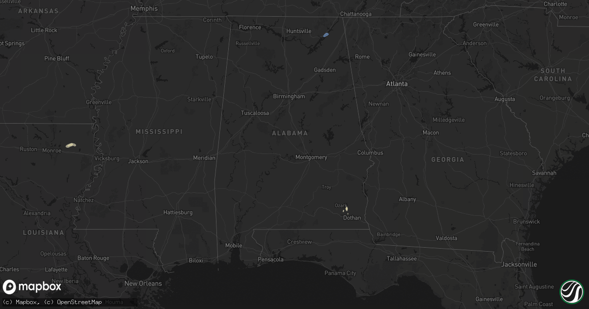
Hail Map in Alabama on April 4, 2026
Get this storm
April 4 map
$229
one time, instant access
Download today. No call, no setup
Keep the $229
Bought the map and want the full workflow? Apply the entire $229 to a subscription within 7 days. None of it is wasted.
Every map, not just this one
This buys you this map. Subscription and you get every map we run, in the markets you choose from a few cities to whole states to nationwide. Plus real-time alerts the moment a storm fires.
Contact data
Name, contact info, occupancy, even credit band for addresses in the footprint. You go from where it hit to who to call.
Become the source they trust
Unlimited branding weather history reports on demand. You already have the documented answer ready for the property owner, and you are the one who showed up with it.
Property data and RoofTrace estimates
Pull up any address you have got, its value and the exact code rules for that jurisdiction, straight from One Click Code. Then RoofTrace estimates the squares, pitch, and roof value, priced the way you price.
Storm reports in Alabama
Alabama
| Date | Description |
|---|---|
| 04/04/20264:08 PM CDT | Tree down blocking county road 64. |
| 04/04/20263:45 PM CDT | Tree down near county rd 59 and 61. |
| 04/04/20262:45 PM CDT | A tree was knocked down blocking both lanes of the roadway at 11884 cr 14. Time estimated by radar. |
| 04/03/202610:00 PM CDT | Large tree down in the roadway. |
| 04/03/20269:55 PM CDT | 6-8 powerlines snapped. |
| 04/03/20269:51 PM CDT | A tree was knocked down blocking all lanes at the intersection of snodgrass road and cr 33 in scottsboro. Time estimated by radar. |
| 04/03/20269:49 PM CDT | One power pole was snapped near its base and powerlines were down at this location on highway 35. |
| 04/03/20269:49 PM CDT | Corrects previous tstm wnd dmg report from 3 ene scottsboro. 6-8 powerlines snapped. |
| 04/03/20269:49 PM CDT | Corrects previous tstm wnd dmg report from 3 e scottsboro. A tree was reported down at 50 clemens road. |
| 04/03/20269:48 PM CDT | A tree was reported down at this location. |
| 04/03/20269:47 PM CDT | A large tree limb was reported down on a residence at 620 skyline shores drive. |
| 04/03/20269:47 PM CDT | Softwood trees reported down at 279 skyline drive. |
| 04/03/20269:43 PM CDT | A tree was knocked down across the roadway at the intersection of july blvd. And woods cove road in scottsboro. Time estimated by radar. |
| 04/03/20269:43 PM CDT | Tree uprooted at 843 camp ground circle... Ssw of scottsboro. |
| 04/03/20269:37 PM CDT | Corrects previous tstm wnd dmg report from 3 nnw langston. Softwood trees reported down at 279 skyline drive. |
| 04/03/20269:37 PM CDT | Corrects previous tstm wnd dmg report from 3 nnw langston. A large tree limb was reported down on a residence at 620 skyline shores drive. |
| 04/03/20269:37 PM CDT | Tree down in roadway. |
| 04/03/20269:15 PM CDT | A tree was knocked down blocking the roadway at the intersection of union hill road and mcannally road. Time estimated by radar. |
All States Impacted by Hail Map on April 4, 2026
Cities Impacted by Hail Map on April 4, 2026
- Lindale, TX
- Defiance, OH
- Ottawa Lake, MI
- Temperance, MI
- Petersburg, MI
- Lambertville, MI
- Ida, MI
- Ozark, AL
- Midland City, AL
- Newton, AL
- Oak Ridge, LA
- Rayville, LA
- Epps, LA
- Robstown, TX
- Muncy Valley, PA
- Hughesville, PA
- Ypsilanti, MI
- Willis, MI
- Milan, MI
- Belleville, MI
- Mount Juliet, TN
- Lebanon, TN
- Hartsville, TN
- Romulus, MI
- Scottsboro, AL


