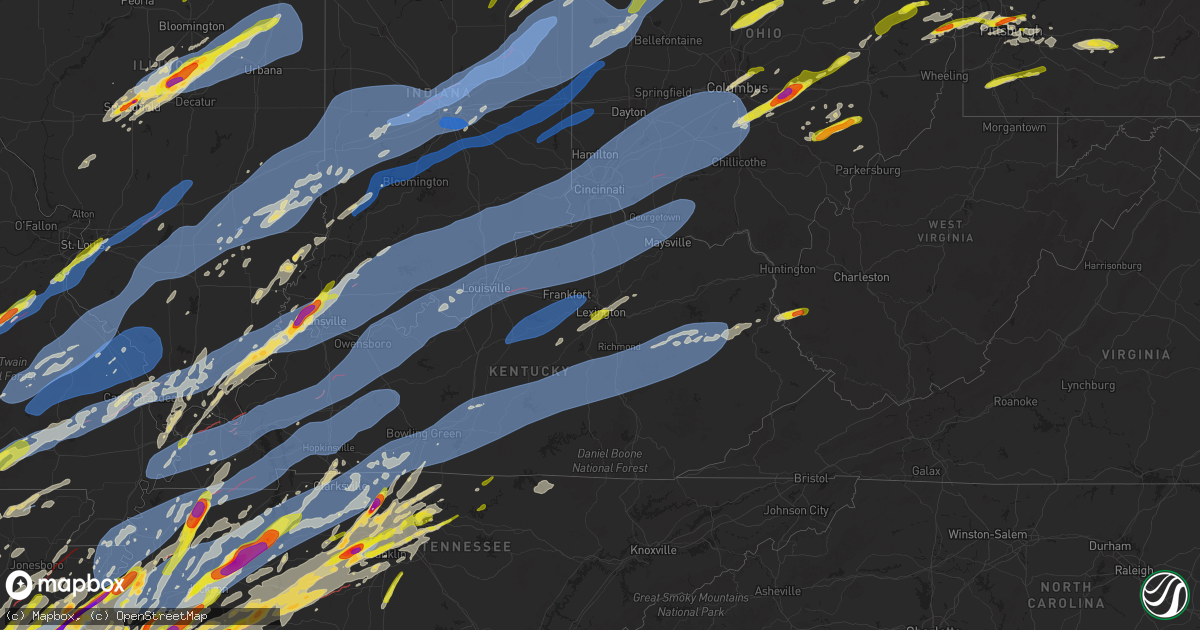
Hail Map on April 2, 2025
Get this storm
April 2 map
$229
one time, instant access
Download today. No call, no setup
Keep the $229
Bought the map and want the full workflow? Apply the entire $229 to a subscription within 7 days. None of it is wasted.
Every map, not just this one
This buys you this map. Subscription and you get every map we run, in the markets you choose from a few cities to whole states to nationwide. Plus real-time alerts the moment a storm fires.
Contact data
Name, contact info, occupancy, even credit band for addresses in the footprint. You go from where it hit to who to call.
Become the source they trust
Unlimited branding weather history reports on demand. You already have the documented answer ready for the property owner, and you are the one who showed up with it.
Property data and RoofTrace estimates
Pull up any address you have got, its value and the exact code rules for that jurisdiction, straight from One Click Code. Then RoofTrace estimates the squares, pitch, and roof value, priced the way you price.
States Impacted by Hail Map on April 2, 2025
Storm reports
Mississippi
| Date | Description |
|---|---|
| 04/02/20255:05 PM CDT | Report from mping: quarter |
| 04/02/20255:00 PM CDT | Quarter size hail jaybird/hollysprings hernando... Ms. |
| 04/02/20255:00 PM CDT | Golfball size hail near nesbitt at lauder and 269. |
| 04/02/20254:52 PM CDT | Spikey tennis ball sized hail. |
| 04/02/20254:40 PM CDT | Golf ball size around the union area of panola county. |
| 04/02/20254:18 PM CDT | Trees down across hwy 51. |
| 04/02/20254:12 PM CDT | Ryans well in itawamba county baseball sized hail. |
| 04/02/20253:45 PM CDT | Large non-spherical hail. |
| 04/02/20252:50 PM CDT | Quarter size hail. |
| 04/02/20251:19 AM CDT | *** 1 inj *** extensive damage across the northern part of marshall county. Multiple homes damaged with numerous trees and powerlines down. |
| 04/02/202512:26 AM CDT | Corrects previous tornado report from 5 ese strayhorn. Home destroyed on waverly circle west of senatobia. |
Oklahoma
| Date | Description |
|---|---|
| 04/02/20257:10 AM CDT | Time estimated by radar. |
Texas
| Date | Description |
|---|---|
| 04/02/20256:15 PM CDT | Quarter size hail reported in the kildare community. |
| 04/02/20256:35 AM CDT | A local report indicates 1.25 inch wind near 1 W Jacksboro |
| 04/02/20256:30 AM CDT | A local report indicates 1.75 inch wind near 7 E Bryson |
| 04/02/20256:27 AM CDT | Time estimated by radar. |
| 04/02/20256:12 AM CDT | Facebook report of 1.5 inch hail in south necessity. |
| 04/02/20256:07 AM CDT | Facebook report of golfball size hail around 5 miles south of wayland. |
| 04/02/20256:01 AM CDT | Report from mping. Hen egg 2.25 in. |
| 04/02/20256:00 AM CDT | Social media reports and photos showed widespread wind damage across olden. |
| 04/02/20255:56 AM CDT | Social media report and photo of planes and hangars destroyed at the eastland municipal airport. |
| 04/02/20255:55 AM CDT | Paneling removed from gas station awning... Scattered trees snapped. Glass window of business shattered. Photos of damage on social media. |
| 04/02/20255:53 AM CDT | Facebook photo showed tennis ball size hail fell near cisco. Location and time estimated based on radar. |
| 04/02/20255:49 AM CDT | Report from mping. Hen egg 2.00 in. |
| 04/02/20255:45 AM CDT | 54 kt gust at cisco awos - kgzn. |
| 04/02/20255:18 AM CDT | Quarter size hail from around 510-525 am. |
| 04/02/20255:01 AM CDT | 66 mph wind gust at the west texas mesonet site northwest of haskell. |
| 04/02/20254:58 AM CDT | Transmission line down in st jo with widespread power outages across montague county. |
| 04/02/20254:15 AM CDT | 71 mph wind gust at the west texas mesonet site west of rotan. |
| 04/02/20254:10 AM CDT | Large trees snapped and metal roor removed from a barn. |
| 04/02/20254:05 AM CDT | Panels and entire truss structure of metal outbuilding roof blown off. |
| 04/02/20254:05 AM CDT | Report from mping: half dollar |
| 04/02/20254:00 AM CDT | Mep tower owned by gamesa wind measured a peak wind gust of 93.5 mph at a height of 100 meters above ground level. |
| 04/02/20253:54 AM CDT | Mesonet station 37 snyder 3e. |
| 04/02/20253:54 AM CDT | Large shipping container flipped onto side that was one quarter full of wood. Barbed wire fence pulled up and minor roof damage to home. |
| 04/02/20253:53 AM CDT | Mesonet station 93 snyder 3ssw scurry county. |
| 04/02/20253:46 AM CDT | 71 mph wind gust measured by the graham municipal airport awos. |
| 04/02/20253:45 AM CDT | A local report indicates 1.75 inch wind near 1 NE Olney |
| 04/02/20253:44 AM CDT | Report from mping: ping pong ball |
| 04/02/20253:40 AM CDT | Downed power pole and sheet metal outbuilding blown apart east of graham on highway 380. There are also multiple reports of other metal buildings and small structures d |
| 04/02/20253:02 AM CDT | Golf ball or a little larger hail. |
| 04/02/20252:15 AM CDT | A local report indicates 2.75 inch wind near Anson |
| 04/02/20252:15 AM CDT | A local report indicates 1.75 inch wind near Anson |
| 04/02/20252:07 AM CDT | A local report indicates 1.00 inch wind near Anson |
| 04/02/20252:05 AM CDT | A local report indicates 1.75 inch wind near 3 NW Anson |
| 04/02/20252:00 AM CDT | A local report indicates 1.75 inch wind near 6 W Anson |
Tennessee
| Date | Description |
|---|---|
| 04/02/20256:46 PM CDT | A local report indicates 1.00 inch wind near White House |
| 04/02/20256:46 PM CDT | Quarter hail observed at milemarker 93 on interstate 40. |
| 04/02/20256:30 PM CDT | Golf ball hail about 1/4 mi east of the courthouse. |
| 04/02/20256:27 PM CDT | A local report indicates 1.00 inch wind near Springfield |
| 04/02/20256:21 PM CDT | Report from mping: ping pong ball |
| 04/02/20256:16 PM CDT | A local report indicates 1.50 inch wind near 3 ESE Coopertown |
| 04/02/20256:14 PM CDT | Quarter hail in pinson relayed by amateur radio. |
| 04/02/20256:11 PM CDT | A local report indicates 1.00 inch wind near Bolivar |
| 04/02/20256:08 PM CDT | Close to baseball-size hail... Windshields blown out... Lots of damage. |
| 04/02/20256:06 PM CDT | A local report indicates 2.50 inch wind near 5 NNE Ashland City |
| 04/02/20255:57 PM CDT | A local report indicates 1.25 inch wind near Camden |
| 04/02/20255:50 PM CDT | A local report indicates 1.00 inch wind near Lakeland |
| 04/02/20255:46 PM CDT | A local report indicates 1.00 inch wind near Williston |
| 04/02/20255:40 PM CDT | A local report indicates 2.50 inch wind near Middle Fork |
| 04/02/20255:40 PM CDT | A local report indicates 1.25 inch wind near 2 NE Lakeland |
| 04/02/20255:39 PM CDT | Report from mping: golf ball |
| 04/02/20255:39 PM CDT | 1/2 dollar sized hail. |
| 04/02/20255:35 PM CDT | A local report indicates 1.50 inch wind near 5 NNE Germantown |
| 04/02/20255:30 PM CDT | Corrects previous hail report from 3 nnw germantown. One inch hail at nws memphis lasted 2-3 minutes. |
| 04/02/20255:30 PM CDT | A local report indicates 1.75 inch wind near Huntingdon |
| 04/02/20255:28 PM CDT | Report from mping: quarter |
| 04/02/20255:23 PM CDT | Structure damage on jones hollow road near lobelville. Time estimated from radar. |
| 04/02/20255:23 PM CDT | Public report of hail just under baseball size near clarksburg. Time estimated via radar. |
| 04/02/20255:14 PM CDT | Report from mping: quarter |
| 04/02/20255:00 PM CDT | Small outdoor shed destroyed in three way. |
| 04/02/20254:50 PM CDT | Half dollar size hail exit 83 n jackson. |
| 04/02/20254:50 PM CDT | Quarter size hail south of i 40 and the 45 bypass. |
| 04/02/20254:45 PM CDT | Quarter size hail at jackson regional airport. |
| 04/02/20254:00 PM CDT | Report of golf ball hail at west tennessee state penn. |
| 04/02/20253:54 PM CDT | Report from mping: quarter . |
| 04/02/20253:54 PM CDT | Report from mping: quarter |
| 04/02/20253:25 PM CDT | Golfball size hail in oakland tn area from chaser. |
| 04/02/20253:18 PM CDT | A local report indicates 1.00 inch wind near Oakland |
| 04/02/20253:18 PM CDT | Report from mping: quarter |
| 04/02/20252:53 PM CDT | Facebook report of golfball size hail near shelby drive and forest hill irene. |
| 04/02/20259:09 AM CDT | Emergency manager provided photos of a large metal shop blown over. Possible tornado damage. |
| 04/02/20255:51 AM CDT | A pergola was destroyed near kings chapel community. |
| 04/02/20254:53 AM CDT | Downed trees in williamsport... Tn reported by em. Time estimated. |
| 04/02/20254:40 AM CDT | Quarter size hail reported in brentwood by public. Ongoing at the time of the report. |
| 04/02/20254:34 AM CDT | Report from mping: half dollar |
| 04/02/20254:30 AM CDT | Trees down on pinecrest ct in fairview. No structural damage. |
| 04/02/20254:30 AM CDT | Hafl dollar sized hail in brentwood from tspotter. Time estimated. |
| 04/02/20254:28 AM CDT | Tspotter report of a tree that fell on a house and car on pine crest court. |
| 04/02/20254:28 AM CDT | Tspotter report of half dollar size hail at west haven. Time estimated by radar. |
| 04/02/20254:24 AM CDT | Em for lewis county reports trees down and outbuilding destroyed in hohenwald. Power lines down as well. Time estimated. |
| 04/02/20254:18 AM CDT | Report from mping: quarter |
| 04/02/20253:46 AM CDT | Tspotter report of quarter size hail near kroger on highway 70. Time radar estimated. |
| 04/02/20253:44 AM CDT | Quarter size hail reported at temple hills. Time estimated by radar. |
| 04/02/20253:37 AM CDT | 60 mph wind gust measured at highway 100 and brush creek rd. |
| 04/02/20253:31 AM CDT | Emergency manager reported multiple trees down in the morris chapel area of hardin county. |
| 04/02/20253:24 AM CDT | A local report indicates 1.25 inch wind near 2 ENE Mount Juliet |
| 04/02/20253:19 AM CDT | Corrects previous hail report from 2 s mount juliet. Time estimated from radar. |
| 04/02/20253:19 AM CDT | Time estimated from radar. |
| 04/02/20253:02 AM CDT | Tspotter report of a tree that fell on a house on old tusculum rd. Time radar estimated. |
| 04/02/20252:33 AM CDT | Pinewood road and hwy 100. Time estimated from radar. |
| 04/02/20251:39 AM CDT | Corrects previous tornado report from grand junction. City hall damaged in grand junction along with numerous homes. Numerous large trees knocked down and uprooted. Tra |
| 04/02/20251:31 AM CDT | *** 1 fatal... 4 inj *** corrects previous tornado report from 5 sw la grange. Mobile home destroyed on sweet road. |
| 04/02/20251:19 AM CDT | At fire station 2. |
| 04/02/202512:42 AM CDT | A tornado caused damage to several structures and landscape across selmer. Time is radar estimated. |
| 04/02/202512:39 AM CDT | Corrects previous tornado report from grand junction. City hall damaged in grand junction along with numerous homes. Numerous large trees knocked down and uprooted. Tra |
| 04/02/202512:18 AM CDT | Homes damaged and trees down on neely road. |
| 04/02/202512:09 AM CDT | Trees and power lines down across the city of clarksville. Time provided by hams. |
| 04/01/202511:57 PM CDT | Several trees down. Time estimated from radar. |
| 04/01/202511:43 PM CDT | Several trees down in erin. Time estimated from radar. |
| 04/01/20259:55 PM CDT | Nickel and quarter sized hail at poplar and highland. |
| 04/01/20259:26 PM CDT | Quarter size hail reported between atoka and brighton. |
| 04/01/20259:17 PM CDT | A local report indicates 1.75 inch wind near Martin |
| 04/01/20258:52 PM CDT | Large tree down blocking highway 431 causing a vehicle accident. |
| 04/01/20258:41 PM CDT | Building destroyed on concord road. |
| 04/01/20258:36 PM CDT | Barn and shop destroyed on morella road. |
| 04/01/20258:32 PM CDT | Trees and power lines down. Possible tornado. |
| 04/01/20258:30 PM CDT | *** 1 fatal *** a tree fell onto a moving vehicle on the roadway. |
| 04/01/20258:15 PM CDT | A local report indicates 62 MPH wind near 1 E Dyersburg |
| 04/01/20257:42 PM CDT | A local report indicates 1.75 inch wind near Martin |
| 04/01/20257:38 PM CDT | A local report indicates 1.75 inch wind near Kenton |
| 04/01/20257:36 PM CDT | A local report indicates 1.75 inch wind near 4 ESE Kenton |
Maryland
| Date | Description |
|---|---|
| 04/02/20255:50 AM CDT | A couple trees down on cranesville road. |
Indiana
| Date | Description |
|---|---|
| 04/02/20256:56 PM CDT | Tree down onto a garage. Time estimated via radar. |
| 04/02/20256:54 PM CDT | Roof damage to a barn on in-10 between culver and argos. Photo relayed by abc 57 on facebook. Time estimated via radar. |
| 04/02/20256:54 PM CDT | Marshall county remc reports nearly a mile swath of 3 phase power poles and lines down on state road 10 between argos and culver and on the south side of lake max. Time |
| 04/02/20256:52 PM CDT | A survey of damage revealed a tornado touched down southeast of rutland on sr-10 and tracked quickly northeast. The tornado moved over numerous empty fields but also im |
| 04/02/20255:57 PM CDT | Private weather station reported 58 mph gust near brook. |
| 04/02/202510:44 AM CDT | Power lines down along farabee rd near pekin... In. |
| 04/02/20258:58 AM CDT | Utility lines down and sheet metal in roadway at n county rd 600 w & conner rd. Time estimated from radar. |
| 04/02/20257:55 AM CDT | Broadcast media reports quarter size hail in decatur. Time estimated via radar. |
| 04/02/20257:50 AM CDT | Trained spotter reports quarter size hail on sr 1. No damage to homes or cars. |
| 04/02/20257:49 AM CDT | Trees down and powerlines down on the road at the intersection of maplecrest rd and stellhorn rd. |
| 04/02/20257:49 AM CDT | Emergency manager reports golf ball size hail north of bluffton. |
| 04/02/20257:36 AM CDT | Report from mping: quarter |
| 04/02/20257:36 AM CDT | Photo on facebook shows half dollar to ping pong ball at the intersection of garmen rd and tonkel rd. Time estimated via radar. |
| 04/02/20257:35 AM CDT | Report from mping: quarter |
| 04/02/20257:35 AM CDT | A local report indicates 1.00 inch wind near 2 E Wallen |
| 04/02/20257:32 AM CDT | Report from mping: quarter |
| 04/02/20257:32 AM CDT | Report from mping: quarter |
| 04/02/20257:32 AM CDT | A local report indicates 1.00 inch wind near 4 ESE Huntertown |
| 04/02/20257:30 AM CDT | Quarter size hail fell at lima rd and till rd. |
| 04/02/20257:30 AM CDT | Cocorahs observer measured up to 1 inch hail. |
| 04/02/20257:30 AM CDT | A local report indicates 1.00 inch wind near Wallen |
| 04/02/20257:30 AM CDT | Quarter size hail fell at lima rd and till rd. |
| 04/02/20257:28 AM CDT | Nickel to quarter size hail fell for several minutes. |
| 04/02/20257:27 AM CDT | Photo on facebook shows quarter to half dollar size hail that fell in aboite. Time estimated via radar. |
| 04/02/20257:26 AM CDT | A local report indicates 1.00 inch wind near 1 N Rolling Hills |
| 04/02/20257:25 AM CDT | Photo on facebook shows ping pong ball sized hail. Time estimated via radar. |
| 04/02/20257:22 AM CDT | A local report indicates 1.00 inch wind near Fort Wayne |
| 04/02/20257:22 AM CDT | A local report indicates 1.00 inch wind near Fort Wayne |
| 04/01/202510:50 PM CDT | Numerous power poles down and broken near the 4h fairgrounds. |
| 04/01/202510:49 PM CDT | Tree downed along state route 101. Time estimated by radar. |
| 04/01/202510:42 PM CDT | Power lines over road. |
| 04/01/202510:38 PM CDT | Numerous trees snapped... Substantial damage to a barn. |
| 04/01/202510:30 PM CDT | Home damaged on garrison hollow road. |
| 04/01/202510:29 PM CDT | Tree uprooted. |
| 04/01/202510:16 PM CDT | Power pole snapped. |
| 04/01/202510:16 PM CDT | Power line blocking both lanes. |
| 04/01/202510:10 PM CDT | Tree on power line... 190n... Just past sultans run... Tree is completely blocking roadway. |
| 04/01/202510:06 PM CDT | Tree over road. Relayed via social media. |
| 04/01/202510:00 PM CDT | Tree down over road. |
| 04/01/20259:57 PM CDT | One main tree branch... 4in diameter... Covering the eastbound lane. |
| 04/01/20259:57 PM CDT | Corrects previous tstm wnd dmg report from duff. One main tree branch... 4in diameter... Covering the eastbound lane. |
| 04/01/20259:57 PM CDT | An ef-0 tornado with peak winds of 80 mph and a path length of 0.06 miles impacted a rural area southeast of heltonville began at this location. Damage was caused to fa |
| 04/01/20259:50 PM CDT | Damage to barns and out buildings in the area. |
| 04/01/20259:49 PM CDT | Numerous reports of trees down... Damage and debris from storms mainly across eastern part of lawrence co. Time estimated from radar. |
| 04/01/20259:42 PM CDT | Trained spotter reported a large tree downed in berne in adams county in indiana. |
| 04/01/20259:39 PM CDT | Huntingburg airport reporting 62.1 mph wind gust. |
| 04/01/20259:37 PM CDT | Large tree uprooted. Time estimated from radar. |
| 04/01/20259:33 PM CDT | Corrects previous tstm wnd gst report from 3 n johnsburg. Corrects previous tstm wnd gst report from 3 n johnsburg. Huntingburg airport reporting 62.1 mph wind gust. |
| 04/01/20259:33 PM CDT | Corrects previous tstm wnd gst report from 3 n johnsburg. Huntingburg airport reporting 62.1 mph wind gust. |
| 04/01/20259:33 PM CDT | Power lines and a tree down. |
| 04/01/20259:27 PM CDT | Emergency manager reports roof damage to barns... Silos... And machine sheds east of redkey on s cr 325 w. Debris scattered in a nearby field. Time estimated via radar. |
| 04/01/20259:27 PM CDT | Picture of tree over road between greenfield and maxwell on sr9. |
| 04/01/20259:24 PM CDT | Emergency manager reports powerlines down and trees down at 400 s and state road 1 north of redkey. |
| 04/01/20259:23 PM CDT | Tree onto a house near 550 s and 200 w. No injuries reported. Time estimated by radar. |
| 04/01/20259:22 PM CDT | Semi overturned. |
| 04/01/20259:18 PM CDT | Picture of large tree limb over the road. |
| 04/01/20259:15 PM CDT | A local report indicates 62 MPH wind near Dunkirk |
| 04/01/20259:15 PM CDT | Minor roof damage to homes. Time estimated from radar. |
| 04/01/20259:14 PM CDT | Multiple trees downed. |
| 04/01/20259:14 PM CDT | House damaged. |
| 04/01/20259:13 PM CDT | Personal weather station kineaton8 1 mile south of eaton... Indiana gusted to 100 mph from a thunderstorm at 10:13 pm edt. |
| 04/01/20259:10 PM CDT | Part of roof blown off of a house and laying in the front yard near millersburg rd and n eskew rd... Boonville... In. Possible tornado. |
| 04/01/20259:10 PM CDT | Tree down near 5th and broadway. Time very roughly estimated from radar. |
| 04/01/20259:10 PM CDT | Report of roof damage... With water entering the structure... On morre st. Between 7th st and forrest ave. In boonville... In. |
| 04/01/20259:09 PM CDT | Trees across road near hindostan. Time estimated from radar. |
| 04/01/20259:08 PM CDT | Law enforcement reports of a large tree downed near mill grove in blackford county in indiana. Time is radar estimated. |
| 04/01/20259:06 PM CDT | Law enforcement reported a tree had fallen on a house near mill grove in blackford county in indiana. Time is radar estimated. Injuries/fatalities are unknown at this t |
| 04/01/20259:06 PM CDT | *** 1 inj *** corrects previous tstm wnd dmg report from 1 wsw mill grove. Law enforcement reported a barn was blown into a house near mill grove in blackford county in |
| 04/01/20259:06 PM CDT | Asos station kmie muncie. |
| 04/01/20259:05 PM CDT | Report of a home with serious damage on cr 400 e between cr 300 s and cr 400 s. Time estimated from radar. |
| 04/01/20259:05 PM CDT | A local report indicates 63 MPH wind near 1 ENE Newburgh |
| 04/01/20259:03 PM CDT | A local report indicates 63 MPH wind near 2 NW Newburgh |
| 04/01/20259:03 PM CDT | Roof blown off a house by thunderstorm winds. Time estimated from radar. |
| 04/01/20259:03 PM CDT | Time approximated from radar. Location is approximate. ^00 west is shut down due to utility poles in the roadway. |
| 04/01/20259:03 PM CDT | Asos station kevv evansville in. |
| 04/01/20259:02 PM CDT | Tree and power lines down. |
| 04/01/20259:02 PM CDT | Several windows broken in dormitories at ball state university. Time estimated from radar. |
| 04/01/20259:01 PM CDT | Transformer damage reported. |
| 04/01/20258:58 PM CDT | Corrects previous tstm wnd dmg report from 4 s gaston. Utility lines down and sheet metal in roadway at n county rd 600 w & conner rd. Time estimated from radar. |
| 04/01/20258:58 PM CDT | Trees and powerlines down in area. |
| 04/01/20258:52 PM CDT | Delayed report. Tree down. |
| 04/01/20258:52 PM CDT | A local report indicates 79 MPH wind near 3 NNW River Forest |
| 04/01/20258:49 PM CDT | Numerous trees down... Including a very large one on highland court. |
| 04/01/20258:47 PM CDT | Multiple trees downed. |
| 04/01/20258:42 PM CDT | Plethora of damage to homes and businesses... Many roads impassable from large amounts of debris. |
| 04/01/20258:39 PM CDT | Time estimated from radar. |
| 04/01/20258:38 PM CDT | Trees and power lines down. |
| 04/01/20258:35 PM CDT | Reports of downed powerlines in the area from storms. |
| 04/01/20258:35 PM CDT | Thunderstorm winds were measured at 87 mph north of lapel. Time estimated from radar. Location estimated. |
| 04/01/20258:34 PM CDT | Power lines taken down near 3rd/broadway in oaktown. |
| 04/01/20258:30 PM CDT | Delayed report. Trees down. |
| 04/01/20258:30 PM CDT | Tree down with power lines. Time very roughly estimated from radar. |
| 04/01/20258:30 PM CDT | Report from mping: quarter |
| 04/01/20258:30 PM CDT | Unknown number of tree branches down. Winds shaking house considerably. Time estimated from radar. |
| 04/01/20258:30 PM CDT | Side of carmel old town antique mall building peeled off by thunderstorm winds. Time estimated from radar. |
| 04/01/20258:30 PM CDT | Aluminum siding blown off a house and a 12-inch diameter tree was split in half...suspected lightning strike. Time estimated from radar. |
| 04/01/20258:30 PM CDT | A local report indicates 1.00 inch wind near 3 ESE Beech Grove |
| 04/01/20258:30 PM CDT | Furniture blown... Large limbs and tree tops down from thunderstorm winds. Time estimated from radar. |
| 04/01/20258:30 PM CDT | Traffic signal was blown down into the intersection at west 86th street and harcourt road. Live electric line. Time estimated from radar. |
| 04/01/20258:26 PM CDT | Building damage and large tree limbs broken. Time estimated from radar. |
| 04/01/20258:26 PM CDT | Reports of debris and damage within carmel. Trees and powerlines down and roads flooded. |
| 04/01/20258:25 PM CDT | Per indianapolis dispatch center... We have at least 6 different incidents with trees into homes/buildings. Locations in the indianapolis area are unknown at this time. |
| 04/01/20258:20 PM CDT | Large tree down into a street from thunderstorm winds. Time estimated from radar. |
| 04/01/20258:18 PM CDT | Power poles snapped and along lafayette rd. One landed on a car. Sheet metal in road and in powerlines. Semi flipped on side nearby. Time estimated from radar. |
| 04/01/20258:18 PM CDT | A local report indicates 65 MPH wind near Indianapolis Intl Airp |
| 04/01/20258:18 PM CDT | A local report indicates 65 MPH wind near Indianapolis Int'l Airp |
| 04/01/20258:18 PM CDT | A local report indicates 65 MPH wind near 2 SSE Vincennes |
| 04/01/20258:15 PM CDT | A local report indicates 81 MPH wind near 3 ESE Danville |
| 04/01/20258:15 PM CDT | At least a dozen trees down in the area. |
| 04/01/20258:15 PM CDT | Report of tree on house nearby. Time estimated from radar. |
| 04/01/20258:15 PM CDT | A local report indicates 70 MPH wind near Monrovia |
| 04/01/20258:15 PM CDT | A local report indicates 60 MPH wind near Bruceville |
| 04/01/20258:14 PM CDT | Damage in branches subdivision neighborhood in brownsburg. |
| 04/01/20258:13 PM CDT | Location described as northeast of danville. Two reports of 70 mph thunderstorm winds. |
| 04/01/20258:11 PM CDT | Housing development damaged. Time estimated from radar. |
| 04/01/20258:10 PM CDT | Structure collapse with a few people unaccounted for. Time estimated from radar.... |
| 04/01/20258:10 PM CDT | Trees down and possibly other damage from thunderstorm winds along east county road 600 north between north raceway road and ronald regan parkway. Time estimated from r |
| 04/01/20258:10 PM CDT | Damage to hession farms inc. Time estimated from radar. |
| 04/01/20257:58 PM CDT | Delayed report. Barn blown 80 yards downstream. |
| 04/01/20257:55 PM CDT | Awos station kcfj crawfordsville. |
| 04/01/20257:50 PM CDT | Cup anemometer at 33 feet. |
| 04/01/20257:48 PM CDT | Emergency manager reports 1 injury at 6060 market street in orland. Roof lost on a 1 story assisted living building. Insulation and debris strewn in nearby fields and i |
| 04/01/20257:48 PM CDT | Damage reported to a barn and a home on st rd 120. Time estimated via radar. |
| 04/01/20257:48 PM CDT | Emergency manager reports a barn with structural damage to the roof at 7640 n 750 w ij orland. Time estimated via radar. |
| 04/01/20257:48 PM CDT | A local report indicates 63 MPH wind near 4 S Delphi |
| 04/01/20257:48 PM CDT | Trained spotter reports an estimated wind gust of 98.4 mph using an anemometer. |
| 04/01/20257:37 PM CDT | Lagrange county sheriffs office reports leaning/downed power lines on sr 120 between cr 110 e and cr 900 e. Time estimated via radar. |
| 04/01/20257:33 PM CDT | Corrects previous non-tstm wnd gst report from vincennes. |
| 04/01/20257:30 PM CDT | Thunderstorm winds caused large oak tree to collapse on powerline... Causing power outage. Time estimated from radar. |
| 04/01/20257:30 PM CDT | Multiple trees down onto powerlines at the intersection of st rd 120 and 900 west. Time estimated via radar. |
| 04/01/20257:25 PM CDT | Tree and power lines down onto a vehicle across n. Hillside drive. Time estimated via radar. |
| 04/01/20257:24 PM CDT | An ef-1 tornado with peak winds of 105 mph and a path length of 8.55 miles began in a rural field just east of numa... In. Damage was caused to a home and a few structu |
| 04/01/20257:24 PM CDT | Goshen airport is without power. Estimated 70+ mph winds. |
| 04/01/20257:23 PM CDT | Numerous tree damage in the area. |
| 04/01/20257:15 PM CDT | Home significantly damaged. Reports of tree damage as well. Power out across town from wind damage. |
| 04/01/20257:14 PM CDT | An ef-1 tornado with peak winds of 110 mph and a path length of 4.45 miles began right at the il/in state line and tracked ene toward west new goshen. The tornado then |
| 04/01/20257:13 PM CDT | Report of structure damage. Time estimated from radar. |
| 04/01/20257:10 PM CDT | Three semi-trucks were overturned by thunderstorm winds near the indiana-illinois state border. |
| 04/01/20257:09 PM CDT | Powerlines down on sr19 near 600 north. Time estimated via radar. |
| 04/01/20257:05 PM CDT | Substantial damage to a home in bourbon. Garage is completely gone and part of home has severe structural damage. Time estimated via radar. |
| 04/01/20257:05 PM CDT | Marshall county remc reports over 20 broken poles along 12th rd between cedar rd and beech rd. Time estimated via radar. |
| 04/01/20257:05 PM CDT | News now warsaw relays report of a woman trapped in her car after a tree fell on it. Unknown the extent of any injuries. Time estimated via radar. |
| 04/01/20257:05 PM CDT | Us 30 was closed for several hours on the evening of april 2nd after at least 3 semis flipped over at the intersection with cedar rd north of bourbon. Unknown if there |
| 04/01/20257:04 PM CDT | Emergency manager confirms multiple houses with roofs off on rose ln and crocut ct in bourbon. Time estimated via radar. |
| 04/01/20257:04 PM CDT | Structural damage reported to a house on the east side of bourbon. Time estimated via radar. |
| 04/01/20257:04 PM CDT | Roof gone and structural damage to the bourbon township trustee building at the intersection of center street and n washington street. Relayed by abc 57. Time estimated |
| 04/01/20257:04 PM CDT | Abc 57 in south bend relays report that 3 semis tipped over on us 30 in bourbon. Parts of us 30 are closed. Unknown if any injuries. Time estimated via radar. |
| 04/01/20257:03 PM CDT | Photo relayed by wsbt of damage to northern indiana manufacturing inc. The factory is at the intersection of s ecker avenue and w quad street. Time estimated via radar. |
| 04/01/20257:03 PM CDT | Photo relayed by wsbt in south bend of damage to the northern indiana manufacturing factory in bourbon. Factory is at the intersection of w quad street and s ecker aven |
| 04/01/20257:01 PM CDT | Emergency manager relayed a report of a tree down on hawthorne lane in logansport. Time estimated via radar. |
| 04/01/20257:00 PM CDT | Lots of damage reported east of argos... In on sr 10 including trees down onto powerlines and large trees limbs snapped. |
Michigan
| Date | Description |
|---|---|
| 04/01/20258:20 PM CDT | 6 different power outages of 200-1000 each in far sw jackson county. |
| 04/01/20257:56 PM CDT | A local report indicates 1.00 inch wind near Port Austin |
| 04/01/20257:52 PM CDT | Photo found on facebook |
| 04/01/20257:50 PM CDT | Size estimated from photo on facebook. |
| 04/01/20257:42 PM CDT | Photos sent on facebook. |
Georgia
| Date | Description |
|---|---|
| 04/02/20255:36 PM CDT | 911 dispatch reported a tree down blocking one lane on highway 17 north. |
| 04/02/20255:01 PM CDT | Irwin county 911 reported a tree was down near hwy 32 in between ambrose and bushnell. Time was estimated by radar. |
| 04/02/20255:00 PM CDT | Photo provided to local media of two large trees downed in twin city... Ga. |
| 04/02/20254:58 PM CDT | Irwin county 911 dispatch reported a tree down along county line road. Time estimated by radar. |
| 04/02/20254:58 PM CDT | Irwin county 911 dispatch reported a tree down along county line road. Time estimated by radar. |
Kansas
| Date | Description |
|---|---|
| 04/02/20257:27 AM CDT | Possible tornado. A semi-truck was overturned two miles north of arma. |
| 04/02/20257:20 AM CDT | Some snapped trees... Broken power poles to the sw and ne. Video on slack. |
Illinois
| Date | Description |
|---|---|
| 04/02/20256:59 PM CDT | Structure damage with barn damaged. |
| 04/02/20256:53 PM CDT | Outbuilding destroyed... And power poles broken. |
| 04/02/20256:49 PM CDT | A local report indicates 63 MPH wind near 3 E Martinsville |
| 04/02/20256:48 PM CDT | Outbuilding destroyed and semi trailer overturned. |
| 04/02/20256:46 PM CDT | Front porch removed from house. Barn and garage collapsed. Two sheds destroyed. Multiple trees down. Time estimated from radar. |
| 04/02/20256:46 PM CDT | Front porch re in 3996 8614 building damage and large tree limbs broken. Time estimated from radar. |
| 04/02/20256:45 PM CDT | Three inch tree limbs broken by high winds. |
| 04/02/20256:38 PM CDT | Outbuilding destroyed and porch damaged. Time estimated from radar. |
| 04/02/20256:38 PM CDT | Tree damage in greenup. |
| 04/02/20256:37 PM CDT | Corrects time of previous tstm wnd dmg report from 2 n greenup. Damage to small outbuildings and several large tree branches down. |
| 04/02/20256:36 PM CDT | Tree limbs down... Fence blown down... Mature pine trees snapped in half. |
| 04/02/20256:30 PM CDT | Outbuildings destroyed. |
| 04/02/20256:30 PM CDT | Tree and structure damage along i-70. |
| 04/02/20256:29 PM CDT | Report from mping: half dollar |
| 04/02/20256:28 PM CDT | Power poles down. |
| 04/02/20256:27 PM CDT | Spotter reporting 60 to 70 mph wind gusts west of louisville. |
| 04/02/20256:26 PM CDT | Roof peeled off an animal pen. |
| 04/02/20256:26 PM CDT | Damage to small outbuildings and several large tree branches down. |
| 04/02/20256:22 PM CDT | Tree blown down at 11461 n 1776 rd. |
| 04/02/20256:22 PM CDT | Large tree limbs blown down. |
| 04/02/20256:20 PM CDT | Corrects previous tstm wnd gst report from 2 w louisville. Between 60 and 70 mph wind gusts on kinmnudy road. Corrected time. |
| 04/02/20256:18 PM CDT | Hangar damaged. |
| 04/02/20256:15 PM CDT | Large branch broken off tree. |
| 04/02/20256:10 PM CDT | Outbuilding blown onto road. Time estimated from radar. |
| 04/02/20256:08 PM CDT | Ef1 strength... Max wind speed 105 mph... Path length 2.55 miles. Tracked northeast. Much of the structural damage was concentrated along n. 500th st. North of e. 700th |
| 04/02/20256:07 PM CDT | Two apartment buildings in altamont lost their roofs at the a frame apartments. |
| 04/02/20256:00 PM CDT | Reports of sporadic tree damage throughout the county... As well as a few downed powerlines near salem. |
| 04/02/20256:00 PM CDT | Power pole snapped by high winds. |
| 04/02/20255:40 PM CDT | 3 inch tree limbs broken by high winds. |
| 04/02/20255:37 PM CDT | Minor roof damage to a home. |
| 04/02/20255:26 PM CDT | Mesonet station cw2101 mahomet. |
| 04/02/20255:22 PM CDT | Trees down. |
| 04/02/20255:21 PM CDT | Trees down. |
| 04/02/20255:19 PM CDT | Tree damage in mansfield. |
| 04/02/20255:14 PM CDT | 3 homes damaged. |
| 04/02/20255:14 PM CDT | Power lines downed just east of cissna park. Relayed by broadcast media... Time estimated by radar. |
| 04/02/20255:12 PM CDT | Trees down. |
| 04/02/20255:12 PM CDT | Measured 60 mph wind gust in seymour around i-72. |
| 04/02/20255:01 PM CDT | Photo shows damage to multiple buildings on a farm near 100n road and 500e road east of loda. Time estimated by radar. |
| 04/02/20255:00 PM CDT | Outbuilding damaged east of farmer city. |
| 04/02/20255:00 PM CDT | Powerline down at e washington st and argenta rd between maroa and friends creek. |
| 04/02/20255:00 PM CDT | Outbuildings damaged in mansfield. |
| 04/02/20254:59 PM CDT | Power lines damaged near 600n road and 300e |
| 04/02/20254:56 PM CDT | Latham fire estimates wind gusts of 60 mph. |
| 04/02/20254:45 PM CDT | Power poles snapped 2 miles sw of deland. |
| 04/02/20254:44 PM CDT | Report from mping: golf ball |
| 04/02/20254:40 PM CDT | A local report indicates 60 MPH wind near 3 WNW Belleville |
| 04/02/20254:38 PM CDT | Report from mping: half dollar |
| 04/02/20254:32 PM CDT | Reported at cps. |
| 04/02/20254:29 PM CDT | Latham fire estimating wind gusts to 90 mph. |
| 04/02/20254:27 PM CDT | Latham fire estimating 60 to 70 mph wind gusts. |
| 04/02/20254:27 PM CDT | Lnderson ky 3782 8767 awos station kehr henderson ky. |
| 04/02/20254:25 PM CDT | A few powerlines down on main street in dupo. |
| 04/02/20254:23 PM CDT | Power lines down from high winds with power out in bellflower. Localized flooding. |
| 04/02/20254:20 PM CDT | A local report indicates 1.00 inch wind near Bellflower |
| 04/02/20254:19 PM CDT | A local report indicates 1.25 inch wind near Bellflower |
| 04/02/20254:03 PM CDT | Report from mping: quarter |
| 04/02/20254:00 PM CDT | Downed trees from high winds in downs. Roughly 4 to 6 inch diameter. |
| 04/02/20253:53 PM CDT | Report from mping: quarter |
| 04/02/20253:50 PM CDT | Report from mping: golf ball |
| 04/02/20253:50 PM CDT | A few quarter size hail stones in lane. |
| 04/02/20253:47 PM CDT | Semi truck blown over on nb i-55 at the sherman exit. Time estimated by radar. |
| 04/02/20253:46 PM CDT | Egg size hail at 2000 ave and highway 121 in latham. |
| 04/02/20253:46 PM CDT | Quarter size hail in kenney. |
| 04/02/20253:45 PM CDT | Golf ball size hail in kenney... Photo from wcia. |
| 04/02/20253:45 PM CDT | A local report indicates 1.50 inch wind near Kenney |
| 04/02/20253:37 PM CDT | Half dollar size hail in mount pulaski. |
| 04/02/20253:24 PM CDT | House with light structural damage at 748 500th in elkhart. |
| 04/02/20253:24 PM CDT | Large tree branch broken down in elkhart by high winds. |
| 04/02/20253:24 PM CDT | 70 to 75 mph winds estimated in elkart. |
| 04/02/20253:23 PM CDT | Estimated 50 to 60 mph wind gusts. |
| 04/02/20253:19 PM CDT | Golf ball size hail on north grand in springfield. |
| 04/02/20253:15 PM CDT | Quarter size hail at peoria rd and dirksen. |
| 04/02/20253:15 PM CDT | Corrects previous tstm wnd dmg report from sherman for the time of report. Semi truck blown over on nb i-55 at the sherman exit. Time estimated by radar. |
| 04/02/20253:15 PM CDT | Egg size hail at 3100 block piper rd. |
| 04/02/20253:14 PM CDT | Quarter size hail at 2801 n 5th street in springfield. |
| 04/02/202512:10 PM CDT | 2 to 3 inch tree limbs snapped at 503 s market. |
| 04/02/202510:55 AM CDT | Mesonet station fw2710 towanda station elevation: 793 ft. |
| 04/02/202510:35 AM CDT | Power lines down... With some structure damage outside of town. |
| 04/02/202510:27 AM CDT | Semi blown over at exit 133 on i-55. |
| 04/02/202510:26 AM CDT | Photo of roof damage to shed in hartsburg. |
| 04/02/202510:26 AM CDT | Shingle damage to nws building. |
| 04/02/202510:26 AM CDT | Tree down. Time estimated from radar. |
| 04/02/202510:26 AM CDT | Roof ripped off eaton manufacturing building. |
| 04/02/202510:26 AM CDT | 2 powerlines down in lincoln. |
| 04/02/202510:26 AM CDT | Powerlines down due to fallen trees at 1037 n jefferson st... 500 n adam st and 829 n hamilton. |
| 04/02/202510:26 AM CDT | Tree blown down at 1019 heightman dr... 516 n madison and 119 grand ave. |
| 04/02/202510:26 AM CDT | Powerline with pole snapped at 513 east front st. |
| 04/02/202510:26 AM CDT | Corrects previous tstm wnd dmg report from hartsburg. Photo of roof damage to shed in hartsburg. Tree and power lines also down. |
| 04/02/202510:25 AM CDT | Large tree branch down and in the road. |
| 04/02/202510:21 AM CDT | *** 2 inj *** corrects previous tstm wnd dmg report from 1 w hartsburg. Social media report of 2 semis flipped on highway 155 near hartsburg. |
| 04/02/202510:21 AM CDT | Social media report of 2 semis flipped on highway 155 near hartsburg. |
| 04/02/202510:16 AM CDT | Power pole snapped at 1400 350th ave. |
| 04/02/20259:10 AM CDT | A local report indicates 1.00 inch wind near El Paso |
| 04/02/20259:10 AM CDT | A local report indicates 1.00 inch wind near El Paso |
| 04/01/20258:50 PM CDT | Vehicle turned over no injuries. |
| 04/01/20258:43 PM CDT | Ef2... 115 mph... The tornado began in extreme southwestern massac county doing tree damage and damage to the roof of a home in extreme southern pope county. The tornad |
| 04/01/20257:36 PM CDT | Possible tornado. |
| 04/01/20257:20 PM CDT | Between 60 and 70 mph wind gusts on kinmnudy road. |
| 04/01/20257:14 PM CDT | Tree blown onto a house. Time estimated from radar. |
| 04/01/20257:08 PM CDT | A local report indicates 64 MPH wind near Edgar County Airport |
| 04/01/20257:07 PM CDT | Barn destroyed along the county line at intersection of e. 2250th st. And fern lake rd. |
| 04/01/20257:05 PM CDT | Two semis overturned on i-70. |
| 04/01/20257:03 PM CDT | Several buildings destroyed at a farm. Time estimated from radar. |
Ohio
| Date | Description |
|---|---|
| 04/02/202512:40 PM CDT | Picture provided. |
| 04/02/202511:49 AM CDT | A local report indicates 1.00 inch wind near 4 ENE Carrollton |
| 04/02/202511:47 AM CDT | A local report indicates 1.00 inch wind near 2 S Akron |
| 04/02/202511:42 AM CDT | Time estimated via radar. |
| 04/02/202511:34 AM CDT | A local report indicates 1.00 inch wind near New Philadelphia |
| 04/02/202511:33 AM CDT | A local report indicates 1.00 inch wind near 1 NW New Philadelphia |
| 04/02/202511:05 AM CDT | Via mping report. |
| 04/02/202511:05 AM CDT | Ping pong ball sized hail |
| 04/02/202511:00 AM CDT | A local report indicates 1.00 inch wind near Wills Creek |
| 04/02/202511:00 AM CDT | Picture of ping pong to golf ball size hail on social media. |
| 04/02/202511:00 AM CDT | Social media photo of ping pong to golf ball sized hail in mcconnelsville. |
| 04/02/202511:00 AM CDT | Picture of ping pong size hail in mcconnelsville. |
| 04/02/202511:00 AM CDT | Picture of ping pong to golf ball sized hail on social media. |
| 04/02/202511:00 AM CDT | Picture of ping pong to golf ball sized hail on social media. |
| 04/02/202510:50 AM CDT | A local report indicates 1.00 inch wind near 1 N Bucyrus |
| 04/02/202510:35 AM CDT | Report from mping: quarter |
| 04/02/202510:30 AM CDT | Picture of ping pong to golf ball sized hail on social media near buckeye lake. Dented vehicles are also being mentioned. |
| 04/02/202510:30 AM CDT | Golf ball sized hail near shoreline drive. |
| 04/02/202510:30 AM CDT | Ping pong ball sized hail in thornville. |
| 04/02/202510:26 AM CDT | A local report indicates 1.50 inch wind near 2 SE Heath |
| 04/02/202510:24 AM CDT | Rt from 3 nnw germantown. One inch hail at nws memp |
| 04/02/202510:24 AM CDT | A local report indicates 2.00 inch wind near Buckeye Lake |
| 04/02/202510:15 AM CDT | A local report indicates 1.25 inch wind near Baltimore |
| 04/02/202510:09 AM CDT | Report from mping: quarter |
| 04/02/202510:05 AM CDT | Report from mping: quarter |
| 04/02/202510:00 AM CDT | A local report indicates 1.00 inch wind near 1 E Lexington |
| 04/02/202510:00 AM CDT | Time estimated via radar. |
| 04/02/20259:49 AM CDT | A local report indicates 1.00 inch wind near 2 N Grandview Heights |
| 04/02/20259:19 AM CDT | Hail up to ping pong ball-size. Time estimated via radar. |
| 04/02/20258:47 AM CDT | Reported by trained spotter. |
| 04/02/20258:24 AM CDT | A local report indicates 1.00 inch wind near Cridersville |
| 04/02/20258:16 AM CDT | Report from mping: quarter |
| 04/02/20258:16 AM CDT | Quarter size hail fell in van wert at westwood drive and ervin rd. |
| 04/02/20258:12 AM CDT | Report from mping: quarter |
| 04/02/20257:19 AM CDT | Report from mping: quarter |
| 04/02/20253:50 AM CDT | Tree down on route 681 in cherry ridge. |
| 04/02/20253:50 AM CDT | Water rescue on state road 93 at a house. Time estimated by radar. |
| 04/02/20253:03 AM CDT | Trees down. |
| 04/02/20253:03 AM CDT | Several down trees. |
| 04/02/20253:00 AM CDT | Tree down on power lines. Time estimated by radar. |
| 04/02/20252:48 AM CDT | Tree |
| 04/02/20252:46 AM CDT | Trees down and uprooted. Time estimated from radar. |
| 04/02/20252:42 AM CDT | Tree down on russel road. Time estimated by radar. |
| 04/02/20252:40 AM CDT | Tree down on south blackburn road. Time estimated by radar. |
| 04/02/20252:33 AM CDT | Downed powerlines. Time estimated by radar. |
| 04/02/20252:25 AM CDT | Down trees. |
| 04/02/20252:24 AM CDT | Tree down on route 376. |
| 04/02/20252:21 AM CDT | Trees down. |
| 04/02/20252:20 AM CDT | Trees down. |
| 04/02/20252:20 AM CDT | Trees down. |
| 04/02/20252:19 AM CDT | Trees down. |
| 04/02/20252:15 AM CDT | Tree down on border school road. Time estimated by radar. |
| 04/02/20252:13 AM CDT | Trees down. |
| 04/02/20252:12 AM CDT | Tree down. Time is radar estimated. |
| 04/02/20252:12 AM CDT | Tree down near intersection of state route 800 and seven mile road. Time estimated. |
| 04/02/20252:10 AM CDT | Tree down randerson road and mckee road. Time estimated by radar. |
| 04/02/20252:00 AM CDT | Tree down on power lines. Time estimated by radar. |
| 04/02/20252:00 AM CDT | Keystone station road blocked by trees in the roadway. |
| 04/02/20251:55 AM CDT | Petersburg road blocked by downed trees. |
| 04/02/20251:55 AM CDT | State rt 139 was blocked by a downed powerline. |
| 04/02/20251:55 AM CDT | Jisco west road closed due to downed powerlines. |
| 04/02/20251:51 AM CDT | Tree down on a car and partially onto a house roof. Time estimated. |
| 04/02/20251:43 AM CDT | Trees down on houses in the new lexington area. Substantial power outages to much of perry county. |
| 04/02/20251:39 AM CDT | Multiple trees and power lines down around junction city. Time estimated based on radar. |
| 04/02/20251:34 AM CDT | Barn destroyed and damage to a house. Time estimated from radar. |
| 04/02/20251:17 AM CDT | Tree downed across a parked vehicle. |
| 04/02/20251:15 AM CDT | Multiple power poles were downed. |
| 04/02/20251:06 AM CDT | Multiple power poles were downed. |
| 04/02/202512:40 AM CDT | Large tree uprooted and downed onto home. |
| 04/02/202512:29 AM CDT | A tornado touched down in eastern clinton county... Ohio... Just south of sabina. Damage to barns... Silos and trees were observed between clinton and fayette counties |
| 04/02/202512:28 AM CDT | Asos station kiln wilmington air park. |
| 04/02/202512:26 AM CDT | Multiple trees were downed. |
| 04/02/202512:24 AM CDT | Corrects previous report. Kiln asos. |
| 04/02/202512:21 AM CDT | Sign blown off of business. |
| 04/02/202512:21 AM CDT | Four power poles were downed. |
| 04/02/202512:21 AM CDT | Multiple power poles snapped. Wall collapse at barn. |
| 04/02/202512:17 AM CDT | A tornado touched down in northern brown county... Ohio... Causing damage to a barn and would continue to damage trees as it tracked northeast through northern highland |
| 04/02/202512:03 AM CDT | Several mature trees uprooted or had large limbs split off. |
| 04/02/202512:00 AM CDT | Asos station kluk cincinnati lunken field. |
| 04/02/202512:00 AM CDT | Asos station kmgy dayton wright brothers airport. |
| 04/01/202511:58 PM CDT | Large mature tree uprooted. |
| 04/01/202511:57 PM CDT | Power pole and lines downed. |
| 04/01/202511:55 PM CDT | Pieces of roofing blown off. |
| 04/01/202511:52 PM CDT | Asos station kluk cincinnati lunken field. |
| 04/01/202511:51 PM CDT | Large tree down house along foxboro court. Time estimated by radar. |
| 04/01/202511:33 PM CDT | Awos station kowx ottawa. |
| 04/01/202511:30 PM CDT | Power poles down in the road. Time estimated via radar. |
| 04/01/202511:28 PM CDT | Bardshar rd between bogart rd and miller rd closed due to a downed power pole and powerlines in roadway. Time estimated via radar. |
| 04/01/202511:25 PM CDT | Mesonet station aw078 bowling green. |
| 04/01/202511:20 PM CDT | Downed tree across roadway. Time estimated via radar. |
| 04/01/202511:19 PM CDT | Semi truck blown on its side at us20/cr220 blocking intersection. |
| 04/01/202511:17 PM CDT | Window blown out of apt building at state street/elmore. |
| 04/01/202511:17 PM CDT | Tree down on wires at 400 block of fremont st. |
| 04/01/202511:15 PM CDT | Semi truck blown on its side on sr 23 blocking all lanes. Time estimated via radar. |
| 04/01/202511:15 PM CDT | Awos station ks24 3 nne green springs. |
| 04/01/202511:13 PM CDT | Tree down within 10000 block of lochard road. Time estimated by radar. |
| 04/01/202511:05 PM CDT | Tree limbs down on property due to thunderstorm winds. |
| 04/01/202511:05 PM CDT | Large tree uprooted. Time estimated via radar. |
| 04/01/202510:56 PM CDT | Large tree down and blocking road at main/west main. |
| 04/01/202510:55 PM CDT | Dispatch reports trees and power poles down across roadway. Time estimated via radar. |
| 04/01/202510:53 PM CDT | Seventeen rail cars and associated shipping containers were blown over. Time estimated via radar. |
| 04/01/202510:53 PM CDT | Asos station kfdy findlay. |
| 04/01/202510:50 PM CDT | Dispatch reports large tree across roadway with wires down. |
| 04/01/202510:49 PM CDT | Tree downed at county road 197 and township road 167 on south side of vanlue. Time estimated via radar. |
| 04/01/202510:45 PM CDT | Pole downed at north main street and east market street in mount blanchard. Time estimated via radar. |
| 04/01/202510:45 PM CDT | Large tree fell onto a house resulting in structural damage. Time estimated via radar. |
| 04/01/202510:45 PM CDT | Large tree down on home. Time estimated via radar. |
| 04/01/202510:45 PM CDT | Poles downed at intersection of oh route 37 and county road 180. Time estimated via radar. |
| 04/01/202510:39 PM CDT | Half of barn destroyed along township road 30 in forest. Time estimated via radar. |
| 04/01/202510:39 PM CDT | Tree downed onto vehicle and window blown-out at business in mccomb. |
| 04/01/202510:37 PM CDT | Pole downed at intersection of county roads 24 and 60. Time estimated via radar. |
| 04/01/202510:35 PM CDT | Pole downed on east side of rawson. Time estimated via radar. |
| 04/01/202510:35 PM CDT | Tree downed. Time estimated via radar. |
| 04/01/202510:22 PM CDT | Awos station kaoh 2 wnw westminster. |
| 04/01/202510:15 PM CDT | Part of a barn was reported in the roadway on sr 66 ... South of ottoville. |
| 04/01/202510:13 PM CDT | Large tree down on a house in dupont... Oh. Time estimated via radar. |
| 04/01/202510:12 PM CDT | Several homes with extensive damage in dupont... Oh. |
| 04/01/202510:12 PM CDT | Report of several trees uprooted at mendon rd and middle point rd. |
| 04/01/202510:12 PM CDT | Mobile home rolled several times in the 22000 block of county road i-22. 3 injuries reported. Time estimated via radar. |
| 04/01/202510:11 PM CDT | Tree branches reported down. |
| 04/01/202510:10 PM CDT | Photos on x of power poles and tree branches down. A home lost its roof at the corner of jennings rd and mendon rd. Time estimated via radar. |
| 04/01/202510:07 PM CDT | Emergency manager reports a 65 mph gust at the van wert fairgrounds measured on a davis station. Time given by emergency manager. |
| 04/01/202510:00 PM CDT | Village of ohio city fire dept reporting some poles snapped and some trees down on west side of town. |
| 04/01/202510:00 PM CDT | Barn destroyed at 7225 ainsworth road in ohio city... Oh. Time estimated via radar. |
| 04/01/20259:51 PM CDT | Power poles down and trees down in several parts of the county including montezuma. |
| 04/01/20259:50 PM CDT | Tree downed near intersection of mill and blake roads. Time estimated. |
Arkansas
| Date | Description |
|---|---|
| 04/02/20256:50 PM CDT | Ar state hwy 160 near gin city is blocked by downed power lines and power poles. Potential tornado. |
| 04/02/20256:47 PM CDT | Received video of confirmed tornado near the miller and lafayette county border... Looking southeastward from the highway 160 bridge east of doddridge. |
| 04/02/20256:45 PM CDT | Powerlines down near anderson tully on highway 373 south of weona. |
| 04/02/20256:39 PM CDT | Major roof damage to westside school gymnasium. |
| 04/02/20256:24 PM CDT | Trees and powerlines down. A home and shop were damaged east of county road 173. |
| 04/02/20256:22 PM CDT | Roof blown off of home. Numerous trees down. Possible tornado. |
| 04/02/20256:19 PM CDT | ** delayed report ** ef2 damage found by nws survey team. This is separate from previsouly alymyra tornado |
| 04/02/20256:11 PM CDT | A local report indicates 2.75 inch wind near 3 SW Worden |
| 04/02/20256:06 PM CDT | A local report indicates a tornado near 3 E Fisher |
| 04/02/20256:05 PM CDT | Trees and powerlines down on highway 214 east of fisher. |
| 04/02/20256:00 PM CDT | Preliminary rating ef1 |
| 04/02/20255:31 PM CDT | A local report indicates 1.00 inch wind near Cabot |
| 04/02/20255:30 PM CDT | Pictures via social media. |
| 04/02/20255:30 PM CDT | Report from mping: half dollar |
| 04/02/20255:29 PM CDT | Report relayed by kark. |
| 04/02/20255:28 PM CDT | Pictures show hailstone against a tape measure. |
| 04/02/20255:19 PM CDT | Report from mping: quarter |
| 04/02/20254:45 PM CDT | A local report indicates 60 MPH wind near Oppelo |
| 04/02/20254:12 PM CDT | Trees reported to be blown down. |
| 04/02/20253:21 PM CDT | Measured via rooftop anemometer. |
| 04/02/20252:13 PM CDT | Reported via mping. |
| 04/02/20251:52 PM CDT | The roof of a mobile home was removed. |
| 04/02/20257:29 AM CDT | A local report indicates 2.50 inch wind near Forrest City |
| 04/01/20258:25 PM CDT | A tree was reported on a house along columbia ave in camden. |
| 04/01/20258:17 PM CDT | Multiple trees down east of forrest city. Sign damage also reported. |
| 04/01/20258:10 PM CDT | Overturned semi at mm 18 on interstate 55. |
| 04/01/20258:09 PM CDT | Structural damage to several homes in monette. Report delayed from time of occurrence. Possible tornado. |
| 04/01/20257:55 PM CDT | A local report indicates 2.75 inch wind near Turrell |
| 04/01/20257:32 PM CDT | Near the fairgrounds. |
| 04/01/20257:31 PM CDT | Several car windows smashed by large hail. |
| 04/01/20257:30 PM CDT | Public photo of tornado near lake columbia. |
| 04/01/20257:28 PM CDT | A local report indicates 2.75 inch wind near Forrest City |
| 04/01/20257:19 PM CDT | Baseball sized hail in the 100 block of washington street. |
Kentucky
| Date | Description |
|---|---|
| 04/02/20256:54 PM CDT | Tree down at davis crossroads. |
| 04/02/20256:08 PM CDT | A local report indicates 1.00 inch wind near 2 WSW Blandville |
| 04/02/20255:00 AM CDT | Tree down on power lines. Time estimated by radar. |
| 04/02/20254:00 AM CDT | Tree down on power lines. Time estimated by radar. |
| 04/02/20253:50 AM CDT | Johnson county 911 center relayed a report of a down tree on ky-581 in tutor key. Time estimated from radar. |
| 04/02/20253:49 AM CDT | Roadway blocked by downed trees on highway 39 at the garrard/lincoln county line. |
| 04/02/20253:30 AM CDT | Tree down on power lines. Time estimated by radar. |
| 04/02/20253:25 AM CDT | Mesonet station wlbt west liberty 2 sw. |
| 04/02/20253:10 AM CDT | Tree down on power lines. Time estimated by radar. |
| 04/02/20252:58 AM CDT | Rowan county 911 center reported a tree down on the 500 block of crix ridge rd. Time estimated from radar. |
| 04/02/20252:45 AM CDT | A tree was reported downed on a house at 2375 cow creek road |
| 04/02/20252:37 AM CDT | A large tree was downed at the intersection of red lick road and coral avenue in the community of wisemantown. The tree took some power or phone lines down with it... W |
| 04/02/20252:35 AM CDT | Krga awos reported a 67 mph wind gust at 3:35 am edt. |
| 04/02/20252:35 AM CDT | Emergency manager reported a tree on a house at 905 furnace jct... Northeast of ravenna. The home is badly damaged as a result. There are other reports of trees down on |
| 04/02/20252:15 AM CDT | Kentucky mesonet. |
| 04/02/20251:52 AM CDT | Tree down. Time estimated from radar data. |
| 04/02/20251:45 AM CDT | Tree down. Time estimated from radar data. |
| 04/02/20251:45 AM CDT | Kentucky mesonet. |
| 04/02/20251:40 AM CDT | Tree fell through a house in the eastern valley estates subdivision. |
| 04/02/20251:36 AM CDT | A local report indicates 1.00 inch wind near 1 N Lexington |
| 04/02/20251:31 AM CDT | Several camping trailers blown over and roof blown off a business on lone valley road. |
| 04/02/20251:25 AM CDT | Kentucky mesonet. |
| 04/02/20251:25 AM CDT | Ky mesonet station rndh measured a 63 mph wind gust. |
| 04/02/20251:14 AM CDT | Tree down on a house in eastern valley estates. |
| 04/02/20251:01 AM CDT | Tree down. Time estimated from radar data. |
| 04/02/202512:57 AM CDT | Tree down. Time estimated from radar data. |
| 04/02/202512:52 AM CDT | Trees downed as well as some siding blown onto road along ky 435. Time estimated by radar. |
| 04/02/202512:48 AM CDT | 60-65 mph wind gusts at wbko-tv. |
| 04/02/202512:36 AM CDT | Entire top of tree snapped off. |
| 04/02/202512:35 AM CDT | Recorded at the kentucky mesonet site. |
| 04/02/202512:30 AM CDT | Tree down on n walnut st. |
| 04/02/202512:30 AM CDT | Tree down and powerlines down. |
| 04/02/202512:25 AM CDT | Tree down on watermelon rd. |
| 04/02/202512:08 AM CDT | Kfft asos reported a peak wind gust of 58 mph at 1:08 am edt. |
| 04/01/202511:55 PM CDT | Large hardwood tree downed across the road. |
| 04/01/202511:38 PM CDT | 75 yards of roof peeled up at 11851 plantside drive. |
| 04/01/202511:38 PM CDT | Two buildings lost roofing at 11901 plantside drive. |
| 04/01/202511:35 PM CDT | Trees snapped. |
| 04/01/202511:35 PM CDT | Multiple trees down... Roof and window damage to homes in beckley hills subdivision. |
| 04/01/202511:30 PM CDT | Structural damage to nw corner of roof at 2641 technology drive. |
| 04/01/202511:30 PM CDT | Partial building collapse on ampere drive. |
| 04/01/202510:43 PM CDT | A local report indicates 72 MPH wind near Powderly |
| 04/01/20259:40 PM CDT | Tornado on the ground. |
| 04/01/20259:29 PM CDT | Tornado spotted on ground. |
| 04/01/20259:04 PM CDT | Cr 1303 grain bins damaged... Building damaged... Barge tops blown into trees. |
| 04/01/20259:01 PM CDT | Awos station kehr henderson ky. |
| 04/01/20259:00 PM CDT | Top of tree snapped onto road blocking intersection of glen rose rd and e manslick rd. |
| 04/01/20258:49 PM CDT | A local report indicates 60 MPH wind near 5 NNW Corydon |
| 04/01/20258:39 PM CDT | A local report indicates a tornado near 4 W Reidland |
| 04/01/20258:30 PM CDT | *** 4 inj *** multiple injuries reported... Power poles and trees snapped. |
| 04/01/20258:30 PM CDT | Mesonet station ew0626 gage. |
| 04/01/20258:19 PM CDT | *** 4 inj *** multiple structures damaged in the gage community. Multiple snapped power poles and trees. 4 injured... 1 critical condition. |
| 04/01/20258:18 PM CDT | *** 4 inj *** the tornado began near the town of gage in eastern ballard county... Snapping power poles and doing damage to several barns and outbuildings. One barn app |
Missouri
| Date | Description |
|---|---|
| 04/02/20256:56 PM CDT | The tornado began near the dalhousie golf club and moved northeast into the southwest side of the city of cape girardeau north of shawnee parkway. The tornado caused tr |
| 04/02/20256:51 PM CDT | A local report indicates a tornado near 2 SSE Dutchtown |
| 04/02/20256:48 PM CDT | Power poles down and roof damage to 2 structures. |
| 04/02/20256:47 PM CDT | Significant damage tornado confirmed. |
| 04/02/20256:09 PM CDT | An ef-2 |
| 04/02/20254:43 PM CDT | A local report indicates 60 MPH wind near 1 NE Farmington |
| 04/02/20254:22 PM CDT | Report from mping: quarter |
| 04/02/20254:21 PM CDT | Report from mping: quarter |
| 04/02/20253:55 PM CDT | Trees down over highway n at highway 21 near lesterville. |
| 04/02/20253:31 PM CDT | Damage to out buildings. |
| 04/02/20253:25 PM CDT | West plains schools reported 1 inch hail. |
| 04/02/20253:25 PM CDT | Trees down between eminence and d hwy. Delayed report. |
| 04/02/20253:16 PM CDT | A national weather service survey team found ef-1 tornado damage southwest of west plains... Missouri from highway jj to county road 8800. The tornado path length was 1 |
| 04/02/20253:14 PM CDT | Golf ball to tennis ball size hail at southfork... Howell county. |
| 04/02/20253:01 PM CDT | Quarter size hail yy 1mile off 101 reported by caulfield fire. |
| 04/02/20253:00 PM CDT | Picture via social media. |
| 04/02/20252:55 PM CDT | Public picture of 2.5 inch hail. Time estimated based on radar. |
| 04/02/20252:05 PM CDT | Large trees down. Time estimated based on radar. |
| 04/02/20252:03 PM CDT | Damage at the houston airport. Two hangar doors damaged along with a couple of large trees down. |
| 04/02/20252:02 PM CDT | Quarter size hail 10 mins ago north of macomb on spence school road 1 1/2 mile west of hwy y. |
| 04/02/20252:00 PM CDT | Via social media. |
| 04/02/20252:00 PM CDT | Outbuilding damaged and one was tipped over. |
| 04/02/20251:55 PM CDT | Several reports in ava of quarter size hail. |
| 04/02/20251:23 PM CDT | Via slack message of 1 inch hail. Mt zion area. |
| 04/02/20258:36 AM CDT | Delayed report. Downed wires near stanfield road. Time based on dispatch report and confirmed from radar. |
| 04/02/20258:34 AM CDT | Team surveying damage found numerous residences damaged. |
| 04/02/20258:07 AM CDT | Delayed report. Via social media. Pictures of damage to siding and trees down in the neighborhood. Time based on radar estimates. |
| 04/02/20257:52 AM CDT | Delayed report. Downed wires near crystal springs road. Time based on dispatch report and confirmed from radar. |
| 04/02/20257:40 AM CDT | Tornado track has been reported from the south through east side of nevada. Multiple semi trucks have been overturned on i-49... Roofs are off structures... And trees a |
| 04/02/20257:37 AM CDT | Large trees down. Via social media pictures. |
| 04/02/20257:32 AM CDT | A nws survey team found ef-1 tornado damage extending from southwest of moundville to nevada to northwest of walker. Eight train cars were knocked over... Widespread tr |
| 04/02/20257:24 AM CDT | Home on f hwy at ulysses road damaged |
| 04/02/20257:06 AM CDT | Deputy reported rain wrapped tornado east of ballard on ground. Also confirmed by tds on radar. |
| 04/02/20257:02 AM CDT | Radar confirmed tornado occurred in rural bates county northeast of butler. Assessing damage was not possible due to no access to area. Will label it an ef unknown. |
| 04/02/20255:36 AM CDT | Delayed social media report of property damage and small tree limbs down at a residence and park. Time estimated from radar. |
| 04/02/20254:34 AM CDT | Social media report of downed tree limbs from thunderstorm outflow north of grain valley. Time estimated from radar. |
| 04/01/20257:53 PM CDT | Asos station kcgi cape girardeau mo. |
| 04/01/20257:45 PM CDT | Metal building destroyed. |
| 04/01/20257:17 PM CDT | A local report indicates 59 MPH wind near Cape Girardeau |
| 04/01/20257:02 PM CDT | Tornado reported near cape girardeau fire station 1. |
| 04/01/20257:00 PM CDT | *** 1 inj *** home destroyed ... One injury from tornado. |
Alabama
| Date | Description |
|---|---|
| 04/02/20255:51 PM CDT | Nickles with a few quarters mixed in. |
| 04/02/20255:51 PM CDT | Corrects previous hail report from 3 w posey field airport. Nickels with a few quarters mixed in. |
Pennsylvania
| Date | Description |
|---|---|
| 04/02/20251:40 PM CDT | Picture provided via social media. |
| 04/02/20251:34 PM CDT | A local report indicates 1.00 inch wind near 1 E Wilkinsburg |
| 04/02/20251:24 PM CDT | A local report indicates 1.00 inch wind near Glenshaw |
| 04/02/20251:24 PM CDT | Near the intersection of laurelwood drive and middle road. |
| 04/02/20251:22 PM CDT | Picture provided. |
| 04/02/20251:22 PM CDT | Size estimated based on picture. |
| 04/02/20251:22 PM CDT | A local report indicates 1.00 inch wind near Ross Township |
| 04/02/20251:22 PM CDT | Picture provided. |
| 04/02/20251:22 PM CDT | A local report indicates 1.00 inch wind near Ross Township |
| 04/02/20251:21 PM CDT | A local report indicates 1.00 inch wind near 1 NE Ross Township |
| 04/02/20251:21 PM CDT | Picture provided. |
| 04/02/20251:21 PM CDT | A local report indicates 1.00 inch wind near Ross Township |
| 04/02/20251:21 PM CDT | A local report indicates 1.00 inch wind near West View |
| 04/02/20251:20 PM CDT | Pictured provided via social media. |
| 04/02/20251:20 PM CDT | 327 photos sent on facebook. |
| 04/02/20251:20 PM CDT | Report from mping. |
| 04/02/20251:20 PM CDT | A local report indicates 1.25 inch wind near 1 SSW West View |
| 04/02/20251:20 PM CDT | A local report indicates 1.50 inch wind near 1 E Avalon |
| 04/02/20251:20 PM CDT | A local report indicates 1.00 inch wind near Highcliff |
| 04/02/20251:20 PM CDT | A local report indicates 1.50 inch wind near 1 NNE Bellevue |
| 04/02/20251:18 PM CDT | A local report indicates 1.50 inch wind near Emsworth |
| 04/02/20251:17 PM CDT | Hail size estimated based on picture comparison with quarter. |
| 04/02/20251:17 PM CDT | A local report indicates 1.25 inch wind near 1 SSE Dixmont |
| 04/02/20251:16 PM CDT | A local report indicates 1.00 inch wind near 1 NNW Montour Junction |
| 04/02/20251:14 PM CDT | Reported by allegheny county ema at the office off hookstown grade road. |
| 04/02/20251:14 PM CDT | A local report indicates 1.00 inch wind near 1 SE California |
| 04/02/20251:12 PM CDT | Report from mping. |
| 04/02/20251:10 PM CDT | Report from mping. |
| 04/02/20254:15 AM CDT | Part of a roof and siding blown off a structure. |
| 04/02/20253:40 AM CDT | Picture of a down tree sent via social media. |
West Virginia
| Date | Description |
|---|---|
| 04/02/202512:50 PM CDT | Report from mping: quarter |
| 04/02/202512:48 PM CDT | A local report indicates 1.00 inch wind near New Cumberland |
| 04/02/202512:47 PM CDT | A local report indicates 1.00 inch wind near New Cumberland |
| 04/02/202512:43 PM CDT | A local report indicates 1.00 inch wind near New Cumberland |
| 04/02/20256:50 AM CDT | Tree down in webster springs. Time estimated by radar. |
| 04/02/20256:10 AM CDT | Tree down on waterlou smith church road. Time estimated by radar. |
| 04/02/20256:10 AM CDT | Tree down on robert c byrd fwy & garretts fork rd. Time estimated by radar. |
| 04/02/20256:10 AM CDT | Tree down on union campground road. Time estimated by radar. |
| 04/02/20256:00 AM CDT | Tree down on power lines. Time estimated by radar. |
| 04/02/20256:00 AM CDT | Tree down on power lines. Time estimated by radar. |
| 04/02/20255:54 AM CDT | Tree down on slab camp road. Time estimated by radar. |
| 04/02/20255:54 AM CDT | Trees down. |
| 04/02/20255:50 AM CDT | Trees down in saint george. |
| 04/02/20255:50 AM CDT | Tree down on alton road. Time estimated by radar. |
| 04/02/20255:40 AM CDT | Tree down 3 miles down on tallmansville. Time estimated by radar. |
| 04/02/20255:40 AM CDT | Tree down with power lines blocking road. Hoovertown road. Time estimated by radar. |
| 04/02/20255:40 AM CDT | Tree down on road at chestnut flats. Time estimated by radar. |
| 04/02/20255:32 AM CDT | Trees down on sago rd. |
| 04/02/20255:25 AM CDT | Large tree blocking the roadway herb hyre road. Time estimated by radar. |
| 04/02/20255:24 AM CDT | Tree down blocking barger hill road. Time estimated by radar. |
| 04/02/20255:15 AM CDT | Power lines down due to fallen tree. Power outages around the area. Time estimated by radar. |
| 04/02/20255:15 AM CDT | Tree down on wilson creek bridge. Time estimated by radar. |
| 04/02/20255:15 AM CDT | Tree down. Time estimated by radar. |
| 04/02/20255:15 AM CDT | Tree down on gassaway road. Time estimated by radar. |
| 04/02/20255:10 AM CDT | Tree down on daniel boone parkway. Time estimated by radar. |
| 04/02/20255:05 AM CDT | Tree down on power lines. Time estimated by radar. |
| 04/02/20255:04 AM CDT | Tree down on benjamin price bridge road. Time estimated by radar. |
| 04/02/20255:00 AM CDT | Tree down on power lines. Time estimated by radar. |
| 04/02/20254:55 AM CDT | Tree down on stollings road. Time estimated by radar. |
| 04/02/20254:40 AM CDT | Tree down on power lines on spruce rise road. Time estimated by radar. |
| 04/02/20254:30 AM CDT | Trees down. |
| 04/02/20254:30 AM CDT | Tree down on stonegate drive. Time estimated by radar. |
| 04/02/20254:30 AM CDT | Down trees. |
| 04/02/20254:29 AM CDT | Trees and wires down. |
| 04/02/20254:27 AM CDT | Large tree fell taking down utility lines on volcano rd. |
| 04/02/20254:26 AM CDT | Trees down. |
| 04/02/20254:25 AM CDT | Down trees and wires. |
| 04/02/20254:25 AM CDT | Trees down. |
| 04/02/20254:20 AM CDT | Tree down blocking entire road on ravenswood pike. Time estimated by radar. |
| 04/02/20254:15 AM CDT | Tree down. Time estimated by radar. |
| 04/02/20254:10 AM CDT | Tree down on silver street. Time estimated by radar. |
| 04/02/20254:06 AM CDT | 200 means rd - trees down on power lines. |
| 04/02/20253:55 AM CDT | Trees down. |
| 04/02/20253:54 AM CDT | Tree down on marietta run crossover. Time estimated by radar. |
| 04/02/20253:50 AM CDT | Tree down on power lines. Time estimated by radar. |
| 04/02/20253:40 AM CDT | Tree down 12 inches in diameter on atkinson road. Time estimated by radar. |
| 04/02/20253:40 AM CDT | Tree down blocking whole road haddox run road. Time estimated by radar. |
| 04/02/20253:34 AM CDT | Tree down blocking entire brohard road with power lines. Radar estimated. |
| 04/02/20253:30 AM CDT | Tree down on power lines. Time estimated by radar. |
| 04/02/20253:20 AM CDT | Tree down. Time estimated by radar. |
| 04/02/20253:10 AM CDT | Tree down blocking the road with power lines. Browns ridge road... Rockport. Time estimated by radar. |
| 04/02/20253:08 AM CDT | Trees down. |
| 04/02/20253:07 AM CDT | Corrected to thunderstorm wind gust |
| 04/02/20253:05 AM CDT | Power poles down. |
| 04/02/20253:04 AM CDT | Trees down. |
| 04/02/20253:00 AM CDT | Tree down on power lines. Time estimated by radar. |
| 04/02/20252:54 AM CDT | Corrects previous tstm wnd dmg report from 5 e mineral wells. Power lines down due to fallen tree. Power outages around the area. Time estimated by radar. |
Cities Impacted by Hail Map on April 2, 2025
- Butler, MO
- Urich, MO
- Montrose, MO
- Clinton, MO
- Ada, OK
- Sasakwa, OK
- Holdenville, OK
- Roff, OK
- Fitzhugh, OK
- Broken Arrow, OK
- Bixby, OK
- Davis, OK
- La Fontaine, IN
- Marion, IN
- Wabash, IN
- Andrews, IN
- Huntington, IN
- Roanoke, IN
- Fort Wayne, IN
- Moundville, MO
- Calvin, OK
- Pittsburg, KS
- Stonewall, OK
- Fittstown, OK
- Coweta, OK
- Sulphur, OK
- Stratford, OK
- Leo, IN
- Huntertown, IN
- Auburn, IN
- Spencerville, IN
- Bluffton, IN
- Allen, OK
- Tupelo, OK
- Liberty Center, IN
- Nocona, TX
- Saint Jo, TX
- Poneto, IN
- Warren, IN
- Lamar, OK
- Montpelier, IN
- Craigville, IN
- Wagoner, OK
- Ossian, IN
- Decatur, IN
- Centrahoma, OK
- Leon, OK
- Burneyville, OK
- Rossburg, OH
- New Weston, OH
- Hanna, OK
- Yorkshire, OH
- Botkins, OH
- Fort Loramie, OH
- New Bremen, OH
- Minster, OH
- Anna, OH
- Osgood, OH
- New Knoxville, OH
- Maria Stein, OH
- Coalgate, OK
- Eufaula, OK
- Van Wert, OH
- Middle Point, OH
- Delphos, OH
- Fort Jennings, OH
- Markle, IN
- Madill, OK
- Wardville, OK
- Wapakoneta, OH
- Rockford, OH
- Berne, IN
- Monroe, IN
- Willshire, OH
- Ohio City, OH
- Antwerp, OH
- Cecil, OH
- Cloverdale, OH
- El Dorado Springs, MO
- Pilot Grove, MO
- Boonville, MO
- Red Oak, OK
- Milburn, OK
- Tishomingo, OK
- Lima, OH
- Uniopolis, OH
- Harrod, OH
- Blairstown, MO
- Continental, OH
- Wapanucka, OK
- Coleman, OK
- Morral, OH
- La Rue, OH
- Harpster, OH
- Upper Sandusky, OH
- Nevada, OH
- Bucyrus, OH
- Monroeville, IN
- Cardington, OH
- Ashley, OH
- Waldo, OH
- Marion, OH
- Circleville, OH
- Mount Blanchard, OH
- Vanlue, OH
- Wharton, OH
- Carey, OH
- Mount Gilead, OH
- Edison, OH
- Mansfield, OH
- Fredericktown, OH
- Bellville, OH
- Wilburton, OK
- Columbus, OH
- Ashville, OH
- Lockbourne, OH
- Lancaster, OH
- Amanda, OH
- Carroll, OH
- Canal Winchester, OH
- New Riegel, OH
- Van Buren, IN
- New Albany, OH
- Westerville, OH
- Leipsic, OH
- Garrett, IN
- Laotto, IN
- Wister, OK
- Thurston, OH
- Baltimore, OH
- Pleasantville, OH
- Millersport, OH
- Thornville, OH
- Buckeye Lake, OH
- Johnstown, OH
- Cameron, OK
- Crestline, OH
- Galion, OH
- Poteau, OK
- Shady Point, OK
- Pickerington, OH
- Reynoldsburg, OH
- Glouster, OH
- Nelsonville, OH
- Murray City, OH
- Heath, OH
- Glenford, OH
- New Straitsville, OH
- Shawnee, OH
- Hebron, OH
- Hopewell, OH
- Mount Perry, OH
- Grove City, OH
- Jacksontown, OH
- Newark, OH
- Nashport, OH
- Frazeysburg, OH
- Dresden, OH
- Zanesville, OH
- Conesville, OH
- Coshocton, OH
- Adamsville, OH
- Corning, OH
- Malta, OH
- Chesterhill, OH
- Mcconnelsville, OH
- Stockport, OH
- Beverly, OH
- Greenwich, OH
- Shelby, OH
- Shiloh, OH
- Ashland, OH
- Pocola, OK
- Hackett, AR
- Fort Smith, AR
- Springdale, AR
- Caledonia, OH
- Granville, OH
- Alexandria, OH
- McCutchenville, OH
- Plainfield, OH
- West Lafayette, OH
- Bloomville, OH
- Sycamore, OH
- Rogers, AR
- Hindsville, AR
- Lowell, AR
- Caldwell, OH
- Newcomerstown, OH
- New Lexington, OH
- Crooksville, OH
- Roseville, OH
- Vincent, OH
- Waterford, OH
- Fleming, OH
- Oark, AR
- Blue Rock, OH
- New Philadelphia, OH
- Midvale, OH
- Dennison, OH
- Uhrichsville, OH
- Gnadenhutten, OH
- Sherrodsville, OH
- Dover, OH
- Mineral City, OH
- Dellroy, OH
- Magnolia, OH
- Bowerston, OH
- Carrollton, OH
- Ratcliff, AR
- Tuscarawas, OH
- Deer, AR
- Ozark, AR
- Port Washington, OH
- Altus, AR
- Clarksville, AR
- Paris, AR
- Wooster, OH
- Shreve, OH
- Big Prairie, OH
- Smithville, OK
- Fredericksburg, OH
- Apple Creek, OH
- Minerva, OH
- Mechanicstown, OH
- Salineville, OH
- Kensington, OH
- Brewster, OH
- Dundee, OH
- Navarre, OH
- Summitville, OH
- Marshallville, OH
- Rittman, OH
- Doylestown, OH
- Barberton, OH
- Richmond, OH
- Bloomingdale, OH
- Steubenville, OH
- Hopedale, OH
- Toronto, OH
- Irondale, OH
- New Cumberland, WV
- Empire, OH
- Georgetown, PA
- Hookstown, PA
- Fort Towson, OK
- Sycamore, PA
- Graysville, PA
- Hugo, OK
- Grant, OK
- Weirton, WV
- Jewett, OH
- Mena, AR
- Sawyer, OK
- Arthur City, TX
- Powderly, TX
- Prosperity, PA
- Waynesburg, PA
- Amity, PA
- Marianna, PA
- Fredericktown, PA
- Clarksville, PA
- Brownsville, PA
- Scenery Hill, PA
- Beallsville, PA
- Richeyville, PA
- Daisytown, PA
- California, PA
- Fayette City, PA
- Coal Center, PA
- Newell, PA
- Star Junction, PA
- Allenport, PA
- Elco, PA
- Perryopolis, PA
- Grindstone, PA
- Roscoe, PA
- Stockdale, PA
- Huntington, AR
- Greenwood, AR
- Mansfield, AR
- Booneville, AR
- Lavaca, AR
- Charleston, AR
- Clinton, PA
- Aliquippa, PA
- South Heights, PA
- Burgettstown, PA
- Stratton, OH
- Coraopolis, PA
- Dawson, PA
- Scottdale, PA
- Smithton, PA
- Alverton, PA
- Ruffs Dale, PA
- Pittsburgh, PA
- Sewickley, PA
- McKees Rocks, PA
- Ava, MO
- Parthenon, AR
- Mansfield, MO
- Vestaburg, PA
- Ambridge, PA
- Lavon, TX
- Nevada, TX
- Glenshaw, PA
- Cedarcreek, MO
- Farmersville, TX
- Branch, AR
- Royse City, TX
- Rockwall, TX
- Imperial, PA
- Allison Park, PA
- Cheswick, PA
- Indianola, PA
- Tarentum, PA
- Macomb, MO
- Norwood, MO
- Mountain Grove, MO
- Bradleyville, MO
- Oakmont, PA
- Harrison, AR
- Jasper, AR
- Monroeville, PA
- Kissee Mills, MO
- Rueter, MO
- Hartville, MO
- Seymour, MO
- Yellville, AR
- Gibsonia, PA
- Cecil, AR
- Thornfield, MO
- New Kensington, PA
- Verona, PA
- Squires, MO
- Bethel Park, PA
- Cuddy, PA
- McDonald, PA
- Oakdale, PA
- Bridgeville, PA
- Morgan, PA
- Bergholz, OH
- Hammondsville, OH
- Leetsdale, PA
- Crescent, PA
- Mountain Home, AR
- Oakland, AR
- Lakeview, AR
- Midway, AR
- Gainesville, MO
- Huggins, MO
- Graff, MO
- Cabool, MO
- Success, MO
- Bucyrus, MO
- Plato, MO
- Heavener, OK
- Western Grove, AR
- Hasty, AR
- Export, PA
- Murrysville, PA
- Turtle Creek, PA
- Pitcairn, PA
- East Pittsburgh, PA
- Trafford, PA
- Irwin, PA
- Duquesne, PA
- Mckeesport, PA
- Braddock, PA
- North Versailles, PA
- Homestead, PA
- Wilmerding, PA
- East McKeesport, PA
- West Mifflin, PA
- Clairton, PA
- Dravosburg, PA
- Everton, AR
- Saint Joe, AR
- Valley Springs, AR
- Flippin, AR
- Houston, MO
- Licking, MO
- Gassville, AR
- Cotter, AR
- New Alexandria, PA
- Greensburg, PA
- Latrobe, PA
- Ardara, PA
- Pettigrew, AR
- Harrison City, PA
- Jeannette, PA
- Westmoreland City, PA
- Claridge, PA
- Manor, PA
- Tecumseh, MO
- Hardenville, MO
- Wright City, OK
- Valliant, OK
- Dardanelle, AR
- Forbes Road, PA
- Summit, AR
- Lenox, MO
- Salem, MO
- Ligonier, PA
- Bolivar, PA
- New Florence, PA
- Roby, MO
- Kingston, AR
- Huntsville, AR
- Berryville, AR
- Johnstown, PA
- Green Forest, AR
- Compton, AR
- Alpena, AR
- Bull Shoals, AR
- Dover, AR
- Talihina, OK
- Pyatt, AR
- Peel, AR
- Saltsburg, PA
- Ponca, AR
- Stuart, OK
- Bethel, OK
- Hannastown, PA
- Crabtree, PA
- Waldron, AR
- Hartman, AR
- Derry, PA
- Laughlintown, PA
- Rector, PA
- Boswell, PA
- Broken Bow, OK
- Omaha, AR
- South Fork, PA
- Kirbyville, MO
- Hollister, MO
- Olive Branch, MS
- Memphis, TN
- Collierville, TN
- Pomona, MO
- West Plains, MO
- Caulfield, MO
- Pottersville, MO
- Pelsor, AR
- Gamaliel, AR
- Havana, AR
- Bakersfield, MO
- Clarkridge, AR
- Henderson, AR
- Udall, MO
- New Blaine, AR
- Cherryville, MO
- Delaware, AR
- Belleville, AR
- Gepp, AR
- Duke, MO
- Edgar Springs, MO
- Newburg, MO
- New Berlin, IL
- Watson, OK
- Cove, AR
- Hatfield, AR
- Dora, MO
- Danville, AR
- Drury, MO
- Magazine, AR
- Vendor, AR
- Davidsville, PA
- Wesco, MO
- Steelville, MO
- Springfield, IL
- Moody, MO
- Riverton, IL
- Sherman, IL
- London, AR
- Russellville, AR
- Pottsville, AR
- Oakland, TN
- Somerville, TN
- Crawfordsville, AR
- Paris, TX
- Vanderbilt, PA
- Pleasant Plains, IL
- Mountain View, MO
- New Enterprise, PA
- Woodbury, PA
- Owensville, MO
- Cantrall, IL
- Loami, IL
- Eminence, MO
- Pindall, AR
- Eads, TN
- Helena, AR
- Byhalia, MS
- Germantown, TN
- Rossville, TN
- Moscow, TN
- Williston, TN
- Bourbon, MO
- Potosi, MO
- Blue Springs, MS
- Tupelo, MS
- Saltillo, MS
- Guntown, MS
- Baldwyn, MS
- Davisville, MO
- Richwoods, MO
- Sullivan, MO
- Peace Valley, MO
- Birch Tree, MO
- Batesville, MS
- Williamsville, IL
- Clarksdale, MS
- Turrell, AR
- Marion, AR
- Detroit, TX
- Blossom, TX
- Mount Pulaski, IL
- Athens, IL
- Elkhart, IL
- Cadet, MO
- Blackwell, MO
- Lincoln, IL
- Chestnut, IL
- Beason, IL
- Middletown, IL
- Buffalo, IL
- Mason, TN
- Stanton, TN
- Fletcher, MO
- Dittmer, MO
- De Soto, MO
- Booneville, MS
- Fulton, MS
- Mantachie, MS
- Clinton, IL
- Wapella, IL
- Kenney, IL
- Waynesville, IL
- Latham, IL
- Maroa, IL
- Nettleton, MS
- Lyon, MS
- Charleston, MS
- Tutwiler, MS
- Hettick, IL
- Hernando, MS
- Lawndale, IL
- Atlanta, IL
- Coahoma, MS
- Plantersville, MS
- Greenfield, IL
- Millington, TN
- Drummonds, TN
- Rockbridge, IL
- Sardis, MS
- Hillsboro, MO
- Harriet, AR
- Burlison, TN
- Henning, TN
- Golden, MS
- Earle, AR
- Covington, TN
- Whiteville, TN
- Coldwater, MS
- Senatobia, MS
- Como, MS
- Willow Springs, MO
- Palmyra, IL
- Ellington, MO
- Marks, MS
- Chatham, IL
- Rienzi, MS
- Weldon, IL
- Dewitt, IL
- Farmer City, IL
- Dierks, AR
- Newhope, AR
- Belmont, MS
- Langley, AR
- Kirby, AR
- Dennis, MS
- Glenwood, AR
- Caddo Gap, AR
- Ripley, TN
- McLean, IL
- Spearsville, LA
- Rochester, IL
- Sledge, MS
- Barnhart, MO
- Dawson, IL
- Lesterville, MO
- Chesterfield, IL
- Mercer, TN
- Imperial, MO
- Courtland, MS
- Atoka, TN
- Holly Springs, MS
- Lane, IL
- Le Roy, IL
- Arrowsmith, IL
- Bellflower, IL
- Denmark, TN
- Jackson, TN
- New Site, MS
- Nashville, GA
- Alapaha, GA
- Willacoochee, GA
- Crenshaw, MS
- Sarah, MS
- Annapolis, MO
- Arcadia, MO
- Ironton, MO
- Munford, TN
- Brighton, TN
- Mechanicsburg, IL
- Auburn, IL
- Divernon, IL
- Glenarm, IL
- Pevely, MO
- Arnold, MO
- Columbia, IL
- Saint Louis, MO
- Heyworth, IL
- Illiopolis, IL
- Red Banks, MS
- Warrensburg, IL
- Decatur, IL
- Niantic, IL
- Norman, AR
- Oreana, IL
- Argenta, IL
- Forsyth, IL
- Bonnerdale, AR
- Saybrook, IL
- Foosland, IL
- Gibson City, IL
- Paxton, IL
- Mount Ida, AR
- Melvin, IL
- Elliott, IL
- Cisco, IL
- Redford, MO
- Centerville, MO
- Fredericktown, MO
- Wray, GA
- Brownsville, TN
- Farmington, MO
- Doe Run, MO
- Pawnee, IL
- Cherokee, AL
- Marietta, MS
- Tishomingo, MS
- East Carondelet, IL
- Gates, TN
- Mansfield, IL
- Belleville, IL
- Dupo, IL
- Millstadt, IL
- East Saint Louis, IL
- Halls, TN
- Fisher, IL
- Black, MO
- Vulcan, MO
- Rison, AR
- Middle Brook, MO
- Pilot Knob, MO
- Belleview, MO
- Bismarck, MO
- Park Hills, MO
- Sainte Genevieve, MO
- Bonne Terre, MO
- Perryville, MO
- Bloomsdale, MO
- Saint Mary, MO
- Modoc, IL
- Prairie Du Rocher, IL
- Evansville, IL
- Wilmar, AR
- Festus, MO
- Crystal City, MO
- Herculaneum, MO
- Valmeyer, IL
- Waterloo, IL
- Caseyville, IL
- Fairview Heights, IL
- O'Fallon, IL
- Lebanon, IL
- Collinsville, IL
- Highland, IL
- Saint Jacob, IL
- Troy, IL
- Trenton, IL
- Star City, AR
- Ambrose, GA
- Ocilla, GA
- Loda, IL
- Oakfield, TN
- Medina, TN
- De Land, IL
- Monticello, IL
- White Heath, IL
- Nesbit, MS
- Plainview, AR
- Winona, MO
- Mountain View, AR
- Warren, AR
- Red Bay, AL
- Briggsville, AR
- Rover, AR
- Ola, AR
- Perryville, AR
- Casa, AR
- Adona, AR
- Perry, AR
- Morrilton, AR
- Greenville, IL
- Pocahontas, IL
- Ellis Grove, IL
- Baldwin, IL
- Walsh, IL
- Chester, IL
- Sparta, IL
- Marissa, IL
- Houston, AR
- Bigelow, AR
- Mahomet, IL
- Seymour, IL
- Plumerville, AR
- Conway, AR
- Mayflower, AR
- Dewey, IL
- Champaign, IL
- Yorktown, AR
- Couch, MO
- Cedar Grove, TN
- Lexington, TN
- Alton, MO
- Milan, TN
- Lavinia, TN
- Bondville, IL
- Urbana, IL
- Doniphan, MO
- Fremont, MO
- Anchor, IL
- Sibley, IL
- Thomasboro, IL
- Rantoul, IL
- Haughton, LA
- Bossier City, LA
- Searcy, AR
- Batesville, AR
- Marcella, AR
- Pleasant Grove, AR
- Romance, AR
- Sherwood, AR
- Little Rock, AR
- North Little Rock, AR
- Beech Bluff, TN
- Buckley, IL
- Iuka, MS
- Gould, AR
- Grady, AR
- Ludlow, IL
- Gifford, IL
- Chatsworth, IL
- Gilman, IL
- Onarga, IL
- Roberts, IL
- Thawville, IL
- Smithboro, IL
- Penfield, IL
- Ogden, IL
- Armstrong, IL
- Cissna Park, IL
- Saint Joseph, IL
- Potomac, IL
- Rankin, IL
- Lamar, MS
- Okawville, IL
- Tilden, IL
- Oakdale, IL
- Coulterville, IL
- Addieville, IL
- Steeleville, IL
- Percy, IL
- Nashville, IL
- Cutler, IL
- Collison, IL
- Cordova, TN
- Arlington, TN
- Millen, GA
- Cabot, AR
- Michigan City, MS
- Grand Junction, TN
- La Grange, TN
- Midville, GA
- Garfield, GA
- Twin City, GA
- De Valls Bluff, AR
- Hazen, AR
- Jacksonville, AR
- Maumelle, AR
- Friars Point, MS
- Yuma, TN
- Huntingdon, TN
- Little Rock Air Force Base, AR
- Longview, TX
- Pangburn, AR
- Letona, AR
- Carlisle, AR
- Stuttgart, AR
- Biscoe, AR
- Princeton, LA
- Barksdale Afb, LA
- Jefferson, TX
- Harleton, TX
- Southaven, MS
- Van Buren, MO
- Poplar Bluff, MO
- Grandin, MO
- Ellsinore, MO
- Dundee, MS
- Rossville, IL
- Hoopeston, IL
- Austin, AR
- Ward, AR
- Des Arc, AR
- Beebe, AR
- Tunica, MS
- Cotton Plant, AR
- Florence, AL
- Waterloo, AL
- McRae, AR
- Diana, TX
- Black Rock, AR
- Smithville, AR
- Buena Vista, TN
- Westport, TN
- Monticello, AR
- Altheimer, AR
- De Witt, AR
- Bruceton, TN
- Lonoke, AR
- Burns, TN
- White Bluff, TN
- Haleyville, AL
- Clarks Hill, SC
- Keyesport, IL
- Ravenden, AR
- Imboden, AR
- Malvern, AR
- Lonsdale, AR
- Benton, AR
- Judsonia, AR
- Bald Knob, AR
- Bradford, AR
- Hallsville, TX
- Evening Shade, AR
- Poughkeepsie, AR
- Williford, AR
- Hickory Valley, TN
- Horn Lake, MS
- Williamsville, MO
- Mill Spring, MO
- Camden, TN
- Holladay, TN
- Wildersville, TN
- Hollow Rock, TN
- Mulberry Grove, IL
- Fillmore, IL
- Ramsey, IL
- Bingham, IL
- Vandalia, IL
- Hoyleton, IL
- Carlyle, IL
- Bartelso, IL
- Hoffman, IL
- Patoka, IL
- Centralia, IL
- Richview, IL
- Sandoval, IL
- Irvington, IL
- Ashley, IL
- Waynesboro, GA
- Lewisburg, TN
- Columbia, TN
- Chapel Hill, TN
- College Grove, TN
- Eagleville, TN
- Ashland City, TN
- Almyra, AR
- Bolivar, TN
- Logansport, LA
- Portia, AR
- Camden, AR
- Gloster, LA
- Grand Cane, LA
- San Augustine, TX
- Sparkman, AR
- Zavalla, TX
- Newport, AR
- Sheridan, AR
- Alicia, AR
- Etoile, TX
- Thida, AR
- Kensett, AR
- Huntington, TX
- Wappapello, MO
- Naylor, MO
- Chester, TX
- Cotton Valley, LA
- Oxly, MO
- Greenville, MO
- Stonewall, LA
- Patton, MO
- Redfield, AR
- Emerson, AR
- Rockwood, IL
- Swifton, AR
- Stephens, AR
- Shongaloo, LA
- Lowndes, MO
- Pocahontas, AR
- Marquand, MO
- Frierson, LA
- Campbell Hill, IL
- Carthage, AR
- Fairdealing, MO
- Magnolia, AR
- Cord, AR
- England, AR
- Higginson, AR
- Success, AR
- Harviell, MO
- Hoxie, AR
- Minden, LA
- Maynard, AR
- Marble Hill, MO
- Newark, AR
- Bearden, AR
- Pinckneyville, IL
- Sedgewickville, MO
- Garner, AR
- Shreveport, LA
- Glenallen, MO
- Walnut Ridge, AR
- Hensley, AR
- Oil Trough, AR
- Shelbyville, TX
- Center, TX
- Scott, AR
- Dukedom, TN
- De Soto, IL
- Palmersville, TN
- McKenzie, TN
- Sardis, TN
- Karnak, IL
- Grand Chain, IL
- Cunningham, KY
- Tamaroa, IL
- Makanda, IL
- Paducah, KY
- Carbondale, IL
- Buncombe, IL
- Scotts Hill, TN
- Phil Campbell, AL
- Bardwell, KY
- Reagan, TN
- Hackleburg, AL
- Gleason, TN
- Vienna, IL
- Russellville, AL
- Fancy Farm, KY
- Fulton, KY
- Goreville, IL
- Savannah, TN
- Morris Chapel, TN
- Saltillo, TN
- Bear Creek, AL
- Hickory, KY
- Wingo, KY
- Mayfield, KY
- Dresden, TN
- Du Quoin, IL
- Kevil, KY
- Cypress, IL
- Elkville, IL
- Sedalia, KY
- Carterville, IL
- Belknap, IL
- Spruce Pine, AL
- Hornbeak, TN
- Vergennes, IL
- Alto Pass, IL
- Obion, TN
- Union City, TN
- Cairo, IL
- Pomona, IL
- Murphysboro, IL
- Ashland, MS
- Bells, TN
- Dyersburg, TN
- Jonesboro, IL
- Friendship, TN
- Charleston, MO
- Cobden, IL
- Thebes, IL
- Troy, TN
- Tamms, IL
- Hickman, KY
- Newbern, TN
- Alamo, TN
- East Prairie, MO
- Broseley, MO
- Fisher, AR
- Wheatley, AR
- Oak Ridge, MO
- Frohna, MO
- Friedheim, MO
- Hickory Ridge, AR
- Rector, AR
- Paragould, AR
- Ava, IL
- Farrar, MO
- Fisk, MO
- State University, AR
- Lafe, AR
- Zalma, MO
- Daisy, MO
- Uniontown, MO
- Brinkley, AR
- Clarendon, AR
- Corning, AR
- Leopold, MO
- Puxico, MO
- Qulin, MO
- Millersville, MO
- Cherry Valley, AR
- Marmaduke, AR
- Jonesboro, AR
- Wynne, AR
- Sturdivant, MO
- Pollard, AR
- Dudley, MO
- Robinsonville, MS
- Ulm, AR
- Avinger, TX
- Griffithville, AR
- McCrory, AR
- Pleasant Plains, AR
- Linden, TX
- Alexander, AR
- Ravenden Springs, AR
- Hardy, AR
- Salem, IL
- Odin, IL
- Alma, IL
- Walnut Hill, IL
- Woodlawn, IL
- Kell, IL
- Iuka, IL
- Dix, IL
- Mount Vernon, IL
- Texico, IL
- Mount Hope, AL
- Moulton, AL
- Casscoe, AR
- Big Sandy, TN
- Eva, TN
- Waverly, TN
- Joelton, TN
- Pleasant View, TN
- Wickliffe, KY
- Toone, TN
- Medon, TN
- Piedmont, MO
- Des Arc, MO
- Patterson, MO
- Silva, MO
- Lodi, MO
- Morocco, IN
- Brook, IN
- Brilliant, AL
- Lake Cormorant, MS
- Walls, MS
- Kingston Springs, TN
- Culleoka, TN
- Kentland, IN
- Rensselaer, IN
- Weiner, AR
- Biggers, AR
- Villa Ridge, IL
- Mound City, IL
- Olmsted, IL
- Mounds, IL
- Cypress Inn, TN
- Lutts, TN
- El Paso, AR
- Hunter, AR
- Colt, AR
- Bivins, TX
- Vilonia, AR
- Jackson, MO
- Gipsy, MO
- McGee, MO
- Springfield, TN
- Goodlettsville, TN
- Greenbrier, TN
- Pinson, TN
- Edgewood, IL
- Farina, IL
- Kinmundy, IL
- Xenia, IL
- Mason, IL
- Louisville, IL
- Dieterich, IL
- Flora, IL
- Rinard, IL
- Johnsonville, IL
- Holly Grove, AR
- Neelyville, MO
- Wheatfield, IN
- Medaryville, IN
- Stewart, TN
- Ullin, IL
- Dongola, IL
- La Center, KY
- Barlow, KY
- Poyen, AR
- Traskwood, AR
- Atlanta, TX
- Queen City, TX
- Harrisburg, AR
- Augusta, AR
- Datto, AR
- Pegram, TN
- Nashville, TN
- Tuckerman, AR
- Francesville, IN
- Cumberland Furnace, TN
- Charlotte, TN
- Cedar Hill, TN
- Chapmansboro, TN
- Clarksville, TN
- Newton, IL
- Noble, IL
- Ingraham, IL
- Wheeler, IL
- Clay City, IL
- Sailor Springs, IL
- Mabelvale, AR
- Bay, AR
- Lake City, AR
- Olney, IL
- Dundas, IL
- Metropolis, IL
- Winamac, IN
- Whitewater, MO
- Cape Girardeau, MO
- Trumann, AR
- Arkadelphia, AR
- Gurdon, AR
- Bauxite, AR
- West Paducah, KY
- Cross Plains, TN
- Whites Creek, TN
- Prattsville, AR
- Doddridge, AR
- Toledo, IL
- Montrose, IL
- Adams, TN
- Paron, AR
- Oran, MO
- Advance, MO
- Du Bois, IL
- Knobel, AR
- Hickory Plains, AR
- Chaffee, MO
- Scott City, MO
- Brownwood, MO
- Gorham, IL
- Grand Tower, IL
- Old Appleton, MO
- Altenburg, MO
- Jacob, IL
- Wolf Lake, IL
- Fouke, AR
- Saint Peter, IL
- Watson, IL
- Altamont, IL
- Effingham, IL
- Teutopolis, IL
- Jewett, IL
- Casey, IL
- Charleston, IL
- Greenup, IL
- Hidalgo, IL
- Westfield, IL
- Yale, IL
- Willow Hill, IL
- Martinsville, IL
- Marshall, IL
- Paris, IL
- West Liberty, IL
- Annapolis, IL
- Oblong, IL
- Sainte Marie, IL
- Claremont, IL
- Sumner, IL
- West York, IL
- Robinson, IL
- Dennison, IL
- Hutsonville, IL
- West Union, IL
- Stoy, IL
- Bradley, AR
- Bono, AR
- Scheller, IL
- Palestine, AR
- Grantsburg, IL
- Marked Tree, AR
- Golconda, IL
- Downs, IL
- Donaldson, AR
- Orlinda, TN
- Portland, TN
- White House, TN
- Cottontown, TN
- Indian Mound, TN
- Woodlawn, TN
- Collinwood, TN
- New Johnsonville, TN
- Monette, AR
- Roland, AR
- Leachville, AR
- Marianna, AR
- Moro, AR
- McClure, IL
- Forrest City, AR
- Vermilion, IL
- Clinton, IN
- Bridgeport, IL
- Flat Rock, IL
- Bluford, IL
- Keenes, IL
- Haynes, AR
- Goodwin, AR
- Parkin, AR
- Ithaca, MI
- Herod, IL
- Eddyville, IL
- Elizabethtown, IL
- Franklin, KY
- Wheeler, MI
- Equality, IL
- Simpson, IL
- Stonefort, IL
- Junction, IL
- Rosiclare, IL
- Sesser, IL
- Benton, IL
- Bremen, IN
- Nappanee, IN
- Claypool, IN
- Oak Grove, KY
- Fort Campbell, KY
- Cardwell, MO
- Hot Springs Village, AR
- Huron, TN
- Pembroke, KY
- Beedeville, AR
- Keo, AR
- Caraway, AR
- Lewisville, AR
- Taylor, AR
- Dana, IN
- Chrisman, IL
- West Terre Haute, IN
- Hillsdale, IN
- Cayuga, IN
- Palestine, IL
- New Goshen, IN
- Shelburn, IN
- Sullivan, IN
- Universal, IN
- Farmersburg, IN
- Fairbanks, IN
- Terre Haute, IN
- Merom, IN
- Trenton, TN
- Dyer, TN
- Rutherford, TN
- Anna, IL
- Kenton, TN
- Lakeville, IN
- Plymouth, IN
- Widener, AR
- Madison, AR
- New Paris, IN
- Saint Francisville, IL
- Allendale, IL
- Topeka, IN
- Carmi, IL
- Mill Shoals, IL
- Grayville, IL
- Albion, IL
- Burnt Prairie, IL
- Enfield, IL
- Warsaw, IN
- Cisne, IL
- Geff, IL
- Manila, AR
- Tyronza, AR
- Sturgis, KY
- Shawneetown, IL
- Sherrill, AR
- Stamps, AR
- Buckner, AR
- Leola, AR
- Essexville, MI
- Eldorado, IL
- Winona Lake, IN
- Heth, AR
- Goshen, IN
- Mishawaka, IN
- Elkhart, IN
- Wakarusa, IN
- Milford, IN
- Bourbon, IN
- Etna Green, IN
- Leesburg, IN
- Syracuse, IN
- Cromwell, IN
- Ligonier, IN
- Millersburg, IN
- Albion, IN
- Wawaka, IN
- Kimmell, IN
- Kendallville, IN
- Rome City, IN
- Lagrange, IN
- Wolcottville, IN
- South Milford, IN
- Shipshewana, IN
- Middlebury, IN
- Howe, IN
- Bronson, MI
- Hudson, IN
- Orland, IN
- Angola, IN
- Burr Oak, MI
- Sturgis, MI
- Tucker, AR
- Omaha, IL
- Norris City, IL
- Mount Carmel, IL
- Pimento, IN
- Unionville, MI
- Bellmont, IL
- Browns, IL
- Bone Gap, IL
- Rives, TN
- Waldo, AR
- Roe, AR
- Sharon, TN
- Martin, TN
- Greenfield, TN
- Dyess, AR
- Lepanto, AR
- Joiner, AR
- New Haven, IL
- Morganfield, KY
- Sebewaing, MI
- Pigeon, MI
- Bay Port, MI
- Coldwater, MI
- Colon, MI
- Proctor, AR
- Sherwood, MI
- South Fulton, TN
- Union City, MI
- Gilmore, AR
- Brazil, IN
- Crawfordsville, IN
- Carbon, IN
- Waveland, IN
- Mecca, IN
- Rosedale, IN
- Bloomingdale, IN
- Kingman, IN
- Bridgeton, IN
- Riley, IN
- Rockville, IN
- Marshall, IN
- Montezuma, IN
- Centerpoint, IN
- Quincy, IN
- Patricksburg, IN
- Harmony, IN
- Cloverdale, IN
- Clay City, IN
- Russellville, IN
- Hymera, IN
- Bowling Green, IN
- Greencastle, IN
- Jasonville, IN
- Cory, IN
- Staunton, IN
- Fillmore, IN
- New Ross, IN
- Roachdale, IN
- Coal City, IN
- Knightsville, IN
- Bainbridge, IN
- Reelsville, IN
- Lewis, IN
- Ladoga, IN
- Poland, IN
- Putnamville, IN
- Spencer, IN
- New Market, IN
- Marion, IL
- Creal Springs, IL
- Ozark, IL
- Carrier Mills, IL
- New Burnside, IL
- Uniontown, KY
- Mount Vernon, IN
- Caseville, MI
- Wadesville, IN
- Evansville, IN
- Grapevine, AR
- Pine Bluff, AR
- Blytheville, AR
- Steele, MO
- Lawrenceville, IL
- Oaktown, IN
- Elkton, MI
- Kinde, MI
- Pulaski, IL
- Port Austin, MI
- Filion, MI
- McNeil, AR
- Edwardsport, IN
- Wilson, AR
- Frenchmans Bayou, AR
- Quincy, MI
- Tekonsha, MI
- Haubstadt, IN
- Danville, IN
- Pittsboro, IN
- Brownsburg, IN
- Jamestown, IN
- Coatesville, IN
- Gosport, IN
- North Salem, IN
- Lebanon, IN
- Lizton, IN
- Clayton, IN
- Stilesville, IN
- Martinsville, IN
- Amo, IN
- Brooklyn, IN
- Monrovia, IN
- Camby, IN
- Paragon, IN
- Indianapolis, IN
- Mooresville, IN
- Avon, IN
- Plainfield, IN
- Vincennes, IN
- Luxora, AR
- Sandborn, IN
- Linton, IN
- Freelandville, IN
- Carlisle, IN
- Bruceville, IN
- Osceola, AR
- Harrisburg, IL
- Cooter, MO
- Caruthersville, MO
- Crocketts Bluff, AR
- Argos, IN
- Tippecanoe, IN
- Culver, IN
- Fort Branch, IN
- Monterey, IN
- Elberfeld, IN
- Knox, IN
- Lynnville, IN
- Grovertown, IN
- Walkerton, IN
- Princeton, IN
- Francisco, IN
- Oakland City, IN
- Ridgway, IL
- Greenwood, IN
- West Newton, IN
- New Harmony, IN
- Chidester, AR
- Jonesville, MI
- Wabbaseka, AR
- Humphrey, AR
- Lyons, IN
- Switz City, IN
- Bloomfield, IN
- Worthington, IN
- Bassett, AR
- Fishers, IN
- Mccordsville, IN
- Carmel, IN
- Fortville, IN
- Pendleton, IN
- Noblesville, IN
- Beech Grove, IN
- Zionsville, IN
- Westfield, IN
- Whitestown, IN
- Cicero, IN
- Lapel, IN
- New Palestine, IN
- Fairland, IN
- Greenfield, IN
- Fountaintown, IN
- Maxwell, IN
- Ingalls, IN
- Anderson, IN
- Frankton, IN
- Fremont, IN
- Montgomery, MI
- Reading, MI
- Allen, MI
- Litchfield, MI
- Hillsdale, MI
- Hayti, MO
- Hornersville, MO
- Dell, AR
- Finley, TN
- Lenox, TN
- Hanover, MI
- Concord, MI
- Homer, MI
- Ridgely, TN
- Trimble, TN
- Stendal, IN
- Winslow, IN
- North Adams, MI
- Osseo, MI
- Boaz, KY
- Cave In Rock, IL
- Hampton, AR
- Wilkinson, IN
- Charlottesville, IN
- Carthage, IN
- Knightstown, IN
- Spiceland, IN
- Shirley, IN
- Markleville, IN
- Kennard, IN
- Alexandria, IN
- Middletown, IN
- New Castle, IN
- Daleville, IN
- Yorktown, IN
- Muncie, IN
- Gaston, IN
- Fordyce, AR
- Brookport, IL
- Thornton, AR
- Calvert City, KY
- Symsonia, KY
- Freedom, IN
- Benton, KY
- Solsberry, IN
- Kuttawa, KY
- Eddyville, KY
- Gilbertsville, KY
- Grand Rivers, KY
- Bloomington, IN
- Ellettsville, IN
- Unionville, IN
- Morgantown, IN
- Stinesville, IN
- Smithland, KY
- Marion, KY
- Tiline, KY
- Fredonia, KY
- Springport, IN
- Matthews, IN
- Upland, IN
- Summitville, IN
- Fairmount, IN
- Cement City, MI
- Jerome, MI
- Addison, MI
- Pittsford, MI
- Clinton, KY
- Farmington, KY
- Otwell, IN
- Poseyville, IN
- Chandler, IN
- Henderson, KY
- Boonville, IN
- Reed, KY
- Corydon, KY
- Spottsville, KY
- Newburgh, IN
- Waverly, KY
- Owensboro, KY
- Kingsland, AR
- Ivan, AR
- Melber, KY
- Arlington, KY
- New Madrid, MO
- Columbus, KY
- Princeton, KY
- Columbia City, IN
- Richland, IN
- Jasper, IN
- Dawson Springs, KY
- Nebo, KY
- Water Valley, KY
- Anniston, MO
- Ledbetter, KY
- Puryear, TN
- Cottage Grove, TN
- Burna, KY
- Hazel, KY
- Murray, KY
- Salem, KY
- Providence, KY
- Hanson, KY
- Madisonville, KY
- Manitou, KY
- Earlington, KY
- Slaughters, KY
- Island, KY
- Rumsey, KY
- Sacramento, KY
- Calhoun, KY
- Centertown, KY
- Livermore, KY
- Chrisney, IN
- Spurgeon, IN
- Tennyson, IN
- Lincoln City, IN
- Gentryville, IN
- Santa Claus, IN
- Dale, IN
- Lamar, IN
- Velpen, IN
- Saint Meinrad, IN
- Ferdinand, IN
- Holland, IN
- Huntingburg, IN
- Saint Anthony, IN
- Dubois, IN
- Loogootee, IN
- French Lick, IN
- Schnellville, IN
- Shoals, IN
- Celestine, IN
- Birdseye, IN
- Eckerty, IN
- Almo, KY
- Buchanan, TN
- Dexter, KY
- Cadiz, KY
- Hardin, KY
- Hughes, AR
- Lexa, AR
- Kirksey, KY
- Rockport, IN
- Grandview, IN
- Evanston, IN
- Bristow, IN
- Saint Croix, IN
- Tell City, IN
- English, IN
- Cannelburg, IN
- Eaton, IN
- Hartford City, IN
- Portland, IN
- Dunkirk, IN
- Parker City, IN
- Albany, IN
- Redkey, IN
- Bryant, IN
- Pennville, IN
- Mooreland, IN
- Selma, IN
- Ridgeville, IN
- Losantville, IN
- Farmland, IN
- Geneva, IN
- Keystone, IN
- Petroleum, IN
- Modoc, IN
- Winchester, IN
- Williamsburg, IN
- Fountain City, IN
- Economy, IN
- Lynn, IN
- Hagerstown, IN
- Union City, IN
- Union City, OH
- Saratoga, IN
- Greenville, OH
- Fort Recovery, OH
- Salamonia, IN
- Coldwater, OH
- Ansonia, OH
- Celina, OH
- Saint Henry, OH
- Burkettsville, OH
- Mendon, OH
- Montezuma, OH
- Humboldt, TN
- Bradford, TN
- New Edinburg, AR
- Poplar Grove, AR
- West Memphis, AR
- Brickeys, AR
- Dover, TN
- New Concord, KY
- Houston, OH
- Saint Marys, OH
- Versailles, OH
- Sidney, OH
- Russia, OH
- Chickasaw, OH
- Venedocia, OH
- Spencerville, OH
- Jackson Center, OH
- Maplewood, OH
- Trafalgar, IN
- Bargersville, IN
- Franklin, IN
- Edinburgh, IN
- Shelbyville, IN
- Needham, IN
- Boggstown, IN
- Homer, IN
- Manilla, IN
- Waldron, IN
- Rushville, IN
- Morristown, IN
- Arlington, IN
- Gadsden, TN
- Sebree, KY
- Utica, KY
- Trezevant, TN
- Atwood, TN
- Marvell, AR
- Hartford, KY
- White Plains, KY
- Mortons Gap, KY
- Nortonville, KY
- Bremen, KY
- Graham, KY
- Central City, KY
- Whitesville, KY
- Philpot, KY
- Fordsville, KY
- Lewisport, KY
- Maceo, KY
- Reynolds Station, KY
- Hawesville, KY
- Gracey, KY
- Hopkinsville, KY
- Cerulean, KY
- Crofton, KY
- West Helena, AR
- Troy, IN
- Cannelton, IN
- Dundee, KY
- Rome, IN
- Cloverport, KY
- Convoy, OH
- Wren, OH
- Scott, OH
- Grover Hill, OH
- Haviland, OH
- Melrose, OH
- Paulding, OH
- Oakwood, OH
- Taswell, IN
- Grantsburg, IN
- Paoli, IN
- Milltown, IN
- Marengo, IN
- Mitchell, IN
- Campbellsburg, IN
- West Baden Springs, IN
- Hardinsburg, IN
- Orleans, IN
- Mansfield, TN
- Bedford, IN
- Palmyra, IN
- Depauw, IN
- Borden, IN
- Pekin, IN
- Brownstown, IN
- Underwood, IN
- Henryville, IN
- Vallonia, IN
- Scottsburg, IN
- Fredericksburg, IN
- Salem, IN
- Seymour, IN
- Austin, IN
- Crothersville, IN
- Henry, TN
- Paris, TN
- Hardinsburg, KY
- Derby, IN
- Stephensport, KY
- Rhodelia, KY
- Webster, KY
- Union Star, KY
- Leavenworth, IN
- Branchville, IN
- Battletown, KY
- Payneville, KY
- Leopold, IN
- Brandenburg, KY
- Mauckport, IN
- Central, IN
- Corydon, IN
- Falls Of Rough, KY
- Harned, KY
- Irvington, KY
- Guston, KY
- New Bavaria, OH
- Holgate, OH
- Hamler, OH
- Defiance, OH
- Columbus Grove, OH
- Waynesfield, OH
- Beaverdam, OH
- Lafayette, OH
- Alger, OH
- Bluffton, OH
- Ada, OH
- Connersville, IN
- Falmouth, IN
- Glenwood, IN
- Napoleon, OH
- Malinta, OH
- Grelton, OH
- McClure, OH
- Milton, IN
- Cambridge City, IN
- Brownsville, IN
- Centerville, IN
- Richmond, IN
- Greens Fork, IN
- Webster, IN
- New Paris, OH
- Hollansburg, OH
- New Madison, OH
- Palestine, OH
- Arcanum, OH
- Bradford, OH
- Marysville, IN
- Lexington, IN
- Nabb, IN
- Deputy, IN
- Hanover, IN
- Paris Crossing, IN
- Commiskey, IN
- Madison, IN
- North Vernon, IN
- Laconia, IN
- Ekron, KY
- Elizabeth, IN
- Lanesville, IN
- New Middletown, IN
- New Albany, IN
- Louisville, KY
- Georgetown, IN
- Floyds Knobs, IN
- New Salisbury, IN
- Ramsey, IN
- Greenville, IN
- Crandall, IN
- Memphis, IN
- Sellersburg, IN
- Clarksville, IN
- Jeffersonville, IN
- Elkton, KY
- Greenville, KY
- Lewisburg, KY
- Belton, KY
- Beechmont, KY
- Drakesboro, KY
- Powderly, KY
- Dunmor, KY
- Rockport, KY
- Browder, KY
- Beech Creek, KY
- Springville, TN
- Gillett, AR
- Liberty Center, OH
- Grand Rapids, OH
- Gettysburg, OH
- Laurel, IN
- Metamora, IN
- Liberty, IN
- Camden, OH
- Eaton, OH
- Milton, KY
- Dupont, IN
- Canaan, IN
- Holton, IN
- Butlerville, IN
- Prospect, KY
- Charlestown, IN
- Goshen, KY
- Vine Grove, KY
- Muldraugh, KY
- West Point, KY
- Morgantown, KY
- Rochester, KY
- Beaver Dam, KY
- Cromwell, KY
- Horse Branch, KY
- Mount Cory, OH
- Rawson, OH
- Pandora, OH
- Findlay, OH
- McComb, OH
- Arlington, OH
- Benton Ridge, OH
- Jenera, OH
- Dola, OH
- Dunkirk, OH
- Forest, OH
- Kenton, OH
- Williamstown, OH
- Fostoria, OH
- Tiffin, OH
- Alvada, OH
- Green Springs, OH
- Bloomdale, OH
- Bascom, OH
- Republic, OH
- Van Buren, OH
- Arcadia, OH
- Oak Harbor, OH
- Bradner, OH
- Lindsey, OH
- Burgoon, OH
- Clyde, OH
- Gibsonburg, OH
- Cygnet, OH
- West Millgrove, OH
- Wayne, OH
- Risingsun, OH
- Old Fort, OH
- Helena, OH
- Fremont, OH
- North Baltimore, OH
- Bettsville, OH
- Kansas, OH
- Port Clinton, OH
- Bellevue, OH
- Vickery, OH
- Lakeside Marblehead, OH
- Castalia, OH
- Sandusky, OH
- West Alexandria, OH
- Versailles, IN
- Napoleon, IN
- Osgood, IN
- Batesville, IN
- Greensburg, IN
- Sunman, IN
- Dillsboro, IN
- Moores Hill, IN
- Milan, IN
- Aurora, IN
- Cross Plains, IN
- Vevay, IN
- Florence, IN
- Patriot, IN
- Bennington, IN
- Rising Sun, IN
- Glenview, KY
- Fairdale, KY
- Masonic Home, KY
- Shepherdsville, KY
- Brooks, KY
- Crestwood, KY
- Pewee Valley, KY
- Tennessee Ridge, TN
- Cumberland City, TN
- Fisherville, KY
- Simpsonville, KY
- Hurricane Mills, TN
- McEwen, TN
- Erin, TN
- Trenton, KY
- Falkner, MS
- Dickson, TN
- Vanleer, TN
- Florence, KY
- Union, KY
- Morning View, KY
- Burlington, KY
- Warsaw, KY
- Independence, KY
- Crittenden, KY
- Verona, KY
- Alexandria, KY
- Walton, KY
- Petersburg, KY
- Latonia, KY
- Fort Thomas, KY
- Milford, OH
- Erlanger, KY
- Loveland, OH
- Miamitown, OH
- Lawrenceburg, IN
- West Chester, OH
- Newport, KY
- Melbourne, KY
- Silver Grove, KY
- California, KY
- Hebron, KY
- Ft Mitchell, KY
- Camp Dennison, OH
- Bellevue, KY
- Mason, OH
- Addyston, OH
- Harrison, OH
- Covington, KY
- Guilford, IN
- Goshen, OH
- Miamiville, OH
- Morrow, OH
- Dayton, KY
- North Bend, OH
- Cincinnati, OH
- New Richmond, OH
- Cleves, OH
- Batavia, OH
- Maineville, OH
- Terrace Park, OH
- Hooven, OH
- West Harrison, IN
- Amelia, OH
- South Lebanon, OH
- Pleasant Plain, OH
- Blanchester, OH
- Clarksville, OH
- Oregonia, OH
- Lebanon, OH
- Kings Mills, OH
- Owensville, OH
- Bethel, OH
- Williamsburg, OH
- Fayetteville, OH
- Shelbyville, KY
- New Castle, KY
- Pendleton, KY
- La Grange, KY
- Sulphur, KY
- Smithfield, KY
- Bedford, KY
- Westport, KY
- Turners Station, KY
- Campbellsburg, KY
- Buckner, KY
- Pleasureville, KY
- Bagdad, KY
- Finchville, KY
- Eminence, KY
- Frankfort, KY
- Bethlehem, KY
- Owenton, KY
- Lockport, KY
- Sparta, KY
- Perry Park, KY
- Worthville, KY
- Glencoe, KY
- New Liberty, KY
- Williamstown, KY
- Stamping Ground, KY
- Jonesville, KY
- Dry Ridge, KY
- Sanders, KY
- Palmyra, TN
- Southside, TN
- Cunningham, TN
- Allensville, KY
- Russellville, KY
- Olmstead, KY
- Guthrie, KY
- Adairville, KY
- Walnut, MS
- Middleton, TN
- Saulsbury, TN
- Henderson, TN
- Luray, TN
- Tiplersville, MS
- Akron, OH
- Sugar Tree, TN
- Jacks Creek, TN
- Hornsby, TN
- Pocahontas, TN
- Sterling City, TX
- Westbrook, TX
- Parsons, TN
- Darden, TN
- Selmer, TN
- Bethel Springs, TN
- Linden, TN
- Auburn, KY
- Adamsville, TN
- Bowling Green, KY
- Big Spring, TX
- Nunnelly, TN
- Centerville, TN
- Only, TN
- Lobelville, TN
- Milledgeville, TN
- Enville, TN
- Middletown, OH
- Springboro, OH
- Hamilton, OH
- Waynesville, OH
- Franklin, OH
- Monroe, OH
- Miamisburg, OH
- Fairfield, OH
- Crossville, IL
- Trenton, OH
- Dayton, OH
- Wilmington, OH
- Wilberforce, OH
- Spring Valley, OH
- Yellow Springs, OH
- Bellbrook, OH
- Harveysburg, OH
- Cedarville, OH
- Xenia, OH
- Lynchburg, OH
- Sardinia, OH
- Mount Orab, OH
- Greenfield, OH
- Hillsboro, OH
- New Vienna, OH
- Martinsville, OH
- Midland, OH
- Bainbridge, OH
- Leesburg, OH
- Jamestown, OH
- West Jefferson, OH
- Mount Sterling, OH
- New Holland, OH
- Port William, OH
- Harrisburg, OH
- Galloway, OH
- South Charleston, OH
- Clarksburg, OH
- Jeffersonville, OH
- South Solon, OH
- Frankfort, OH
- Hilliard, OH
- Springfield, OH
- Bloomingburg, OH
- South Salem, OH
- Sabina, OH
- Washington Court House, OH
- Orient, OH
- London, OH
- Sadieville, KY
- Corinth, KY
- Moscow, OH
- Butler, KY
- Foster, KY
- Neville, OH
- Felicity, OH
- Falmouth, KY
- Georgetown, OH
- Berry, KY
- Hamersville, OH
- De Mossville, KY
- Winchester, OH
- Augusta, KY
- Brooksville, KY
- Germantown, KY
- Cynthiana, KY
- Aberdeen, OH
- Russellville, OH
- Ripley, OH
- Mount Olivet, KY
- Maysville, KY
- Georgetown, KY
- Dover, KY
- Manchester, OH
- West Union, OH
- Peebles, OH
- Seaman, OH
- Coxs Creek, KY
- Bardstown, KY
- Bloomfield, KY
- Springfield, KY
- Willisburg, KY
- Horse Cave, KY
- Finger, TN
- Taylorsville, KY
- Mount Eden, KY
- Fairfield, KY
- Chaplin, KY
- Decaturville, TN
- Waddy, KY
- Lawrenceburg, KY
- Versailles, KY
- Midway, KY
- Harrodsburg, KY
- Salvisa, KY
- Woodburn, KY
- Rockfield, KY
- Rocky Hill, KY
- Cave City, KY
- Smiths Grove, KY
- Park City, KY
- Alvaton, KY
- Glasgow, KY
- Oakland, KY
- Scottsville, KY
- Brownsville, KY
- Mammoth Cave, KY
- Cub Run, KY
- Munfordville, KY
- Magnolia, KY
- Hardyville, KY
- Greensburg, KY
- Campbellsville, KY
- Summersville, KY
- Canmer, KY
- Bonnieville, KY
- Center, KY
- Nicholasville, KY
- Wilmore, KY
- Bath Springs, TN
- Bon Aqua, TN
- Williamsport, OH
- Stoutsville, OH
- Chillicothe, OH
- Commercial Point, OH
- Groveport, OH
- Sweetwater, TX
- Lexington, KY
- Stamford, TX
- Rule, TX
- Sylvester, TX
- Merkel, TX
- Haskell, TX
- Anson, TX
- Paris, KY
- Hamlin, TX
- Throckmorton, TX
- Chandlersville, OH
- Philo, OH
- Avoca, TX
- Lueders, TX
- Albany, TX
- McCaulley, TX
- Lyles, TN
- Primm Springs, TN
- Duck River, TN
- Gallatin, TN
- Hendersonville, TN
- Fairview, TN
- Stanton, TX
- Lenorah, TX
- Madison, TN
- Holliday, TX
- Olney, TX
- Edmonton, KY
- Summer Shade, KY
- Knob Lick, KY
- Adolphus, KY
- Eighty Eight, KY
- Lucas, KY
- Austin, KY
- Etoile, KY
- Graham, TX
- Ravenna, KY
- Stanton, KY
- Clay City, KY
- Franklin, TN
- Tarzan, TX
- Williamsport, TN
- Newcastle, TX
- Wellington, KY
- Campton, KY
- Slade, KY
- Pine Ridge, KY
- Rogers, KY
- Bryson, TX
- Jacksboro, TX
- Ezel, KY
- Woodson, TX
- Bethpage, TN
- Gradyville, KY
- Columbia, KY
- Elk Horn, KY
- Lebanon, KY
- Bradfordsville, KY
- Mannsville, KY
- Knifley, KY
- Liberty, KY
- Stanford, KY
- Dunnville, KY
- Gravel Switch, KY
- Middleburg, KY
- Hustonville, KY
- Richmond, KY
- Parksville, KY
- Paint Lick, KY
- Lancaster, KY
- Danville, KY
- Junction City, KY
- Westmoreland, TN
- Kings Mountain, KY
- Crab Orchard, KY
- Waynesburg, KY
- Eubank, KY
- Bethelridge, KY
- Yosemite, KY
- Russell Springs, KY
- Frenchburg, KY
- Berea, KY
- Denniston, KY
- Brodhead, KY
- Waco, KY
- Irvine, KY
- Mount Vernon, KY
- Sandgap, KY
- Beattyville, KY
- McKee, KY
- Vincent, KY
- Orlando, KY
- Livingston, KY
- Booneville, KY
- Zoe, KY
- Tyner, KY
- Somerset, KY
- Windsor, KY
- Science Hill, KY
- Mize, KY
- Cannel City, KY
- West Liberty, KY
- Hazel Green, KY
- Jackson, KY
- Hermitage, TN
- Old Hickory, TN
- Mount Juliet, TN
- Jermyn, TX
- Henrietta, TX
- Gail, TX
- Lebanon, TN
- Oil Springs, KY
- Flatgap, KY
- Salyersville, KY
- Ramer, TN
- Snyder, TX
- Fluvanna, TX
- Castalian Springs, TN
- Hampshire, TN
- Carnegie, PA
- Windthorst, TX
- Stantonville, TN
- Stambaugh, KY
- Tutor Key, KY
- Vancleve, KY
- River, KY
- Sitka, KY
- Paintsville, KY
- Wittensville, KY
- Staffordsville, KY
- Guys, TN
- Hohenwald, TN
- Loving, TX
- Waynesboro, TN
- Clifton, TN
- Miles, TX
- Bronte, TX
- Bowie, TX
- Keaton, KY
- Michie, TN
- Brentwood, TN
- Scotland, TX
- Bellevue, TX
- Louisa, KY
- Fort Gay, WV
- Genoa, WV
- Dunlow, WV
- Winters, TX
- Ballinger, TX
- Norton, TX
- Shiloh, TN
- Blaine, KY
- Santa Fe, TN
- Crump, TN
- Ringgold, TX
- Crum, WV
- Hartsville, TN
- Jayton, TX
- Ovalo, TX
- Tuscola, TX
- Lawn, TX
- Antioch, TN
- Montague, TX
- Kiahsville, WV
- Ranger, WV
- Telephone, TX
- Aspermont, TX
- Old Glory, TX
- Goldsboro, TX
- Red Boiling Springs, TN
- Abilene, TX
- Muenster, TX
- Gainesville, TX
- Smyrna, TN
- O'Brien, TX
- Rochester, TX
- Nolensville, TN
- Clyde, TX
- Murfreesboro, TN
- Arrington, TN
- Bennington, OK
- Baird, TX
- Secor, IL
- El Paso, IL
- Mount Pleasant, TN
- Boswell, OK
- Weinert, TX
- Robert Lee, TX
- Munday, TX
- Knox City, TX
- La Vergne, TN
- Maryneal, TX
- Whitesboro, TX
- Cisco, TX
- Sadler, TX
- Moss, TN
- Seymour, TX
- Goree, TX
- Roscoe, TX
- Antlers, OK
- Atoka, OK
- Spring Hill, TN
- Thompsons Station, TN
- Cartwright, OK
- Pottsboro, TX
- Denison, TX
- Calera, OK
- Moran, TX
- Colbert, OK
- Mead, OK
- Caddo, TX
- Carthage, TN
- Ranger, TX
- Eastland, TX
- Gordonsville, TN
- Watertown, TN
- Kingston, OK
- Durant, OK
- Breckenridge, TX
- Cross Plains, TX
- Pleasant Shade, TN
- Gainesboro, TN
- Granville, TN
- Strawn, TX
- Graford, TX
- Caddo, OK
- Bokchito, OK
- Olivehill, TN
- Rising Star, TX
- Lane, OK
- Gordon, TX
- Palo Pinto, TX
- Iowa Park, TX
- Electra, TX
- Hawley, TX
- Perrin, TX
- Wichita Falls, TX
- Moyers, OK
- Finley, OK
- Bokoshe, OK
- Spiro, OK
- Monroe, TN
- Nashoba, OK
- Snow, OK
- Rattan, OK
- Jamestown, TN
- Pall Mall, TN
- Byrdstown, TN