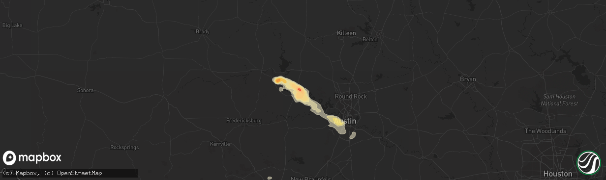
Hail Map in Marble Falls, TX on April 2, 2013
The weather event in Marble Falls, TX on April 2, 2013 includes Hail map. 1 state and 131 cities were impacted and suffered possible damage. The total estimated number of properties impacted is 0.
Hail
0
Estimated number of impacted properties by a 1.00" hail or larger0
Estimated number of impacted properties by a 1.75" hail or larger0
Estimated number of impacted properties by a 2.50" hail or largerStorm reports in Marble Falls, TX
Marble Falls, TX
| Date | Description |
|---|---|
| 04/02/20134:00 PM CDT | Delayed report |
| 04/02/20133:25 PM CDT | A local report indicates 1.75 inch wind near 1 SSW MARBLE FALLS |
| 04/02/20133:20 PM CDT | A local report indicates 2.00 inch wind near 3 SE MARBLE FALLS |
| 04/02/20133:20 PM CDT | Golfball size hail. |
| 04/02/20133:15 PM CDT | 15-18 min duration |
| 04/02/20133:12 PM CDT | Golf to baseball size hail at intersection of hwys 71 281 |
| 04/02/20133:10 PM CDT | Nickel to quarter size hail. |
All States Impacted by Hail Map on April 2, 2013
All Cities Impacted by Hail Map on April 2, 2013
- Boling, TX
- Wharton, TX
- Hitchcock, TX
- Schulenburg, TX
- West Point, TX
- Garwood, TX
- East Bernard, TX
- Asherton, TX
- Big Wells, TX
- Crystal City, TX
- Catarina, TX
- Cotulla, TX
- Needville, TX
- Muldoon, TX
- Flatonia, TX
- San Antonio, TX
- Santa Fe, TX
- Texas City, TX
- La Marque, TX
- La Grange, TX
- Waelder, TX
- Harwood, TX
- Dale, TX
- Red Rock, TX
- Lockhart, TX
- Rosanky, TX
- Moulton, TX
- Luling, TX
- Gonzales, TX
- Katy, TX
- Spicewood, TX
- Marble Falls, TX
- Killeen, TX
- Alvin, TX
- Missouri City, TX
- Rosharon, TX
- Mullin, TX
- Mertzon, TX
- Marathon, TX
- Smithville, TX
- Giddings, TX
- Midkiff, TX
- Llano, TX
- Kingsland, TX
- Pasadena, TX
- Houston, TX
- Dickinson, TX
- Burnet, TX
- Round Mountain, TX
- Horseshoe Bay, TX
- Glen Flora, TX
- Richmond, TX
- El Campo, TX
- Hallettsville, TX
- Louise, TX
- Eagle Lake, TX
- Sublime, TX
- Beasley, TX
- Galveston, TX
- Liverpool, TX
- Pledger, TX
- Helotes, TX
- Dryden, TX
- Guy, TX
- Lytle, TX
- Rosenberg, TX
- Sugar Land, TX
- Big Lake, TX
- Richland Springs, TX
- Castroville, TX
- Boerne, TX
- Devine, TX
- Ozona, TX
- Moore, TX
- Yancey, TX
- Pearsall, TX
- Damon, TX
- Mingus, TX
- Gordon, TX
- Sheffield, TX
- Fort Stockton, TX
- Bulverde, TX
- Hondo, TX
- Bertram, TX
- Stafford, TX
- Austin, TX
- Buchanan Dam, TX
- Leander, TX
- Weimar, TX
- Manvel, TX
- Columbus, TX
- Sonora, TX
- Pipe Creek, TX
- New Braunfels, TX
- Bellaire, TX
- Fresno, TX
- League City, TX
- Goldthwaite, TX
- Van Vleck, TX
- Brookshire, TX
- Wimberley, TX
- Marion, TX
- Seguin, TX
- Maxwell, TX
- Tow, TX
- Sterling City, TX
- Port Bolivar, TX
- Shiner, TX
- Schertz, TX
- Wallis, TX
- Bastrop, TX
- Sealy, TX
- Alleyton, TX
- Cat Spring, TX
- Martindale, TX
- Angleton, TX
- Webster, TX
- Pearland, TX
- Friendswood, TX
- Ledbetter, TX
- Fulshear, TX
- Del Valle, TX
- Cibolo, TX
- Cedar Creek, TX
- Carrizo Springs, TX
- Kyle, TX
- Buda, TX
- Three Rivers, TX
- Johnson City, TX
- Canyon Lake, TX
- Spring Branch, TX


