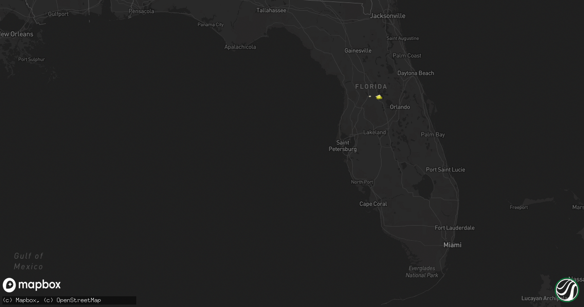
Hail Map in Florida on March 30, 2021
Get this storm
March 30 map
$229
one time, instant access
Download today. No call, no setup
Keep the $229
Bought the map and want the full workflow? Apply the entire $229 to a subscription within 7 days. None of it is wasted.
Every map, not just this one
This buys you this map. Subscription and you get every map we run, in the markets you choose from a few cities to whole states to nationwide. Plus real-time alerts the moment a storm fires.
Contact data
Name, contact info, occupancy, even credit band for addresses in the footprint. You go from where it hit to who to call.
Become the source they trust
Unlimited branding weather history reports on demand. You already have the documented answer ready for the property owner, and you are the one who showed up with it.
Property data and RoofTrace estimates
Pull up any address you have got, its value and the exact code rules for that jurisdiction, straight from One Click Code. Then RoofTrace estimates the squares, pitch, and roof value, priced the way you price.
Storm reports in Florida
Florida
| Date | Description |
|---|---|
| 03/30/20215:50 PM CDT | Emergency management reported sheriff deputy observed a downed tree as well as some downed electrical lines on cr-528. Hail of unknown size was also observed. Time esti |
| 03/30/20215:10 PM CDT | Tree and powerline down near sw 38th ave and sw 67th ave. Radar estimated time. |
| 03/30/20215:05 PM CDT | Tree down near nw hwy 225 and nw 125th st. Radar estimated time. |
| 03/30/20212:58 AM CDT | At 758 PM EDT, a severe thunderstorm was located near Lake Harris, moving east at 5 mph. HAZARD...60 mph wind gusts and quarter size hail. SOURCE...Radar indicated. IMPACT...Hail damage to vehicles is expected. Expect wind damage to roofs, siding, and trees. Locations impacted include... Howey-In-the-hills, Lake Harris, Hawthorne, Yalaha and Okahumpka. |
| 03/30/20211:48 AM CDT | At 648 PM EDT, a severe thunderstorm was located near Bushnell, moving northeast at 10 mph. HAZARD...Quarter size hail. SOURCE...Radar indicated. IMPACT...Damage to vehicles is expected. Locations impacted include... Lake Panasoffkee, Sumterville and Adamsville. |
| 03/30/20211:45 AM CDT | At 645 PM EDT, a severe thunderstorm was located near Ocala, moving east at 15 mph. HAZARD...60 mph wind gusts and penny size hail. SOURCE...Radar indicated. IMPACT...Expect damage to roofs, siding, and trees. Locations impacted include... Ocala, Anthony and Burbank. |
| 03/30/20211:00 AM CDT | At 559 PM EDT, a severe thunderstorm was located near Ocala Airport, or 8 miles northwest of Ocala, moving northeast at 10 mph. HAZARD...60 mph wind gusts and penny size hail. SOURCE...Radar indicated. IMPACT...Expect damage to roofs, siding, and trees. Locations impacted include... Ocala, Sparr, Anthony, Ocala Airport, Reddick, McIntosh and Lowell. |
| 03/29/20217:10 PM CDT | Numerous 1-inch and larger tree branches downed throughout the planatation at leesburg community. Delayed report from trained spotter. |
| 03/29/20217:07 PM CDT | Dime to quarter size hail reported by trained storm spotter. |
All States Impacted by Hail Map on March 30, 2021
Cities Impacted by Hail Map on March 30, 2021
- Yalaha, FL
- Okahumpka, FL
- Leesburg, FL
- Howey In The Hills, FL
- Groveland, FL
- Monticello, AR
- Warren, AR
- Wilmar, AR
- Sumterville, FL
- Eustis, FL
- Fountain Hill, AR
- Dermott, AR
- Tillar, AR
- Hamburg, AR
- Rison, AR
- Seminary, MS
- Carrollton, MS
- Vardaman, MS
- Calhoun City, MS
- Gore Springs, MS
- Duck Hill, MS
- North Carrollton, MS
- McCarley, MS
- Winona, MS
- Eupora, MS
- Amory, MS
- Greenwood Springs, MS
- Smithville, MS
- Arkadelphia, AR
- Carthage, AR
- Leola, AR


