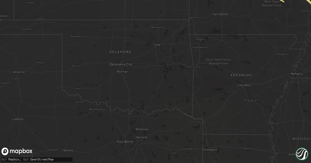
Hail Map on March 28, 2012
Get this storm
March 28 map
$229
one time, instant access
Download today. No call, no setup
Keep the $229
Bought the map and want the full workflow? Apply the entire $229 to a subscription within 7 days. None of it is wasted.
Every map, not just this one
This buys you this map. Subscription and you get every map we run, in the markets you choose from a few cities to whole states to nationwide. Plus real-time alerts the moment a storm fires.
Contact data
Name, contact info, occupancy, even credit band for addresses in the footprint. You go from where it hit to who to call.
Become the source they trust
Unlimited branding weather history reports on demand. You already have the documented answer ready for the property owner, and you are the one who showed up with it.
Property data and RoofTrace estimates
Pull up any address you have got, its value and the exact code rules for that jurisdiction, straight from One Click Code. Then RoofTrace estimates the squares, pitch, and roof value, priced the way you price.
States Impacted by Hail Map on March 28, 2012
Storm reports
West Virginia
| Date | Description |
|---|---|
| 03/28/20125:07 PM CDT | Time estimated from radar |
| 03/28/20123:15 PM CDT | A local report indicates 1.00 inch wind near MILTON |
| 03/28/20123:15 PM CDT | A local report indicates 1.00 inch wind near KENOVA |
| 03/28/20123:08 PM CDT | A local report indicates 1.25 inch wind near 6 NW BUFFALO |
| 03/28/20123:05 PM CDT | A local report indicates 1.00 inch wind near HUNTINGTON |
| 03/28/20122:30 PM CDT | Hail covering ground. |
| 03/28/20122:15 PM CDT | .88 to 1 in hail in town center of mill creek via randolph county warning point |
| 03/28/20122:13 PM CDT | Report from huttonsville prison. |
| 03/28/20122:06 PM CDT | Hail covering ground. |
| 03/28/20121:53 PM CDT | Prolific...wind-driven hail covered the ground a few inches deep |
| 03/28/20121:47 PM CDT | A local report indicates 1.00 inch wind near 1 W BRAKE |
| 03/28/20121:45 PM CDT | A local report indicates 1.00 inch wind near FRENCH CREEK |
| 03/28/20121:45 PM CDT | A local report indicates 1.00 inch wind near ROCK CAVE |
| 03/28/20121:35 PM CDT | 1 inch to 1.25 inch hail covering the ground |
| 03/28/20121:34 PM CDT | A local report indicates 2.00 inch wind near SAND RUN |
| 03/28/20121:32 PM CDT | Dime to quarter size hail covering the ground. |
| 03/28/20121:05 PM CDT | A local report indicates 1.00 inch wind near HUNTINGTON |
| 03/28/20121:05 PM CDT | Tree down along 219 just north of thomas |
Missouri
| Date | Description |
|---|---|
| 03/28/20126:50 PM CDT | A local report indicates 1.00 inch wind near PILOT KNOB |
| 03/27/20127:05 PM CDT | A local report indicates 1.25 inch wind near PILOT KNOB |
Montana
| Date | Description |
|---|---|
| 03/28/20123:09 PM CDT | Power outage in lolo. Most of the towns along highway 93 south of lolo are impacted by this. |
| 03/28/20122:56 PM CDT | Three 25-40 foot cedar trees were snapped at the trunks. Up to 2 feet in diameter at various heights behind the washington-grizzley stadium. |
| 03/28/20122:50 PM CDT | Papa murphys pizza sign destroyed on brooks street in downtown missoula |
| 03/27/20127:22 PM CDT | Geyser dot measures 63 mph thunderstorm wind gust. |
Virginia
| Date | Description |
|---|---|
| 03/28/20126:55 PM CDT | Large tree down on driveway in bonsack area |
| 03/28/20125:20 PM CDT | Tree down on jump mountain road in rockbridge baths. |
| 03/28/20122:40 PM CDT | A local report indicates 1.00 inch wind near 1 NNE BLUE GRASS |
| 03/28/20122:12 PM CDT | Several trees down |
| 03/28/20122:11 PM CDT | Tree blown down in thunderstorm wind |
| 03/28/20122:10 PM CDT | Small limbs blown down in thunderstorm wind |
| 03/28/20122:09 PM CDT | Hail was at least the size of pennies. Barn was toppled by thunderstorm winds. |
| 03/28/20122:05 PM CDT | Time estimated from radar. Branches blown down in wind. |
| 03/28/20122:03 PM CDT | Several small branches knocked down. Largest was about 2 inches in diameter. |
| 03/27/20128:12 PM CDT | Trees down along mount zion road near highway 17. |
| 03/27/20127:20 PM CDT | Large tree down on oberlin rd |
| 03/27/20127:10 PM CDT | Tree branch fell on trailer. |
Illinois
| Date | Description |
|---|---|
| 03/28/20126:38 PM CDT | Golf ball size hail reported in jonesboro. |
| 03/28/20126:34 PM CDT | Ping pong ball size hail reported in anna. |
| 03/28/20126:25 PM CDT | Quarter size hail reported along highway 127. |
Kentucky
| Date | Description |
|---|---|
| 03/28/20126:20 PM CDT | Hail bigger than nickels...up to quarter size...along with plenty of smaller hailstones. |
| 03/28/20124:08 PM CDT | The hail ranged from dime to quarter size. |
| 03/28/20123:12 PM CDT | Fell for about 7 minutes downtown. |
| 03/28/20123:00 PM CDT | Several trees down along rosewood dr. |
| 03/28/20122:58 PM CDT | Along highway 460 in far western scott county. |
| 03/28/20122:58 PM CDT | Fell about 8 minutes...hail covered the groung. |
| 03/28/20122:55 PM CDT | Damage to a car. |
| 03/28/20122:45 PM CDT | A local report indicates 1.00 inch wind near RUSSELL |
| 03/28/20122:30 PM CDT | A local report indicates 1.25 inch wind near WORTHINGTON |
| 03/28/20122:22 PM CDT | A local report indicates 65 MPH wind near GREENUP |
| 03/28/20122:20 PM CDT | Hikes point. |
| 03/28/20122:17 PM CDT | Gene snyder and shelbyville rd |
| 03/28/20122:15 PM CDT | Hail around the size of quarters. |
| 03/28/20122:13 PM CDT | A local report indicates 1.75 inch wind near MIDDLETOWN |
| 03/28/20122:10 PM CDT | A local report indicates 1.00 inch wind near JEFFERSONTOWN |
| 03/28/20122:05 PM CDT | E-spotter report of hail in seneca gardens. |
| 03/28/20121:57 PM CDT | At presbyterian theological seminary. |
Pennsylvania
| Date | Description |
|---|---|
| 03/28/201211:16 AM CDT | A local report indicates 1.00 inch wind near INDIAN HEAD |
| 03/28/201210:51 AM CDT | Event occurred between 1136 am 03/28/2012 and 1151 am 03/28/2012 |
| 03/28/201210:37 AM CDT | A local report indicates 1.00 inch wind near INDIAN HEAD |
| 03/28/201210:28 AM CDT | Event occurred between 1113 am 03/28/2012 and 1128 am 03/28/2012 |
| 03/28/201210:14 AM CDT | Event occurred between 1059 am 03/28/2012 and 1114 am 03/28/2012 |
| 03/28/20129:28 AM CDT | Relayed via media |
| 03/28/20128:59 AM CDT | A local report indicates 1.00 inch wind near IMPERIAL |
| 03/28/20128:59 AM CDT | Event occurred between 944 am 03/28/2012 and 959 am 03/28/2012 |
| 03/28/20128:35 AM CDT | Event occurred between 920 am 03/28/2012 and 935 am 03/28/2012 |
| 03/28/20128:03 AM CDT | Event occurred between 848 am 03/28/2012 and 903 am 03/28/2012 |
| 03/28/20127:48 AM CDT | A local report indicates 1.00 inch wind near BROCKWAY |
Texas
| Date | Description |
|---|---|
| 03/28/20124:07 AM CDT | The police department in freer reported estimated wind gusts in the 50 to 60 mph range. |
Kansas
| Date | Description |
|---|---|
| 03/28/20126:57 PM CDT | Delayed report from severe hail verification experiment - shave. |
| 03/28/20126:56 PM CDT | A local report indicates 1.25 inch wind near 1 N CARBONDALE |
| 03/28/20126:55 PM CDT | Delayed report. |
| 03/28/20126:54 PM CDT | A local report indicates 1.75 inch wind near 3 SSW CARBONDALE |
| 03/28/20126:52 PM CDT | A local report indicates 1.00 inch wind near COUNCIL GROVE |
| 03/28/20126:50 PM CDT | Hail estimated at 2 inches based on comparison to hen egg in facebook storm report. |
| 03/28/20126:49 PM CDT | A local report indicates 1.00 inch wind near COUNCIL GROVE |
| 03/28/20126:48 PM CDT | A local report indicates 1.00 inch wind near COUNCIL GROVE |
| 03/28/20126:47 PM CDT | Delayed report from the severe hazards analysis and verification experiment...shave |
| 03/28/20126:45 PM CDT | Hail estimated at 2.5 inches from facebook storm report image. |
| 03/28/20126:36 PM CDT | A local report indicates 1.75 inch wind near 4 SW CARBONDALE |
| 03/28/20126:33 PM CDT | Hail covering ground |
| 03/28/20126:33 PM CDT | A local report indicates 1.75 inch wind near 4 S CARBONDALE |
| 03/28/20126:33 PM CDT | A local report indicates 1.25 inch wind near 3 SE SCRANTON |
| 03/28/20126:28 PM CDT | Numerous 2 to 2.25 inch hail stones reported. |
| 03/28/20126:22 PM CDT | A local report indicates 1.25 inch wind near 3 E BURLINGAME |
| 03/28/20126:20 PM CDT | A local report indicates 2.00 inch wind near 5 SSE SCRANTON |
| 03/28/20126:04 PM CDT | A local report indicates 1.00 inch wind near 2 WNW CARBONDALE |
| 03/28/20125:58 PM CDT | A local report indicates 1.00 inch wind near 2 WNW CARBONDALE |
| 03/28/20125:52 PM CDT | A local report indicates 1.50 inch wind near 6 N BURLINGAME |
| 03/28/20125:47 PM CDT | A local report indicates 2.00 inch wind near 3 NW SCRANTON |
| 03/28/20125:35 PM CDT | A local report indicates 1.00 inch wind near 3 N BURLINGAME |
| 03/28/20125:25 PM CDT | Delayed report from the severe hazards analysis and verification experiment...shave |
| 03/27/201211:36 PM CDT | A local report indicates 1.00 inch wind near SW BERN |
| 03/27/201210:51 PM CDT | A local report indicates 1.00 inch wind near 2 N SENECA |
| 03/27/201210:16 PM CDT | A local report indicates 1.00 inch wind near BAILEYVILLE |
| 03/27/201210:15 PM CDT | Hail fell for over 20 minutes in bern |
| 03/27/201210:03 PM CDT | A local report indicates 1.00 inch wind near 4 SSW BAILEYVILLE |
| 03/27/20129:57 PM CDT | A local report indicates 1.75 inch wind near 5 WNW BERN |
| 03/27/20129:19 PM CDT | A local report indicates 1.00 inch wind near 3 SSE MAYETTA |
| 03/27/20129:15 PM CDT | A plethora of golfball-sized hail occurring 2 miles north of hilltop. |
| 03/27/20129:11 PM CDT | Golfball to tennis ball size hail. |
| 03/27/20129:11 PM CDT | A local report indicates 1.00 inch wind near 2 W HOYT |
| 03/27/20129:10 PM CDT | Delayed report |
| 03/27/20129:08 PM CDT | Delayed report from social media. |
| 03/27/20128:57 PM CDT | A local report indicates 4.25 inch wind near MADISON |
| 03/27/20128:55 PM CDT | A local report indicates 1.00 inch wind near 7 NW READING |
| 03/27/20128:47 PM CDT | A local report indicates 1.00 inch wind near MADISON |
| 03/27/20128:38 PM CDT | A local report indicates 2.00 inch wind near 5 SSE BUSHONG |
| 03/27/20128:33 PM CDT | A local report indicates 1.75 inch wind near 11 N EMPORIA |
| 03/27/20128:26 PM CDT | A local report indicates 1.00 inch wind near 6 S ADMIRE |
| 03/27/20128:25 PM CDT | A local report indicates 1.25 inch wind near 2 E WESTMORELAND |
| 03/27/20128:17 PM CDT | A local report indicates 1.50 inch wind near 4 NNW LOUISVILLE |
| 03/27/20128:07 PM CDT | A local report indicates 1.50 inch wind near 3 NW WAMEGO |
| 03/27/20128:06 PM CDT | A local report indicates 1.50 inch wind near 5 SSE BUSHONG |
| 03/27/20128:00 PM CDT | Also reporting a strongly rotating wall cloud. |
| 03/27/20128:00 PM CDT | Delayed report from social media. |
| 03/27/20127:46 PM CDT | A local report indicates 2.00 inch wind near 5 S BUSHONG |
| 03/27/20127:43 PM CDT | Delayed report from social media. |
| 03/27/20127:15 PM CDT | A local report indicates 1.75 inch wind near DUNLAP |
| 03/27/20127:15 PM CDT | Disk shaped with several golfball-sized. |
| 03/27/20127:11 PM CDT | A local report indicates 1.00 inch wind near 1 SW EMPORIA |
| 03/27/20127:10 PM CDT | Quarter to dime size hail reported. |
| 03/27/20127:10 PM CDT | A local report indicates 1.25 inch wind near DUNLAP |
| 03/27/20127:08 PM CDT | Commerical ave and kansas st. |
| 03/27/20127:06 PM CDT | A local report indicates 1.00 inch wind near CARBONDALE |
| 03/27/20127:05 PM CDT | Lots of golfball hail in town. |
| 03/27/20127:05 PM CDT | A local report indicates 1.25 inch wind near 2 W OVERBROOK |
| 03/27/20127:02 PM CDT | Relayed by wfo topeka. Received on facebook page. |
| 03/27/20127:01 PM CDT | A local report indicates 1.75 inch wind near 5 W OVERBROOK |
| 03/27/20127:00 PM CDT | Delayed report from the severe hazards analysis and verification experiment...shave |
| 03/27/20127:00 PM CDT | A local report indicates 1.50 inch wind near MADISON |
Ohio
| Date | Description |
|---|---|
| 03/28/20123:03 PM CDT | A local report indicates 1.25 inch wind near SOUTH POINT |
| 03/28/20122:38 PM CDT | A local report indicates 1.25 inch wind near SOUTH POINT |
| 03/28/20122:36 PM CDT | A local report indicates 1.00 inch wind near IRONTON |
| 03/28/20122:34 PM CDT | A local report indicates 1.25 inch wind near IRONTON |
Nebraska
| Date | Description |
|---|---|
| 03/28/20121:52 PM CDT | A local report indicates 1.00 inch wind near 3 W OXFORD |
| 03/28/20121:50 PM CDT | Field covered in hail. Pea to nickle sized with quarter sized mixed in. |
| 03/27/201210:30 PM CDT | Nicekl to quarter size hail. Enough hail to make the ground white. |
Cities Impacted by Hail Map on March 28, 2012
- Barboursville, WV
- Salt Rock, WV
- Milton, WV
- Versailles, KY
- Chapmanville, WV
- Mayetta, KS
- Hoyt, KS
- Garden City, MO
- Holden, MO
- Blairstown, MO
- Hillsboro, KY
- Rockville, MO
- Butler, MO
- Rich Hill, MO
- Oak Grove, MO
- Lone Jack, MO
- Paris, KY
- Sharpsburg, KY
- Owingsville, KY
- Moorefield, KY
- Carlisle, KY
- Clinton, MO
- Urich, MO
- Chilhowee, MO
- Lehr, ND
- Culloden, WV
- Ironton, OH
- Kitts Hill, OH
- Huntington, WV
- Flatwoods, KY
- Hurricane, WV
- South Point, OH
- Chesapeake, OH
- Ona, WV
- Russell, KY
- South Shore, KY
- Proctorville, OH
- Franklin Furnace, OH
- Worthington, KY
- Greenup, KY
- Ashland, KY
- Council Grove, KS
- Mount Sterling, KY
- Winchester, KY
- Holbrook, NE
- Arapahoe, NE
- Grain Valley, MO
- Buckner, MO
- Virgil, KS
- Du Bois, NE
- Oneida, KS
- Bern, KS
- Seneca, KS
- Greenock, PA
- Jeannette, PA
- Adamsburg, PA
- Rillton, PA
- Irwin, PA
- Clairton, PA
- Mckeesport, PA
- Greensburg, PA
- Elizabeth, PA
- Glassport, PA
- West Mifflin, PA
- Pittsburgh, PA
- Boonville, MO
- Bunceton, MO
- Leon, WV
- Gassaway, WV
- Webster Springs, WV
- Cowen, WV
- Sutton, WV
- Erbacon, WV
- Little Birch, WV
- Diana, WV
- Shelbyville, KY
- Taylorsville, KY
- Mount Eden, KY
- Lawrenceburg, KY
- Waddy, KY
- Missouri City, MO
- Liberty, MO
- Independence, MO
- Excelsior Springs, MO
- Orrick, MO
- Olive Hill, KY
- Beatrice, NE
- Filley, NE
- Encinal, TX
- Frohna, MO
- Altenburg, MO
- Waynesburg, KY
- Louisa, KY
- Fort Gay, WV
- Eskridge, KS
- Wolf Lake, IL
- Georgetown, KY
- Sadieville, KY
- Karnes City, TX
- Kenedy, TX
- Madison, KS
- Gridley, KS
- Hartford, KS
- Hamilton, KS
- Lexington, KY
- Courtland, KS
- Bentleyville, PA
- Eighty Four, PA
- Scenery Hill, PA
- Diller, NE
- Tilden, TX
- Linwood, KS
- Eudora, KS
- Tonganoxie, KS
- Denison, KS
- Meriden, KS
- Mcconnelsville, OH
- Helvetia, WV
- Pickens, WV
- Huttonsville, WV
- Mill Creek, WV
- Calliham, TX
- Beeville, TX
- Cynthiana, KY
- Stamping Ground, KY
- Reading, KS
- Sibley, MO
- New Stanton, PA
- Arona, PA
- South Park, PA
- Bridgeville, PA
- Bethel Park, PA
- Herminie, PA
- Americus, KS
- Wamego, KS
- Saint George, KS
- Olpe, KS
- Emporia, KS
- French Creek, WV
- Mabie, WV
- Freer, TX
- San Diego, TX
- Silver Lake, KS
- Prichard, WV
- Catlettsburg, KY
- Vanceburg, KY
- Rush, KY
- Grayson, KY
- East Lynn, WV
- Branchland, WV
- Wayne, WV
- Emerson, KY
- Floresville, TX
- Sandgap, KY
- Tyner, KY
- McKee, KY
- Alma, KS
- Allen, KS
- Kenova, WV
- Louisville, KY
- Wathena, KS
- Troy, KS
- Carbondale, KS
- Scranton, KS
- Midkiff, WV
- Wallingford, KY
- Flemingsburg, KY
- Tollesboro, KY
- Ranger, WV
- Mayslick, KY
- Maysville, KY
- Harveyville, KS
- Frankfort, KY
- Midway, KY
- Burlingame, KS
- Linn, WV
- Coxs Mills, WV
- Rock Cave, WV
- Weston, WV
- Burnsville, WV
- Ireland, WV
- Walkersville, WV
- Crawford, WV
- Orlando, WV
- Cleveland, WV
- Glenville, WV
- Campbellton, TX
- Falls City, TX
- Three Rivers, TX
- Fisherville, KY
- Cotulla, TX
- Laredo, TX
- Horton, KS
- Blackburn, MO
- Concordia, MO
- Yoakum, TX
- Kenna, WV
- Advent, WV
- Walton, WV
- Gandeeville, WV
- Anna, IL
- Jonesboro, IL
- Cobden, IL
- Weston, MO
- Pedro, OH
- Webbville, KY
- Sandy Hook, KY
- Blackwater, MO
- Pilot Grove, MO
- Ewing, KY
- Morehead, KY
- Wishek, ND
- Burgettstown, PA
- Joffre, PA
- Yorktown, TX
- Hambleton, WV
- Onaga, KS
- Westmoreland, KS
- Runge, TX
- Hobson, TX
- Lathrop, MO
- Cameron, MO
- Stewartsville, MO
- Osborn, MO
- Kingston, MO
- Turney, MO
- Plattsburg, MO
- Polo, MO
- Middle Brook, MO
- Winfield, WV
- Red House, WV
- Eleanor, WV
- Fraziers Bottom, WV
- Buffalo, WV
- Dilley, TX
- Big Wells, TX
- Appleton City, MO
- Claysville, PA
- Washington, PA
- Avella, PA
- Dwight, KS
- Alta Vista, KS
- Oxford, NE
- Fairview, KS
- Corning, OH
- Crooksville, OH
- Alto Pass, IL
- Grand Tower, IL
- Big Springs, WV
- Harrisville, WV
- Smithville, WV
- Paola, KS
- Sweet Springs, MO
- Thomas, WV
- Parsons, WV
- Hendricks, WV
- Montrose, WV
- Thousandsticks, KY
- Baileyville, KS
- Millstone, WV
- Perryville, MO
- Reedy, WV
- Sandyville, WV
- Spencer, WV
- Arnoldsburg, WV
- Le Roy, WV
- Maple Hill, KS
- Topeka, KS
- Upperglade, WV
- Camden On Gauley, WV
- De Kalb, MO
- Rushville, MO
- Mathias, WV
- Moorefield, WV
- Calhoun, MO
- Alice, TX
- Orange Grove, TX
- Perryopolis, PA
- Dawson, PA
- Hollenberg, KS
- Hanover, KS
- Odell, NE
- Centerview, MO
- Kansas City, MO
- Rossville, KS
- Goliad, TX
- Concepcion, TX
- Blue Springs, MO
- Annville, KY
- Ivydale, WV
- Centralia, KS
- Vermillion, KS
- Looneyville, WV
- Willow Wood, OH
- Simpsonville, KY
- Finchville, KY
- Smithville, MO
- Eglon, WV
- Aurora, WV
- Lesage, WV
- Lansing, KS
- Leavenworth, KS
- Proctor, WV
- Robstown, TX
- Cameron, WV
- Bagdad, KY
- Everest, KS
- Ceredo, WV
- Lavalette, WV
- Argillite, KY
- Garrison, KY
- Orma, WV
- Whiting, KS
- Netawaka, KS
- Holton, KS
- Saltsburg, PA
- Apollo, PA
- Export, PA
- Admire, KS
- Flatgap, KY
- Martha, KY
- Blaine, KY
- Keaton, KY
- Stambaugh, KY
- McLouth, KS
- Guysville, OH
- Coolville, OH
- Frametown, WV
- Eureka, SD
- Waverly, MO
- Belvue, KS
- Clendenin, WV
- Elkview, WV
- Ironton, MO
- Pilot Knob, MO
- Holbrook, PA
- Waynesburg, PA
- Rogersville, PA
- Weirton, WV
- Toronto, OH
- Bulger, PA
- New Cumberland, WV
- Imperial, PA
- Darragh, PA
- Nicholasville, KY
- Richmond, KY
- Alum Bridge, WV
- Kanawha Head, WV
- Bartow, WV
- Sand Fork, WV
- Tallmansville, WV
- Macfarlan, WV
- Arcadia, MO
- Belleview, MO
- Sistersville, WV
- Middlebourne, WV
- New Martinsville, WV
- Newton, WV
- Ripley, WV
- Gay, WV
- Left Hand, WV
- Amma, WV
- Saint Joseph, MO
- Rockwood, IL
- Farrar, MO
- Overbrook, KS
- Durbin, WV
- Midway, PA
- McDonald, PA
- Booneville, KY
- Ricetown, KY
- Formoso, KS
- Jewell, KS
- Murrysville, PA
- Monroeville, PA
- Delmont, PA
- Burchard, NE
- Table Rock, NE
- Pawnee City, NE
- Steinauer, NE
- Southside, WV
- Delia, KS
- Auburn, KS
- Sod, WV
- Emlenton, PA
- Morrowville, KS
- Fairbury, NE
- Mahaska, KS
- Oneida, KY
- Axtell, KS
- Shippenville, PA
- Wallback, WV
- Chloe, WV
- Liberty, NE
- Yawkey, WV
- Alum Creek, WV
- Griffithsville, WV
- Sumerco, WV
- Bonne Terre, MO
- Belle Vernon, PA
- West Newton, PA
- Monongahela, PA
- Smithton, PA
- Creekside, PA
- Home, PA
- Given, WV
- Charleston, WV
- Liberty, WV
- Poth, TX
- Thornton, WV
- Blue Grass, VA
- Birchleaf, VA
- Bee, VA
- Fairmont, WV
- Farmington, WV
- Worthington, WV
- Manhattan, KS
- Montrose, MO
- Schell City, MO
- Wetmore, KS
- Bendena, KS
- Rosedale, WV
- Alkol, WV
- Rayville, MO
- Richmond, MO
- Dawson, NE
- Sabetha, KS
- Platte City, MO
- Dearborn, MO
- Humboldt, NE
- Corning, KS
- Littleton, WV
- Ovando, MT
- Bethany, WV
- Henderson, WV
- Clintwood, VA
- Mount Zion, WV
- Grantsville, WV
- Genoa, WV
- Ligonier, PA
- Highland, KS
- Robinson, KS
- Gallipolis Ferry, WV
- Apple Grove, WV
- Norborne, MO
- Villisca, IA
- Waldron, MO
- Malta Bend, MO
- Buena Vista, PA
- Wymore, NE
- West Hamlin, WV
- Grafton, WV
- Irvine, KY
- Knob Noster, MO
- Warrensburg, MO
- Blue Springs, NE
- Mannington, WV
- Moundsville, WV
- Glen Easton, WV
- Seguin, TX
- Easton, KS
- Sardis, OH
- Isonville, KY
- Lowmansville, KY
- Sitka, KY
- New Matamoras, OH
- Woodsfield, OH
- Graysville, OH
- Long Lake, SD
- Manchester, KY
- Jerusalem, OH
- Clarington, OH
- Beallsville, OH
- Jacksonburg, WV
- Reader, WV
- Pine Grove, WV
- Goff, KS
- Evans, WV
- Duck, WV
- Wind Ridge, PA
- Corder, MO
- Wilmore, KY
- Cuero, TX
- Creighton, MO
- Leeton, MO
- Basehor, KS
- Savannah, MO
- Finleyville, PA
- Venetia, PA
- New Eagle, PA
- Bunola, PA
- Sextons Creek, KY
- Nixon, TX
- Hamlin, WV
- Tornado, WV
- Muscotah, KS
- Portland, OH
- Millwood, WV
- Ravenswood, WV
- Cuddy, PA
- Mount Jackson, VA
- Edinburg, VA
- Nordheim, TX
- Palestine, WV
- Elwood, NE
- Elwood, KS
- Coal Center, PA
- Charleroi, PA
- Lewisville, OH
- Racine, OH
- Circleville, WV
- Tunnelton, WV
- Moatsville, WV
- Lincoln, MO
- Windsor, MO