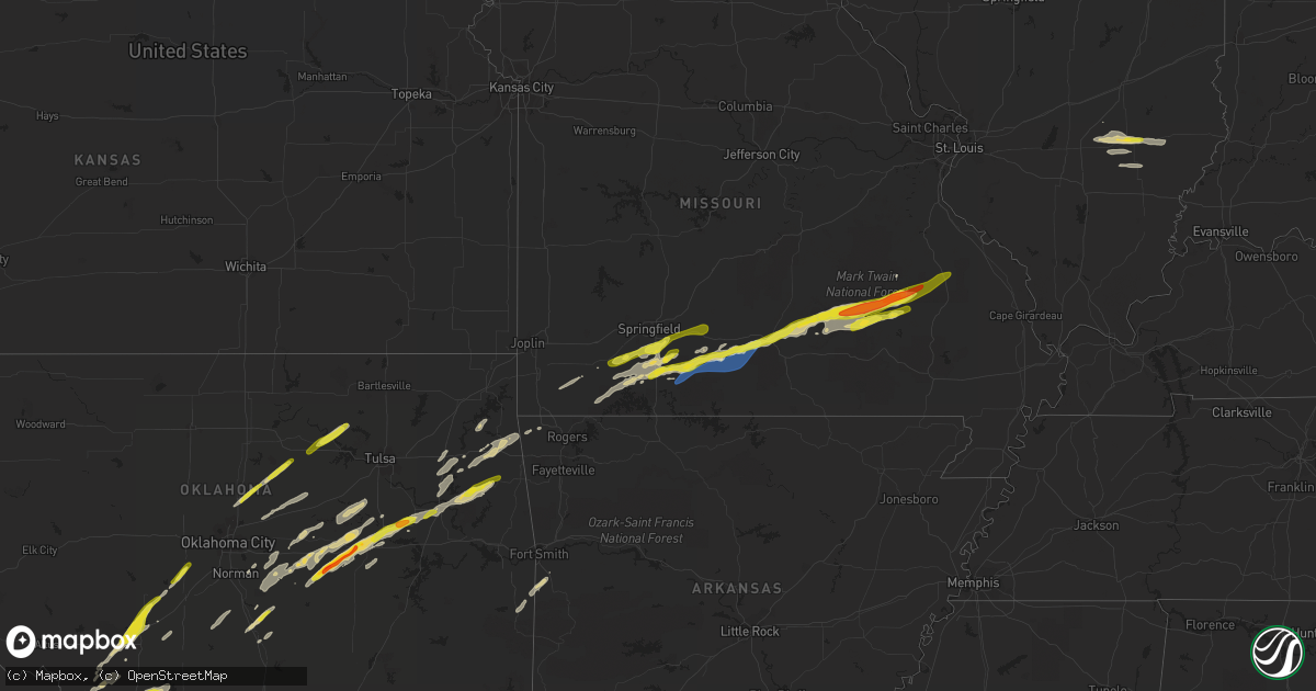
Hail Map on March 23, 2023
Get this storm
March 23 map
$229
one time, instant access
Download today. No call, no setup
Keep the $229
Bought the map and want the full workflow? Apply the entire $229 to a subscription within 7 days. None of it is wasted.
Every map, not just this one
This buys you this map. Subscription and you get every map we run, in the markets you choose from a few cities to whole states to nationwide. Plus real-time alerts the moment a storm fires.
Contact data
Name, contact info, occupancy, even credit band for addresses in the footprint. You go from where it hit to who to call.
Become the source they trust
Unlimited branding weather history reports on demand. You already have the documented answer ready for the property owner, and you are the one who showed up with it.
Property data and RoofTrace estimates
Pull up any address you have got, its value and the exact code rules for that jurisdiction, straight from One Click Code. Then RoofTrace estimates the squares, pitch, and roof value, priced the way you price.
States Impacted by Hail Map on March 23, 2023
Storm reports
Missouri
| Date | Description |
|---|---|
| 03/23/20236:43 PM CDT | Per county commissioner. |
| 03/23/20236:36 PM CDT | Damage to a trailer. |
| 03/23/20236:22 PM CDT | Delayed report. A large tree was reported to be blown down on saddlebrook drive and another one on highway a. |
| 03/23/20236:13 PM CDT | Corrects time of previous tstm wnd dmg report from ava. Damage to a trailer. |
| 03/23/20236:01 PM CDT | Multiple trees down. Roof and structural damage to several outbuildings. |
| 03/23/20236:00 PM CDT | Tree down on hwy o near goodhope. |
| 03/23/20235:50 PM CDT | Tree down. |
| 03/22/202311:54 PM CDT | Mo-37 northbound & southbound closed due to flooding. |
| 03/22/202310:53 PM CDT | Delayed social media report. Downed fence... Downed trees... Trampoline and grill blown away. |
| 03/22/202310:53 PM CDT | Delayed social media report. Downed fence... Downed trees... Trampoline and grill blown away. |
| 03/22/202310:50 PM CDT | 2 large trees down... Powerlines down. |
| 03/22/202310:50 PM CDT | Report from mping... 1-inch tree limbs broken... Shingles blown off. |
| 03/22/202310:48 PM CDT | Report from mping... 3-inch tree limbs broken... Power poles broken. |
| 03/22/202310:46 PM CDT | Report from mping... Trees uprooted or snapped... Minor roof damage. |
| 03/22/202310:38 PM CDT | Corrects time for previous tstm wnd dmg report from ava. Time estimated from radar. Tree branch down in town. |
| 03/22/202310:25 PM CDT | A local report indicates 60 MPH wind near 2 SSW BRADLEYVILLE |
| 03/22/202310:24 PM CDT | Delayed social media report. Tree down over the road. |
| 03/22/202310:20 PM CDT | Time estimated from radar. 4 large trees uprooted and water breaching home. |
| 03/22/20239:48 PM CDT | Time estimated from radar. Tree branch down in town. |
| 03/22/20239:39 PM CDT | Roof damage reported to barns and a residence in the sarvis point road area. |
| 03/22/20239:37 PM CDT | Large tree blocking both lanes of mo-125. |
| 03/22/20239:32 PM CDT | Time estimated from radar. |
| 03/22/20239:30 PM CDT | Many mature trees downed... Uprooted... Or snapped. |
| 03/22/20239:22 PM CDT | A local report indicates 1.00 inch wind near 3 WNW OZARK |
| 03/22/20239:20 PM CDT | Report from mping: quarter |
| 03/22/20239:19 PM CDT | Corrects time for previous tstm wnd dmg report from 1 w linden. Time estimated from radar. 4 large trees uprooted and water breaching home. |
| 03/22/20239:19 PM CDT | Corrects time for previous tstm wnd dmg report from ozark. Report from mping... 3-inch tree limbs broken... Power poles broken. |
| 03/22/20238:27 PM CDT | Outbuilding destroyed and heavy damage to a machine shed. Several large trees down. |
| 03/22/20238:24 PM CDT | Estimated ping pong sized hail... Time estimated from radar. |
| 03/22/20238:23 PM CDT | A local report indicates 1.25 inch wind near 6 N ROUND SPRING |
| 03/22/20237:45 PM CDT | Corrects time of previous hail report from 6 n round spring. |
| 03/22/20237:30 PM CDT | Delayed social media report. |
Kentucky
| Date | Description |
|---|---|
| 03/23/20233:10 AM CDT | Radio communications tower collapsed on north sand ridge. |
| 03/23/20232:45 AM CDT | A local report indicates 59 MPH wind near KFGX FLEMING-MASON APT |
Oklahoma
| Date | Description |
|---|---|
| 03/23/20236:00 PM CDT | A local report indicates 1.00 inch wind near ONETA |
| 03/23/20233:50 PM CDT | A local report indicates 1.50 inch wind near 3 NNW CLEARVIEW |
| 03/23/20233:45 PM CDT | Report from mping: ping pong ball |
| 03/23/20233:41 PM CDT | Report from mping: quarter |
| 03/23/20233:37 PM CDT | Dime to quarter size hail covering the ground. |
| 03/23/20233:37 PM CDT | Time and location estimated by radar. |
| 03/23/20233:30 PM CDT | A local report indicates 1.00 inch wind near 5 S CROMWELL |
| 03/23/20233:30 PM CDT | A local report indicates 1.50 inch wind near 1 E BEARDEN |
| 03/23/20233:25 PM CDT | A local report indicates 1.75 inch wind near 5 NNW WEWOKA |
| 03/22/20239:33 PM CDT | A local report indicates 1.00 inch wind near 3 N POCASSET |
| 03/22/20238:18 PM CDT | Reported at loves travel center. |
| 03/22/20238:08 PM CDT | A local report indicates 1.75 inch wind near 2 NNE BURKBURNETT |
Texas
| Date | Description |
|---|---|
| 03/23/20235:27 AM CDT | Spotter measured a 71 mph wind gust via personal weather station in decatur. |
| 03/23/20235:15 AM CDT | Spotter measured 62 mph in cottondale. |
| 03/23/20235:14 AM CDT | Delayed report - sporadic downed trees near pr-3496. Time estimated via radar. |
| 03/23/20235:09 AM CDT | Delayed report - sporadic trees down... Minor roof and structure damage to houses along cr 3633. Time estimated via radar. |
| 03/23/20235:03 AM CDT | Hwy 199 near the wise/parker county line is shut down due to power lines across the road. An overturned rv was reported near this location as well. |
| 03/23/20234:58 AM CDT | Trailer home overturned with two persons trapped inside at 4950 lone star road just west of poolville. |
| 03/23/20234:52 AM CDT | Reports of a trailer home overturned with three persons trapped at 2525 bounty road southwest of whitt. |
| 03/23/20234:47 AM CDT | 60 mph wind gust measured at mineral wells airport. |
| 03/23/20233:50 AM CDT | Relayed via spc: home weather station in eastland measured a 59 mph wind gust. |
| 03/23/20232:45 AM CDT | A local report indicates 1.75 inch wind near 4 N TALPA |
| 03/23/20232:45 AM CDT | A local report indicates 1.00 inch wind near 3 ENE TALPA |
| 03/23/20232:15 AM CDT | There were windows broken by golf ball size hail. |
| 03/23/20232:00 AM CDT | A local report indicates 1.75 inch wind near 5 S BRONTE |
| 03/23/20232:00 AM CDT | A local report indicates 1.75 inch wind near TENNYSON |
| 03/23/20231:50 AM CDT | One-inch diameter hail in gordonville. |
| 03/23/20231:48 AM CDT | Delayed report. Scattered broken tree limbs and shingles missing. Uprooted tree measuring ten inches in diameter. Sheet metal torn off shed. |
| 03/23/20231:46 AM CDT | Half-dollar sized hail 3 miles north of sadler. |
| 03/23/20231:45 AM CDT | Measured a 71 mph wind gust on personal weather station 3 miles west of whitesboro. |
| 03/23/20231:42 AM CDT | One inch diameter hail just north of whitesboro. |
| 03/23/20231:25 AM CDT | 60mph winds and half-inch hail in gainesville. |
| 03/22/20239:26 PM CDT | A local report indicates 1.00 inch wind near 2 ENE MANKINS |
| 03/22/20238:11 PM CDT | A local report indicates 2.75 inch wind near 2 WSW BURKBURNETT |
| 03/22/20238:08 PM CDT | Outbuilding heavily damaged by thunderstorm winds. |
| 03/22/20238:04 PM CDT | A local report indicates 1.50 inch wind near BURKBURNETT |
| 03/22/20237:20 PM CDT | A local report indicates 1.25 inch wind near 6 WSW ELECTRA |
West Virginia
| Date | Description |
|---|---|
| 03/23/20234:22 AM CDT | Two trees down along rt 10 south of branchland. Time estimated from radar. |
| 03/23/20234:15 AM CDT | Portion of the roof was damaged at hamlin pk-8 school. |
| 03/23/20233:50 AM CDT | Considerable tree damage along with structural damage to several homes in the shoals community. Damage was consistently blown in an easterly direction with no sign of o |
| 03/22/202310:11 PM CDT | A few trees were reported down near morgan's grove park in shepherdstown. |
| 03/22/202310:03 PM CDT | A tree was reported down near duke rd and elementary dr. |
| 03/22/202310:00 PM CDT | A tree was reported down near dry run rd and thatcher rd. |
Pennsylvania
| Date | Description |
|---|---|
| 03/23/20233:47 PM CDT | Tree down near the intersection of brent road and jervis road. |
| 03/23/20233:47 PM CDT | Tree down near the intersection of brent road and jervis road. |
Illinois
| Date | Description |
|---|---|
| 03/23/20238:55 AM CDT | Quarter size hail reported at briscoe surplus sales in flora. |
| 03/23/20232:30 AM CDT | 4 large cedar trees down across saraville road. |
| 03/23/20232:28 AM CDT | A few trees down... Some of which fell into power lines. |
| 03/23/20232:02 AM CDT | Tree and power line down. |
California
| Date | Description |
|---|---|
| 03/22/20237:35 PM CDT | Haille road. Time estimated by radar. |
Cities Impacted by Hail Map on March 23, 2023
- Flora, IL
- Clay City, IL
- Xenia, IL
- Louisville, IL
- Iuka, IL
- Kinmundy, IL
- Cisne, IL
- Johnsonville, IL
- Olney, IL
- Noble, IL
- Rinard, IL
- Pauls Valley, OK
- Byars, OK
- Wewoka, OK
- Seminole, OK
- Wetumka, OK
- Okemah, OK
- Vernon, TX
- Harrold, TX
- Weleetka, OK
- Oklaunion, TX
- Perkins, OK
- Stillwater, OK
- Ripley, OK
- Henryetta, OK
- Okmulgee, OK
- Morris, OK
- Glencoe, OK
- Boynton, OK
- Maramec, OK
- Pawnee, OK
- Guthrie, OK
- Cleveland, OK
- Jennings, OK
- Coyle, OK
- Meridian, OK
- Oktaha, OK
- Hominy, OK
- Osage, OK
- Muskogee, OK
- Fort Gibson, OK
- Hulbert, OK
- Tahlequah, OK
- Proctor, OK
- Walnut Shade, MO
- Spokane, MO
- Reeds Spring, MO
- Chestnutridge, MO
- Forsyth, MO
- Ozark, MO
- Chadwick, MO
- Garrison, MO
- Ava, MO
- Oldfield, MO
- Cassville, MO
- Maysville, OK
- Lindsay, OK
- Bristow, OK
- Beggs, OK
- Castle, OK
- Prague, OK
- Sparks, OK
- Meeker, OK
- Welling, OK
- Chouteau, OK
- Wagoner, OK
- Locust Grove, OK
- Paden, OK
- Barnsdall, OK
- Colcord, OK
- Galena, MO
- Electra, TX
- Noble, OK
- Norman, OK
- Youngstown, OH
- Bradley, OK
- Jay, OK
- Peggs, OK
- Oaks, OK
- Kansas, OK
- Twin Oaks, OK
- Rose, OK
- Purcell, OK
- Lowellville, OH
- Paoli, OK
- Lexington, OK
- Wayne, OK
- Newalla, OK
- Boley, OK
- Porter, OK
- Salem, IL
- Cape Fair, MO
- Aurora, MO
- Washington, OK
- Blanchard, OK
- Yale, OK
- Bowlegs, OK
- Maud, OK
- Haskell, OK
- Edmond, OK
- Seymour, MO
- Coweta, OK
- Norwood, MO
- Drury, MO
- Sparta, MO
- Crowell, TX
- Seymour, TX
- Rogersville, MO
- Bruner, MO
- Mountain Grove, MO
- Vanzant, MO
- Cabool, MO
- Elk Creek, MO
- Willow Springs, MO
- Houston, MO
- Yukon, MO
- Eunice, MO
- Summersville, MO
- Hartshorn, MO
- Eminence, MO
- Salem, MO
- Iowa Park, TX
- Burkburnett, TX
- Devol, OK
- Munday, TX
- Knox City, TX
- Randlett, OK
- Temple, OK
- Goree, TX
- Ellington, MO
- Redford, MO
- Centerville, MO
- Lesterville, MO
- Bunker, MO
- Annapolis, MO
- Ironton, MO
- Arcadia, MO
- Fredericktown, MO
- Farmington, MO
- Lawton, OK
- Elgin, OK
- Medicine Park, OK
- Apache, OK
- Anadarko, OK
- Holliday, TX
- Pocasset, OK
- Chickasha, OK
- Minco, OK
- Tuttle, OK
- Wichita Falls, TX
- Crane, MO
- Marionville, MO
- Billings, MO
- Clever, MO
- Nixa, MO
- Fordland, MO
- Vulcan, MO
- Alex, OK
- Grandfield, OK
- Rotan, TX
- Gravette, AR
- Decatur, AR
- Hollister, OK
- Loveland, OK
- Aspermont, TX
- Corning, CA
- Sterling City, TX
- Chico, CA
- Roby, TX
- Sylvester, TX
- Sweetwater, TX
- Benjamin, TX
- Inola, OK
- Fletcher, OK
- Rush Springs, OK
- Marlow, OK
- Tryon, OK
- Stroud, OK
- Cushing, OK
- Carney, OK
- Agra, OK
- Wellston, OK
- Chandler, OK
- Earlsboro, OK
- Cache, OK
- Indiahoma, OK
- Chattanooga, OK
- Frederick, OK
- McCaulley, TX
- Hamlin, TX
- Anson, TX
- Shawnee, OK
- Rule, TX
- Mounds, OK
- Faxon, OK
- Tecumseh, OK
- Highlandville, MO
- Ponce De Leon, MO
- Old Glory, TX
- Eucha, OK
- Spavinaw, OK
- Luther, OK
- Wheaton, MO
- Purdy, MO
- Rocky Comfort, MO
- Fairview, MO
- Macomb, OK
- Wanette, OK
- Mcloud, OK
- Waurika, OK
- Paducah, TX
- Comanche, OK
- Park Hill, OK
- Shell Knob, MO
- Walters, OK
- Davidson, OK
- Taneyville, MO
- Bradleyville, MO
- Squires, MO
- Midkiff, TX
- Big Lake, TX
- Wynnewood, OK
- Council Hill, OK
- Ozona, TX
- Verden, OK
- Bronte, TX
- Carlsbad, TX
- Robert Lee, TX
- Ballinger, TX
- San Angelo, TX
- Norton, TX
- Miles, TX
- Graham, TX
- Woodson, TX
- Breckenridge, TX
- Newcastle, TX
- Mertzon, TX
- Forestburg, TX
- Muenster, TX
- Montague, TX
- Sunset, TX
- Bowie, TX
- Saint Jo, TX
- Verona, MO
- Eldorado, TX
- Stratford, OK
- Winters, TX
- Throckmorton, TX
- Dustin, OK
- Haskell, TX
- Weinert, TX
- Rankin, TX
- McCamey, TX
- Iraan, TX
- Olney, TX
- Hedgesville, WV
- Martinsburg, WV
- Jacksboro, TX
- Mansfield, MO
- Ranger, TX
- De Leon, TX
- Desdemona, TX
- Mingus, TX
- Strawn, TX
- Dublin, TX
- Stephenville, TX
- Gordon, TX
- Palo Pinto, TX
- Santo, TX
- Graford, TX
- Mineral Wells, TX
- Bluff Dale, TX
- Millsap, TX
- Perrin, TX
- Weatherford, TX
- Poolville, TX
- Tolar, TX
- Granbury, TX
- Lipan, TX
- Springtown, TX
- Paradise, TX
- Boyd, TX
- Azle, TX
- Eastland, TX
- Talpa, TX
- Cresson, TX
- Newark, TX
- Decatur, TX
- Rhome, TX
- Ponder, TX
- Godley, TX
- Fort Worth, TX
- Coleman, TX
- Novice, TX
- Krum, TX
- Aledo, TX
- Gainesville, TX
- Lindsay, TX
- Whitesboro, TX
- Sadler, TX
- Sherman, TX
- Pottsboro, TX
- Denison, TX
- Cartwright, OK
- Colbert, OK
- Sonora, TX
- Cross Plains, TX
- Burkett, TX
- Hackett, AR
- Comanche, TX
- Menard, TX
- May, TX
- Greenwood, AR
- Brownwood, TX
- Santa Anna, TX
- Gorman, TX
- Rising Star, TX
- Sidney, TX
- Early, TX
- Blanket, TX
- Bangs, TX
- Geff, IL
- Howe, OK
- Heavener, OK
- Poteau, OK
- Huntington, AR
- Cameron, OK
- Gordonville, TX
- Thackerville, OK
- Wingate, TX
- Henrietta, TX
- Windthorst, TX
- Scotland, TX
- Albany, TX
- Goldsboro, TX
- Tuscola, TX
- Cisco, TX
- Carbon, TX
- Belleview, MO
- Hastings, OK
- Goldthwaite, TX
- Mullin, TX