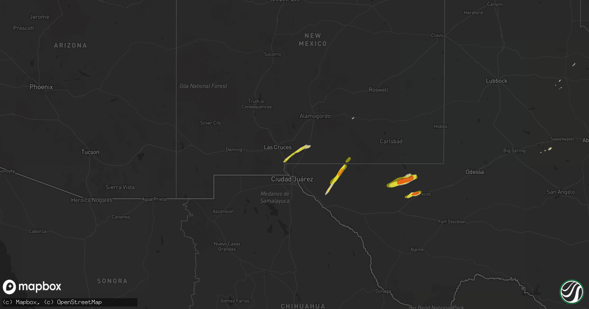
Hail Map on March 13, 2020
Get this storm
March 13 map
$229
one time, instant access
Download today. No call, no setup
Keep the $229
Bought the map and want the full workflow? Apply the entire $229 to a subscription within 7 days. None of it is wasted.
Every map, not just this one
This buys you this map. Subscription and you get every map we run, in the markets you choose from a few cities to whole states to nationwide. Plus real-time alerts the moment a storm fires.
Contact data
Name, contact info, occupancy, even credit band for addresses in the footprint. You go from where it hit to who to call.
Become the source they trust
Unlimited branding weather history reports on demand. You already have the documented answer ready for the property owner, and you are the one who showed up with it.
Property data and RoofTrace estimates
Pull up any address you have got, its value and the exact code rules for that jurisdiction, straight from One Click Code. Then RoofTrace estimates the squares, pitch, and roof value, priced the way you price.
States Impacted by Hail Map on March 13, 2020
Storm reports
New Mexico
| Date | Description |
|---|---|
| 03/13/20204:22 PM CDT | Delayed public web report. Corrected for time of occurrence based on damage survey. Tornado caused damage to house... Taking the porch and partial roof off. 4x4 posts w |
| 03/13/20204:00 PM CDT | Delayed public web report. Tornado caused damage to house... Taking the porch and partial roof off. 4x4 posts were driven into the roof in front of the house. Time is b |
| 03/13/20206:48 AM CDT | At 1147 AM MDT, a severe thunderstorm was located 17 miles south of Timberon, moving northeast at 40 mph. HAZARD...60 mph wind gusts and quarter size hail. SOURCE...Radar indicated. IMPACT...Hail damage to vehicles is expected. Expect wind damage to roofs, siding, and trees. Locations impacted include... Pinon, Lincoln National Forest, Crow Flats and The Otero Mesa. |
| 03/13/202012:34 AM CDT | At 533 PM MDT, a severe thunderstorm was located 15 miles south of Cornudas, moving northeast at 35 mph. HAZARD...60 mph wind gusts and quarter size hail. SOURCE...Radar indicated. IMPACT...Hail damage to vehicles is expected. Expect wind damage to roofs, siding, and trees. Locations impacted include... Cornudas, Salt Flat and Cornudas Mountains. |
| 03/12/202010:54 PM CDT | At 353 PM MDT, a severe thunderstorm was located 5 miles east of Orogrande, moving northeast at 45 mph. HAZARD...60 mph wind gusts and quarter size hail. SOURCE...Radar indicated. IMPACT...Hail damage to vehicles is expected. Expect wind damage to roofs, siding, and trees. Locations impacted include... Timberon, Orogrande, Pinon, Weed and The Otero Mesa. |
| 03/12/202010:05 PM CDT | At 304 PM MDT, a severe thunderstorm was located near Alamogordo, moving northeast at 40 mph. HAZARD...60 mph wind gusts and quarter size hail. SOURCE...Radar indicated. IMPACT...Hail damage to vehicles is expected. Expect wind damage to roofs, siding, and trees. Locations impacted include... Cloudcroft, Alamogordo, Mayhill, Silver Lake, Burro Flats, High Rolls, Mountain Park, La Luz, Sixteen Springs, Benson Ridge, Cox Canyon, Boles Acres, Karr Canyon and Dry Canyon. |
| 03/12/20209:58 PM CDT | At 258 PM MDT, a severe thunderstorm was located 5 miles west of Orogrande, moving northeast at 40 mph. It will move over Highway 54 near Orogrande. HAZARD...60 mph wind gusts and quarter size hail. SOURCE...Radar indicated. IMPACT...Hail damage to vehicles is expected. Expect wind damage to roofs, siding, and trees. Locations impacted include... Orogrande and The Otero Mesa. |
| 03/12/20209:21 PM CDT | At 220 PM MDT, a severe thunderstorm was located 6 miles northeast of Berino, moving northeast at 40 mph. HAZARD...60 mph wind gusts and quarter size hail. SOURCE...Radar indicated. IMPACT...Hail damage to vehicles is expected. Expect wind damage to roofs, siding, and trees. Locations impacted include... Chaparral, Orogrande, Vado, Anthony, Berino and High Valley. |
Texas
| Date | Description |
|---|---|
| 03/13/20205:44 AM CDT | At 1044 AM CDT, a severe thunderstorm was located near Possum Kingdom State Park, or 20 miles east of Breckenridge, moving east at 45 mph. HAZARD...Quarter size hail. SOURCE...Radar indicated. IMPACT...Damage to vehicles is possible. Locations impacted include... Mineral Wells, Graford and Possum Kingdom State Park. |
| 03/13/20205:29 AM CDT | At 1028 AM CDT, a severe thunderstorm was located near Trophy Club, moving east at 55 mph. A 53 mph wind gust was reported at Alliance Airport with this storm. HAZARD...60 mph wind gusts. SOURCE...Radar indicated. IMPACT...Expect damage to roofs, siding, and trees.This includes the following highways... Interstate 35W between mile markers 60 and 64, and between mile markers 69 and 82. Interstate 35E between mile markers 437 and 461.PRECAUTIONARY/PREPAREDNESS ACTIONS...For your protection get inside a sturdy structure and stay away fromwindows. |
| 03/13/20203:33 AM CDT | At 831 PM CDT, a severe thunderstorm was located 8 miles west of Wink, moving east at 30 mph. HAZARD...60 mph wind gusts and quarter size hail. SOURCE...Radar indicated. IMPACT...Hail damage to vehicles is expected. Expect wind damage to roofs, siding, and trees. Locations impacted include... Kermit, Wink and Winkler County Airport. |
| 03/13/20203:02 AM CDT | At 802 PM CDT, a severe thunderstorm was located near Pecos, moving northeast at 30 mph. HAZARD...60 mph wind gusts and quarter size hail. SOURCE...Radar indicated. IMPACT...Hail damage to vehicles is expected. Expect wind damage to roofs, siding, and trees. Locations impacted include... Pecos, Barstow and Pecos Municipal Airport. This includes Interstate 20 between mile markers 33 and 63. |
| 03/13/20202:54 AM CDT | At 754 PM CDT, a severe thunderstorm was located 8 miles west of Mentone, moving east at 30 mph. HAZARD...Golf ball size hail and 60 mph wind gusts. SOURCE...Radar indicated. IMPACT...People and animals outdoors will be injured. Expect hail damage to roofs, siding, windows, and vehicles. Expect wind damage to roofs, siding, and trees. Locations impacted include... Mentone and Slash Ranch. |
| 03/13/20202:37 AM CDT | At 736 PM CDT, a severe thunderstorm was located 7 miles north of Toyah, moving east at 20 mph. HAZARD...Golf ball size hail and 60 mph wind gusts. SOURCE...Radar indicated. IMPACT...People and animals outdoors will be injured. Expect hail damage to roofs, siding, windows, and vehicles. Expect wind damage to roofs, siding, and trees. Locations impacted include... Pecos, Toyah and Pecos Municipal Airport. This includes Interstate 20 between mile markers 22 and 42. |
| 03/13/20202:11 AM CDT | At 711 PM CDT, a severe thunderstorm was located 20 miles southwest of Orla, or 28 miles northwest of Toyah, moving east at 30 mph. HAZARD...60 mph wind gusts and half dollar size hail. SOURCE...Radar indicated. IMPACT...Hail damage to vehicles is expected. Expect wind damage to roofs, siding, and trees. Locations impacted include... Orla. |
| 03/13/20201:13 AM CDT | At 612 PM MDT, a severe thunderstorm was located 8 miles north of Dell City, moving northeast at 50 mph. HAZARD...60 mph wind gusts and half dollar size hail. SOURCE...Radar indicated. IMPACT...Hail damage to vehicles is expected. Expect wind damage to roofs, siding, and trees. Locations impacted include... Dell City, Lincoln National Forest and Crow Flats. |
| 03/12/202010:11 PM CDT | At 310 AM CDT, a severe thunderstorm was located near Tennyson, or 11 miles southeast of Robert Lee, moving east at 45 mph. HAZARD...60 mph wind gusts and quarter size hail. SOURCE...Radar indicated. IMPACT...Hail damage to vehicles is expected. Expect wind damage to roofs, siding, and trees. This severe thunderstorm will be near... Tennyson around 315 AM CDT. Maverick around 325 AM CDT. Norton around 330 AM CDT. Ballinger and Hatchel around 345 AM CDT. Benoit around 355 AM CDT. Crews around 400 AM CDT.Other locations impacted by this severe thunderstorm include TheIntersection Of Highway 208 And Ranch Road 2662, Wilmeth, LakeWinters Lake and Ballinger Lake. |
| 03/12/20208:58 PM CDT | At 157 AM CDT, a severe thunderstorm was located 9 miles southeast of Saint Lawrence, or 17 miles south of Garden City, moving east at 45 mph. HAZARD...60 mph wind gusts and quarter size hail. SOURCE...Radar indicated. IMPACT...Hail damage to vehicles is expected. Expect wind damage to roofs, siding, and trees. This severe thunderstorm will be near... Broome around 240 AM CDT. Water Valley around 250 AM CDT.Other locations impacted by this severe thunderstorm include rural areas of southern Sterling, southwestern Coke, and northwestern Tom Green counties, including U S-87 Near The Coke-Tom Green County Line. |
| 03/12/20208:54 PM CDT | At 153 AM CDT, a severe thunderstorm was located 18 miles south of Garden City, moving northeast at 35 mph. HAZARD...60 mph wind gusts and quarter size hail. SOURCE...Radar indicated. IMPACT...Hail damage to vehicles is expected. Expect wind damage to roofs, siding, and trees. Locations impacted include... Saint Lawrence. |
| 03/12/20208:20 PM CDT | At 120 AM CDT, a severe thunderstorm was located 22 miles north of Rankin, moving northeast at 55 mph. HAZARD...60 mph wind gusts and half dollar size hail. SOURCE...Radar indicated. IMPACT...Hail damage to vehicles is expected. Expect wind damage to roofs, siding, and trees. Locations impacted include... Garden City, Midkiff and Saint Lawrence. |
| 03/12/20208:13 PM CDT | Tornado ended 1.2 miles nw of barstow. Tornado lasted 1 minute. Estimated peak windspeeds of 100 mph. An ef-1 was the given classification. Path length was 0.47 miles a |
| 03/12/20207:53 PM CDT | Tornado ended 5.75 miles ne of mentone. Ef-unknown. Path length was 12 miles. Tornado lasted 9 minutes. |
Cities Impacted by Hail Map on March 13, 2020
- Strawn, TX
- Graford, TX
- Breckenridge, TX
- Poolville, TX
- Cloudcroft, NM
- Loraine, TX
- Maryneal, TX
- Saint Jo, TX
- Leon, OK
- Burneyville, OK
- Weatherford, TX
- Mineral Wells, TX
- Perrin, TX
- Whitt, TX
- Quanah, TX
- Eldorado, OK
- Pecos, TX
- Salt Flat, TX
- Fort Hancock, TX
- Dell City, TX
- Fort Worth, TX
- White Sands Missile Range, NM
- Roscoe, TX
- Haslet, TX
- Rhome, TX
- Newark, TX
- Berino, NM
- Anthony, NM
- Mesquite, NM
- Mentone, TX
- Springtown, TX
- Azle, TX