Hail Map in Florida on March 12, 2022
Get this storm
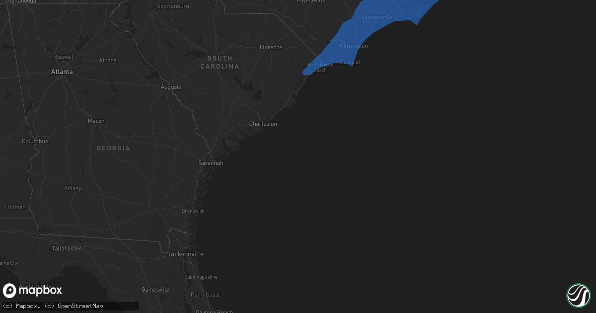
March 12 map
$229
one time, instant access
Download today. No call, no setup
Keep the $229
Bought the map and want the full workflow? Apply the entire $229 to a subscription within 7 days. None of it is wasted.
Every map, not just this one
This buys you this map. Subscription and you get every map we run, in the markets you choose from a few cities to whole states to nationwide. Plus real-time alerts the moment a storm fires.
Contact data
Name, contact info, occupancy, even credit band for addresses in the footprint. You go from where it hit to who to call.
Become the source they trust
Unlimited branding weather history reports on demand. You already have the documented answer ready for the property owner, and you are the one who showed up with it.
Property data and RoofTrace estimates
Pull up any address you have got, its value and the exact code rules for that jurisdiction, straight from One Click Code. Then RoofTrace estimates the squares, pitch, and roof value, priced the way you price.
Storm reports in Florida
Florida
| Date | Description |
|---|---|
| 03/12/202211:51 AM CST | Asos at kfpr measured a wind gust of 50kts/58mph from the west. |
| 03/12/202211:48 AM CST | Indian river county emo relayed reports of screen and soffit damage to one home at 1195 54th ave. Along with minor tree and shrub damage in the area. Trees were reporte |
| 03/12/202210:32 AM CST | Em reported multiple homes with roof... Carport... And/or window damage at leisure acres mobile home park. |
| 03/12/20229:31 AM CST | Report from putnam county em of evidence of tornado damage and debris path. Path near lake george across wetland/water management district across hwy 17 eastward along |
| 03/12/20228:34 AM CST | Time estimated by radar. Tree fell onto a house... Causing minimal damage. |
| 03/12/20228:33 AM CST | Mesonet station xcbn clam bayou nature park. |
| 03/12/20228:29 AM CST | Report of tree down at roberts rd. And beach village way. Report of wooden frame section in a concrete wall has blown over. |
| 03/12/20228:20 AM CST | Report from putnam co. Em of possible tornado and damage to 2 homes at 120 eagle trail... Crescent city. |
| 03/12/20228:07 AM CST | Powerlines down and roof damage on a home. |
| 03/12/20227:30 AM CST | Delayed report. Social media reports a few large trees down near blanding and harlow blvd. |
| 03/12/20227:18 AM CST | Mesonet station xwki weeki wachee. |
| 03/12/20227:16 AM CST | Spotter reported tree limbs down near intersection of state road 50 and u.s. 19 in weeki wachee. |
| 03/12/20227:15 AM CST | Mesonet station av639 ocala. |
| 03/12/20227:12 AM CST | Possible tornado damage. Picture shared on social media of apartment complex structure damage |
| 03/12/20226:55 AM CST | Report of a portion of a residential roof was blown off. |
| 03/12/20226:52 AM CST | At 1252 PM EST, a severe thunderstorm was located near South Beach, or near Vero Beach, moving east at 55 mph. HAZARD...60 mph wind gusts. SOURCE...Radar indicated. IMPACT...Expect damage to roofs, siding, and trees. Locations impacted include... Fort Pierce, Vero Beach, Indian River Shores, Vero Beach South and Gifford. |
| 03/12/20226:50 AM CST | Large tree split. Social media report. |
| 03/12/20226:50 AM CST | Large tree blown down. Social media report. |
| 03/12/20226:43 AM CST | Asos station kgnv gainesville. |
| 03/12/20226:43 AM CST | At 1243 AM EST/1143 PM CST/, a severe thunderstorm was located 23 miles southwest of Port St. Joe, moving northeast at 45 mph. HAZARD...60 mph wind gusts. SOURCE...Radar indicated. IMPACT...Expect damage to roofs, siding, and trees. Locations impacted include... Carrabelle, Eastpoint, Apalachicola, St George Island, Port St. Joe, Franklin, Sopchoppy, Carrabelle Beach, Royal Bluff, Eleven Mile, St George Island St Pk, Odena, Cape San Blas, Indian Pass, Beverly, Panacea, Medart, Buckhorn, Bay City and Apalachicola Airport. |
| 03/12/20226:37 AM CST | Numerous trees and lower lines down. Two truck/trailers were over turned... People were trapped inside. Roof torn off mobile home. |
| 03/12/20226:37 AM CST | Public reports to emergency manager of trees down and a 5-wheel truck and trailer over turned with people trapped inside. Near inglis and highway 40. |
| 03/12/20226:37 AM CST | Numerous trees and power lines down. Two truck/trailers were over turned... People were trapped inside. Roof torn off mobile home. |
| 03/12/20226:30 AM CST | Trees down in the bronson area... Reported to emergency management by the public. |
| 03/12/20226:25 AM CST | Several trees in the chiefland area were down... Some on power lines. These were public reports to emergency management. |
| 03/12/20224:15 AM CST | At 1015 AM EST, severe thunderstorms were located along a line extending from near Bethune Beach to Maytown to near Champions Gate, moving east at 60 mph. HAZARD...60 mph wind gusts and penny size hail. SOURCE...Radar indicated. IMPACT...Expect damage to roofs, siding, and trees. Locations impacted include... Orlando, Kissimmee, Sanford, Titusville and Apopka. |
| 03/12/20224:11 AM CST | At 1011 AM EST, severe thunderstorms were located along a line extending from near Four Corners to near Lakeland to 11 miles east of Parrish to 16 miles southwest of South Sarasota, moving east at 40 mph. HAZARD...60 mph wind gusts. SOURCE...Radar indicated. IMPACT...Expect damage to roofs, siding, and trees. Locations impacted include... Lakeland, Sarasota, Poinciana, Plant City, Winter Haven, Haines City, Bartow, Lake Wales, Auburndale and Fort Meade. |
| 03/12/20224:02 AM CST | At 1002 AM EST, a severe thunderstorm was located near Four Corners, or 9 miles southwest of Bay Lake, moving east at 70 mph. HAZARD...60 mph wind gusts and penny size hail. SOURCE...Radar indicated. IMPACT...Expect damage to roofs, siding, and trees. Locations impacted include... Orlando, Kissimmee, Bay Lake, Celebration and Buena Ventura Lakes. |
| 03/12/20223:30 AM CST | At 930 AM EST, severe thunderstorms were located along a line extending from 6 miles northeast of Ormond-By-the-Sea to near Ocoee to 9 miles southwest of Lake Louisa, moving east at 60 mph. HAZARD...60 mph wind gusts and penny size hail. SOURCE...Radar indicated. IMPACT...Expect damage to roofs, siding, and trees. Locations impacted include... Orlando, Deltona, Daytona Beach, Port Orange and Sanford. |
| 03/12/20223:26 AM CST | At 925 AM EST, severe thunderstorms were located along a line extending from near Groveland to near Zephyrhills West to Egypt Lake-Leto to near Fort Desoto Park to 23 miles southwest of Anna Maria, moving east at 35 mph. HAZARD...60 mph wind gusts. SOURCE...Radar indicated. IMPACT...Expect damage to roofs, siding, and trees. Locations impacted include... Tampa, St. Petersburg, Clearwater, Lakeland, Sarasota, Bradenton, Pinellas Park, Plant City, Temple Terrace and West Park. |
| 03/12/20222:52 AM CST | At 852 AM EST, a severe thunderstorm was located over Crescent City, moving east at 55 mph. HAZARD...60 mph wind gusts. SOURCE...Radar indicated. IMPACT...Expect damage to roofs, siding, and trees. Locations impacted include... Palm Coast, Flagler Beach, Bunnell, Andalusia, Beverly Beach and Espanola. |
| 03/12/20222:45 AM CST | At 843 AM EST, severe thunderstorms were located along a line extending from near The Villages to near Hill n Dale to near New Port Richey to 30 miles west of Bay Pines, moving east at 45 mph. HAZARD...60 mph wind gusts. SOURCE...Radar indicated. IMPACT...Expect damage to roofs, siding, and trees. Locations impacted include... Tampa, St. Petersburg, Clearwater, Largo, Pinellas Park, Temple Terrace, Seminole, Safety Harbor, New Port Richey and West Park. |
| 03/12/20222:43 AM CST | At 842 AM EST, severe thunderstorms were located along a line extending from near Lake George to near Lady Lake and into Sumter County, moving east at 55 mph. HAZARD...60 mph wind gusts and penny size hail. SOURCE...Radar indicated. IMPACT...Expect damage to roofs, siding, and trees. Locations impacted include... Orlando, Deltona, Daytona Beach, Port Orange and Sanford. |
| 03/12/20222:37 AM CST | At 837 AM EST, a severe thunderstorm was located near Salt Springs, moving northeast at 45 mph. HAZARD...60 mph wind gusts. SOURCE...Radar indicated. IMPACT...Expect damage to roofs, siding, and trees. Locations impacted include... Crescent City, Salt Springs, Fruitland and Georgetown. |
| 03/12/20221:55 AM CST | At 754 AM EST, severe thunderstorms were located along a line extending from 7 miles south of Rainbow Lakes Estates to 17 miles northwest of Beacon Square, moving east at 40 mph. HAZARD...60 mph wind gusts. SOURCE...Radar indicated. IMPACT...Expect damage to roofs, siding, and trees. Locations impacted include... Hernando, Spring Hill, New Port Richey, Sugarmill Woods, Brooksville, Inverness, Wildwood, Lake Panasoffkee, Ridge Manor and Bushnell. |
| 03/12/20221:22 AM CST | At 721 AM EST, severe thunderstorms were located along a line extending from 16 miles west of Rainbow Lakes Estates to 28 miles west of Pine Island, moving east at 40 mph. HAZARD...60 mph wind gusts. SOURCE...Radar indicated. IMPACT...Expect damage to roofs, siding, and trees. Locations impacted include... Hernando, Sugarmill Woods, Inverness, Inglis, Arbor Lakes, Lecanto, Homosassa Springs, Citronelle, Leisure Acres and Inverness Highlands. |
| 03/11/202211:55 PM CST | At 555 AM EST, severe thunderstorms were located along a line extending from 10 miles southeast of Boston to 11 miles east of Woodville, moving east at 50 mph. HAZARD...60 mph wind gusts. SOURCE...Radar indicated. IMPACT...Expect damage to roofs, siding, and trees. Locations impacted include... Madison, Greenville, Lee, Lovett, Moseley Hall, Ebb, Hopewell, Cherry Lake, Hamburg, Hanson, Pinetta and Sirmans. |
| 03/11/202211:30 PM CST | At 529 AM EST, severe thunderstorms were located along a line extending from 11 miles southwest of Thomasville to 10 miles west of Crawfordville, moving east at 35 mph. A 51 mph wind gust was measured in Tallahassee with this line. HAZARD...60 mph wind gusts. SOURCE...Radar indicated. IMPACT...Expect damage to roofs, siding, and trees. Locations impacted include... Monticello, Alma, Dills, Cody, Hells Half Acre, Lamont, Nash, Thomas City, Drifton, Casa Blanco, Waukeenah, Wacissa, Wacissa Springs, Lake Miccosukee, Fincher, Festus, Aucilla, Capps, Lois and Fanlew. |
| 03/11/202210:35 PM CST | At 435 AM EST, severe thunderstorms were located along a line extending from 8 miles west of Luraville to 68 miles south of St George Island, moving northeast at 60 mph. HAZARD...60 mph wind gusts. SOURCE...Radar indicated. IMPACT...Expect damage to roofs, siding, and trees. Locations impacted include... Mayo, Cross City, Steinhatchee, Horseshoe Point, Suwannee, Horseshoe Beach, Tennille, Shamrock, Clara, Cross City Airport, Shired Island, Old Town, Jonesboro, Jack Lee Island, Grady, Hatch Bend, Salem, San Pedro Junction, Fanning Springs and Cedar Island. |
| 03/11/20229:33 PM CST | At 333 AM EST, a severe thunderstorm was located near Perry, moving northeast at 45 mph. HAZARD...60 mph wind gusts. SOURCE...Radar indicated. IMPACT...Expect damage to roofs, siding, and trees. Locations impacted include... Mayo, Perry, Pinland, Cooks Hammock, Jug Island, Chancey, Smith, Buckville, Carbur, Alton, Mayo Junction, Adams Beach, Townsend, Dekle Beach, Foley, Perry-Foley Airport, Bucell Junction, Athena, San Pedro Junction and Day. |
| 03/11/20228:13 PM CST | At 213 AM EST, a severe thunderstorm was located near Apalachicola, moving east at 45 mph. HAZARD...60 mph wind gusts. SOURCE...Radar indicated. IMPACT...Expect damage to roofs, siding, and trees. Locations impacted include... Carrabelle, Eastpoint, Apalachicola, St George Island, St. Marks, Franklin, Sopchoppy, Carrabelle Beach, Royal Bluff, St George Island St Pk, Panacea, Medart, Buckhorn, Bay City, Apalachicola Airport, Liveoak Island, Curtis Mill, Alligator Point, Saint Teresa and Turkey Point. |
All States Impacted by Hail Map on March 12, 2022
Cities Impacted by Hail Map on March 12, 2022
- Inglis, FL
- Dunnellon, FL
- Ocala, FL
- Yankeetown, FL
- Crystal River, FL
- Brooksville, FL
- Spring Hill, FL
- Pinellas Park, FL
- Saint Petersburg, FL
- Indian Rocks Beach, FL
- Largo, FL
- Clearwater, FL
- Belleair Beach, FL
- Crescent City, FL
- Sebring, FL
- Vero Beach, FL
- Fort Pierce, FL
- Creswell, NC
- Pink Hill, NC
- Kure Beach, NC
- Swanquarter, NC
- Currie, NC
- Grandy, NC
- Pollocksville, NC
- Havelock, NC
- Kill Devil Hills, NC
- Salter Path, NC
- Pantego, NC
- Jamesville, NC
- New Bern, NC
- Stumpy Point, NC
- Harkers Island, NC
- Nags Head, NC
- Calabash, NC
- Hampstead, NC
- Atlantic, NC
- Belhaven, NC
- Greenville, NC
- Dover, NC
- Wallace, NC
- Wilmington, NC
- Pinetown, NC
- Newport, NC
- Hubert, NC
- Holly Ridge, NC
- Ocracoke, NC
- Merritt, NC
- Oak Island, NC
- Hobucken, NC
- Atlantic Beach, NC
- Kitty Hawk, NC
- Gloucester, NC
- Bolivia, NC
- Williamston, NC
- North Myrtle Beach, SC
- Maple Hill, NC
- Bayboro, NC
- Chinquapin, NC
- Edward, NC
- Midway Park, NC
- Windsor, NC
- Ayden, NC
- Rocky Point, NC
- Trenton, NC
- Blounts Creek, NC
- Powells Point, NC
- Vandemere, NC
- Smyrna, NC
- Harbinger, NC
- Cove City, NC
- Conway, SC
- Wrightsville Beach, NC
- Davis, NC
- Plymouth, NC
- Stacy, NC
- Riegelwood, NC
- Rose Hill, NC
- Poplar Branch, NC
- Scranton, NC
- Marshallberg, NC
- Southport, NC
- Point Harbor, NC
- Nakina, NC
- Roper, NC
- Engelhard, NC
- Ocean Isle Beach, NC
- Manteo, NC
- Lowland, NC
- Emerald Isle, NC
- Delco, NC
- Frisco, NC
- Ash, NC
- Manns Harbor, NC
- Burgaw, NC
- Ivanhoe, NC
- Cedar Island, NC
- Chocowinity, NC
- Fairfield, NC
- Winnabow, NC
- Waves, NC
- Castle Hayne, NC
- Winterville, NC
- Shiloh, NC
- Whiteville, NC
- Tarawa Terrace, NC
- Corolla, NC
- Richlands, NC
- Vanceboro, NC
- Bath, NC
- Beaufort, NC
- Rodanthe, NC
- Longs, SC
- Atkinson, NC
- Jarvisburg, NC
- Hertford, NC
- Sneads Ferry, NC
- Beulaville, NC
- Sunset Beach, NC
- Buxton, NC
- Washington, NC
- Jacksonville, NC
- Stella, NC
- Sealevel, NC
- Avon, NC
- Supply, NC
- Ernul, NC
- Swansboro, NC
- Kinston, NC
- Loris, SC
- Elizabeth City, NC
- Maysville, NC
- Camp Lejeune, NC
- Columbia, NC
- Grimesland, NC
- Grifton, NC
- Kelly, NC
- Morehead City, NC
- Oriental, NC
- Tabor City, NC
- Aurora, NC
- Leland, NC
- Hatteras, NC
- Longwood, NC
- Arapahoe, NC
- Myrtle Beach, SC
- Bolton, NC
- Willard, NC
- Carolina Beach, NC
- Wanchese, NC
- Shallotte, NC
- Grantsboro, NC
- Little River, SC
- Knotts Island, NC
- Virginia Beach, VA
- Chesapeake, VA


