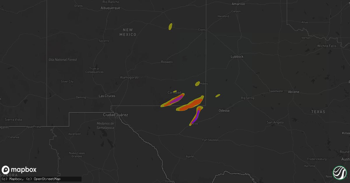
Hail Map on March 12, 2019
Get this storm
March 12 map
$229
one time, instant access
Download today. No call, no setup
Keep the $229
Bought the map and want the full workflow? Apply the entire $229 to a subscription within 7 days. None of it is wasted.
Every map, not just this one
This buys you this map. Subscription and you get every map we run, in the markets you choose from a few cities to whole states to nationwide. Plus real-time alerts the moment a storm fires.
Contact data
Name, contact info, occupancy, even credit band for addresses in the footprint. You go from where it hit to who to call.
Become the source they trust
Unlimited branding weather history reports on demand. You already have the documented answer ready for the property owner, and you are the one who showed up with it.
Property data and RoofTrace estimates
Pull up any address you have got, its value and the exact code rules for that jurisdiction, straight from One Click Code. Then RoofTrace estimates the squares, pitch, and roof value, priced the way you price.
States Impacted by Hail Map on March 12, 2019
Storm reports
Texas
| Date | Description |
|---|---|
| 03/12/20196:40 AM CDT | At 1140 PM CDT, severe thunderstorms were located along a line extending from 7 miles northwest of Caprock, moving northeast at 55 mph. HAZARD...60 mph wind gusts. SOURCE...Radar indicated. IMPACT...Expect damage to roofs...siding and trees. Locations impacted include... Post, Crosbyton, Spur, Jayton, Dickens and Lake Alan Henry. |
| 03/12/20196:37 AM CDT | At 1136 PM CDT, severe thunderstorms were located along a line extending from 11 miles northwest of Gail to near Luther to Forsan, moving east at 55 mph. HAZARD...70 mph wind gusts and penny size hail. SOURCE...Radar indicated. IMPACT...Expect considerable tree damage. Damage is likely to mobile homes, roofs, and outbuildings. Locations impacted include... Big Spring, Snyder, Colorado City, Gail, Coahoma, Loraine, Forsan, Sand Springs, Lake Colorado City, Lake Colorado City State Park, Inadale, Luther, Fluvanna, Colorado City Airport, J B Thomas Reservoir, Champion Creek Reservoir, Westbrook, Cuthbert, Dunn and Vincent.This includes Interstate 20 between mile markers 179 and 228. |
| 03/12/20196:30 AM CDT | Sherrifs office reported roof damage in mabank. No injuries reported. Time estimated based on radar. |
| 03/12/20196:30 AM CDT | Correction made on location. Sherrifs office reported roof damage ne of mabank |
| 03/12/20195:58 AM CDT | At 1058 PM CDT, a severe thunderstorm was located over O'donnell, or 12 miles south of Tahoka, moving northeast at 50 mph. HAZARD...70 mph wind gusts and ping pong ball size hail. SOURCE...Radar indicated. IMPACT...People and animals outdoors will be injured. Expect hail damage to roofs, siding, windows, and vehicles. Expect considerable tree damage. Wind damage is also likely to mobile homes, roofs, and outbuildings. Locations impacted include... Post, O'donnell, Caprock, Grassland, Southland and Justiceburg. |
| 03/12/20195:55 AM CDT | Em reports several trees down and barn damage from cr346 to cr344 near ables springs |
| 03/12/20195:50 AM CDT | Sherrifs office reported some power lines down and some trees down. Time estimated based on radar. |
| 03/12/20195:45 AM CDT | Navarro mills dam reports gust of 61 mph. |
| 03/12/20195:25 AM CDT | Mckinney |
| 03/12/20195:25 AM CDT | Several reports of trees and fences down across parts of dallas county. Also a few reports of 18 wheelers knocked over |
| 03/12/20195:21 AM CDT | Em reports wind gust of 72 mph at ut dallas and point north park |
| 03/12/20195:20 AM CDT | Sherman asos reported wind gust of 67 mph. |
| 03/12/20195:20 AM CDT | Semi rolled over in italy |
| 03/12/20195:15 AM CDT | Addison |
| 03/12/20195:15 AM CDT | Hillsboro asos reports wind gust of 61 mph |
| 03/12/20195:00 AM CDT | Em reports wind gust of 80 mph in grand prairie |
| 03/12/20194:52 AM CDT | Wind gust to 78 mph at dallas/fort worth international airport |
| 03/12/20194:50 AM CDT | Logistics facility on airfield dr at dfw airport had roof damage. Multiple cars damaged. Time estimated based on radar. |
| 03/12/20194:40 AM CDT | Social media reports 18 wheeler flipped on i-35 near sanger |
| 03/12/20194:40 AM CDT | Several reports of power lines... Trees... And fences down across parts tarrant county. Via chat and social media |
| 03/12/20194:30 AM CDT | *** 1 inj *** one occupant injured in small modular home sw of cleburne. Time estimated based on radar. |
| 03/12/20194:25 AM CDT | Em reports trees blown over and some roof damage in godley. Time estimated based on radar |
| 03/12/20194:23 AM CDT | Fort worth nas asos reports 75 mph wind gust |
| 03/12/20194:15 AM CDT | Bowie asos reports wind gust of 61 mph. |
| 03/12/20194:14 AM CDT | Wunderground station ktxgranb71 measured 66g80 mph |
| 03/12/20194:13 AM CDT | 8-inch diameter trees down |
| 03/12/20194:10 AM CDT | At 910 PM CDT, a severe thunderstorm was located 15 miles southeast of Balmorhea Lake, or 22 miles northeast of Fort Davis, moving northeast at 50 mph. HAZARD...60 mph wind gusts and quarter size hail. SOURCE...Radar indicated. IMPACT...Hail damage to vehicles is expected. Expect wind damage to roofs, siding, and trees. Locations impacted include... Fort Stockton, Saragosa, Verhalen, Fort Stockton-Pecos County Airport, Coyanosa, B F Goodrich Testing Track and Firestone Test Track.This includes Interstate 10 between mile markers 211 and 269. |
| 03/12/20193:37 AM CDT | Delayed report: nws storm survey has found damage related to an ef1 tornado in northwest parker county. |
| 03/12/20193:30 AM CDT | Mineral wells asos reports wind gust of 59 mph. |
| 03/12/20193:30 AM CDT | A local report indicates 1.00 inch wind near 13 SE MENARD |
| 03/12/20193:28 AM CDT | Em reports wind damage to several buildings of mineral wells high school |
| 03/12/20193:25 AM CDT | Delayed report: nws storm survey has found damage related to an ef1 tornado near mineral wells from wednesday mornings squall line. |
| 03/12/20193:22 AM CDT | Law enforcement reported trees and power lines down in zephyr and some possible damage to buildings. |
| 03/12/20193:19 AM CDT | Along its path... The tornado overturned a small residence and threw it for 50 feet... Thankfully the resident of the home was uninjured. The tornado tore off several r |
| 03/12/20193:13 AM CDT | At 813 PM CDT, a severe thunderstorm was located 9 miles north of Pecos, moving northeast at 55 mph. HAZARD...60 mph wind gusts and quarter size hail. SOURCE...Radar indicated. IMPACT...Hail damage to vehicles is expected. Expect wind damage to roofs, siding, and trees. Locations impacted include... Pecos, Kermit and Winkler County Airport. This includes Interstate 20 between mile markers 34 and 39. |
| 03/12/20193:10 AM CDT | Em reports power poles down and mobile home damage in the city of bryson. |
| 03/12/20193:07 AM CDT | Law enforcement reported power poles down... Roof damage... And windows blown in throughout the city of junction. |
| 03/12/20193:05 AM CDT | At 804 PM CDT/704 PM MDT/, a severe thunderstorm was located 15 miles north of Mentone, moving east at 40 mph. HAZARD...60 mph wind gusts and quarter size hail. SOURCE...Radar indicated. IMPACT...Hail damage to vehicles is expected. Expect wind damage to roofs, siding, and trees. Locations impacted include... Kermit, Eunice, Jal, Mentone, Jal Airport, Eunice Airport, Bennett and Slash Ranch. |
| 03/12/20193:03 AM CDT | The tornado ripped off several roofs... Blew out windows and damaged trees and power lines. It turned a one by four piece of wood into a missile. This missile went thro |
| 03/12/20193:00 AM CDT | Photo via social media of power lines down just north of rising star |
| 03/12/20192:16 AM CDT | At 716 PM CDT/616 PM MDT/, a severe thunderstorm was located over Malaga, or 14 miles southeast of Carlsbad, moving northeast at 40 mph. HAZARD...70 mph wind gusts and half dollar size hail. SOURCE...Radar indicated. IMPACT...Hail damage to vehicles is expected. Expect considerable tree damage. Wind damage is also likely to mobile homes, roofs, and outbuildings. Locations impacted include... Loving, Malaga, Red Bluff Reservoir and Halfway. |
| 03/12/20192:15 AM CDT | A local report indicates 60 MPH wind near 1 SW THROCKMORTON |
| 03/12/20191:44 AM CDT | A local report indicates 58 MPH wind near 2 NNE WEINERT |
| 03/12/20191:40 AM CDT | Roof blown off a barn. Phone lines down along hwy 180. |
| 03/12/20191:31 AM CDT | A local report indicates 65 MPH wind near STAMFORD |
| 03/12/20191:30 AM CDT | Roof completely peeled off of the calvary baptist church on armstrong street. |
| 03/12/20191:27 AM CDT | Corrects previous tstm wnd dmg report from 4 ssw ballinger. Power pole snapped in half along cr 259 off of hwy 67. |
| 03/12/20191:06 AM CDT | At 605 PM CDT/505 PM MDT/, a severe thunderstorm was located over McKittrick Canyon, or near Pine Springs, moving east at 50 mph. HAZARD...60 mph wind gusts and quarter size hail. SOURCE...Radar indicated. IMPACT...Hail damage to vehicles is expected. Expect wind damage to roofs, siding, and trees. Locations impacted include... Pine Springs, Loving, McKittrick Canyon, Guadalupe Mountains National Park, Malaga, Carlsbad Caverns National Park and Whites City. |
| 03/12/201912:58 AM CDT | A local report indicates 70 MPH wind near 2 E ROSCOE |
| 03/12/201912:45 AM CDT | West texas mesonet |
| 03/12/201912:45 AM CDT | Reported a wind gust between 60 and 70 mph. |
| 03/12/201912:40 AM CDT | A trained spotter reported an 18 wheeler blown over at the intersection of highway 84 and interstate 20. |
| 03/12/201912:40 AM CDT | Electric lines down throughout the county. Portable buildings blown over along i-20. |
| 03/12/201912:35 AM CDT | Awos station sww... Sweetwater. |
| 03/12/201912:27 AM CDT | Power pole snapped in half along cr 259 off of hwy 67. |
| 03/12/201912:05 AM CDT | Multiple power lines broken and rvs toppled over. Time estimated from radar |
| 03/11/201911:35 PM CDT | A local report indicates 58 MPH wind near 4 SW BIG SPRING |
| 03/11/201911:35 PM CDT | A local report indicates 63 MPH wind near 5 SW ST. LAWRENCE |
| 03/11/201911:30 PM CDT | A local report indicates 58 MPH wind near 2 ESE GAIL |
| 03/11/201911:30 PM CDT | Steel building completely destroyed 1/4 mile southeast of dimmitt. Power is out throughout dimmitt. Time estimated from mesonet. |
| 03/11/201911:27 PM CDT | A power pole snapped at east front street and terrell street in midland. |
| 03/11/201911:25 PM CDT | A professional weather station at 25 feet above the ground reported 64 mph winds in big spring. |
| 03/11/201911:15 PM CDT | A local report indicates 58 MPH wind near 5 SSW GRAHAM |
| 03/11/201911:00 PM CDT | A local report indicates 71 MPH wind near 1 N O'DONNELL |
| 03/11/201910:55 PM CDT | *** 1 inj *** two warehouses heavily damaged... Utility poles damaged... And semi blown over on highway 87 causing minor injury to driver. |
| 03/11/201910:55 PM CDT | A local report indicates 72 MPH wind near 1 N O'DONNELL |
| 03/11/201910:55 PM CDT | A local report indicates 58 MPH wind near 3 NE LAMESA |
| 03/11/201910:50 PM CDT | A local report indicates 58 MPH wind near 1 NE AMHERST |
| 03/11/201910:45 PM CDT | Possible tornado... Damage to house and debris in powerlines. |
| 03/11/201910:45 PM CDT | A local report indicates 78 MPH wind near 2 SE LAMESA |
| 03/11/201910:39 PM CDT | Multiple power poles snapped at the base and leaning over the road. Time estimated from radar. |
| 03/11/201910:32 PM CDT | A local report indicates 64 MPH wind near FORT STOCKTON |
| 03/11/201910:25 PM CDT | Orla cwop f3711 |
| 03/11/201910:25 PM CDT | A local report indicates 79 MPH wind near MCDONALD OBSERVATORY |
| 03/11/20198:40 PM CDT | Hail was on highway 302. |
| 03/11/20198:38 PM CDT | A local report indicates 62 MPH wind near 1 NNW CRANE |
| 03/11/20198:35 PM CDT | Marfa cwop f1173 |
| 03/11/20198:35 PM CDT | A local report indicates 59 MPH wind near PECOS |
| 03/11/20198:33 PM CDT | A local report indicates 60 MPH wind near MARFA |
| 03/11/20198:30 PM CDT | A local report indicates 79 MPH wind near MCDONALD OBSERVATORY |
| 03/11/20198:18 PM CDT | A local report indicates 1.00 inch wind near 23 SSE ORLA |
| 03/11/20198:16 PM CDT | Destroyed vehicle. Est 45 to 50 mph winds |
| 03/11/20198:15 PM CDT | Baseball sized hail observed along cr 200 north of pecos... Severely damaged a vehicle |
| 03/11/20198:01 PM CDT | Roof and structural damage approximately one half mile west of pecos airport. Time estimated from radar. |
| 03/11/20198:01 PM CDT | Aerostat site nw of marfa |
| 03/11/20197:45 PM CDT | 3.7 n of fm 2119 |
| 03/11/20197:38 PM CDT | A local report indicates 1.00 inch wind near 23 SSE ORLA |
| 03/11/20197:34 PM CDT | A local report indicates 59 MPH wind near 3 ENE VAN HORN |
Oklahoma
| Date | Description |
|---|---|
| 03/12/20194:45 AM CDT | A local report indicates 59 MPH wind near 2 SE BURNEYVILLE |
| 03/12/20192:38 AM CDT | A local report indicates 59 MPH wind near 2 ESE HOBART |
New Mexico
| Date | Description |
|---|---|
| 03/12/20196:55 PM CDT | Chaves county sheriff spotted a rain wrapped tornado north of hagerman that continued into dexter. Several homes in dexter have been damaged and a gas leak has been rep |
| 03/12/20196:45 PM CDT | Park ranger at carlsbad caverns np |
| 03/12/20193:46 AM CDT | At 845 PM CDT, a severe thunderstorm was located 12 miles northeast of Humble City, or 14 miles east of Lovington, moving northeast at 40 mph. HAZARD...70 mph wind gusts and quarter size hail. SOURCE...Radar indicated. IMPACT...Hail damage to vehicles is expected. Expect considerable tree damage. Wind damage is also likely to mobile homes, roofs, and outbuildings. Locations impacted include... Denver City, Plains and Bronco. |
| 03/12/20193:45 AM CDT | At 844 PM CDT/744 PM MDT/, a severe thunderstorm was located 10 miles south of Eunice, moving east at 25 mph. HAZARD...60 mph wind gusts and quarter size hail. SOURCE...Radar indicated. IMPACT...Hail damage to vehicles is expected. Expect wind damage to roofs, siding, and trees. Locations impacted include... Hobbs, Lovington, Eunice, Jal, Monument, Humble City, Eunice Airport, Nadine, Knowles, Lea County Regional Airport, Oil Center, Industrial Airpark and Higginbotham. |
| 03/12/20192:27 AM CDT | At 726 PM CDT/626 PM MDT/, a severe thunderstorm was located 7 miles west of Orla, or 26 miles west of Mentone, moving east at 45 mph. HAZARD...60 mph wind gusts and quarter size hail. SOURCE...Radar indicated. IMPACT...Hail damage to vehicles is expected. Expect wind damage to roofs, siding, and trees. Locations impacted include... Red Bluff Reservoir, Orla and Red Bluff. |
| 03/12/20192:16 AM CDT | At 716 PM MDT, a severe thunderstorm was located 7 miles west of Monument, or 15 miles west of Hobbs, moving east at 35 mph. HAZARD...60 mph wind gusts and quarter size hail. SOURCE...Radar indicated. IMPACT...Hail damage to vehicles is expected. Expect wind damage to roofs, siding, and trees. Locations impacted include... Hobbs, Lovington, Nadine, Monument, Humble City, Knowles, Lea County Regional Airport, Oil Center and Industrial Airpark. |
| 03/12/20191:09 AM CDT | At 608 PM MDT, a severe thunderstorm was located 8 miles northeast of Avalon, or 14 miles northeast of Carlsbad, moving east at 45 mph. HAZARD...60 mph wind gusts and quarter size hail. SOURCE...Radar indicated. IMPACT...Hail damage to vehicles is expected. Expect wind damage to roofs, siding, and trees. Locations impacted include... Carlsbad, Avalon, Carlsbad North, Lea County Zip Franklin Memorial Airport, Loco Hills, Lake Avalon, Otis, Cavern City Air Terminal and Living Desert State Park. |
| 03/12/201912:40 AM CDT | At 539 PM MDT, a severe thunderstorm was located 7 miles northwest of Cottonwood, or 12 miles north of Artesia, moving northeast at 55 mph. HAZARD...60 mph wind gusts and quarter size hail. SOURCE...Radar indicated. IMPACT...Hail damage to vehicles is expected. Expect wind damage to roofs, siding, and trees. Locations impacted include... Dexter, Hagerman, Lake Arthur, Bottomless Lakes State Park, Greenfield and Roswell Correctional Facility.This includes Highway 285 between Mile Markers 79 and 98. |
| 03/11/201911:20 PM CDT | At 418 PM MDT, severe thunderstorms were located along a line extending from 9 miles northeast of Cornudas to 5 miles southwest of Sierra Blanca to 20 miles west of Indian Hot Springs, moving northeast at 40 mph. HAZARD...60 mph wind gusts and quarter size hail. SOURCE...Radar indicated. IMPACT...Hail damage to vehicles is expected. Expect wind damage to roofs, siding, and trees. Locations impacted include... Dell City... Salt Flat... Sierra Blanca... Allamoore... Indian Hot Springs... Fort Quitman... Cornudas... Frenchman Canyon... and Indio Mountains Research Station.Portions of Interstate 10 between Sierra Blanca and Van Horn, and U.S. Highway 62/180 around Salt Flat will be impacted by this line of storms. |
| 03/11/201910:34 PM CDT | At 333 PM MDT, severe thunderstorms were located along a line extending from 4 miles southwest of High Rolls to 6 miles south of Sunspot to 13 miles southwest of Timberon, moving northeast at 35 mph. HAZARD...Ping pong ball size hail and 60 mph wind gusts. SOURCE...Radar indicated. IMPACT...People and animals outdoors will be injured. Expect hail damage to roofs, siding, windows, and vehicles. Expect wind damage to roofs, siding, and trees. Locations impacted include... Timberon... Sacramento... Cloudcroft... Alamogordo... Sunspot... Pinon... Mayhill... Silver Lake... Burro Flats... Weed... Elk Silver... High Rolls... Mountain Park... La Luz... and Sixteen Springs. |
| 03/11/201910:16 PM CDT | At 316 PM MDT, a severe thunderstorm was located 10 miles southwest of Sunspot, moving northeast at 45 mph. HAZARD...60 mph wind gusts and penny size hail. SOURCE...Radar indicated. IMPACT...Expect damage to roofs, siding, and trees. Locations impacted include... Alamogordo... Sunspot... Burro Flats... High Rolls... La Luz... Holloman Air Force Base... Mountain Park... Boles Acres... Karr Canyon... Benson Ridge... and Oliver Lee State Park. |
| 03/11/201910:04 PM CDT | At 304 PM MDT, severe thunderstorms were located along a line extending from 19 miles west of Three Rivers to 8 miles west of Tularosa to 12 miles southeast of White Sands National Monument, moving northeast at 60 mph. HAZARD...70 mph wind gusts and penny size hail. SOURCE...Radar indicated. IMPACT...Expect considerable tree damage. Damage is likely to mobile homes, roofs, and outbuildings. Locations impacted include... Three Rivers... Tularosa... La Luz... and Three Rivers Petroglyph Site. |
| 03/11/20198:37 PM CDT | Ktcc asos. |
| 03/11/20198:16 PM CDT | Junction of highway 529...62 and 180 |
| 03/11/20197:45 PM CDT | A local report indicates 1.00 inch wind near 6 W FORT SUMNER |
| 03/11/20197:11 PM CDT | A local report indicates 1.75 inch wind near LOVING |
| 03/11/20197:11 PM CDT | Tornado confirmed south of malaga near hwy 285...moved quickly ne...no damage reported. |
| 03/11/20197:03 PM CDT | A local report indicates 1.00 inch wind near CARLSBAD |
| 03/11/20197:01 PM CDT | A local report indicates 76 MPH wind near CARLSBAD |
| 03/11/20197:01 PM CDT | Power lines knocked down on sierra vista dr next to carlsbad airport. |
Cities Impacted by Hail Map on March 12, 2019
- Loving, NM
- Carlsbad, NM
- Salt Flat, TX
- Pecos, TX
- Mentone, TX
- Jal, NM
- Kermit, TX
- Pyote, TX
- Wink, TX
- Barstow, TX
- Fort Sumner, NM
- Lovington, NM
- Hobbs, NM
- Andrews, TX
- Sierra Blanca, TX
- Balmorhea, TX
- Fort Davis, TX
- Fort Stockton, TX
- Dell City, TX
- Marathon, TX
- Imperial, TX
- Comstock, TX
- Dryden, TX
- Coahoma, TX
- Lamesa, TX
- Big Spring, TX
- Alamogordo, NM
- Cloudcroft, NM
- Timberon, NM
- Lenorah, TX
- Stanton, TX
- Ozona, TX
- Welch, TX
- Odonnell, TX
- Tahoka, TX
- Odessa, TX
- Goldsmith, TX
- Van Horn, TX
- Seminole, TX
- Seagraves, TX
- High Rolls Mountain Park, NM
- Ira, TX
- Westbrook, TX
- Kanopolis, KS
- Ellsworth, KS
- Ellinwood, KS
- Claflin, KS
- Eunice, NM
- Sonora, TX
- Beverly, KS
- Holyrood, KS
- Stillwater, OK
- Gail, TX
- Artesia, NM
- Oberlin, KS
- San Angelo, TX
- Minneapolis, KS
- Beloit, KS
- Pinon, NM
- Menard, TX
- London, TX
- Concordia, KS
- Monahans, TX
- Sacramento, NM
- Lake Arthur, NM
- Kendall, KS
- Lincoln, KS
- Eldorado, TX
- Lorraine, KS
- Fort Hancock, TX
- Agenda, KS
- Belleville, KS
- Junction, TX
- Colorado City, TX