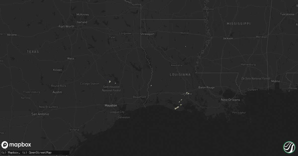
Hail Map in Louisiana on March 11, 2012
Get this storm
March 11 map
$229
one time, instant access
Download today. No call, no setup
Keep the $229
Bought the map and want the full workflow? Apply the entire $229 to a subscription within 7 days. None of it is wasted.
Every map, not just this one
This buys you this map. Subscription and you get every map we run, in the markets you choose from a few cities to whole states to nationwide. Plus real-time alerts the moment a storm fires.
Contact data
Name, contact info, occupancy, even credit band for addresses in the footprint. You go from where it hit to who to call.
Become the source they trust
Unlimited branding weather history reports on demand. You already have the documented answer ready for the property owner, and you are the one who showed up with it.
Property data and RoofTrace estimates
Pull up any address you have got, its value and the exact code rules for that jurisdiction, straight from One Click Code. Then RoofTrace estimates the squares, pitch, and roof value, priced the way you price.
Storm reports in Louisiana
Louisiana
| Date | Description |
|---|---|
| 03/10/201210:13 PM CST | Visiting spotter from tennessee reports brief tornado touchdowns near evangeline hwy. |
| 03/10/201210:11 PM CST | Report by public of tree down on house off riverside rd. |
| 03/10/201210:02 PM CST | Reports of trees and powerlines down. |
| 03/10/20129:51 PM CST | Restaurant worker reported tornado crossing i-10 near the overpass. |
| 03/10/20129:35 PM CST | Spotter visiting from tennessee reported winds gusts 50 to 60 mph and dime size hail. |
| 03/10/20129:31 PM CST | Public reported a possible tornado. |
| 03/10/20129:27 PM CST | Public reported a possible tornado |
| 03/10/20127:55 PM CST | Large tree down across hwy 772. Took power lines and poles down. |
| 03/10/20127:36 PM CST | Sheriffs dept reports tree down on hwy 112. |
| 03/10/20127:29 PM CST | Shed blown down... Flatbed trailor thrown and flipped over...tool shed doors blown out. |
| 03/10/20127:28 PM CST | Trees fell in the lake providence area...including one that blocked la highway 596. |
| 03/10/20127:20 PM CST | Powerlines down |
| 03/10/20127:05 PM CST | Trees and power lines down |
| 03/10/20127:03 PM CST | Trees and powerlines down |
| 03/10/20127:03 PM CST | Trees and powerlines down. One tree down on a house along highway 586 causing minor damage to the house. |
| 03/10/20126:57 PM CST | Trees and power lines down |
| 03/10/20126:57 PM CST | Numerous trees and powerlines down in the fiske community. One structure with at least minor damage. |
| 03/10/20126:45 PM CST | Along la highway 2 between mer rouge and the west carroll parish border at least 20 trees were blown down...an 18 wheeler was blown over...a grain silo was blown over.. |
| 03/10/20126:45 PM CST | Recorded at bayou bonne idee aero service east of mer rouge |
| 03/10/20126:38 PM CST | Powerlines down |
| 03/10/20126:37 PM CST | Trees and power lines down |
| 03/10/20126:30 PM CST | Tree down across hwy 138...blocking rd |


