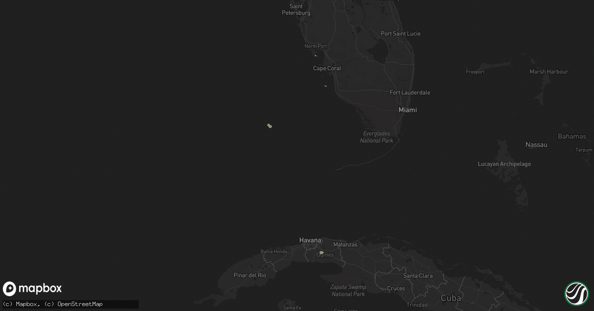
Hail Map on March 10, 2011
Get this storm
March 10 map
$229
one time, instant access
Download today. No call, no setup
Keep the $229
Bought the map and want the full workflow? Apply the entire $229 to a subscription within 7 days. None of it is wasted.
Every map, not just this one
This buys you this map. Subscription and you get every map we run, in the markets you choose from a few cities to whole states to nationwide. Plus real-time alerts the moment a storm fires.
Contact data
Name, contact info, occupancy, even credit band for addresses in the footprint. You go from where it hit to who to call.
Become the source they trust
Unlimited branding weather history reports on demand. You already have the documented answer ready for the property owner, and you are the one who showed up with it.
Property data and RoofTrace estimates
Pull up any address you have got, its value and the exact code rules for that jurisdiction, straight from One Click Code. Then RoofTrace estimates the squares, pitch, and roof value, priced the way you price.
States Impacted by Hail Map on March 10, 2011
Storm reports
Idaho
| Date | Description |
|---|---|
| 03/09/20119:50 PM CST | A local report indicates 66 MPH wind near BERN |
| 03/09/20118:45 PM CST | A local report indicates 61 MPH wind near 5 N PORTNEUF |
| 03/09/20118:39 PM CST | Severe thunderstorms. Reports out of american falls indicate roof of building blown off into power lines. Power out in parts of american falls. |
| 03/09/20118:05 PM CST | A local report indicates 78 MPH wind near SSE AMERICAN FALLS |
| 03/09/20118:05 PM CST | Observer reports two pine trees and power poles down. Power outage at residence. |
| 03/09/20118:00 PM CST | Power line damage on major line between heyburn and rupert. Town of rupert is out of power. |
Florida
| Date | Description |
|---|---|
| 03/10/201111:20 AM CST | Amateur radio reports indicate trees down and construction debris around sw 9th st and sw 36th ct in miami. |
| 03/10/201111:19 AM CST | Interserction of rickenbacker causeway and us 1. Noaa hrd employee reported spinning debris and car shaking with funnel cloud touching down over land in the vicinity of |
| 03/10/201111:05 AM CST | A brief tornado touchdown was observed in a parking lot at fort lauderdale hollywood international airport. A light pole and a couple of signs were knocked down. No oth |
| 03/10/201111:03 AM CST | A local report indicates 70 MPH wind near DORAL |
| 03/10/201111:01 AM CST | Measured at fort lauderdale executive airport - kfxe. |
| 03/10/201110:40 AM CST | Retired nws employee reported uprooted ficus tree... Approx. 3 feet in diameter...at the flamingo lakes golf course. Estimated winds of 60 mph. |
Virginia
| Date | Description |
|---|---|
| 03/10/20115:59 PM CST | Ef0 tornado with estimated 65 mph wind. Approximately 15 softwood trees snapped along with many large branches broken in a 4.5 mile path with a 75 yard width. Tornado o |
| 03/10/20115:55 PM CST | Very large tree down...collapsed the roof on condo complex...no injuries but units uninhabitable. |
| 03/10/20115:40 PM CST | Numerous trees reported knocked down. Windows of a house reported blown out. |
| 03/10/20115:40 PM CST | Tree down on road |
| 03/10/20115:40 PM CST | Large tree down on road |
| 03/10/20115:40 PM CST | Several trees down near lombardy rd and new dragonbridge rd |
| 03/10/20115:18 PM CST | 3-4 trees down near bealeton rd and rogues rd |
| 03/10/20115:17 PM CST | Ef1. Max winds 90mph. |
| 03/10/20115:15 PM CST | Large tree reported knocked down. |
| 03/10/20115:08 PM CST | Power poles snapped near chancellor rd and old plank rd |
| 03/10/20115:00 PM CST | Tree down at courthouse rd at blockhouse rd |
| 03/10/20115:00 PM CST | Multiple trees down |
| 03/10/20114:59 PM CST | A local report indicates 61 MPH wind near RICHMOND INTERNATIONAL |
| 03/10/20114:50 PM CST | Pool shed thrown about 20 feet in cracked a 6 by 6 inch post in half. |
| 03/10/20114:48 PM CST | Power lines and traffic lights down at the intersection of the boulevard and lakeview. Also a tree down on a house. |
| 03/10/20114:40 PM CST | Reports of trees down and damage to a carport. |
| 03/10/20114:36 PM CST | Trees down on dueling rd near taylor hwy |
| 03/10/20114:05 PM CST | Tree down interstate 85 mile marker 33 |
| 03/10/20113:40 PM CST | The roof of a chicken house has been blown off and is blocking route 622. |
| 03/10/20113:32 PM CST | Multiple trees reported knocked down. |
| 03/10/20113:24 PM CST | Tree down on lunenburg county rd |
| 03/10/20113:20 PM CST | Tree down on redd shop road |
| 03/10/20113:20 PM CST | Tree down on germantown rd |
| 03/10/20113:00 PM CST | Tree down on shuffletown road near saxe |
| 03/10/20112:55 PM CST | Two trees are reported down in drakes branch. |
| 03/10/20112:55 PM CST | A tree was blown down in wylliesburg. |
| 03/10/201112:45 PM CST | Roanoke city manager reports several trees blown down across northwest roanoke. |
| 03/10/201112:45 PM CST | Part of roof and deck blown down at the highland farms apartments |
| 03/10/201112:40 PM CST | The roof of a church located a block away from salem city hall was damaged by strong winds. |
| 03/09/20116:15 PM CST | A local report indicates 60 MPH wind near 1 ESE BEALETON |
| 03/09/20116:00 PM CST | 12-20 trees down near eleanor lawrence park and walney road on va-28. Time estimated. |
Montana
| Date | Description |
|---|---|
| 03/10/20112:28 AM CST | Fence and tree damage reported near airport |
| 03/10/20112:02 AM CST | Microburst resulted in damage to numerous vinyl fences...some roof shingles and house siding along el rancho drive in billings heights. |
| 03/10/20111:55 AM CST | A local report indicates 59 MPH wind near 2 NNE LAUREL |
North Carolina
| Date | Description |
|---|---|
| 03/10/20114:39 PM CST | Halifax 911 received report of tree down on road at 27921 hwy 561 in enfield |
| 03/10/20114:39 PM CST | Halifax 911 received report of tree down in yard at hwy 158 and community dr in roanoke rapids |
| 03/10/20114:28 PM CST | Trained spotter reported strong winds est 50mph and numerous small tree limbs 1-2 inches dia between rocky mount and tarboro on hwy 64e at exit 478. |
| 03/10/20114:20 PM CST | Roof blown off a residence on langley with people inside but no injries. |
| 03/10/20114:05 PM CST | Wayne co 911 recevied report of power line down in goldsboro at 507 e walnut. |
| 03/10/20114:05 PM CST | Wayne co 911 received report of power line down at cokers mill rd and n beston rd |
| 03/10/20114:05 PM CST | Fallen tree blocked frank price church road... 5000 block |
| 03/10/20114:05 PM CST | Fallen tree damaged apartment building |
| 03/10/20111:55 PM CST | One tree down in the road of bonlee school road near bear creek. |