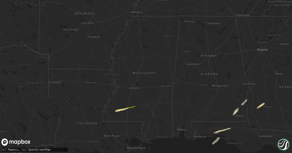
Hail Map in Mississippi on March 9, 2025
Get this storm
March 9 map
$229
one time, instant access
Download today. No call, no setup
Keep the $229
Bought the map and want the full workflow? Apply the entire $229 to a subscription within 7 days. None of it is wasted.
Every map, not just this one
This buys you this map. Subscription and you get every map we run, in the markets you choose from a few cities to whole states to nationwide. Plus real-time alerts the moment a storm fires.
Contact data
Name, contact info, occupancy, even credit band for addresses in the footprint. You go from where it hit to who to call.
Become the source they trust
Unlimited branding weather history reports on demand. You already have the documented answer ready for the property owner, and you are the one who showed up with it.
Property data and RoofTrace estimates
Pull up any address you have got, its value and the exact code rules for that jurisdiction, straight from One Click Code. Then RoofTrace estimates the squares, pitch, and roof value, priced the way you price.
Storm reports in Mississippi
Mississippi
| Date | Description |
|---|---|
| 03/09/202510:03 AM CDT | Nickel to quarter size. |
| 03/09/20259:38 AM CDT | This was reported by the lincoln county em. |
| 03/09/20259:38 AM CDT | Updates the previous hail report from west lincoln. Odd shaped hail was reported with spikes on most of the stones. Very few were circular or spherical. Largest diamete |
| 03/08/20259:24 PM CST | Several trees and power lines down along givens rd. |
| 03/08/20259:15 PM CST | Several trees down along with some power lines. Hwy 27 and hwy 44 and along robert tynes rd. |
All States Impacted by Hail Map on March 9, 2025
Cities Impacted by Hail Map on March 9, 2025
- Coden, AL
- Foley, AL
- Magnolia Springs, AL
- Bassfield, MS
- Carson, MS
- Columbia, MS
- Collins, MS
- Sumrall, MS
- Seminary, MS
- Moselle, MS
- Ellisville, MS
- Hattiesburg, MS
- Petal, MS
- Ovett, MS
- Laurel, MS
- Richton, MS
- Meadville, MS
- Roxie, MS
- Crosby, MS
- Bude, MS
- Smithdale, MS
- McCall Creek, MS
- Brookhaven, MS
- Bogue Chitto, MS
- Monticello, MS
- Sontag, MS
- Miramar Beach, FL
- Santa Rosa Beach, FL
- Clayton, AL
- Albany, GA
- Leary, GA
- Morgan, GA
- Dawson, GA
- Leesburg, GA
- Ozark, AL
- Midland City, AL
- Eufaula, AL
- Georgetown, GA
- Fort Gaines, GA
- Abbeville, AL
- Eglin Afb, FL
- Defuniak Springs, FL
- Niceville, FL
- Ponce De Leon, FL
- Westville, FL
- Daleville, AL
- Marianna, FL
- Newton, AL
- Fort Rucker, AL
- Skipperville, AL


