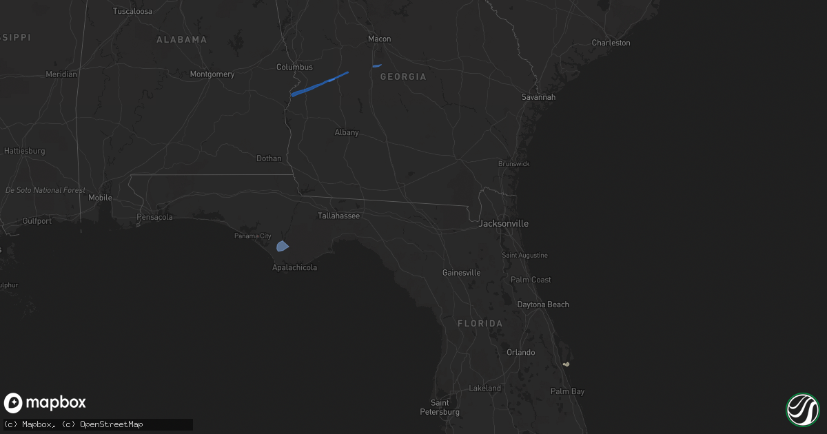
Hail Map in Florida on March 9, 2022
Get this storm
March 9 map
$229
one time, instant access
Download today. No call, no setup
Keep the $229
Bought the map and want the full workflow? Apply the entire $229 to a subscription within 7 days. None of it is wasted.
Every map, not just this one
This buys you this map. Subscription and you get every map we run, in the markets you choose from a few cities to whole states to nationwide. Plus real-time alerts the moment a storm fires.
Contact data
Name, contact info, occupancy, even credit band for addresses in the footprint. You go from where it hit to who to call.
Become the source they trust
Unlimited branding weather history reports on demand. You already have the documented answer ready for the property owner, and you are the one who showed up with it.
Property data and RoofTrace estimates
Pull up any address you have got, its value and the exact code rules for that jurisdiction, straight from One Click Code. Then RoofTrace estimates the squares, pitch, and roof value, priced the way you price.
Storm reports in Florida
Florida
| Date | Description |
|---|---|
| 03/09/202212:51 PM CST | City of deland reports tree down across garfield ave... North of minnesota ave. Road is blocked. |
| 03/09/202212:06 PM CST | Local broadcast media relayed report of an old... Large tree that was knocked down onto a roadway in dr. Phillips. |
| 03/09/20226:17 AM CST | Damage to windows and cars at fire station... Along with damage at adjacent substation. |
| 03/09/20223:25 AM CST | At 925 AM EST/825 AM CST/, a severe thunderstorm was located over Mexico Beach, or 7 miles northwest of Port St. Joe, moving northeast at 30 mph. HAZARD...60 mph wind gusts. SOURCE...Radar indicated. IMPACT...Expect damage to roofs, siding, and trees. Locations impacted include... Mexico Beach, Wewahitchka, Tyndall Air Force Base, Overstreet, Honeyville, Sumatra, Howard Creek, Willis Landing, Beacon Hill, Dalkeith, Saint Joe Beach and Fort Gadsden. |
| 03/09/20222:00 AM CST | At 800 AM EST/700 AM CST/, severe thunderstorms were located along a line extending from Stonemill Creek to 7 miles south of Wewahitchka to near Mexico Beach, moving east at 35 mph. HAZARD...60 mph wind gusts. SOURCE...Radar indicated. IMPACT...Expect damage to roofs, siding, and trees. Locations impacted include... Mexico Beach, Stonemill Creek, Orange, Wewahitchka, East Camp, Honeyville, Jewel Fire Tower, Vilas, Chipola Cutoff, Jensen Place, Central City, Red Hill, Overstreet, Poplar Camp, Kern, Willis Landing, Nixon Garden, Twin Pole, Dalkeith and Saint Joe Beach. |
| 03/08/202210:39 PM CST | At 439 PM EST, a severe thunderstorm was located 12 miles south of Mayo, moving northeast at 55 mph. HAZARD...60 mph wind gusts. SOURCE...Radar indicated. IMPACT...Expect damage to roofs, siding, and trees. Locations impacted include... Hatch Bend, Grady and Fletcher Springs. |


