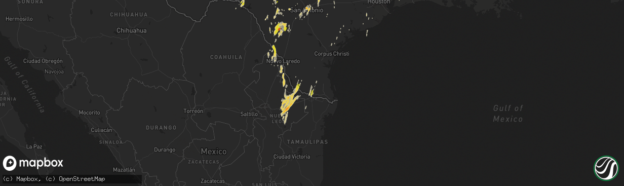
Hail Map on March 8, 2016
The weather event on March 8, 2016 includes Hail map. 4 states and 252 cities were impacted and suffered possible damage. The total estimated number of properties impacted is 83,534.
Want more than just the map?
Turn this storm into a full workflow.
- Owner + property data so you know who to knock
- OnDemand branded weather history reports to win the "did we even have hail?" argument
- RoofTrace estimate so reps stop guessing numbers at the door
Bought this map? Upgrade within 7 days and we'll credit the $230. (10-15 min setup call)
Hail
83,534
Estimated number of impacted properties by a 1.00" hail or larger2,026
Estimated number of impacted properties by a 1.75" hail or larger658
Estimated number of impacted properties by a 2.50" hail or largerStorm reports
Oklahoma
| Date | Description |
|---|---|
| 03/08/201610:47 AM CST | A small shed was blown down and a lean to horse barn was blown into a house causing some roof damage. Time estimated from radar. |
Texas
| Date | Description |
|---|---|
| 03/08/20165:35 PM CST | Quarter to half dollar size hail in ireland. |
| 03/08/20165:09 PM CST | Spotter report of golfball size hail 5 miles ssw of evant... Tx |
| 03/08/20163:50 PM CST | A local report indicates 1.00 inch wind near COMSTOCK |
| 03/08/20163:05 PM CST | Hail fell between 230pm and 305pm |
| 03/08/201612:35 PM CST | Delayed report - wind damage in downtown malakoff received from public via twitter. Time is radar estimated. |
| 03/08/201612:30 PM CST | Numerous trees and powerlines down. Roof damage to a home in downtown malakoff. |
| 03/08/201612:23 PM CST | 10 power poles snapped at base hwy 287/fm 309. Trees/powerlines snapped fm309 s of goodlow. |
| 03/08/201610:40 AM CST | Mobile home side damaged with tree branches down. Heavy rain and pea sized hail also reported. |
| 03/08/201610:25 AM CST | Delayed report---roof damage to warehouses on the 2600 block of industrial lane in garland. Time estimated via radar. |
| 03/08/201610:24 AM CST | Damage to a barn... Awning... And mobile home and trees in the area. |
| 03/08/20169:58 AM CST | Delayed report---damage to a barn and a few trees down near the community of bailey. |
| 03/08/20169:17 AM CST | Nws and emergency manager storm survey determined that a weak ef0 tornado formed a few miles southeast of andice. Damage was reported to a few residences... Trees... An |
| 03/08/20169:05 AM CST | *** 1 inj *** delayed report - garland pd report via twitter damage to buildings and vehicles 2600 block of industrial ln. 1 injured. |
| 03/08/20169:04 AM CST | Delayed report---powerlines down along alamo road between campbell and n. Collins rd. |
| 03/08/20169:00 AM CST | Delayed report---social media pictures show damage to large silo near first and main street in frisco. |
| 03/08/20169:00 AM CST | Damage to the roof of a residential structure in the colony reported via ham radio...power lines also down. |
| 03/08/20168:54 AM CST | Survey team found ef-0 damage in the colony from 3/8/16 storm. Pns will be released later this afternoon. |
| 03/08/20168:54 AM CST | Delayed report from social media---damage to homes in the colony near colony hs. Fd responding. |
| 03/08/20168:53 AM CST | Large branches down on rufe snow drive sidewalk. |
| 03/08/20168:35 AM CST | Delayed report - nws employee reports tree damage in grapevine just west of 121/360 split. Time radar estimated. |
| 03/08/20168:30 AM CST | Fence damage at the 2000 block of bradley ct. In keller |
| 03/08/20168:30 AM CST | Delayed report - wind damage to l.d. Bell high school in hurst relayed via twitter from public. Time estimated 830am. |
| 03/08/20168:30 AM CST | Delayed report - roof damage to wa porter elementary in hurst. Time radar estimated |
| 03/08/20168:25 AM CST | Delayed report - johnson rd closed between keller-smithfield and railhead due to downed power lines. |
| 03/08/20168:18 AM CST | Roof blown off of a business at saginaw-main near 820 in the city of saginaw. Time estimated via radar. |
| 03/08/20168:15 AM CST | Several large trees snapped at the mira vista golf course. Largest tree was 36 inches in diameter. Total of 25 trees uprooted. |
| 03/08/20168:15 AM CST | Delayed report---damage to roof of ice center near birdville h.s. In north richland hills. Time estimated via radar. |
| 03/08/20168:15 AM CST | Delayed report - damage to campus building at tcc northwest. Time is radar estimated. |
| 03/08/20168:15 AM CST | Delayed report - damage to campus building at tcc northwest. Time is radar estimated. |
| 03/08/20168:15 AM CST | Estimated 70mph winds with quarter sized hail in saginaw. |
| 03/08/20168:14 AM CST | Measured 66 mph wind gust at fort worth joint reserve base |
| 03/08/20168:13 AM CST | Damage to siding at a service station at blue mound road. Time estimated via radar. |
| 03/08/20168:13 AM CST | Delayed report---damage to small shed near verizon store just north of 820 in lake worth. Time estimated via radar. |
| 03/08/20168:05 AM CST | Delayed report - damage to benbrook marina relayed via twitter |
| 03/08/20168:05 AM CST | Dozens of boats damaged at benbrook lake marina. Picnic tables blown into lake. Boat masts wrapped around poles. |
| 03/08/20168:00 AM CST | Damage reported in a subdivision on orchard dr in flower mound. |
| 03/08/20167:55 AM CST | Delayed report - heavy rain and nickel size hail along with winds estimated at 65 mph. Report from former nws employee. |
| 03/08/20167:45 AM CST | Large tree branches and damage to carport reported on lakeshore loop near lake buchanan |
| 03/08/20167:40 AM CST | Large tree branches and damage to carport reported on lakeshore loop near lake buchanan |
| 03/08/20167:40 AM CST | Damage to a private marina on lake buchanan |
| 03/08/20167:36 AM CST | Delayed report - damage to brick home on meandering way. Window blown out and chimney toppled. Time radar estimated. |
| 03/08/20167:35 AM CST | Quarter to ping pong ball size hail |
| 03/08/20167:30 AM CST | 3-5 mobile homes rolled a few miles west of granbury near the community of tolar. |
| 03/08/20167:21 AM CST | Delayed report---social media pictures and broadcast media show video of tornado near tolar. Time estimated via radar. |
| 03/08/20167:04 AM CST | 60 mph wind gust measured at stephenville awos |
| 03/08/20166:55 AM CST | Delayed report - numerous damage reports in stephenville including tarleton state univ and erath county courthouse |
| 03/08/20166:47 AM CST | Delayed report---damage to press box at tarleton memorial stadium in stephenville. Time estimated via radar. |
| 03/08/20165:56 AM CST | Quarter size hail reported by public on facebook near business 83 and 23rd street. |
| 03/08/20165:51 AM CST | Fm 344 and highway 110...power poles partially covering the roadway. |
| 03/08/20165:42 AM CST | Tree down on fm 2868 approximately 1 mile from highway 155. |
| 03/08/20163:55 AM CST | Tree across dean road between county road 1130 and county road 1113. |
| 03/08/20163:12 AM CST | Tree down on county road 431 and county road 472. |
| 03/08/201612:45 AM CST | Large hail at the fort sam houston golf course |
| 03/07/20169:15 PM CST | A local report indicates 1.00 inch wind near 8 SSE CHAPPEL |
| 03/07/20168:45 PM CST | Estimated 60 mph from customs border patrol |
| 03/07/20168:20 PM CST | Downed power lines |
| 03/07/20168:20 PM CST | A local report indicates 1.00 inch wind near LEAKEY |
| 03/07/20168:10 PM CST | A local report indicates 1.00 inch wind near LEAKEY |
| 03/07/20168:00 PM CST | A local report indicates 1.50 inch wind near 6 NE FREDONIA |
| 03/07/20167:45 PM CST | At the j4 farm |
| 03/07/20167:45 PM CST | Estimated 60 mph from customs border patrol |
| 03/07/20167:44 PM CST | A local report indicates 1.00 inch wind near 2 N RICHLAND SPRINGS |
| 03/07/20167:35 PM CST | A local report indicates 1.00 inch wind near LAWN |
| 03/07/20167:35 PM CST | Quarter to ping pong ball size hail |
| 03/07/20167:34 PM CST | Tree damage reported |
| 03/07/20167:34 PM CST | A local report indicates a tornado near 5 NE FREDONIA |
| 03/07/20167:30 PM CST | Around the rancho encino sub division |
| 03/07/20167:30 PM CST | The golfball size hal lasted for 15 minutes... To around 745 pm. |
| 03/07/20167:30 PM CST | A local report indicates 4.00 inch wind near 4 NE KATEMCY |
| 03/07/20167:30 PM CST | A local report indicates 2.75 inch wind near 3 SE VOCA |
| 03/07/20167:23 PM CST | A local report indicates 1.00 inch wind near CARRIZO SPRINGS |
| 03/07/20167:20 PM CST | Irrigation sprinkler was tipped over...trees uprooted...and tree branches down. |
| 03/07/20167:17 PM CST | Shingles off of manufactured home...construction trailer tipped on its side... And large overhead doors were damaged |
| 03/07/20167:10 PM CST | A local report indicates 2.75 inch wind near VOCA |
| 03/07/20167:10 PM CST | A nws damage assessment team determined an ef-1 tornado with maximum wind speeds between 95 mph and 110 mph touched down. The maximum width of the tornado was 185 yards |
| 03/07/20166:57 PM CST | A local report indicates 2.00 inch wind near 7 WSW KATEMCY |
| 03/07/20166:36 PM CST | A local report indicates 2.00 inch wind near HEXT |
| 03/07/20166:33 PM CST | A local report indicates 1.25 inch wind near VOCA |
Louisiana
| Date | Description |
|---|---|
| 03/08/20165:45 PM CST | Tree down and power line down on claudes road |
| 03/08/20165:10 PM CST | Home damaged in west monroe. |
| 03/08/20163:47 PM CST | Tree down mt zion road and kingston |
| 03/08/20163:45 PM CST | Tree down texas avenue at lakeshore |
| 03/08/20163:40 PM CST | Trees and powerlines down |
| 03/08/20163:20 PM CST | Trees and power lines down |
| 03/08/20162:53 PM CST | Trees and power lines down |
| 03/08/20162:40 PM CST | Trees and powerlines down |
| 03/08/20162:37 PM CST | Trees and power lines down |
| 03/08/20162:20 PM CST | Trees and power lines down |
| 03/07/201611:20 PM CST | Trees were downed near quitman. |
| 03/07/20168:48 PM CST | Us highway 171 is closed between la highway 3276 in stonewall and us highway 5 in keachi. |
| 03/07/20167:47 PM CST | Tree down on hwy 6 east. |
Minnesota
| Date | Description |
|---|---|
| 03/08/20168:37 AM CST | Delayed report. Photos from buhl showing several large stones. Largest was 1.5 inches. |
| 03/08/20167:37 AM CST | Delayed report received at 1025 am. Hail was still on ground and ranged from pea size to 1 1/8 inch. Time of event estimated with radar. |
Arkansas
| Date | Description |
|---|---|
| 03/08/20165:30 PM CST | Multiple trees down in and around quitman |
| 03/08/20165:19 PM CST | Part of a roof was torn off of a house...construction trailer was moved 150 feet...and a construction vehicle was moved 100 feet. |
| 03/08/20165:00 PM CST | Trees down in southeast part of the county |
Cities Impacted by Hail Map on March 8, 2016
- Hibbing, MN
- Lampasas, TX
- Frisco, TX
- Aubrey, TX
- Prosper, TX
- Flower Mound, TX
- Denton, TX
- Lake Dallas, TX
- Little Elm, TX
- Lewisville, TX
- Sulphur, LA
- Westlake, LA
- Lake Charles, LA
- Fort Worth, TX
- San Antonio, TX
- Jacksonville, TX
- Uvalde, TX
- Brimson, MN
- Weatherford, TX
- Big Wells, TX
- Camp Wood, TX
- Franklin, TX
- Haltom City, TX
- Jacksboro, TX
- Bridgeport, TX
- Provencal, LA
- Robeline, LA
- Natchez, LA
- Natchitoches, LA
- Florien, LA
- Woodsboro, TX
- New Braunfels, TX
- Seguin, TX
- San Marcos, TX
- Kingsbury, TX
- Laredo, TX
- Smiley, TX
- Crystal City, TX
- Stephenville, TX
- Dublin, TX
- Isabella, MN
- Waynoka, OK
- Brady, TX
- Mason, TX
- Voca, TX
- Lorena, TX
- Chilton, TX
- Crowley, TX
- Joshua, TX
- Hamilton, TX
- Harper, TX
- Goldthwaite, TX
- Aledo, TX
- Jonesboro, TX
- Star, TX
- Purmela, TX
- Lometa, TX
- Evant, TX
- Menard, TX
- Fort McKavett, TX
- Ozona, TX
- San Saba, TX
- Hext, TX
- Fredonia, TX
- Mcallen, TX
- Mission, TX
- Sonora, TX
- Gatesville, TX
- Valley Mills, TX
- Rio Grande City, TX
- Tow, TX
- Bluffton, TX
- Comstock, TX
- Del Rio, TX
- Jbsa Ft Sam Houston, TX
- Montgomery, TX
- Sentinel, OK
- Mountain Park, OK
- Pearsall, TX
- Rocksprings, TX
- Pontotoc, TX
- London, TX
- Richland Springs, TX
- Cherokee, TX
- Valley Spring, TX
- Rochelle, TX
- Buda, TX
- Kyle, TX
- Nemo, TX
- Paradise, TX
- Mullin, TX
- Mountain Home, TX
- Junction, TX
- Leakey, TX
- Hunt, TX
- Barksdale, TX
- Dequincy, LA
- Vinton, LA
- Dilley, TX
- Roma, TX
- Eden, TX
- Asherton, TX
- Henderson, TX
- Leander, TX
- Liberty Hill, TX
- Brookeland, TX
- Hondo, TX
- Huntsville, TX
- New Waverly, TX
- Poolville, TX
- Perrin, TX
- Big Spring, TX
- Coahoma, TX
- Mountain Iron, MN
- Kinney, MN
- Palestine, TX
- Walnut Springs, TX
- Iredell, TX
- Zephyr, TX
- Glen Rose, TX
- Sterling City, TX
- Llano, TX
- Dodson, LA
- Cotulla, TX
- Maxwell, TX
- Caldwell, TX
- Batesville, TX
- Natalia, TX
- Babbitt, MN
- Carrizo Springs, TX
- Bertram, TX
- Eros, LA
- Chatham, LA
- Winnie, TX
- Gonzales, TX
- Hico, TX
- Morgan, TX
- Meridian, TX
- Kopperl, TX
- Atascosa, TX
- Lytle, TX
- San Ygnacio, TX
- Lawn, TX
- Tuscola, TX
- Ovalo, TX
- Sabinal, TX
- Buffalo Gap, TX
- Abilene, TX
- Edinburg, TX
- Brackettville, TX
- Pottsville, TX
- Burnet, TX
- Bend, TX
- Buchanan Dam, TX
- Concan, TX
- Knippa, TX
- Brazoria, TX
- Boerne, TX
- Westbrook, TX
- Mertzon, TX
- Boling, TX
- Pledger, TX
- De Leon, TX
- Poteet, TX
- Marble Falls, TX
- Pollok, TX
- Alto, TX
- Wells, TX
- Bigfoot, TX
- Cedar Creek, TX
- Apple Springs, TX
- Cleburne, TX
- Granbury, TX
- Comanche, TX
- Floydada, TX
- Roosevelt, OK
- Giddings, TX
- Converse, TX
- Lake Providence, LA
- Naval Air Station Jrb, TX
- Universal City, TX
- Schertz, TX
- Von Ormy, TX
- Jbsa Lackland, TX
- Jbsa Randolph, TX
- Crawford, TX
- Rio Frio, TX
- Wortham, TX
- Bedford, TX
- Euless, TX
- Dallas, TX
- Colleyville, TX
- Grapevine, TX
- Salado, TX
- Buffalo, TX
- Jonesboro, LA
- Celina, TX
- Buhl, MN
- Somerset, TX
- Pipe Creek, TX
- Plainview, TX
- Linn, TX
- Roosevelt, TX
- Georgetown, TX
- Florence, TX
- Frankston, TX
- Goldonna, LA
- Winnfield, LA
- Catarina, TX
- Many, LA
- Arlington, TX
- North Richland Hills, TX
- Hurst, TX
- Southlake, TX
- Jasper, TX
- La Pryor, TX
- Arapaho, OK
- Weatherford, OK
- Mora, LA
- Bluff Dale, TX
- Novice, TX
- Goldsboro, TX
- Lena, LA
- Carnegie, OK
- Sweeny, TX
- Hominy, OK
- Fort Cobb, OK
- Rusk, TX
- Waelder, TX
- Reklaw, TX
- Laneville, TX
- Lipan, TX
- Blanket, TX
- Victoria, TX
- Chico, TX
- Briggs, TX
- Saint Hedwig, TX
- Littlefork, MN
- Hidalgo, TX
- Pharr, TX
- Austin, TX
- Refugio, TX
- Kempner, TX
- Eldorado, TX
- West Monroe, LA
- Centerville, TX
- Athens, TX
- Waller, TX
- Plantersville, TX
- Port Lavaca, TX
- Haslet, TX
- Keller, TX