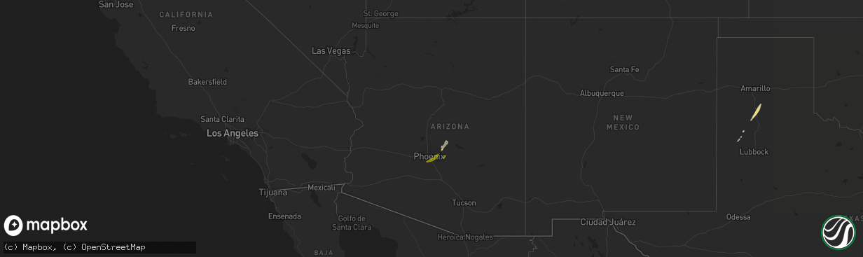
Hail Map in Arizona on March 8, 2013
The weather event in Arizona on March 8, 2013 includes Hail map. 2 states and 12 cities were impacted and suffered possible damage. The total estimated number of properties impacted is 76,962.
Want more than just the map?
Turn this storm into a full workflow.
- Owner + property data so you know who to knock
- OnDemand branded weather history reports to win the "did we even have hail?" argument
- RoofTrace estimate so reps stop guessing numbers at the door
Bought this map? Upgrade within 7 days and we'll credit the $230. (10-15 min setup call)
Hail
76,962
Estimated number of impacted properties by a 1.00" hail or larger0
Estimated number of impacted properties by a 1.75" hail or larger0
Estimated number of impacted properties by a 2.50" hail or largerStorm reports in Arizona
Arizona
| Date | Description |
|---|---|
| 03/08/20133:45 PM CST | 5-6 inch diameter tree knocked down |
| 03/08/20133:43 PM CST | Tree limbs blown down 60th st between indian school and thomas. Time estimated based on radar. |
| 03/08/20133:39 PM CST | Large tree blown down at mesa riverview shopping center |


