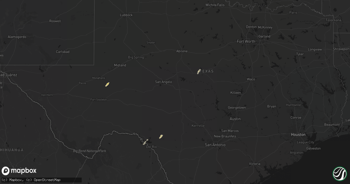
Hail Map in Texas on March 5, 2026
Get this storm
March 5 map
$229
one time, instant access
Download today. No call, no setup
Keep the $229
Bought the map and want the full workflow? Apply the entire $229 to a subscription within 7 days. None of it is wasted.
Every map, not just this one
This buys you this map. Subscription and you get every map we run, in the markets you choose from a few cities to whole states to nationwide. Plus real-time alerts the moment a storm fires.
Contact data
Name, contact info, occupancy, even credit band for addresses in the footprint. You go from where it hit to who to call.
Become the source they trust
Unlimited branding weather history reports on demand. You already have the documented answer ready for the property owner, and you are the one who showed up with it.
Property data and RoofTrace estimates
Pull up any address you have got, its value and the exact code rules for that jurisdiction, straight from One Click Code. Then RoofTrace estimates the squares, pitch, and roof value, priced the way you price.
Storm reports in Texas
Texas
| Date | Description |
|---|---|
| 03/04/20269:00 PM CST | Storm chaser reported tornado looking west of quail. |
| 03/04/20267:56 PM CST | A local report indicates 1.75 inch wind near 10 SE Hedley |
| 03/04/20267:51 PM CST | Report from mping: quarter |
| 03/04/20267:50 PM CST | Relayed by broadcast media. Time estimated from radar. |
| 03/04/20267:35 PM CST | Report from mping: hen egg+ |
| 03/04/20267:30 PM CST | Report from mping: hen egg |
| 03/04/20267:27 PM CST | Time estimated from radar. |
| 03/04/20267:21 PM CST | Report from mping: half dollar |
| 03/04/20267:20 PM CST | Report from mping: half dollar |
| 03/04/20266:15 PM CST | Public reported penny to quarter size hail. Time estimated by radar. |
All States Impacted by Hail Map on March 5, 2026
Cities Impacted by Hail Map on March 5, 2026
- Myakka City, FL
- Wimauma, FL
- Parrish, FL
- Arcadia, FL
- Lithia, FL
- Plant City, FL
- Crane, TX
- Moorefield, WV
- Mathias, WV
- Baker, WV
- North Port, FL
- Bowling Green, FL
- Ona, FL
- Punta Gorda, FL
- Webster, FL
- Brownwood, TX
- Bangs, TX
- Quitaque, TX
- Butler, OK
- Custer City, OK
- Taloga, OK
- Leedey, OK
- Galva, KS
- Gypsum, KS
- Del Rio, TX
- Lakeview, TX
- Memphis, TX
- Comstock, TX
- Putnam, OK
- Hutchinson, KS
- Burrton, KS
- Haven, KS
- Wellington, TX
- Erick, OK
- Seiling, OK
- Hollis, OK
- Texola, OK
- Hedley, TX
- Clarendon, TX
- Chester, OK
- Fairview, OK
- Aline, OK
- Waynoka, OK
- Canton, KS
- Sayre, OK
- Sweetwater, OK
- Cheyenne, OK
- Abilene, KS
- Chapman, KS
- Quail, TX
- Enterprise, KS
- Alva, OK
- Dacoma, OK
- Wakefield, KS
- Junction City, KS
- Burdick, KS
- Carmen, OK
- Burlington, OK
- Kiowa, KS
- Milford, KS
- Cherokee, OK
- Wilsey, KS
- Lelia Lake, TX
- Council Grove, KS
- Herington, KS
- Elk City, OK
- Cleo Springs, OK
- Riley, KS
- Alma, KS
- Alta Vista, KS
- Medicine Lodge, KS
- Hazelton, KS
- Rocksprings, TX
- Longford, KS
- Solomon, KS
- Leonardville, KS
- Dwight, KS
- Manhattan, KS
- Attica, KS
- Sharon, KS
- Wamego, KS
- Saint George, KS
- Randolph, KS
- Olsburg, KS
- Helena, OK
- Ringwood, OK
- Clay Center, KS
- Corning, KS
- Goff, KS
- Kingman, KS
- Mayetta, KS
- Denison, KS
- Hoyt, KS
- Blue Rapids, KS
- Hammon, OK
- Spivey, KS
- Zenda, KS
- Westmoreland, KS
- Pretty Prairie, KS
- Valley Falls, KS
- Holton, KS
- Muscotah, KS
- Effingham, KS
- Jet, OK
- Goltry, OK
- Shamrock, TX
- Mclean, TX
- Meno, OK
- Havensville, KS
- Marysville, KS
- Nash, OK
- Everest, KS
- Fairfax, MO
- Wakita, OK
- Buhler, KS
- Moundridge, KS
- Craig, MO
- Thurman, IA
- Wheeler, TX
- Lancaster, KS
- Manchester, OK
- Denton, KS
- Troy, KS
- Ellsworth, KS
- Brookville, KS
- Medford, OK
- Amity, MO
- Westboro, MO
- Tarkio, MO
- Blanchard, IA
- Sidney, IA
- Tabor, IA
- Clarksdale, MO
- Nebraska City, NE
- Omaha, NE
- Honey Creek, IA
- Crescent, IA
- Plattsmouth, NE
- Onaga, KS
- Vermillion, KS
- Centralia, KS
- Randolph, IA
- Malvern, IA
- King City, MO
- Clarinda, IA
- Shambaugh, IA
- Maysville, MO
- Union Star, MO
- Northboro, IA
- Coin, IA
- Briscoe, TX
- Alvo, NE
- Greenwood, NE
- Ashland, NE
- Murdock, NE
- Yorktown, IA
- Shenandoah, IA
- Seneca, KS
- Essex, IA
- Odell, NE
- Blue Springs, NE
- Douglass, KS
- Baileyville, KS
- Denver, MO
- Gentry, MO
- Worth, MO
- Belvue, KS
- Council Bluffs, IA
- Bellevue, NE
- Hollenberg, KS
- Steele City, NE
- Diller, NE
- Reydon, OK
- Hastings, IA
- Elmwood, NE
- Beverly, KS
- Tescott, KS
- Salina, KS
- Macedonia, IA
- Henderson, IA
- Griswold, IA
- Carson, IA
- Grant City, MO
- Beatrice, NE
- Leon, KS
- Hatfield, MO
- Liberty, NE
- Virginia, NE
- Bluff City, KS
- Caldwell, KS
- Underwood, IA
- Kimballton, IA
- Mayfield, KS
- Wellington, KS
- Maitland, MO
- Mound City, MO
- Corning, IA
- Primghar, IA
- Archer, IA
- Exira, IA
- Burchard, NE
- Crab Orchard, NE
- Lewiston, NE
- Kellerton, IA
- Mount Ayr, IA
- Tecumseh, NE
- Elk Creek, NE
- Sabetha, KS
- Wetmore, KS
- Milan, KS
- Steinauer, NE
- Skidmore, MO
- Graham, MO
- Audubon, IA
- Elk Horn, IA
- Harlan, IA
- Falls City, NE
- Morrill, KS
- Fairview, KS
- Salem, NE
- Belle Plaine, KS
- Mulvane, KS
- Pawnee City, NE
- Table Rock, NE
- Hiawatha, KS
- Maryville, MO
- Verdon, NE
- Peck, KS
- Rulo, NE
- Filley, NE
- Bayard, IA
- Percival, IA
- Shubert, NE
- Nemaha, NE
- Udall, KS
- Rose Hill, KS
- Haysville, KS
- Hamburg, IA
- Derby, KS
- Imogene, IA
- Piedmont, KS
- Kirksville, MO
- Brashear, MO
- Ames, IA
- Eureka, KS
- Cainsville, MO
- Blythedale, MO
- Eagleville, MO
- Ridgeway, MO
- Atlantic, IA
- Marne, IA
- Wichita, KS
- Brayton, IA
- Vici, OK
- Arnett, OK
- Humboldt, NE
- Clearwater, KS
- Memphis, MO
- Latham, KS
- Arbela, MO
- Oxford, KS
- Andover, KS
- Augusta, KS
- Bonaparte, IA
- Keosauqua, IA
- Blakesburg, IA
- Ottumwa, IA
- Hillsboro, IA
- Rock Port, MO
- Yates Center, KS
- Mount Pleasant, IA
- Salem, IA
- Gridley, KS
- Burlington, KS
- Le Roy, KS
- Mount Sterling, IA
- Luray, MO
- Farmington, IA
- Kahoka, MO
- Wayland, MO
- Virgil, KS
- Hamilton, KS
- Princeton, KY


