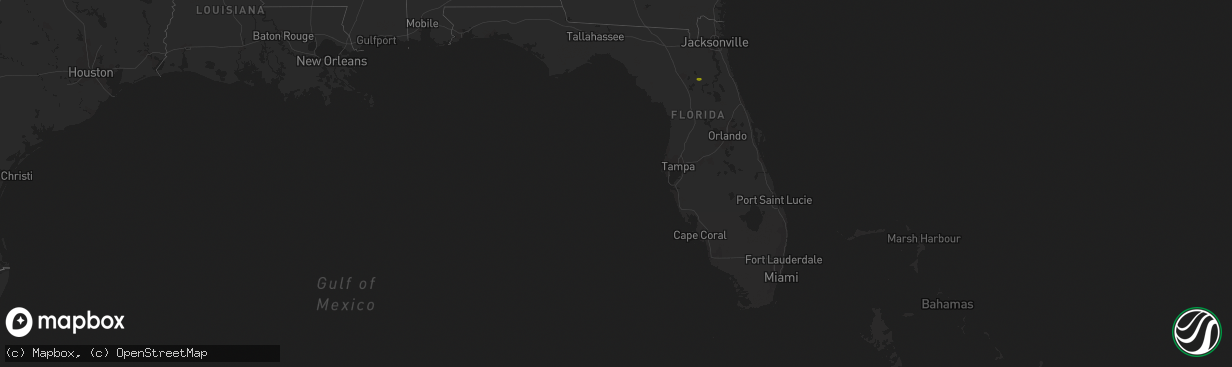
Hail Map in Florida on March 2, 2019
The weather event in Florida on March 2, 2019 includes Hail map. 1 state and 10 cities were impacted and suffered possible damage. The total estimated number of properties impacted is 654.
Want more than just the map?
Turn this storm into a full workflow.
- Owner + property data so you know who to knock
- OnDemand branded weather history reports to win the "did we even have hail?" argument
- RoofTrace estimate so reps stop guessing numbers at the door
Bought this map? Upgrade within 7 days and we'll credit the $230. (10-15 min setup call)
Hail
654
Estimated number of impacted properties by a 1.00" hail or larger0
Estimated number of impacted properties by a 1.75" hail or larger0
Estimated number of impacted properties by a 2.50" hail or largerStorm reports in Florida
Florida
| Date | Description |
|---|---|
| 03/02/20194:12 PM CST | Trees down on state road 11 west of bunnell. |
| 03/02/20191:51 PM CST | 911 call center passed on a report of powerlines down on ne 55th blvd east of gainesville. Time estimated using radar data. |
| 03/02/20196:25 AM CST | Debris covering springhill road for at least 2 miles south of the airport. Also reported twisted and broken trees. |
| 03/02/201912:57 AM CST | At 657 AM EST, a severe thunderstorm was located 7 miles southwest of Midway, moving east at 25 mph. HAZARD...60 mph wind gusts and quarter size hail. SOURCE...Radar indicated. IMPACT...Hail damage to vehicles is expected. Expect wind damage to roofs, siding, and trees. Locations impacted include... Tallahassee, Woodville, Florida A And M, Tallahassee Comm College, Florida State University, Doak Campbell Stadium, Lake Bradford, Leon Sinks, Gaither Community Center, Lake Munson, Tallahassee Memorial Hosp, Eight Mile Pond, Lake Ella, Tallahassee Mall, Tallahassee Regional A/P, State Capital Complex, Governors Square Mall, Springsax Park, Belair and Lake Talquin. |
| 03/01/201911:41 PM CST | At 541 AM EST/441 AM CST/, Doppler radar indicated a severe thunderstorm capable of producing half dollar size hail and damaging winds in excess of 60 mph. This storm was located near Blountstown, and moving east at 40 mph. Locations impacted include... Blountstown, Bristol, Telogia, Clarksville, Red Oak, Selman, Hosford, Chason, Chipola, Kennys Mill, Willis, Nettle Ridge, Lowry, Blountstown Airport, Macedonia, Durham, White Pond, Clio and Rock Bluff. |
| 03/01/201910:30 PM CST | At 429 PM EST, a severe thunderstorm was located over Pomona Park, moving east at 30 mph. HAZARD...60 mph wind gusts and penny size hail. SOURCE...Radar indicated. IMPACT...Expect damage to roofs, siding, and trees. Locations impacted include... Bunnell, Pomona Park, Andalusia, Espanola and Lake Como. |
| 03/01/201910:12 PM CST | At 412 AM CST, a severe thunderstorm was located 18 miles west of Blountstown, moving east at 40 mph. HAZARD...Quarter size hail. SOURCE...Radar indicated. IMPACT...Damage to vehicles is expected. Locations impacted include... Blountstown, Altha, Betts, Moose Pond, Clarksville, Red Oak, Ocheesee, Selman, Fountain, Chason, Chipola, Henderson Mill, Camps Head, Kennys Mill, Center Lake, Willis, Nettle Ridge, Blountstown Airport, Macedonia and Torreya State Park. |
| 03/01/20199:46 PM CST | At 345 PM EST, a severe thunderstorm was located over Interlachen, moving east at 20 mph. HAZARD...Quarter size hail. SOURCE...Radar indicated. IMPACT...Damage to vehicles is expected. Locations impacted include... Palatka, Interlachen, Hollister, Satsuma and Mannville. |
| 03/01/20199:05 PM CST | At 304 PM EST, a severe thunderstorm was located over Orange Heights, or near Melrose, moving east at 20 mph. HAZARD...60 mph wind gusts and quarter size hail. SOURCE...Radar indicated. IMPACT...Hail damage to vehicles is expected. Expect wind damage to roofs, siding, and trees. Locations impacted include... Interlachen, Melrose, Hawthorne, Melrose Landing, Lake Geneva, Florahome, Johnson, Putnam Hall and Mannville. |
| 03/01/20198:34 PM CST | At 234 PM EST, a severe thunderstorm was located near Gainesville, moving east at 15 mph. HAZARD...60 mph wind gusts and quarter size hail. SOURCE...Radar indicated. IMPACT...Hail damage to vehicles is expected. Expect wind damage to roofs, siding, and trees. Locations impacted include... Orange Heights, Gainesville Airport and Waldo. |


