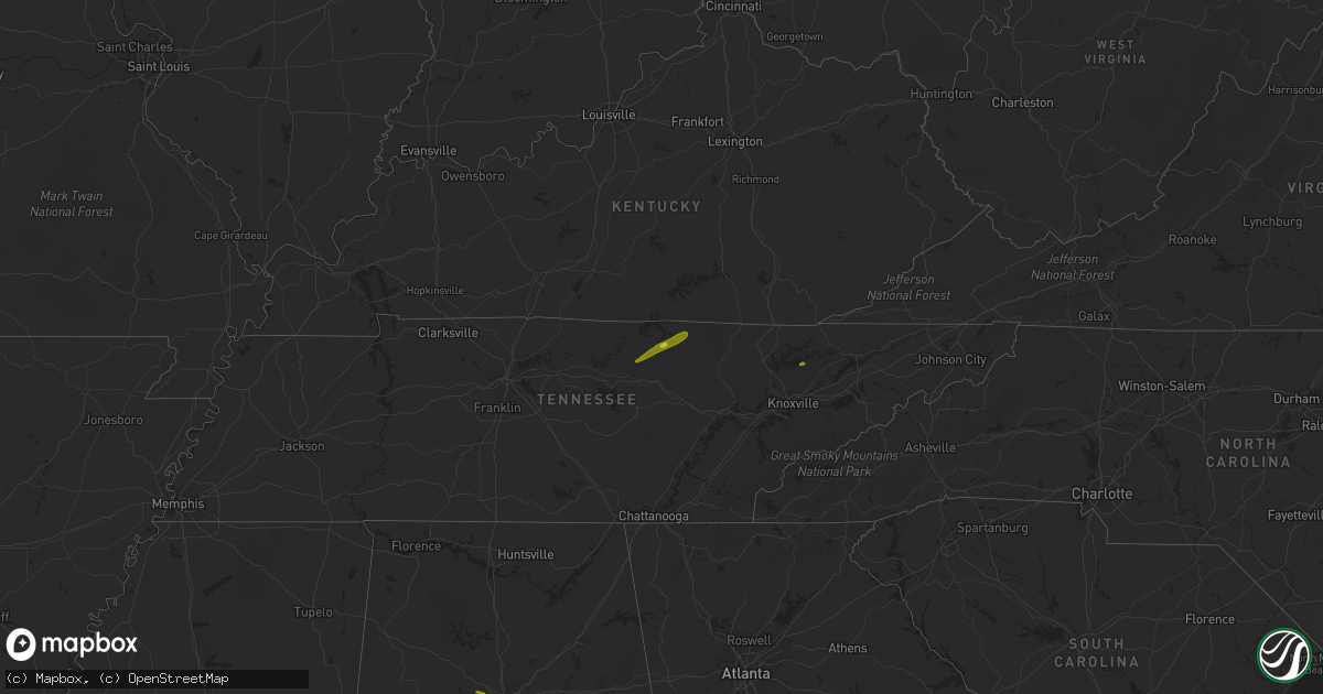
Hail Map on March 1, 2016
Get this storm
March 1 map
$229
one time, instant access
Download today. No call, no setup
Keep the $229
Bought the map and want the full workflow? Apply the entire $229 to a subscription within 7 days. None of it is wasted.
Every map, not just this one
This buys you this map. Subscription and you get every map we run, in the markets you choose from a few cities to whole states to nationwide. Plus real-time alerts the moment a storm fires.
Contact data
Name, contact info, occupancy, even credit band for addresses in the footprint. You go from where it hit to who to call.
Become the source they trust
Unlimited branding weather history reports on demand. You already have the documented answer ready for the property owner, and you are the one who showed up with it.
Property data and RoofTrace estimates
Pull up any address you have got, its value and the exact code rules for that jurisdiction, straight from One Click Code. Then RoofTrace estimates the squares, pitch, and roof value, priced the way you price.
States Impacted by Hail Map on March 1, 2016
Storm reports
Oregon
| Date | Description |
|---|---|
| 02/29/201611:29 PM CST | Squall thunderstorm on cold front. |
| 02/29/20167:30 PM CST | Thunderstorms and lightning caused damage to four homes in nehalem bay. The homes sustained shingle damage from lightning strike.one home was heavily damaged with one w |
| 02/29/20166:30 PM CST | Roof blown off an outbuilding at ananda laurelwood retreat near gaston. Initial indication is that straight-line winds caused the damage. |
Georgia
| Date | Description |
|---|---|
| 02/29/20169:18 PM CST | A tree was downed on mills drive. |
| 02/29/20168:07 PM CST | A tree and power lines were downed at braden rd and salem rd. |
| 02/29/20168:07 PM CST | A tree was downed on mills drive. |
| 02/29/20168:04 PM CST | A tree and power lines were blown down at the intersection of christian circle and christian drive. |
Alabama
| Date | Description |
|---|---|
| 03/01/20165:52 PM CST | Trees down near helena city hall. Time estimated by radar. |
| 03/01/20165:50 PM CST | Tree down blocking road. Corrected time. End point of nws storm survey. |
| 03/01/20165:49 PM CST | Tree reported down. Tin off of roof and tree limbs reported in the vicinity. Time estimated by radar. |
| 03/01/20165:49 PM CST | Trees down blocking roadway. Time estimated by radar. |
| 03/01/20165:49 PM CST | Tree reported down. Tin off of roof and tree limbs reported in the vicinity. Time estimated by radar. Updated event type. |
| 03/01/20165:48 PM CST | Cedar tree down... Estimated 20 to 30 inch diameter. Time estimated. Corrected diameter. |
| 03/01/20165:47 PM CST | Golf ball sized hail reported. |
| 03/01/20165:46 PM CST | Report of trees and power lines down. Road impassable. Corrected time. |
| 03/01/20165:45 PM CST | Tree reported down. |
| 03/01/20165:45 PM CST | Tree reported down. Updated event type. |
| 03/01/20165:44 PM CST | Significant damage reported at bent brook golf course. Possible damage to vehicles. Several trees down. County road 52 blocked by downed trees. Time estimated by radar. |
| 03/01/20165:43 PM CST | Report of four residents injured. Updated information according to jefferson county ema. Corrected time. |
| 03/01/20165:43 PM CST | Significant damage reported at bent brook golf course. Possible damage to vehicles. Several trees down. County road 52 blocked by downed trees. Time estimated by radar. |
| 03/01/20165:43 PM CST | *** 4 inj *** the tornado touched down just east of mcadory high school on the west side of overlook circle.it strengthened to an ef-2 while crossing the bent brook nei |
| 03/01/20165:43 PM CST | Tree down blocking road. Time estimated by radar. |
| 03/01/20165:43 PM CST | Tree damage reported. Corrected time. Updated information. |
| 03/01/20165:42 PM CST | Tree damage reported. Time estimated by radar. |
| 03/01/20165:42 PM CST | *** 4 inj *** report of four residents injured. Updated information according to jefferson county ema. Time estimated by radar. |
| 03/01/20165:42 PM CST | Report of trees and power lines down. Road impassable. |
| 03/01/20165:12 PM CST | Tree reported down. Time estimated by radar. Corrected event type. |
| 03/01/20165:12 PM CST | Tree reported down. Time estimated by radar. Updated event type. |
| 02/29/20168:30 PM CST | Tornado reported with tds signature... Ema reported several trees down |
| 02/29/20168:27 PM CST | A tornado traveled west to east just north of opelika. Numerous trees were snapped off or were uprooted along the path. |
| 02/29/20166:50 PM CST | Multiple trees and power lines down along county road 511 near the clay county and coosa county line. Possible related motor vehicle accident reported nearby. Time esti |
| 02/29/20166:47 PM CST | Trees down blocking alabama highway 511 near parkdale. Time estimated by radar. |
| 02/29/20166:45 PM CST | Nws storm survey tornado end point. |
| 02/29/20166:44 PM CST | Multiple trees down and power lines downand guard rail damaged in goodwater along old rock road and hwy 511... Peterson lane. Updated information. |
| 02/29/20166:42 PM CST | Tornado touched down along settlement road to the east of the old rock house. It moved northeast to near cherry and heflin lanes then turned to the east and tracked par |
Louisiana
| Date | Description |
|---|---|
| 03/01/20164:38 PM CST | A local report indicates 1.00 inch wind near 3 SW WISNER |
| 03/01/20164:21 PM CST | Quarter size hail on 127 just south of olla |
Kentucky
| Date | Description |
|---|---|
| 03/01/20164:25 PM CST | Large tree lying across highway 830 near the intersection with highway 1810. |
| 03/01/20164:03 PM CST | Dorton mesonet site gusted to 61 mph along a line of thunderstorms. |
| 03/01/20163:13 PM CST | Tree down on highway 699. |
| 03/01/20163:08 PM CST | Tree down on highway 1380. |
| 03/01/20162:45 PM CST | Garage damaged near 1304 and highway 11. Time estimated off of radar. |
| 03/01/20162:32 PM CST | Dispatch reported damage on sasser school road and highway 229. One home lost complete roof. Other buildings damaged. Some injuries. |
| 03/01/20162:25 PM CST | Large tree lying across highway 830 near the intersection with highway 1810. |
| 03/01/20162:18 PM CST | Tree down on highway 25 and on highway 90. |
| 03/01/20161:50 PM CST | Trees snapped or uprooted in county. |
Tennessee
| Date | Description |
|---|---|
| 03/01/20163:45 PM CST | Reported by dispatch |
Cities Impacted by Hail Map on March 1, 2016
- Wisner, LA
- Fort Necessity, LA
- Winnsboro, LA
- Columbia, LA
- Grayson, LA
- Pollock, LA
- Trout, LA
- McCalla, AL
- Birmingham, AL
- Adger, AL
- Bessemer, AL
- Brookwood, AL
- State Line, MS
- Georgetown, LA
- Dry Prong, LA
- Jena, LA
- Vance, AL
- Tullos, LA
- Winnfield, LA
- Dodson, LA
- Sikes, LA
- Olla, LA
- Livingston, TN
- Alpine, TN
- Monroe, TN
- Jonesville, LA
- Harrisonburg, LA
- Marion Junction, AL
- Selma, AL
- Columbus, IN
- Sicily Island, LA
- Maynardville, TN
- Rickman, TN
- Hilham, TN
- Cookeville, TN
- Jamestown, TN
- Byrdstown, TN
- Pall Mall, TN
- Adamsville, AL