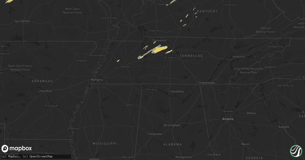
Hail Map in Missouri on March 1, 2012
Get this storm
March 1 map
$229
one time, instant access
Download today. No call, no setup
Keep the $229
Bought the map and want the full workflow? Apply the entire $229 to a subscription within 7 days. None of it is wasted.
Every map, not just this one
This buys you this map. Subscription and you get every map we run, in the markets you choose from a few cities to whole states to nationwide. Plus real-time alerts the moment a storm fires.
Contact data
Name, contact info, occupancy, even credit band for addresses in the footprint. You go from where it hit to who to call.
Become the source they trust
Unlimited branding weather history reports on demand. You already have the documented answer ready for the property owner, and you are the one who showed up with it.
Property data and RoofTrace estimates
Pull up any address you have got, its value and the exact code rules for that jurisdiction, straight from One Click Code. Then RoofTrace estimates the squares, pitch, and roof value, priced the way you price.
Storm reports in Missouri
Missouri
| Date | Description |
|---|---|
| 03/01/20125:55 AM CST | I70 and 5th st |
| 03/01/20125:51 AM CST | 364 and jungs station |
| 03/01/20125:47 AM CST | A local report indicates 1.00 inch wind near WELDON SPRING |
| 03/01/20125:45 AM CST | Went out and measured after storm ended |
| 03/01/20125:35 AM CST | A local report indicates 1.25 inch wind near 1 S NEW MELLE |
| 03/01/20125:26 AM CST | A local report indicates 1.00 inch wind near DUTZOW |
| 03/01/20125:10 AM CST | A local report indicates 1.00 inch wind near 3 S NEW HAVEN |
| 03/01/20125:02 AM CST | A local report indicates 1.00 inch wind near 5 NE DRAKE |
| 03/01/20125:00 AM CST | Hail covering ground. |
| 03/01/20124:56 AM CST | A local report indicates 1.00 inch wind near 2 S WARRENTON |
| 03/01/20124:43 AM CST | Hail covering ground. |
| 03/01/20124:25 AM CST | A local report indicates 1.75 inch wind near 7 N VIENNA |
| 03/01/20124:13 AM CST | A local report indicates 1.00 inch wind near META |
| 03/01/20124:03 AM CST | A local report indicates 1.00 inch wind near 2 NE TUSCUMBIA |
| 03/01/20124:01 AM CST | A local report indicates 1.00 inch wind near TUSCUMBIA |
| 03/01/20124:00 AM CST | A local report indicates 1.25 inch wind near TAOS |
| 03/01/20123:49 AM CST | Golf ball to baseball sized hail damaging motor vehicle windows in area. |
| 03/01/20123:48 AM CST | Observed on highway 54. |
| 03/01/20123:45 AM CST | Hail covered the ground. |
| 03/01/20123:45 AM CST | A local report indicates 1.00 inch wind near HICKORY HILL |
| 03/01/20123:45 AM CST | Quarter size hail covering the ground two inches deep. Hailed for about 10 minutes. |
| 03/01/20123:30 AM CST | A local report indicates 1.75 inch wind near ELDON |
| 03/01/20123:19 AM CST | A local report indicates 1.00 inch wind near GRAVOIS MILLS |
| 03/01/20123:00 AM CST | A local report indicates 1.00 inch wind near 1 NW QUINCY |
| 03/01/20122:45 AM CST | A local report indicates 1.75 inch wind near VISTA |
All States Impacted by Hail Map on March 1, 2012
Cities Impacted by Hail Map on March 1, 2012
- Dickson, TN
- Nashville, TN
- Pegram, TN
- Berger, MO
- Linn, MO
- Loose Creek, MO
- Warrenton, MO
- Marthasville, MO
- Hermann, MO
- Wright City, MO
- Westphalia, MO
- Chamois, MO
- Morrison, MO
- Bonnots Mill, MO
- Jefferson City, MO
- Osceola, MO
- Collins, MO
- Gravois Mills, MO
- Barnett, MO
- Foristell, MO
- Wentzville, MO
- Bland, MO
- Camdenton, MO
- Gerald, MO
- Eugene, MO
- Meta, MO
- Koeltztown, MO
- Rocky Mount, MO
- Saint Elizabeth, MO
- Saint Thomas, MO
- Rosebud, MO
- Owensville, MO
- Augusta, MO
- Vienna, MO
- Tuscumbia, MO
- Eldon, MO
- Argyle, MO
- Defiance, MO
- Roach, MO
- Sunrise Beach, MO
- New Haven, MO
- Belle, MO
- Washington, MO
- Henley, MO
- Climax Springs, MO
- Lake Ozark, MO
- Freeburg, MO
- Lohman, MO
- California, MO
- Russellville, MO
- White Bluff, TN
- Charlotte, TN
- Ashland City, TN
- Vanleer, TN
- Cumberland Furnace, TN
- El Dorado Springs, MO
- Warsaw, MO
- Cross Timbers, MO
- Edwards, MO
- Quincy, MO
- Wheatland, MO
- O'Fallon, MO
- Alamo, TN
- McEwen, TN
- Saint Louis, MO
- Leslie, MO
- Osage Beach, MO
- Earth City, MO
- Saint Peters, MO
- Bridgeton, MO
- Stover, MO
- Olean, MO
- Versailles, MO
- Kaiser, MO
- Hazelwood, MO
- Saint Charles, MO
- Maryland Heights, MO
- Ridgeway, SC
- Golden Eagle, IL
- Brussels, IL
- Camden, TN
- Holladay, TN
- Westport, TN
- New Johnsonville, TN
- Centertown, MO
- Elizabeth, IN
- Ekron, KY
- Laconia, IN
- Brandenburg, KY
- Guston, KY
- Hawesville, KY
- Cannelton, IN
- Woodlawn, TN
- Indian Mound, TN
- Brownsville, KY
- Roundhill, KY
- Erin, TN
- Waverly, TN
- Winnsboro, SC
- Hartsburg, MO
- Chesterfield, MO
- Truesdale, MO
- New Bloomfield, MO
- Lake Saint Louis, MO
- Mount Sterling, MO
- Ashland, MO
- Gaffney, SC
- Smiths Grove, KY
- Oakland, KY
- Glendale, KY
- Elizabethtown, KY
- Kingston Springs, TN
- Cumberland City, TN
- Big Sandy, TN
- Stewart, TN
- Hodgenville, KY
- Moscow Mills, MO
- Old Monroe, MO
- Humboldt, TN
- Leitchfield, KY
- Clarkson, KY
- Mammoth Cave, KY
- Cub Run, KY
- Fort Rucker, AL
- Bowling Green, KY
- Sonora, KY
- Magnolia, KY
- Upton, KY
- Owensboro, KY
- Philpot, KY
- Nevada, MO
- Moundville, MO
- Munfordville, KY
- Chapmansboro, TN
- Buena Vista, TN
- Southside, TN
- Cunningham, TN


