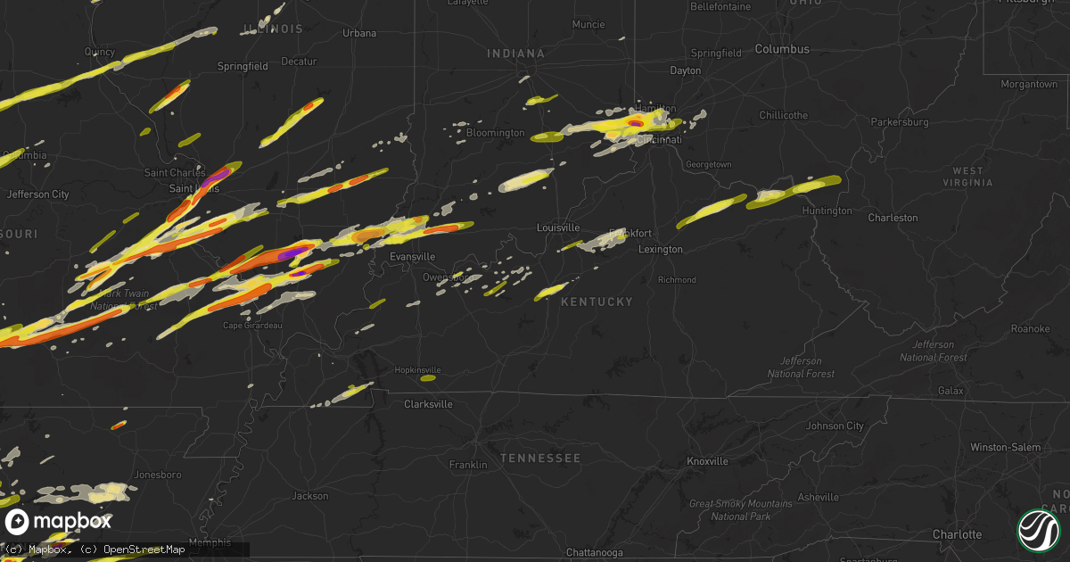
Hail Map in Kentucky on February 28, 2017
Get this storm
February 28 map
$229
one time, instant access
Download today. No call, no setup
Keep the $229
Bought the map and want the full workflow? Apply the entire $229 to a subscription within 7 days. None of it is wasted.
Every map, not just this one
This buys you this map. Subscription and you get every map we run, in the markets you choose from a few cities to whole states to nationwide. Plus real-time alerts the moment a storm fires.
Contact data
Name, contact info, occupancy, even credit band for addresses in the footprint. You go from where it hit to who to call.
Become the source they trust
Unlimited branding weather history reports on demand. You already have the documented answer ready for the property owner, and you are the one who showed up with it.
Property data and RoofTrace estimates
Pull up any address you have got, its value and the exact code rules for that jurisdiction, straight from One Click Code. Then RoofTrace estimates the squares, pitch, and roof value, priced the way you price.
Storm reports in Kentucky
Kentucky
| Date | Description |
|---|---|
| 02/28/20175:59 AM CST | Measured at the crittenden raws observation site. Time of event estimated from radar. |
| 02/28/20175:58 AM CST | Damage to barn and outbuildings. Gas pump damaged. |
| 02/28/20175:58 AM CST | Straight line wind damage of approximately 50-60 mph was surveyed just east of whitfield... Ky on the bullitt/spencer county line and east into spencer county. Damage t |
| 02/28/20175:55 AM CST | Observed at ky mesonet site |
| 02/28/20175:55 AM CST | Roofs blown into road on us42 and pleasant valley road. |
| 02/28/20175:55 AM CST | Observed at ky mesonet site |
| 02/28/20175:55 AM CST | Fencing and trees damaged at country club estates apartments on richardson rd near turkey foot rd. |
| 02/28/20175:53 AM CST | Delayed report. Off-duty nws employee reported 3 telephone poles snapped along crume road. |
| 02/28/20175:52 AM CST | Trees down countywide. Time estimated from radar. |
| 02/28/20175:51 AM CST | Roof removed from house on beaver rd. |
| 02/28/20175:50 AM CST | Mesonet station 2 s eminence /crop/. The duration of the tstm wnd gst event was 1 hour. |
| 02/28/20175:50 AM CST | Garage doors of a wrecker service building blown in. Numerous trees down as well. |
| 02/28/20175:47 AM CST | 10-20 snapped trees with one falling on and crushing a vehicle. |
| 02/28/20175:47 AM CST | Numerous snapped trees. Roof of a small building. Time estimated. |
| 02/28/20175:45 AM CST | Shingles blown off a house |
| 02/28/20175:45 AM CST | Estimated winds as the storm passed. Resident said their mobile home was rocking in the wind. |
| 02/28/20175:43 AM CST | A local report indicates 1.00 inch wind near ALMO |
| 02/28/20175:40 AM CST | Numerous trees down... Multiple roofs blown down. Town is without power. |
| 02/28/20175:40 AM CST | A local report indicates 79 MPH wind near KYMESO CARROLLTON 2E |
| 02/28/20175:38 AM CST | Several barns with damage... Barns destroyed... Major roof damage on newer construction homes... Larger uprooted trees. High concentration of damage on jones road near |
| 02/28/20175:38 AM CST | . |
| 02/28/20175:37 AM CST | Power poles bent over along crittenden drive. |
| 02/28/20175:36 AM CST | Utility pole and power lines down on highway 79 just north of irvington. . |
| 02/28/20175:36 AM CST | An ef-1 tornado touched down 2 miles north of campbellsburg... Ky... Traveled 1 mile |
| 02/28/20175:35 AM CST | A local report indicates 59 MPH wind near KYMESO CARROLLTON 2E |
| 02/28/20175:35 AM CST | Several structures with damage. Trees and power lines down. No power to much of southern portion of the county |
| 02/28/20175:34 AM CST | A local report indicates 75 MPH wind near 2 S CALVERT CITY |
| 02/28/20175:32 AM CST | A local report indicates 60 MPH wind near CLAY |
| 02/28/20175:32 AM CST | Almost every house on smith lane was damaged. Most of the county is without power. Elsewhere in the county... Greenhouses and mobile homes were damaged. |
| 02/28/20175:30 AM CST | Mesonet station 1 ssw westport /lgrn/. The duration of the tstm wnd gst event was 1 hour. |
| 02/28/20175:30 AM CST | Wind speed estimated around 100 mph. Severe damage to cinder block workshop. Northwest load bearning corner of building was competely removed with roof hanging unsuppor |
| 02/28/20175:30 AM CST | Estimated 70 to 80 mph wind gusts by off duty nws employee |
| 02/28/20175:25 AM CST | Several trees down and power is off on shiloh lane. |
| 02/28/20175:25 AM CST | Estimated 100 mph microburst.hardwood trees snapped and uprooted. Grain bin lifted and thrown approximately 50 yards. Residence carport lifted and destroyed. Some metal |
| 02/28/20175:25 AM CST | Ef-2 tornado that began 0.5 miles ese of cuba and lifted 2 miles e of cuba. Peak winds were 120 mph and path length was 1.5 miles. Peak width was 200 yards. Several hea |
| 02/28/20175:25 AM CST | Measured at ky mesonet site |
| 02/28/20175:25 AM CST | Several large trees down at a residence. |
| 02/28/20175:23 AM CST | An ef-1 tornado with maximum winds of 86 mph touched down in far western butler county. Most of the damage was snapped... Twisted... Or uprooted trees. One building was |
| 02/28/20175:23 AM CST | An intermittent swath of straight-line winds occurred from just east of wises landing in trimble county... East to the intersection of us-421 and highway 316. There wer |
| 02/28/20175:22 AM CST | Numerous trees were snapped over a fairly wide area... Though the swath of damage was riddled with many trees that withstood the wind. The most concentrated damage was |
| 02/28/20175:21 AM CST | A local report indicates 68 MPH wind near GRAHMVILLE |
| 02/28/20175:20 AM CST | Straight-line winds occurred intermittently just south of the ohio river from 2 miles west of milton to 2.5 miles east of milton. A mobile home park was damaged with mu |
| 02/28/20175:20 AM CST | Along hwy 58 the wind ripped off the whole back porch of residence and brought it into bedroom and front yard. Took the electric panel and threw it in the yard. |
| 02/28/20175:18 AM CST | Trees sheared off several feet above the ground...coffee tree split and felled...large limbs down. Late report from 3/1 received 3/22. |
| 02/28/20175:15 AM CST | Power pole on a car...powerline on car and trees down |
| 02/28/20175:13 AM CST | A local report indicates 75 MPH wind near 5 W PADUCAH |
| 02/28/20175:07 AM CST | Observed at davis weather station south of clinton |
| 02/28/20175:05 AM CST | Structural damage in town due to strong winds |
| 02/28/20175:05 AM CST | Trees downed. |
| 02/28/20175:05 AM CST | Measured at ky mesonet |
| 02/28/20175:00 AM CST | Roof blown off of agri-chem building along us hwy 51 near town |
| 02/28/20175:00 AM CST | Damage to ballard county high school. Widepsread trees and power lines down across the county. Several homes with damage. |
| 02/28/20173:43 AM CST | A local report indicates 59 MPH wind near KFGX FLEMING-MASON APT |
| 02/28/20173:25 AM CST | Barn destroyed. |
| 02/28/20173:20 AM CST | Trees downed. |
| 02/28/20173:18 AM CST | Old barn destroyed. |
| 02/28/20173:17 AM CST | Three trees down. |
| 02/28/20173:15 AM CST | Outbuildings belonging to the university of kentucky were damaged at newtown pike and interstate 75. Corrected time. |
| 02/28/20173:10 AM CST | Large tree limb blown down in the jackson cemetery. |
| 02/28/20173:02 AM CST | Two large trees down... A fence snapped at the posts... And siding damage. |
| 02/28/20173:00 AM CST | Damage to roof... Trees... And transformers on yarnallton pike. Damage to siding on winding oak trail. . |
| 02/28/20173:00 AM CST | An nws survey team observed damage at masterson station near the blackburn correctional facility where over 50 trees were snapped or uprooted... Many of which were ceda |
| 02/28/20173:00 AM CST | The national weather service in conjunction with the university of kentucky college of agriculture food and environment determined 70-80 mph straight line winds across |
| 02/28/20172:37 AM CST | Quarter size hail. |
| 02/28/20172:28 AM CST | 2 trees down on mellwood ave east of downtown. |
| 02/28/20171:56 AM CST | Tree limbs approximately 12 inches in diameter fell on a vehicle. |
| 02/28/20171:40 AM CST | Delayed report. Several trees down. |
| 02/28/20171:30 AM CST | Delayed report. Utility poles down. Time estimated from radar. |
| 02/28/20171:07 AM CST | Tree blown down. . |
| 02/28/201712:45 AM CST | Several trees and power poles down across town. Street signs down as well. Over 5000 customers without power in owensboro/daviess county |
| 02/28/201712:41 AM CST | Measured at owensboro airport asos. |
| 02/28/201712:35 AM CST | Structural damage to boat dock on pond. Also have large diameter trees snapped and uprooted along hwy 70 and witaker rd. Time based on first wave on radar... But no eye |
| 02/28/201712:35 AM CST | An ef-1 tornado with maximum winds of 86 mph touched down in far western butler county. Most of the damage was snapped... Twisted... Or uprooted trees. One building was |
| 02/27/201711:40 PM CST | Some damage on old rocky point rd including roof damage... Trees down... And fencing down. Trees down on hwy 1253 and 1585. |
| 02/27/201711:35 PM CST | Power lines down on south road and hwy 139 south of cadiz |
| 02/27/201711:30 PM CST | Ef1 tornado from 5 ne of linton to 3 sw of caledonia. 8 mile track... 400 yard maximum width... Peak wind 105 mph. Hundreds of trees snapped/uprooted. 1 grain bin destr |
| 02/27/201711:30 PM CST | Swath of tree damage roughly 1/2 mile path along donaldson creek road. Some damage to houses as well. |
| 02/27/201711:07 PM CST | A local report indicates 60 MPH wind near CERULEAN |
| 02/27/201710:55 PM CST | Power pole on building on west side of murray. Roof damage also. |
| 02/27/201710:45 PM CST | Power pole on building. Blew part of metal roof off and shingles along with the back wall out of an outbuilding and buckled another wall. |
| 02/27/201710:45 PM CST | Large tree limbs down in the community. |
All States Impacted by Hail Map on February 28, 2017
Cities Impacted by Hail Map on February 28, 2017
- Wilmington, IL
- Bonfield, IL
- Essex, IL
- Cincinnati, OH
- Sedan, KS
- Peru, KS
- Havana, KS
- Elk City, KS
- Altona, IL
- North Henderson, IL
- Galva, IL
- Oneida, IL
- Kewanee, IL
- Neponset, IL
- Rio, IL
- Toulon, IL
- Mcalester, OK
- Savanna, OK
- Krebs, OK
- Warsaw, MO
- Clinton, MO
- Windsor, MO
- Pleasanton, KS
- Knob Noster, MO
- Garnett, KS
- Blue Mound, KS
- Harrisonville, MO
- Drexel, MO
- Mound City, KS
- Warrensburg, MO
- Leeton, MO
- La Monte, MO
- Blairstown, MO
- Montrose, MO
- Butler, MO
- Garden City, MO
- Urich, MO
- Paola, KS
- Amoret, MO
- Creighton, MO
- Sedalia, MO
- Amsterdam, MO
- Louisburg, KS
- Adrian, MO
- Green Ridge, MO
- Parker, KS
- Welda, KS
- Centerville, KS
- Archie, MO
- Chilhowee, MO
- La Cygne, KS
- Kincaid, KS
- Holden, MO
- Climax Springs, MO
- Gravois Mills, MO
- Franklin, IN
- Trafalgar, IN
- Quincy, IL
- Palmyra, MO
- Hannibal, MO
- Monroe City, MO
- Payson, IL
- Coffeyville, KS
- Pawhuska, OK
- Wann, OK
- Tyro, KS
- Niotaze, KS
- Liberty, KS
- Copan, OK
- Caney, KS
- Seaton, IL
- White Pigeon, MI
- Constantine, MI
- Winchester, IL
- Roodhouse, IL
- Murrayville, IL
- Hillview, IL
- Weaubleau, MO
- Collins, MO
- Hermitage, MO
- Wheatland, MO
- El Dorado Springs, MO
- Quincy, MO
- Cross Timbers, MO
- Osceola, MO
- Edwards, MO
- Quincy, KY
- South Shore, KY
- Greenup, KY
- Garrison, KY
- Vanceburg, KY
- Atalissa, IA
- Atlanta, IL
- Lincoln, IL
- West Harrison, IN
- Montreal, MO
- Mountain Grove, MO
- Billings, MO
- Fordland, MO
- Galena, MO
- Bucyrus, MO
- Pineville, MO
- Huggins, MO
- Eminence, MO
- Seligman, MO
- Powell, MO
- Sparta, MO
- Hartshorn, MO
- Nixa, MO
- Bruner, MO
- Cabool, MO
- Yukon, MO
- Clever, MO
- Washburn, MO
- Graff, MO
- Raymondville, MO
- Exeter, MO
- Houston, MO
- Mansfield, MO
- Seymour, MO
- Bunker, MO
- Ozark, MO
- Macomb, MO
- Aurora, MO
- Summersville, MO
- Noel, MO
- Purdy, MO
- Salem, MO
- Solo, MO
- Elk Creek, MO
- Cassville, MO
- Rogersville, MO
- Eunice, MO
- Highlandville, MO
- Cape Fair, MO
- Hartville, MO
- Ellington, MO
- Marionville, MO
- Centerville, MO
- Norwood, MO
- Crane, MO
- Verona, MO
- Ponce De Leon, MO
- Guilford, IN
- Moores Hill, IN
- Aurora, IN
- Milan, IN
- Sunman, IN
- Saint Louis, MO
- Saint Charles, MO
- Portage Des Sioux, MO
- Edgemont, AR
- Prim, AR
- Drasco, AR
- Chanute, KS
- Orient, IL
- West Frankfort, IL
- Albion, IN
- Kimmell, IN
- Columbus, KS
- Bartlett, KS
- Scammon, KS
- Chetopa, KS
- Oswego, KS
- Carlisle, AR
- Des Arc, AR
- Hazen, AR
- Republic, MO
- Marissa, IL
- Cherryville, MO
- De Soto, MO
- Arnold, MO
- Potosi, MO
- New Athens, IL
- Mascoutah, IL
- Valmeyer, IL
- East Saint Louis, IL
- Granite City, IL
- Cadet, MO
- Red Bud, IL
- Richwoods, MO
- Festus, MO
- Fults, IL
- Prairie Du Rocher, IL
- Imperial, MO
- East Carondelet, IL
- Cook Sta, MO
- Hillsboro, MO
- Marine, IL
- Lenzburg, IL
- Troy, IL
- Fletcher, MO
- Collinsville, IL
- Glen Carbon, IL
- Dupo, IL
- Waterloo, IL
- Davisville, MO
- Wesco, MO
- Hecker, IL
- Columbia, IL
- Maryville, IL
- Dittmer, MO
- Saint Jacob, IL
- Bloomsdale, MO
- Sullivan, MO
- Edwardsville, IL
- Barnhart, MO
- Bourbon, MO
- Steelville, MO
- Caseyville, IL
- Blackwell, MO
- Madison, WI
- Sun Prairie, WI
- Murray, KY
- Almo, KY
- Farmington, KY
- Hazel, KY
- Conway, AR
- Bigelow, AR
- Roland, AR
- Mayflower, AR
- Maumelle, AR
- North Little Rock, AR
- Moran, KS
- Bronson, KS
- Roseville, IL
- La Harpe, IL
- Blandinsville, IL
- Smithshire, IL
- Hamilton, IL
- Carthage, IL
- Dallas City, IL
- Lomax, IL
- Raritan, IL
- Sciota, IL
- Nauvoo, IL
- Keokuk, IA
- Beebe, AR
- McRae, AR
- Searcy, AR
- Sarcoxie, MO
- Diamond, MO
- Granby, MO
- Carthage, MO
- Seneca, MO
- Joplin, MO
- Quapaw, OK
- Neosho, MO
- Goshen, IN
- Oakland City, IN
- Lynnville, IN
- Kingsville, MO
- Appleton City, MO
- Camanche, IA
- Newport, AR
- Sedalia, KY
- Enfield, IL
- Mill Shoals, IL
- Springerton, IL
- Carmi, IL
- McLeansboro, IL
- Ionia, MO
- Buckner, MO
- Sibley, MO
- Shipshewana, IN
- Bristol, IN
- Middlebury, IN
- Elkhart, IN
- Howe, IN
- Millersburg, IN
- Lagrange, IN
- Poseyville, IN
- New Harmony, IN
- Fair Grove, MO
- Marion, KY
- Licking, MO
- Deepwater, MO
- Lowry City, MO
- Mount Vernon, MO
- Freistatt, MO
- Monett, MO
- Prophetstown, IL
- Tampico, IL
- Annawan, IL
- Mulberry, AR
- Ozark, AR
- Yazoo City, MS
- Hodgenville, KY
- Elizabethtown, KY
- Corunna, IN
- Wellington, MO
- Grandview, MO
- Napoleon, MO
- Kansas City, MO
- Waverly, MO
- Lexington, MO
- Dover, MO
- Corder, MO
- Grain Valley, MO
- Malta Bend, MO
- Lees Summit, MO
- Bates City, MO
- Hardin, MO
- Blue Springs, MO
- Norborne, MO
- Odessa, MO
- Oak Grove, MO
- Higginsville, MO
- New Liberty, IA
- De Witt, IA
- Calamus, IA
- Dixon, IA
- Eldridge, IA
- Grand Mound, IA
- Walcott, IA
- Stockton, IA
- Long Grove, IA
- Donahue, IA
- Orion, IL
- Matherville, IL
- Lynn Center, IL
- Aledo, IL
- Sherrard, IL
- Viola, IL
- Amboy, IL
- Union Star, KY
- Hardinsburg, KY
- Salem, IA
- Mount Pleasant, IA
- Hills, IA
- Bennett, IA
- Wilton, IA
- Clinton, IA
- Riverside, IA
- Parnell, IA
- North English, IA
- South English, IA
- West Branch, IA
- Kalona, IA
- Tipton, IA
- Iowa City, IA
- Moscow, IA
- McCausland, IA
- Keota, IA
- Princeton, IA
- Wellman, IA
- West Liberty, IA
- Cordova, IL
- Taylorsville, KY
- Bagdad, KY
- Shelbyville, KY
- Waddy, KY
- Frankfort, KY
- Wyanet, IL
- Garner, AR
- Bradford, IL
- Tiskilwa, IL
- Blanchester, OH
- Pelsor, AR
- Dover, AR
- Willow Hill, IL
- Oblong, IL
- Willow Wood, OH
- Pedro, OH
- Waterloo, OH
- Franklin Furnace, OH
- Ironton, OH
- Symsonia, KY
- Centerview, MO
- Pleasant Hill, MO
- Lone Jack, MO
- Utica, KY
- Owensboro, KY
- Calhoun, KY
- Yates Center, KS
- Humboldt, KS
- Seatonville, IL
- Hennepin, IL
- Peru, IL
- Depue, IL
- Ladd, IL
- Princeton, IL
- Spring Valley, IL
- Dalzell, IL
- Loogootee, IN
- Whittington, IL
- Mulkeytown, IL
- Christopher, IL
- Benton, IL
- Du Quoin, IL
- Ewing, IL
- Vergennes, IL
- Macedonia, IL
- Sesser, IL
- Yellville, AR
- Saint Joe, AR
- Sandoval, IL
- Hart, MI
- Pentwater, MI
- Springfield, MO
- Rensselaer, IN
- East Lynne, MO
- Peculiar, MO
- Scottsburg, IN
- Salem, IN
- Hawesville, KY
- Lewisport, KY
- Richton Park, IL
- Matteson, IL
- Frankfort, IL
- Country Club Hills, IL
- Flossmoor, IL
- Olympia Fields, IL
- Homewood, IL
- Park Forest, IL
- Tinley Park, IL
- Hume, MO
- Mapleton, KS
- Foster, MO
- Prescott, KS
- Witts Springs, AR
- Hagarville, AR
- Hector, AR
- Deerfield, MO
- Fort Scott, KS
- New Holland, IL
- Ash Grove, MO
- Huntington, IN
- Francesville, IN
- Osgood, IN
- New Trenton, IN
- Brookville, IN
- Fairfield, OH
- Napoleon, IN
- Hamilton, OH
- Hooven, OH
- North Bend, OH
- Cleves, OH
- Lawrenceburg, IN
- Harrison, OH
- West Chester, OH
- Westport, IN
- Miamitown, OH
- Okeana, OH
- Greensburg, IN
- Batesville, IN
- Ottawa, IL
- Erie, KS
- Huntingburg, IN
- Holland, IN
- Stendal, IN
- Dale, IN
- Tennyson, IN
- Fort Wayne, IN
- Mishawaka, IN
- South Bend, IN
- Angola, IN
- Pittsburg, OK
- Wardville, OK
- Kiowa, OK
- Noble, IL
- Walnut Hill, IL
- Salem, IL
- Claremont, IL
- Rinard, IL
- Olney, IL
- Iuka, IL
- Flora, IL
- Johnsonville, IL
- Centralia, IL
- Xenia, IL
- Clay City, IL
- Kell, IL
- Dyer, TN
- Frohna, MO
- Marquand, MO
- Jackson, MO
- Makanda, IL
- Johnston City, IL
- Murphysboro, IL
- Marion, IL
- Uniontown, MO
- Wolf Lake, IL
- Fredericktown, MO
- Sedgewickville, MO
- Grand Tower, IL
- Patton, MO
- Marble Hill, MO
- Energy, IL
- Pomona, IL
- Jacob, IL
- Thompsonville, IL
- Old Appleton, MO
- De Soto, IL
- Millersville, MO
- Carterville, IL
- Cambria, IL
- Gorham, IL
- Carbondale, IL
- Altenburg, MO
- Oak Ridge, MO
- Friedheim, MO
- Herrin, IL
- Pittsburg, IL
- Daisy, MO
- Perryville, MO
- Fremont, IN
- Montgomery, MI
- Camden, MI
- Brimfield, IL
- Laura, IL
- Edelstein, IL
- Princeville, IL
- Boonville, MO
- Prairie Home, MO
- Cole Camp, MO
- Mora, MO
- Smithton, MO
- Campbell Hill, IL
- Elkville, IL
- Royalton, IL
- Belle Rive, IL
- Saint Mary, MO
- Pinckneyville, IL
- Rockwood, IL
- Ina, IL
- Dowell, IL
- Zeigler, IL
- Chester, IL
- Dahlgren, IL
- Ava, IL
- Buckner, IL
- Neodesha, KS
- Cotton Plant, AR
- Brinkley, AR
- Coldwater, MI
- Flat Rock, IN
- Edinburgh, IN
- Coffeen, IL
- Joliet, IL
- Channahon, IL
- Elwood, IL
- Morrison, IL
- Media, IL
- Flemingsburg, KY
- Ewing, KY
- Carlisle, KY
- Tumbling Shoals, AR
- Ida, AR
- Concord, AR
- Wallingford, KY
- Tollesboro, KY
- Mayslick, KY
- Shelbyville, IN
- Arlington, IL
- La Moille, IL
- Mendota, IL
- Shepherdsville, KY
- Columbia City, IN
- South Whitley, IN
- Larwill, IN
- Pierceton, IN
- Stotts City, MO
- Victoria, IL
- Dahinda, IL
- Knoxville, IL
- Amagon, AR
- Bradford, AR
- Rosie, AR
- Thida, AR
- Oil Trough, AR
- Tuckerman, AR
- Newark, AR
- Westville, IN
- Walkerton, IN
- La Porte, IN
- Valparaiso, IN
- Osceola, IN
- Mill Creek, IN
- Union Mills, IN
- North Liberty, IN
- Topeka, IN
- La Fayette, IL
- East Galesburg, IL
- Gilson, IL
- Wyoming, IL
- Galesburg, IL
- Evansville, IN
- Grayville, IL
- Spurgeon, IN
- Annapolis, MO
- Cynthiana, IN
- Golden Gate, IL
- Lesterville, MO
- Ironton, MO
- Wadesville, IN
- Elberfeld, IN
- Doe Run, MO
- Griffin, IN
- Princeton, IN
- Albion, IL
- Fort Branch, IN
- Burnt Prairie, IL
- Fairfield, IL
- Sainte Genevieve, MO
- Haubstadt, IN
- Mount Carmel, IL
- Farmington, MO
- Francisco, IN
- Owensville, IN
- Arcadia, MO
- Crossville, IL
- Pilot Knob, MO
- Butler, IN
- Fillmore, IL
- Oconee, IL
- Herrick, IL
- Findlay, IL
- Lakewood, IL
- Bingham, IL
- Windsor, IL
- Shelbyville, IL
- Tower Hill, IL
- Ramsey, IL
- Streator, IL
- Ransom, IL
- Greenview, IL
- Middletown, IL
- Sterling, IL
- Dixon, IL
- Rock Falls, IL
- Fredonia, WI
- Belgium, WI
- Random Lake, WI
- Dexter, KY
- Shelbina, MO
- Paris, MO
- Moberly, MO
- Madison, MO
- Holliday, MO
- Cairo, MO
- Marshall, AR
- Elmwood, IL
- Huntington, AR
- Lyndon, IL
- Franklin Grove, IL
- Varna, IL
- Toluca, IL
- Yates City, IL
- Saint Augustine, IL
- Lowpoint, IL
- Dunlap, IL
- Chillicothe, IL
- Avon, IL
- Berwick, IL
- Niota, IL
- Washburn, IL
- Williamsfield, IL
- La Rose, IL
- Maquon, IL
- Lacon, IL
- London Mills, IL
- Abingdon, IL
- Dodgeville, WI
- Atkinson, IL
- Jasonville, IN
- Worthington, IN
- La Salle, MI
- Monroe, MI
- Cape Girardeau, MO
- Deforest, WI
- Bloomfield, IN
- Cambridge, IL
- Alexis, IL
- Oak Forest, IL
- Orland Park, IL
- Cedar Vale, KS
- Scott, AR
- Sublette, IL
- Mokena, IL
- Hazel Crest, IL
- New Lenox, IL
- Chicago Heights, IL
- Leslie, AR
- Lincoln, MO
- Augusta, AR
- Bald Knob, AR
- Lone Tree, IA
- Fenton, IL
- Fulton, IL
- Harmon, IL
- Holton, IN
- Versailles, IN
- Milledgeville, IL
- Lanark, IL
- Polo, IL
- Salisbury, MO
- Clifton Hill, MO
- Keytesville, MO
- Huntsville, MO
- Greenwood, MO
- Freeman, MO
- Cleveland, MO
- Belton, MO
- Nelson, MO
- Raymore, MO
- Houstonia, MO
- Pilot Grove, MO
- Mayview, MO
- Strasburg, MO
- Hughesville, MO
- Marshall, MO
- Newark, IL
- Marseilles, IL
- La Salle, IL
- Seneca, IL
- Morris, IL
- Utica, IL
- Shorewood, IL
- Minooka, IL
- Dexter, KS
- Maple City, KS
- Ridgeway, WI
- Orleans, IN
- Crothersville, IN
- Vallonia, IN
- Brownstown, IN
- Campbellsburg, IN
- Hepler, KS
- Bella Vista, AR
- Camden, TN
- Bruceton, TN
- Buena Vista, TN
- Milo, MO
- Sheldon, MO
- Jerico Springs, MO
- Lamar, MO
- Bronaugh, MO
- West Baden Springs, IN
- Brook, IN
- Kentland, IN
- Morocco, IN
- Donovan, IL
- Little Rock, AR
- Taylor, MO
- Oldfield, MO
- Spokane, MO
- S Coffeyville, OK
- Lenapah, OK
- Independence, KS
- Dearing, KS
- Mansfield, AR
- Kendallville, IN
- Ft Mitchell, KY
- Everton, MO
- Walnut, IL
- Ohio, IL
- Chicago, IL
- Clayton, IL
- Liberty, IL
- Lakeside, MI
- Three Oaks, MI
- Harbert, MI
- Sawyer, MI
- New Buffalo, MI
- Michigan City, IN
- Union Pier, MI
- Guston, KY
- Vine Grove, KY
- Irvington, KY
- Columbia, MO
- Falls Of Rough, KY
- Goodman, MO
- Hartshorne, OK
- Stuart, OK
- Miami, MO
- Slater, MO
- Glasford, IL
- Canton, IL
- Centrahoma, OK
- Coalgate, OK
- Wilburton, OK
- Eufaula, OK
- Crowder, OK
- Calvin, OK
- Allen, OK
- Quinton, OK
- Stonewall, OK
- Tupelo, OK
- Manhattan, IL
- Glenwood, IL
- Hillsdale, MI
- Reading, MI
- Orland, IN
- Columbia, IA
- Melcher Dallas, IA
- Knoxville, IA
- Commiskey, IN
- Paris Crossing, IN
- Carrollton, MO
- Alexander, AR
- Mount Sterling, IL
- Walnut, KS
- Sandwich, IL
- Sheridan, IL
- Leland, IL
- Barneveld, WI
- Black Earth, WI
- Blue Mounds, WI
- Earlville, IL
- Lacona, IA
- Greenfield, MO
- Lockwood, MO
- Addieville, IL
- Nashville, IL
- New Haven, IN
- Petersburg, KY
- Smithton, IL
- Millstadt, IL
- West Point, IA
- Osseo, MI
- Waldron, MI
- Pittsford, MI
- Donnellson, IA
- New London, IA
- Paoli, IN
- Deer, AR
- Farmington, IA
- Kahoka, MO
- Fort Madison, IA
- Pleasant Hope, MO
- Willard, MO
- Hustisford, WI
- Iron Ridge, WI
- Juneau, WI
- Galien, MI
- Biscoe, AR
- Wheatley, AR
- Cedar Grove, WI
- Nevada, MO
- Sonora, KY
- Donnellson, IL
- Greenville, IL
- Higginson, AR
- El Paso, AR
- Cabot, AR
- Vilonia, AR
- Austin, AR
- Paron, AR
- Talihina, OK
- Clayton, OK
- Tuskahoma, OK
- Salem, KY
- Sand Creek, MI
- Morenci, MI
- Hudson, MI
- Clayton, MI
- Webster, KY
- Kilbourne, IL
- Bath, IL
- Oakford, IL
- Chandlerville, IL
- Strafford, MO
- Marshfield, MO
- Monee, IL
- Thornton, IL
- Benedict, KS
- Fredonia, KS
- Stark, KS
- Buffalo, KS
- Moundville, MO
- Harned, KY
- Rich Hill, MO
- Woodhull, IL
- Pocahontas, AR
- Imboden, AR
- Ravenden Springs, AR
- Stella, MO
- Robinson, IL
- Trenton, TN
- Harwood, MO
- Walker, MO
- Pleasant Plains, AR
- Lansing, IL
- Niangua, MO
- Conway, MO
- Houston, AR
- Schell City, MO
- Rockville, MO
- Hamilton, IN
- Pleasant Lake, IN
- Waterloo, IN
- Ashley, IN
- Custer, KY
- Garfield, KY
- Alma, AR
- Bunceton, MO
- Otterville, MO
- Verona, IL
- Dillsboro, IN
- Wideman, AR
- Calhoun, MO
- Chadwick, IL
- Glendale, KY
- New Haven, KY
- Cecilia, KY
- Boston, KY
- Galatia, IL
- Ozark, IL
- Goreville, IL
- New Burnside, IL
- Creal Springs, IL
- Philpot, KY
- Reynolds Station, KY
- Whitesville, KY
- West Bend, WI
- Wooldridge, MO
- Reeseville, WI
- Rio, WI
- Waunakee, WI
- Columbus, WI
- Dane, WI
- Beaver Dam, WI
- Seymour, IN
- Shoals, IN
- Dubois, IN
- Bois D Arc, MO
- Churubusco, IN
- Arkansas City, KS
- Oskaloosa, IA
- Cobden, IL
- Jonesboro, IL
- Holladay, TN
- Lonoke, AR
- Danville, IA
- Sweet Springs, MO
- Anna, IL
- Buncombe, IL
- Avilla, IN
- Louise, MS
- Malden, IL
- Patriot, OH
- Redfield, KS
- Winona, MO
- Mount Sterling, IA
- Arbela, MO
- Cantril, IA
- Barnett, MO
- Eldon, MO
- Plymouth, IN
- Bremen, IN
- Magness, AR
- Arena, WI
- Cross Plains, WI
- Keota, OK
- Jasper, IN
- Velpen, IN
- Winslow, IN
- Otwell, IN
- Cannelton, IN
- Clinton, AR
- Oronogo, MO
- Webb City, MO
- Carl Junction, MO
- Weir, KS
- Pittsburg, KS
- Altamont, KS
- Asbury, MO
- Edna, KS
- Galena, KS
- Plainville, IL
- Independence, MO
- Versailles, IL
- Rushville, IL
- Hull, IL
- Overland Park, KS
- Dalton, MO
- Barry, IL
- Timewell, IL
- Beardstown, IL
- Frederick, IL
- Henrietta, MO
- Stilwell, KS
- Freeburg, IL
- House Springs, MO
- Herculaneum, MO
- Saint Libory, IL
- Okawville, IL
- Pevely, MO
- Goshen, OH
- Loveland, OH
- Bee Branch, AR
- Kitts Hill, OH
- Alto Pass, IL
- Silva, MO
- Lodi, MO
- Patterson, MO
- Piedmont, MO
- Greenville, MO
- Mount Washington, KY
- Fisherville, KY
- Lawrenceburg, KY
- Louisville, KY
- Finchville, KY
- Mount Eden, KY
- Midland, OH
- Clarksville, OH
- Montgomery, IL
- Aurora, IL
- Oswego, IL
- Lowell, WI
- Hartford, WI
- Watertown, WI
- Mayville, WI
- Nichols, IA
- Parsons, KS
- Pierce City, MO
- McLean, IL
- Camden, MO
- Levasy, MO
- Orrick, MO
- Richmond, MO
- Granville, IL
- Clyman, WI
- Theresa, WI
- Kewaskum, WI
- Booneville, AR
- Waterloo, WI
- Oark, AR
- Ozone, AR
- Clarksville, AR
- Mountain View, MO
- Atoka, OK
- Fontana, KS
- Wapello, IA
- Morning Sun, IA
- Mountain View, AR
- Melbourne, AR
- Ekron, KY
- Mears, MI
- Kinta, OK
- Roach, MO
- Macks Creek, MO
- Liberal, MO
- Arma, KS
- Arcadia, KS
- Miller, MO
- Pearl, IL
- Cedar Grove, IN
- Humansville, MO
- Flemington, MO
- Anguilla, MS
- Bonne Terre, MO
- Valles Mines, MO
- Slaughters, KY
- Dixon, KY
- Blackburn, MO
- Concordia, MO
- Alma, MO
- Bureau, IL
- Horicon, WI
- Golden City, MO
- Patterson, IL
- Kampsville, IL
- Nebo, IL
- Pleasant Plain, OH
- Yorkville, IL
- Madison, IN
- Addyston, OH
- Elizabethtown, IN
- Hartsville, IN
- Butlerville, IN
- Cross Plains, IN
- Burlington, KY
- Hebron, KY
- Grammer, IN
- Columbus, IN
- Rutland, IL
- Wenona, IL
- Warm Springs, AR
- Milford, OH
- Quincy, MI
- Farrar, MO
- Broughton, IL
- Galesburg, KS
- Richards, MO
- Spencer, WV
- Elkins, AR
- Winslow, AR
- Manlius, IL
- Sheffield, IL
- Albany, IL
- Erie, IL
- Low Moor, IA
- Oregon, IL
- Dennis, KS
- Saint Paul, KS
- Cherryvale, KS
- Thayer, KS
- Allenton, WI
- Rubicon, WI
- Reeds, MO
- Wilson, AR
- Erie, MI
- Oostburg, WI
- Piedmont, KS
- Uniontown, KS
- Fall River, KS
- Garland, KS
- Severy, KS
- Savonburg, KS
- Howard, KS
- Grenola, KS
- Farlington, KS
- Fort Smith, AR
- Westport, TN
- Hartsburg, IL
- Sperry, IA
- Saint Paul, IA
- Yarmouth, IA
- West Burlington, IA
- Bonaparte, IA
- Weiner, AR
- Cash, AR
- Elkland, MO
- Ward, AR
- Perryville, AR
- Jacksonville, AR
- Romance, AR
- Hot Springs Village, AR
- Sherwood, AR
- Big Flat, AR
- Flippin, AR
- Harriet, AR
- Solon, IA
- Norris City, IL
- Mount Judea, AR
- Scottown, OH
- Rolling Fork, MS
- Bardstown, KY
- Garrett, IN
- Willow Springs, MO
- Dukedom, TN
- Fulton, KY
- Auburn, IN
- Midlothian, IL
- Palos Heights, IL
- Homer Glen, IL
- Crestwood, IL
- University Park, IL
- Evergreen Park, IL
- Buda, IL
- Posen, IL
- Riverdale, IL
- Alsip, IL
- Blue Island, IL
- Plainfield, IL
- Oak Lawn, IL
- Mark, IL
- Robbins, IL
- Crest Hill, IL
- Van Orin, IL
- Wedron, IL
- Oglesby, IL
- Lockport, IL
- La Harpe, KS
- Moline, KS
- Girard, KS
- Elk Falls, KS
- Elsmore, KS
- Longton, KS
- Watseka, IL
- Rineyville, KY
- Baroda, MI
- Rome City, IN
- Hudson, IN
- Ligonier, IN
- Wawaka, IN
- Indianapolis, IN
- Mountainburg, AR
- Roanoke, IN
- Fitzhugh, OK
- Hutsonville, IL
- Palestine, IL
- West York, IL
- Fairbanks, IN
- Buchanan, MI
- New Carlisle, IN
- Preston, MO
- Stark City, MO
- Fairview, MO
- Jadwin, MO
- Cuba, MO
- Coal City, IN
- Scotland, AR
- Walnut Grove, MO
- Gary, IN
- Griffith, IN
- Highland, IN
- Rolling Prairie, IN
- Plano, IL
- Westview, KY
- McDaniels, KY
- Leitchfield, KY
- Louisville, IL
- Stover, MO
- Versailles, MO
- Hartford, AR
- Syracuse, MO
- Florence, MO
- Osco, IL
- Huntingdon, TN
- Atwood, TN
- Trezevant, TN
- Magnolia, IL
- McNabb, IL
- Jerusalem, AR
- Worth, IL
- Mineral, IL
- Markham, IL
- Serena, IL
- Romeoville, IL
- Calumet City, IL
- Alpha, IL
- Whiting, IN
- Hometown, IL
- Palos Park, IL
- Cherry, IL
- Dyer, IN
- Chicago Ridge, IL
- Cedar Point, IL
- Munster, IN
- East Chicago, IN
- West Brooklyn, IL
- Putnam, IL
- Dolton, IL
- Triumph, IL
- Dover, IL
- Hammond, IN
- Harvey, IL
- South Holland, IL
- Burbank, IL
- Shirley, AR
- Sumner, IL
- Burlington, IA
- Lenox, MO
- Rolla, MO
- Rocky Comfort, MO
- Hoyleton, IL
- Mineral Point, MO
- Bartelso, IL
- Oakdale, IL
- Saint James, MO
- Crystal City, MO
- Sallisaw, OK
- Muldrow, OK
- Eldred, IL
- Carrollton, IL
- Spencer, IN
- Freedom, IN
- Oxford, OH
- Bronson, MI
- Luray, MO
- North Liberty, IA
- Grovespring, MO
- New Madrid, MO
- Matthews, MO
- Paw Paw, IL
- Millersburg, KY
- Maysville, KY
- Paris, KY
- West Plains, MO
- Maceo, KY
- Brookline, MO
- Pea Ridge, AR
- Bixby, MO
- Viburnum, MO
- Boss, MO
- Martin, TN
- South Fulton, TN
- Garrison, MO
- Ava, MO
- Chadwick, MO
- Reeds Spring, MO
- Walnut Shade, MO
- Chestnutridge, MO
- Forsyth, MO
- Nappanee, IN
- Monmouth, IL
- Stronghurst, IL
- Cameron, IL
- Lebanon, MO
- Judsonia, AR
- Kensett, AR
- Cloverport, KY
- Fordsville, KY
- Mediapolis, IA
- Stigler, OK
- Cornell, IL
- Hallsville, MO
- Thompson, MO
- Centralia, MO
- Jasper, MO
- Granger, IN
- Camdenton, MO
- Notre Dame, IN
- Lynn, IN
- Batesville, AR
- Heber Springs, AR
- Floral, AR
- Higden, AR
- Locust Grove, AR
- Sunrise Beach, MO
- Oldenburg, IN
- Herscher, IL
- Fort Thomas, KY
- Speer, IL
- Henry, IL
- Sparland, IL
- Roberts, IL
- Piper City, IL
- Tilly, AR
- Hollandale, MS
- Silver City, MS
- Belzoni, MS
- Mitchell, IN
- Austin, IN
- Wister, OK
- Bloomfield, KY
- Hartman, AR
- Fulton, MO
- Gilman, IL
- Kinmundy, IL
- Farina, IL
- Alma, IL
- Geneseo, IL
- Mount Union, IA
- Hillsboro, IA
- Plumerville, AR
- Eldridge, MO
- Paducah, KY
- Rocheport, MO
- Whiteman Air Force Base, MO
- Colony, KS
- Percy, IL
- Steeleville, IL
- Cutler, IL
- Leasburg, MO
- Union, MO
- Saint Clair, MO
- Highland, IL
- Alhambra, IL
- Pocahontas, IL
- Worden, IL
- Cedar Hill, MO
- Elsberry, MO
- Jacksonville, IL
- Dow, IL
- Fidelity, IL
- Jerseyville, IL
- Grafton, IL
- Brighton, IL
- Medora, IL
- Pana, IL
- Raleigh, IL
- Eldorado, IL
- Wentworth, MO
- La Russell, MO
- Brighton, MO
- Stoutsville, MO
- Glasgow, MO
- Jacksonville, MO
- Armstrong, MO
- Osawatomie, KS
- Urbana, MO
- Pittsburg, MO
- Spring Green, WI
- Mazomanie, WI
- Marshall, WI
- Morrisonville, WI
- Burnett, WI
- Willis, MI
- Ypsilanti, MI
- Milan, MI
- Belleville, MI
- Mount Zion, WV
- Arnoldsburg, WV
- Reedy, WV
- Grantsville, WV
- Creston, WV
- Dewey, OK
- Franklin, KS
- Mulberry, KS
- Linn Creek, MO
- Crete, IL
- Steger, IL
- Reddick, IL
- South Wilmington, IL
- Gardner, IL
- Dwight, IL
- Durant, IA
- Wheatland, IA
- New Sharon, IA
- Beacon, IA
- University Park, IA
- Chariton, IA
- Gerlaw, IL
- Illinois City, IL
- Joy, IL
- New Boston, IL
- Reynolds, IL
- Warren, IL
- Stockton, IL
- Keswick, IA
- Sigourney, IA
- What Cheer, IA
- Webster, IA
- Lamar, AR
- Dennard, AR
- Cleveland, AR
- Colt, AR
- Forrest City, AR
- Widener, AR
- Palestine, AR
- Scipio, IN
- Ravenden, AR
- Clay, KY
- Sturgis, KY
- Ferdinand, IN
- Saint Anthony, IN
- Eastview, KY
- White Mills, KY
- Cynthiana, KY
- Gallipolis, OH
- Crown City, OH
- Olive Hill, KY
- Grayson, KY
- Hopkinsville, KY
- Pembroke, KY
- Trenton, KY
- Laotto, IN
- Edon, OH
- Oakwood, OH
- Paulding, OH


