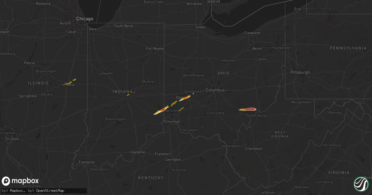
Hail Map on February 27, 2023
Get this storm
February 27 map
$229
one time, instant access
Download today. No call, no setup
Keep the $229
Bought the map and want the full workflow? Apply the entire $229 to a subscription within 7 days. None of it is wasted.
Every map, not just this one
This buys you this map. Subscription and you get every map we run, in the markets you choose from a few cities to whole states to nationwide. Plus real-time alerts the moment a storm fires.
Contact data
Name, contact info, occupancy, even credit band for addresses in the footprint. You go from where it hit to who to call.
Become the source they trust
Unlimited branding weather history reports on demand. You already have the documented answer ready for the property owner, and you are the one who showed up with it.
Property data and RoofTrace estimates
Pull up any address you have got, its value and the exact code rules for that jurisdiction, straight from One Click Code. Then RoofTrace estimates the squares, pitch, and roof value, priced the way you price.
Storm reports
Missouri
| Date | Description |
|---|---|
| 02/27/20232:59 PM CST | 1-inch tree limbs broken; shingles blown off. Time estimated based on radar. |
| 02/27/20232:15 PM CST | Fallen trees in the galmey area. |
North Carolina
| Date | Description |
|---|---|
| 02/27/20235:00 PM CST | Trees down along snowbird rd. |
| 02/27/20234:50 PM CST | Trees down along santeetlah rd. |
Pennsylvania
| Date | Description |
|---|---|
| 02/26/20237:25 PM CST | Oen large tree down blocking the road |
Illinois
| Date | Description |
|---|---|
| 02/27/202310:27 AM CST | A local report indicates 1.50 inch wind near 2 NW ROYAL |
| 02/27/202310:10 AM CST | A local report indicates 1.00 inch wind near GIFFORD |
| 02/27/20239:56 AM CST | Brief tornado touchdown near washington street and warrenville road and the herrick lake forest preserve. |
| 02/27/20239:55 AM CST | Tree uprooted near mill street and diehl road. |
| 02/27/20239:52 AM CST | This tornado occurred in the city limits of naperville with estimated peak winds of 80 mph. Brief tornado touchdown near naperville north high school and tracked north |
| 02/27/20239:50 AM CST | Reports of quarter size hail at wcia... Parkland college... And north of carle hospital. |
| 02/27/20239:42 AM CST | Confirmed tornado near kendall ridge blvd and townsend blvd in joliet. Tree damage... Large objects flipped... Fence blown out and window blown out. |
| 02/27/20239:42 AM CST | Wind damage from possible tornado near kendall ridge blvd and townsend blvd in joliet. Tree damage... Large objects flipped... Fence blown out and window blown out. |
| 02/27/20239:15 AM CST | Two public reports of a tornado touchdown east of paxton relayed by broadcast media. One report includes photos and videos of the tornado... Which may have been on the |
| 02/27/20238:55 AM CST | Corrects previous tornado report from 4 ssw thomasboro. Tornado touched down in the median on i-57 near exit 240. No damage was reported. |
| 02/27/20238:55 AM CST | Tornado reported on the ground. |
| 02/27/20238:45 AM CST | Delayed report...corrects location of previous report from staley and kearns rd. |
| 02/27/20238:45 AM CST | Tornado reported on the ground near staley and kearns rd. |
Indiana
| Date | Description |
|---|---|
| 02/27/20231:58 PM CST | Delayed report. A few trees downed and some roof damage to a residence. Time estimated from radar. Report relayed to nws by wane tv. |
| 02/27/20231:55 PM CST | Tree down in the area of us 24 and redding drive. |
| 02/27/20231:55 PM CST | Tree down at west jefferson and homestead road. |
| 02/27/20231:50 PM CST | Roof damage near churubusco. Report of a metal roof blowing off of a commercial structure on us 33 at the allen/whitley county border. No injuries. Parts of the metal r |
| 02/27/20231:40 PM CST | Delayed report. A few trees downed. Some shingle damage and siding damage to a residence. Time estimated from radar. |
| 02/27/20231:33 PM CST | 1 to 3 inch in diameter limbs blown down. Some of the limbs had rot in them. Time estimated by radar. |
| 02/27/20231:20 PM CST | Photo verified. |
| 02/27/20231:09 PM CST | Photo verified. |
| 02/27/20231:02 PM CST | Report from mping: 1-inch tree limbs broken; shingles blown off. |
| 02/27/202312:53 PM CST | Trees and powerlines blown down. |
| 02/27/202312:53 PM CST | Trees and powerlines down. |
| 02/27/202312:53 PM CST | Trees and powerlines blown down. |
| 02/27/202312:50 PM CST | Trees and powerlines down across northern sections of the county. |
| 02/27/202312:49 PM CST | A local report indicates 59 MPH wind near 3 SSW KEMPTON |
| 02/27/202312:45 PM CST | Report from mping: 3-inch tree limbs broken; power poles broken. |
| 02/27/202312:40 PM CST | Collapsed barn. Reported via social media. Time estimated via radar. |
| 02/27/202312:35 PM CST | Trees and power lines downed. Reported by county ema. Time estimated via radar. |
| 02/27/202312:35 PM CST | Late report of second ef-1 tornado with estimated 100 mph peak winds. 0.30 mile long track. 50 yards maximum width. |
| 02/27/202312:28 PM CST | Late report of ef-1 tornado with estimated 110 mph peak winds. 3.34 mile long track. 50 yards maximum width. |
| 02/27/202312:25 PM CST | Power lines sheared. Twitter post and pictures. Time and duration estimated. |
| 02/27/202312:21 PM CST | Report from mping: 1-inch tree limbs broken; shingles blown off. |
| 02/27/202312:05 PM CST | Report of nickel to quarter size hail falling 7.5 miles west of rochester on state road 14 in western fulton county... In. |
| 02/27/202311:06 AM CST | Potential tornado damage. Outbuildings with roof damage. Time estimated from radar imagery. |
California
| Date | Description |
|---|---|
| 02/27/20232:27 PM CST | Waterspout moved onshore and dissipated. Reported by the public. Video was posted online. |
Ohio
| Date | Description |
|---|---|
| 02/27/20235:28 PM CST | Corrects previous hail report from 7 sse beverly. On pine ridge road in fleming... About a mile southeast of watertown. Pictures provided via social media. Hailstone wi |
| 02/27/20235:28 PM CST | On pine ridge road in fleming... About a mile southeast of watertown. Pictures provided via social media. Hailstone wider than a hand measured at 3 inches. One other st |
| 02/27/20235:27 PM CST | Weather spotter in fleming... Ohio reported quarter-size hail. |
| 02/27/20235:26 PM CST | Washington county 911 center has reports of a tree d |
| 02/27/20235:26 PM CST | Washington county 911 center has reports of a tree down on state route 550 around the 20-mile marker in barlow township... Oh. |
| 02/27/20235:22 PM CST | Described as two by two and a half inches in palmer township. About 3 miles west-southwest of watertown. Picture provided via social media shows stone almost as wide as |
| 02/27/20235:15 PM CST | Time estimated from radar. |
| 02/27/20235:14 PM CST | On the morgan washington athens county lines. Estimated at least one inch diameter from picture provided via social media. Time estimated from radar. |
| 02/27/20234:07 PM CST | Several large pine trees downed near hemstead road near spring street. Time estimated by radar. |
| 02/27/20233:15 PM CST | Roof of garage damaged. Several large branches down. Possible tornado. |
| 02/27/20233:05 PM CST | Utility pole snapped off. |
| 02/27/20233:05 PM CST | Several trees down/snapped off. Possible damage to home. |
| 02/27/20233:05 PM CST | Several |
| 02/27/20233:05 PM CST | Nws survey found damage consistent with a tornado near the town of orient ohio. Maximum estimated wind speeds were 85 mph with a path length of 1.4 miles. |
| 02/27/20233:03 PM CST | Holes in roof of house. Time estimated from radar. |
| 02/27/20233:00 PM CST | Barn down. Time estimated from radar. |
| 02/27/20232:59 PM CST | Spotter report of a couple pine tree limbs around 5 inches in diameter were broken and fell on the road near i-75 between beaverdam and bluffton in allen county in ohio |
| 02/27/20232:52 PM CST | Delayed report. Extensive tree damage at a residence with some roof damage. Time estimated from radar. |
| 02/27/20232:50 PM CST | Time estimated from radar. |
| 02/27/20232:45 PM CST | Trees and power poles down -- time estimated by radar |
| 02/27/20232:40 PM CST | Utility poles down. Time estimated from radar. |
| 02/27/20232:20 PM CST | A local report indicates 1.00 inch wind near YELLOW SPRINGS |
| 02/27/20232:19 PM CST | Nws damage survey has concluded that an ef1 tornado occurred north of new carlisle in clark county... Oh on february 27... 2023. The tornado started at 319 pm... With t |
| 02/27/20232:11 PM CST | Photo verified. Via social media. Time estimated. |
| 02/27/20232:08 PM CST | Emergency manager reported thunderstorm gust wind damage to a closed down restaurant and outbuilding just east of haviland in paulding county in ohio near intersection |
| 02/27/20232:06 PM CST | Dayton xenia road |
| 02/27/20232:06 PM CST | Dayton/xenia road. |
| 02/27/20232:05 PM CST | Convoy fire department reporting structural roof damage to some homes and buildings in convoy. Also some trees snapped in the area. |
| 02/27/20232:00 PM CST | Power pole down on car. Time estimated by radar. |
| 02/27/20231:48 PM CST | Possible tornado from multiple spotters |
| 02/27/20231:37 PM CST | Ef1 tornado confirmed northwest of middletown in butler county ohio. Numerous homes with roof damage... Several barns and outbuildings heavily damaged... And trees snap |
| 02/27/20231:17 PM CST | Via social media. Photo verified. |
| 02/27/20231:17 PM CST | Photo verified. Time estimated from radar. |
| 02/27/20231:16 PM CST | Wires down. Possible tornado. Time estimated from radar. |
| 02/27/20231:16 PM CST | 8 inch diameter ree down. Time estimated from radar. |
Tennessee
| Date | Description |
|---|---|
| 02/27/20234:22 PM CST | Trees down in benton. |
| 02/27/20234:15 PM CST | Trees down in tellico plains and other eastern areas of the county. |
| 02/27/20234:00 PM CST | Trees down in seymour and sevierville areas. |
| 02/27/20234:00 PM CST | Trees down in alcoa and maryville and other areas of county. |
Cities Impacted by Hail Map on February 27, 2023
- Champaign, IL
- Urbana, IL
- Saint Joseph, IL
- Ogden, IL
- Penfield, IL
- Indianapolis, IN
- Mccordsville, IN
- Fortville, IN
- Brookville, IN
- Cedar Grove, IN
- Oxford, OH
- Hamilton, OH
- Joliet, IL
- Somerville, OH
- Trenton, OH
- Middletown, OH
- Camden, OH
- Germantown, OH
- Plainfield, IL
- Naperville, IL
- Lebanon, OH
- Dayton, OH
- Oregonia, OH
- Waynesville, OH
- Xenia, OH
- Fairborn, OH
- Yellow Springs, OH
- Okeana, OH
- Batesville, IN
- Sunman, IN
- Miamisburg, OH
- Millfield, OH
- Amesville, OH
- Chesterhill, OH
- Cutler, OH
- Stockport, OH
- Vincent, OH
- Waterford, OH
- Fleming, OH
- Marietta, OH
- Athens, OH
- Springfield, OH