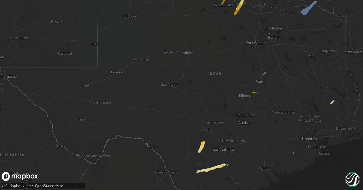
Hail Map in Texas on February 24, 2018
Get this storm
February 24 map
$229
one time, instant access
Download today. No call, no setup
Keep the $229
Bought the map and want the full workflow? Apply the entire $229 to a subscription within 7 days. None of it is wasted.
Every map, not just this one
This buys you this map. Subscription and you get every map we run, in the markets you choose from a few cities to whole states to nationwide. Plus real-time alerts the moment a storm fires.
Contact data
Name, contact info, occupancy, even credit band for addresses in the footprint. You go from where it hit to who to call.
Become the source they trust
Unlimited branding weather history reports on demand. You already have the documented answer ready for the property owner, and you are the one who showed up with it.
Property data and RoofTrace estimates
Pull up any address you have got, its value and the exact code rules for that jurisdiction, straight from One Click Code. Then RoofTrace estimates the squares, pitch, and roof value, priced the way you price.
Storm reports in Texas
Texas
| Date | Description |
|---|---|
| 02/24/20184:20 PM CST | Powerlines down between hallsville and marshall. |
| 02/24/201812:12 PM CST | Peak wind gust measured at the paris/cox field awos of 60 knots or 69 m.p.h. |
| 02/24/201812:00 PM CST | Several reports of wind damage near the community of hopewell just nw of paris---a few trees down... Damage to a carport and a barn destroyed. Event likely occurred bet |
| 02/24/20185:52 AM CST | A local report indicates 1.75 inch wind near JOURDANTON |
| 02/24/20185:50 AM CST | A local report indicates 1.00 inch wind near JOURDANTON |
| 02/24/20185:46 AM CST | Time estimated with radar. |
| 02/24/20185:45 AM CST | Cocorahs volunteer reported golf ball sized hail. |
| 02/24/20185:35 AM CST | At 1135 PM CST, a severe thunderstorm was located near Colmesneil, moving northeast at 35 mph. HAZARD...60 mph wind gusts and quarter size hail. SOURCE...Radar indicated. IMPACT...Hail damage to vehicles is expected. Expect wind damage to roofs, siding, and trees. Locations impacted include... Colmesneil, Rockland, Ebenezer and Sam Rayburn Dam. |
| 02/24/20185:33 AM CST | Quarter sized hail reported by mping user. |
| 02/24/201812:09 AM CST | At 608 AM CST, a severe thunderstorm was located 6 miles south of Terral, moving northeast at 65 mph. HAZARD...Ping pong ball size hail. SOURCE...Radar indicated. IMPACT...People and animals outdoors will be injured. Expect damage to roofs, siding, windows, and vehicles. Locations impacted include... Healdton, Wilson, Ringling, Velma, Terral, Tatums, Loco, Ratliff City, Graham, Pooleville, Grady, Oscar, Cornish, Fox, Courtney and Petersburg. |
| 02/23/201811:57 PM CST | At 556 AM CST, a severe thunderstorm was located 7 miles southeast of Randlett, moving northeast at 60 mph. HAZARD...Ping pong ball size hail. SOURCE...Radar indicated. IMPACT...People and animals outdoors will be injured. Expect damage to roofs, siding, windows, and vehicles. Locations impacted include... Duncan, Marlow, Walters, Comanche, Temple, Hastings, Waurika Lake, Corum, Central High, Empire City, Hulen, Taylor and Charlie. |
| 02/23/201811:51 PM CST | At 551 AM CST, a severe thunderstorm was located 6 miles southwest of Bellevue, moving northeast at 60 mph. HAZARD...Quarter size hail. SOURCE...Radar indicated. IMPACT...Damage to vehicles is expected. Locations impacted include... Bellevue and Vashti. |
| 02/23/201811:45 PM CST | At 545 PM CST, a severe thunderstorm was located over Morgan's Point Resort, or 7 miles northwest of Temple, moving east at 30 mph. HAZARD...60 mph wind gusts and quarter size hail. SOURCE...Radar indicated. IMPACT...Hail damage to vehicles is expected. Expect wind damage to roofs, siding, and trees. Locations impacted include... Temple, Belton, Morgan's Point Resort, Lorena, Troy, Bruceville-Eddy, Moody, Lott and Golinda.This includes Interstate 35 between mile markers 298 and 319. |
| 02/23/201810:43 PM CST | At 442 PM CST, severe thunderstorms were located along a line extending from near Oil City to 6 miles south of Karnack to 6 miles northwest of Elysian Fields, moving east at 40 mph. HAZARD...60 mph wind gusts and quarter size hail. SOURCE...Radar indicated. IMPACT...Hail damage to vehicles is expected. Expect wind damage to roofs, siding, and trees. Locations impacted include... Shreveport, Bossier City, Vivian, Haughton, Greenwood, Blanchard, Waskom, Benton, Cullen, Plain Dealing, Cotton Valley, Oil City, Sarepta, Doyline, Mooringsport, Hosston, Dixie Inn, Belcher, Shongaloo and Gilliam. |
| 02/23/20189:51 PM CST | At 350 PM CST, a severe thunderstorm was located jut west of Hallsville, or 8 miles east of Longview, moving east at 45 mph. HAZARD...60 mph wind gusts. SOURCE...Radar indicated. IMPACT...Expect damage to roofs, siding, and trees. Locations impacted include... Longview, Marshall, Hallsville, Jefferson, Karnack, Woodlawn, Harleton, Gray, Lakeport, Easton, Scottsville, Uncertain, Nesbitt, Darco, Leigh, Jonesville and Judson. |
Cities Impacted by Hail Map on February 24, 2018
- Dilley, TX
- Pleasanton, TX
- Jourdanton, TX
- Charlotte, TX
- Pearsall, TX
- Hondo, TX
- D Hanis, TX
- Medina, TX
- Bandera, TX
- Tarpley, TX
- Chester, TX
- Woodville, TX
- Ringgold, TX
- Ryan, OK
- Nocona, TX
- Bellevue, TX
- Terral, OK
- Cordell, OK
- Ringling, OK
- Plano, TX
- Wharton, TX
- Medicine Park, OK
- Apache, OK
- Elgin, OK
- Lawton, OK
- Wewoka, OK
- Fletcher, OK
- Henrietta, TX
- West, TX
- Penelope, TX
- Mount Calm, TX
- Mountain View, OK
- Gotebo, OK
- Seminole, OK
- Crystal City, TX
- Falls City, TX
- Boling, TX
- Cement, OK
- Chickasha, OK
- Sheppard Afb, TX
- Randlett, OK
- Wichita Falls, TX
- Loco, OK
- Moody, TX
- Troy, TX
- Temple, TX
- Hopkinsville, KY
- Crofton, KY
- Murray, KY
- Mayfield, KY
- Clarksville, TN
- Adairville, KY
- Adams, TN
- Russellville, KY
- Cedar Hill, TN
- Mena, AR
- Wickes, AR
- Grannis, AR
- Magazine, AR
- Paris, AR
- Booneville, AR
- Bald Knob, AR
- Bradford, AR
- Pangburn, AR
- Pleasant Plains, AR
- Oil Trough, AR
- Wilburn, AR
- Judsonia, AR
- Thida, AR
- Newport, AR
- Heber Springs, AR
- Paragould, AR
- Tuckerman, AR
- Bono, AR
- Swifton, AR
- Jonesboro, AR
- Cash, AR
- Walnut Ridge, AR
- Pocahontas, AR
- Knobel, AR
- Delaplaine, AR
- Peach Orchard, AR
- Biggers, AR
- Corning, AR
- Piggott, AR
- Greenway, AR
- Rector, AR
- Lafe, AR
- Fort Towson, OK
- Hugo, OK
- Sumner, TX
- Powderly, TX
- Valliant, OK
- Brookston, TX
- Blossom, TX
- Arthur City, TX
- Detroit, TX
- Paris, TX


