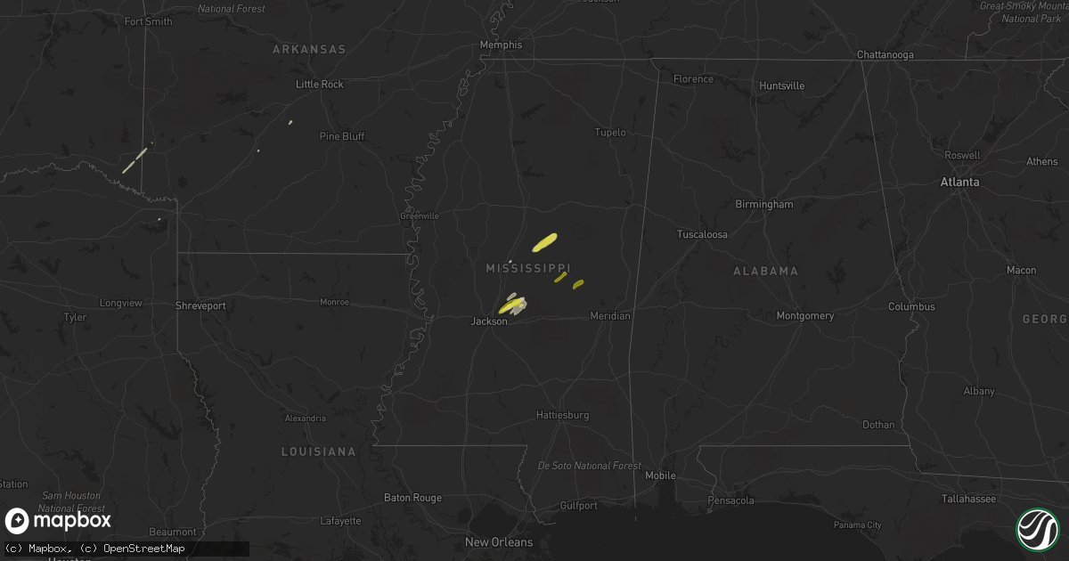
Hail Map in Mississippi on February 23, 2019
Get this storm
February 23 map
$229
one time, instant access
Download today. No call, no setup
Keep the $229
Bought the map and want the full workflow? Apply the entire $229 to a subscription within 7 days. None of it is wasted.
Every map, not just this one
This buys you this map. Subscription and you get every map we run, in the markets you choose from a few cities to whole states to nationwide. Plus real-time alerts the moment a storm fires.
Contact data
Name, contact info, occupancy, even credit band for addresses in the footprint. You go from where it hit to who to call.
Become the source they trust
Unlimited branding weather history reports on demand. You already have the documented answer ready for the property owner, and you are the one who showed up with it.
Property data and RoofTrace estimates
Pull up any address you have got, its value and the exact code rules for that jurisdiction, straight from One Click Code. Then RoofTrace estimates the squares, pitch, and roof value, priced the way you price.
Storm reports in Mississippi
Mississippi
| Date | Description |
|---|---|
| 02/23/20195:40 PM CST | Trees down along hwy 488 and gunter rd. |
| 02/23/20195:20 PM CST | Trees down... Possible tornado. |
| 02/23/20195:17 PM CST | Tornado reported in downtown columbus with debris noted on radar. |
| 02/23/20195:14 PM CST | *** 1 fatal... 19 inj *** corrects previous tornado report from columbus. *** 1 fatal... 19 inj *** the tornado developed on the southwest edge of columbus near 1st str |
| 02/23/20194:55 PM CST | Trained spotter had visual confirmation of a tornado crossing alt hwy 45. Debris noted in the area with damage to a metal shed and trailer. |
| 02/23/20194:53 PM CST | Tree down on watson rd. |
| 02/23/20194:53 PM CST | A brief ef0 tornado touched down ssw of artesia along shlater road west of us 45 where it uprooted and snapped several softwood trees. It quickly moved northeast and cr |
| 02/23/20194:45 PM CST | Corrects time of previous tstm wnd dmg report from 1 nne rosebud. Trees down along hwy 488 and gunter rd. |
| 02/23/20194:40 PM CST | Report of tornado touchdown on hwy 72 on the tishomingo and alcorn county line. |
| 02/23/20194:40 PM CST | Brief tornado along county road 343. Report of downed trees and debris being lofted. |
| 02/23/20194:39 PM CST | Several trees down near the school in becker... Mississippi... On hwy 25. |
| 02/23/20194:30 PM CST | Couple of trees down on hopewell rd. |
| 02/23/20194:13 PM CST | Tree down on maben-bell schoolhouse rd. |
| 02/23/20194:03 PM CST | Two trees down on laurel hill rd. |
| 02/23/20193:55 PM CST | Nickel to quarter size hail fell at the dollar general store at the intersection of hwy 25 and pisgah rd. |
| 02/23/20193:43 PM CST | Motorist reported quarter size hail while driving along hwy 12 near the natchez trace pkwy. |
| 02/23/20193:36 PM CST | Tree down a few miles southeast of port gibson. Location and time estimated by radar. |
| 02/23/20193:23 PM CST | A tree was reported down near the intersection of hwy 429 and hwy 14. |
| 02/23/20193:10 PM CST | Several trees and large limbs down in the satartia area. |
| 02/23/20192:48 PM CST | Trees were down near the hwy 3 and hwy 61 intersection near redwood. |
| 02/23/20192:26 PM CST | Trees down just north of bentonia. |
| 02/22/201910:50 PM CST | At 450 PM CST, a severe thunderstorm was located over Tremont, or 11 miles east of Fulton, moving northeast at 55 mph. HAZARD...60 mph wind gusts. SOURCE...Radar indicated. IMPACT...Expect damage to roofs, siding, and trees. Locations impacted include... Tremont, New Salem, Eastman, Cadamy, Tilden and Bounds Crossroads. |
| 02/22/201910:49 PM CST | At 448 PM CST, a severe thunderstorm was located near Oktoc, or 10 miles southeast of Starkville, moving east at 45 mph. HAZARD...60 mph wind gusts and quarter size hail. SOURCE...Radar indicated. IMPACT...Hail damage to vehicles is expected. Expect wind damage to roofs, siding, and trees. This severe thunderstorm will be near... Bent Oak around 500 PM CST.Other locations impacted by this severe thunderstorm include Artesia. |
| 02/22/201910:08 PM CST | At 407 PM CST, a severe thunderstorm was located near Ackerman, or 16 miles north of Louisville, moving northeast at 30 mph. HAZARD...60 mph wind gusts and quarter size hail. SOURCE...Radar indicated. IMPACT...Hail damage to vehicles is expected. Expect wind damage to roofs, siding, and trees. This severe thunderstorm will be near... Craig Springs around 420 PM CST. Longview around 425 PM CST. Starkville around 435 PM CST. Sessums around 450 PM CST.Other locations impacted by this severe thunderstorm include Sturgis. |
| 02/22/201910:01 PM CST | At 400 PM CST, a severe thunderstorm was located near Carpenter, or 19 miles southeast of Vicksburg, moving northeast at 45 mph. HAZARD...60 mph wind gusts and quarter size hail. SOURCE...Radar indicated. IMPACT...Hail damage to vehicles is expected. Expect wind damage to roofs, siding, and trees. This severe thunderstorm will be near... Utica around 410 PM CST. Raymond around 430 PM CST. Jackson and Bolton around 435 PM CST. Clinton around 440 PM CST.Other locations impacted by this severe thunderstorm include Learned. |
| 02/22/20199:55 PM CST | At 354 PM CST, a severe thunderstorm was located over Cumberland, or 9 miles southwest of Montpelier, moving east at 50 mph. HAZARD...60 mph wind gusts and quarter size hail. SOURCE...Radar indicated. IMPACT...Hail damage to vehicles is expected. Expect wind damage to roofs, siding, and trees. This severe thunderstorm will be near... Pheba around 400 PM CST. Montpelier around 405 PM CST. Griffith around 410 PM CST. Pala Alto around 415 PM CST.Other locations impacted by this severe thunderstorm include Mantee. |
| 02/22/20199:54 PM CST | At 354 PM CST, a severe thunderstorm was located near Keownville, or 10 miles northeast of New Albany, moving northeast at 60 mph. A tornado is possible with this storm. HAZARD...60 mph wind gusts. SOURCE...Radar indicated. IMPACT...Expect damage to roofs, siding, and trees. Locations impacted include... Booneville, New Albany, Baldwyn, Jumpertown, Hinkle, Keownville, New Harmony, Wheeler, Blair, Dumas, Rienzi, Blue Springs, Graham, Jericho, Branyan, Ellistown, Gaston, Jug Fork, Baker and Geeville. |
| 02/22/20199:50 PM CST | At 349 PM CST, a severe thunderstorm was located over Tuscola, or 8 miles north of Harperville, moving northeast at 50 mph. HAZARD...60 mph wind gusts and quarter size hail. SOURCE...Radar indicated. IMPACT...Hail damage to vehicles is expected. Expect wind damage to roofs, siding, and trees. This severe thunderstorm will be near... Madden around 400 PM CST. Edinburg, Dowdville and Dixon around 405 PM CST. Pearl River around 410 PM CST. Philadelphia around 415 PM CST. Burnside around 420 PM CST. Stallo around 425 PM CST. Nanih Waiya around 435 PM CST.Other locations impacted by this severe thunderstorm include Lena,Walnut Grove, Redwater and Standing Pine. |
| 02/22/20199:50 PM CST | At 350 PM CST, a severe thunderstorm was located over Fannin, or 8 miles east of Madison, moving northeast at 50 mph. HAZARD...60 mph wind gusts and quarter size hail. SOURCE...Radar indicated. IMPACT...Hail damage to vehicles is expected. Expect wind damage to roofs, siding, and trees. This severe thunderstorm will be near... Pisgah around 355 PM CST. Ludlow and Farmhaven around 410 PM CST. |
| 02/22/20199:41 PM CST | At 341 PM CST, a severe thunderstorm was located near Kosciusko, moving northeast at 60 mph. HAZARD...Golf ball size hail and 60 mph wind gusts. SOURCE...Radar indicated. IMPACT...People and animals outdoors will be injured. Expect hail damage to roofs, siding, windows, and vehicles. Expect wind damage to roofs, siding, and trees. This severe thunderstorm will be near... Louisville, Ackerman and Mcmillan around 405 PM CST. Betheden around 415 PM CST.Other locations impacted by this severe thunderstorm include Mccool,Ethel, French Camp and Weir. |
| 02/22/20199:30 PM CST | At 330 PM CST, a severe thunderstorm was located near Lorman, or 30 miles northeast of Natchez, moving northeast at 45 mph. HAZARD...60 mph wind gusts and quarter size hail. SOURCE...Radar indicated. IMPACT...Hail damage to vehicles is expected. Expect wind damage to roofs, siding, and trees. This severe thunderstorm will be near... Port Gibson and Pattison around 340 PM CST. Hermanville around 350 PM CST. Rocky Springs around 355 PM CST. Reganton around 405 PM CST. |
| 02/22/20198:59 PM CST | At 259 PM CST, a severe thunderstorm was located near Phoenix, or 11 miles east of Valley Park, moving northeast at 50 mph. HAZARD...60 mph wind gusts and quarter size hail. SOURCE...Radar indicated. IMPACT...Hail damage to vehicles is expected. Expect wind damage to roofs, siding, and trees. This severe thunderstorm will be near... Tinsley around 315 PM CST. Little Yazoo around 320 PM CST. Yazoo City and Benton around 330 PM CST.Other locations impacted by this severe thunderstorm include Eden andSatartia. |
| 02/22/20198:54 PM CST | At 254 PM CST, a severe thunderstorm was located over Aubrey, or 9 miles north of Marvell, moving northeast at 55 mph. HAZARD...60 mph wind gusts. SOURCE...Radar indicated. IMPACT...Expect damage to roofs, siding, and trees. Locations impacted include... Marianna, Hughes, Lexa, Moro, Rondo, Aubrey, Haynes, Brickeys, Lagrange, Jeffersonville, Cody, Kokomo, Oak Forest, Westor, Haleside, Mud Lake, Soudan, Peters, Council and Turkey Scratch. |
| 02/22/20198:53 PM CST | At 252 PM CST, a severe thunderstorm was located over Vaughan, or 15 miles north of Canton, moving northeast at 50 mph. HAZARD...60 mph wind gusts and quarter size hail. SOURCE...Radar indicated. IMPACT...Hail damage to vehicles is expected. Expect wind damage to roofs, siding, and trees. This severe thunderstorm will be near... Cameron around 300 PM CST. Goodman around 305 PM CST. Durant and Newport around 315 PM CST. Mcadams around 320 PM CST. Kosciusko and Possumneck around 325 PM CST. Hesterville around 330 PM CST.Other locations impacted by this severe thunderstorm include Mccool,Ethel, Sallis and West. |
| 02/22/20198:41 PM CST | At 240 PM CST, a severe thunderstorm was located near Vidalia, moving northeast at 50 mph. HAZARD...60 mph wind gusts and quarter size hail. SOURCE...Radar indicated. IMPACT...Hail damage to vehicles is expected. Expect wind damage to roofs, siding, and trees. This severe thunderstorm will be near... Natchez and Vidalia around 250 PM CST. Spokane around 255 PM CST. Stanton around 300 PM CST. Church Hill around 305 PM CST. Lorman around 320 PM CST. Red Lick around 325 PM CST.Other locations impacted by this severe thunderstorm includeRidgecrest. |
| 02/22/20198:14 PM CST | At 213 PM CST, a severe thunderstorm was located near Phoenix, or 17 miles northwest of Clinton, moving northeast at 50 mph. HAZARD...60 mph wind gusts and quarter size hail. SOURCE...Radar indicated. IMPACT...Hail damage to vehicles is expected. Expect wind damage to roofs, siding, and trees. This severe thunderstorm will be near... Little Yazoo around 225 PM CST. Myrleville around 235 PM CST. Benton around 240 PM CST. Way around 245 PM CST. Vaughan around 250 PM CST. Cameron around 300 PM CST.Other locations impacted by this severe thunderstorm includeBentonia. |
All States Impacted by Hail Map on February 23, 2019
Cities Impacted by Hail Map on February 23, 2019
- Ethel, MS
- McCool, MS
- Kosciusko, MS
- Goodman, MS
- Pickens, MS
- Dresden, TN
- Arkadelphia, AR
- Lena, MS
- Brandon, MS
- Maud, TX
- Barnsdall, OK
- Pelahatchie, MS
- Morton, MS
- Canton, MS
- Louisburg, KS
- Paola, KS
- Idabel, OK
- Haworth, OK
- De Queen, AR
- Eagletown, OK
- Gillham, AR
- Poyen, AR
- Traskwood, AR
- Willard, MO
- Bois D Arc, MO
- Billings, MO
- Republic, MO
- Marionville, MO
- Springfield, MO
- Jackson, MS
- Philadelphia, MS
- Carthage, MS
- Union, MS


