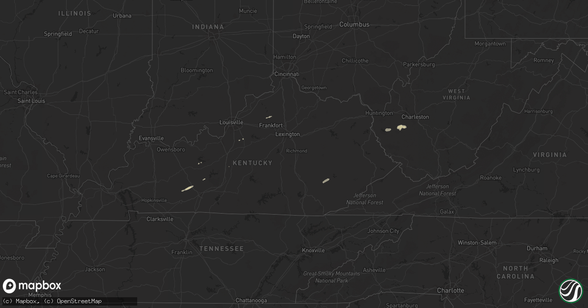
Hail Map in Kentucky on February 23, 2012
Get this storm
February 23 map
$229
one time, instant access
Download today. No call, no setup
Keep the $229
Bought the map and want the full workflow? Apply the entire $229 to a subscription within 7 days. None of it is wasted.
Every map, not just this one
This buys you this map. Subscription and you get every map we run, in the markets you choose from a few cities to whole states to nationwide. Plus real-time alerts the moment a storm fires.
Contact data
Name, contact info, occupancy, even credit band for addresses in the footprint. You go from where it hit to who to call.
Become the source they trust
Unlimited branding weather history reports on demand. You already have the documented answer ready for the property owner, and you are the one who showed up with it.
Property data and RoofTrace estimates
Pull up any address you have got, its value and the exact code rules for that jurisdiction, straight from One Click Code. Then RoofTrace estimates the squares, pitch, and roof value, priced the way you price.
Storm reports in Kentucky
Kentucky
| Date | Description |
|---|---|
| 02/23/20123:28 AM CST | Trees and power lines down blocking ky 522 and 160. |
| 02/23/20122:32 AM CST | Trees down county wide including hwy 80 between mile markers 0 and 1. |
All States Impacted by Hail Map on February 23, 2012
Cities Impacted by Hail Map on February 23, 2012
- Branchland, WV
- Ranger, WV
- Kiahsville, WV
- East Lynn, WV
- Julian, WV
- Alkol, WV
- Yawkey, WV
- Griffithsville, WV
- Oneida, KY
- Cumberland, KY
- Lewisburg, KY
- Morgantown, KY
- Bowling Green, KY
- Sumerco, WV
- Seaman, OH
- Midkiff, WV
- Coxs Creek, KY
- Winchester, OH
- Pleasureville, KY
- Bagdad, KY
- Frankfort, KY
- Shepherdsville, KY
- Caneyville, KY
- Falls Of Rough, KY
- Helton, KY
- Flat Lick, KY
- Beverly, KY
- Bledsoe, KY
- Stoney Fork, KY
- Warbranch, KY
- Manchester, KY
- Walker, KY
- Wellington, KY
- Sonora, KY
- Brownsville, KY
- Leitchfield, KY
- Bulan, KY
- Emmalena, KY
- Ary, KY
- Vest, KY


