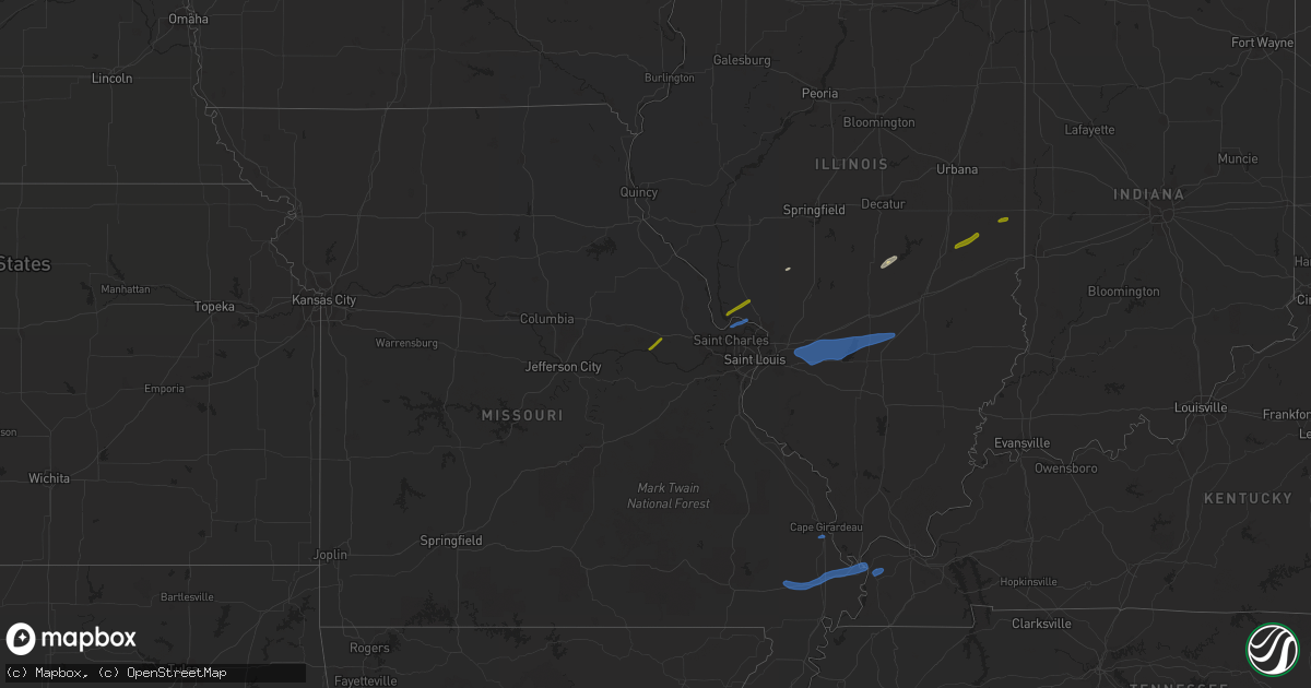
Hail Map on February 22, 2023
Get this storm
February 22 map
$229
one time, instant access
Download today. No call, no setup
Keep the $229
Bought the map and want the full workflow? Apply the entire $229 to a subscription within 7 days. None of it is wasted.
Every map, not just this one
This buys you this map. Subscription and you get every map we run, in the markets you choose from a few cities to whole states to nationwide. Plus real-time alerts the moment a storm fires.
Contact data
Name, contact info, occupancy, even credit band for addresses in the footprint. You go from where it hit to who to call.
Become the source they trust
Unlimited branding weather history reports on demand. You already have the documented answer ready for the property owner, and you are the one who showed up with it.
Property data and RoofTrace estimates
Pull up any address you have got, its value and the exact code rules for that jurisdiction, straight from One Click Code. Then RoofTrace estimates the squares, pitch, and roof value, priced the way you price.
Storm reports
Arkansas
| Date | Description |
|---|---|
| 02/22/20232:02 PM CST | Several utility poles were snapped along highway 149 south of marked tree. |
Illinois
| Date | Description |
|---|---|
| 02/22/20233:55 PM CST | Several trailers on southwest side of newton had roof damage. Several trees broke off or uprooted briefly blocking off access to streets. |
| 02/22/20233:50 PM CST | Roof blown off an old chicken coop house with pea size hail. |
| 02/22/20233:47 PM CST | Powerline tipped over on il 133 east of lovington. Time estimated by radar. |
| 02/22/20233:42 PM CST | Power lines blown down from high winds. |
| 02/22/20233:40 PM CST | Carport blew over across street on old watson road. |
| 02/22/20233:35 PM CST | A local report indicates 60 MPH wind near KELL |
| 02/22/20233:29 PM CST | Power outages from high winds. |
| 02/22/20233:15 PM CST | Corrects previous tstm wnd gst report from 1 wsw litchfield. Measured by k3lf awos. |
| 02/22/20233:01 PM CST | Corrects previous non-tstm wnd gst report from 3 ssw de soto. Asos station kmdh carbondale il. |
| 02/22/20233:00 PM CST | Damage to doors and skylights on pole barn. Tree damage. |
| 02/22/20233:00 PM CST | Corrects previous tstm wnd dmg report from 1 ese carlyle. 12 inch diameter trees blown down. |
| 02/22/20233:00 PM CST | Power pole leaning at old hwy 13 and country club road in carbondale illinois. |
| 02/22/20232:58 PM CST | Several large branches blown down... As well as some shingles blown off of roof of house. |
| 02/22/20232:57 PM CST | A local report indicates 61 MPH wind near 1 ENE GREENVILLE |
| 02/22/20232:55 PM CST | Tin roof on outbuilding peeled up... Tree limbs down and several trees down. |
| 02/22/20232:55 PM CST | Trees down and limbs snapped in jacob. |
| 02/22/20232:50 PM CST | 12 inch trees blown down. |
| 02/22/20232:50 PM CST | Small limbs down... Some siding torn off house. |
| 02/22/20232:45 PM CST | Large tree blown down. |
| 02/22/20232:45 PM CST | Tree limbs down. |
| 02/22/20232:44 PM CST | Power lines down. |
| 02/22/20232:42 PM CST | Downed power poles. |
| 02/22/20232:41 PM CST | Shingles blown off a home. Some large limbs down. |
| 02/22/20232:40 PM CST | Damage to machine shed. |
| 02/22/20232:38 PM CST | Tree uprooted and siding damage on home. |
| 02/22/20232:36 PM CST | Large limbs down and a power line down. |
| 02/22/20232:33 PM CST | Multiple road signs blown over. |
| 02/22/20232:30 PM CST | Trees and limbs down in white city. |
| 02/22/20232:30 PM CST | Pictures received of trees and limbs downed by winds in st jacob. Time estimated. |
| 02/22/20232:28 PM CST | Large tree blown down. |
| 02/22/20232:05 PM CST | Corrects previous tstm wnd dmg report from 2 wsw centreville. Part of roof peeled off of a warehouse near gateway grizzlies stadium. From facebook post with picture of |
| 02/22/20232:05 PM CST | Corrects previous tstm wnd dmg report from 3 ese new design. Large tree blown down. |
| 02/22/20231:58 PM CST | Damage to metal warehouse roof. |
| 02/22/20231:58 PM CST | Part of roof peeled off of a warehouse near gateway grizzlies stadium. From facebook post with picture of damage. |
| 02/22/202312:00 PM CST | A local report indicates 1.05 inch wind near 2 E LINCOLN |
| 02/22/202311:00 AM CST | Time estimated by radar. |
| 02/22/20237:50 AM CST | Hail the size of thumb nails... With some up to size of quarter. |
Kentucky
| Date | Description |
|---|---|
| 02/22/20233:55 PM CST | Utility pole down along epperson road in reidland. |
| 02/22/20233:55 PM CST | Tree down in yard in symsonia area. |
| 02/22/20233:55 PM CST | Power outages along old dukedom road. |
| 02/22/20233:52 PM CST | Estimated 60 mph wind gusts reported from retired nws employee. |
| 02/22/20233:38 PM CST | Tree blocking road on mckendree church road at intersection with childress road. |
| 02/22/20233:35 PM CST | Over 800 customers without power throughout hickman county. |
| 02/22/20233:35 PM CST | Tree down blocking massey road at bethel church road in far western mccracken county. |
| 02/22/20233:25 PM CST | Tree fell on house along bethlehem church road southeast of wickliffe. |
Missouri
| Date | Description |
|---|---|
| 02/22/20233:10 PM CST | Over 1200 customers without power throughout mississippi county. |
| 02/22/20232:55 PM CST | 2481 customers without power in cape girardeau county. |
| 02/22/20232:52 PM CST | Peak wind gust measured at kcgi asos. |
| 02/22/20232:50 PM CST | Several large trees down in cape girardeau area including on cobblefield court... Lexington... And silver spring. |
| 02/22/20232:50 PM CST | Over 1000 customers without power throughout new madrid county. |
| 02/22/20232:40 PM CST | Estimated wind gust from spotter as storm went through 1.5 miles north of delta. A few limbs down. |
| 02/22/20232:35 PM CST | Power lines down due to storm. |
| 02/22/20231:35 PM CST | A local report indicates 60 MPH wind near 3 NNE ORCHARD FARMS |
| 02/22/20231:19 PM CST | Power outages reported in the ellsinore area. |
| 02/22/20231:04 PM CST | Yard furniture tossed. |
| 02/22/20237:20 AM CST | Report from mping: quarter |
Cities Impacted by Hail Map on February 22, 2023
- Jerseyville, IL
- Grafton, IL
- Dow, IL
- Warrenton, MO
- Marthasville, MO
- Fort Mcdowell, AZ
- Paradise Valley, AZ
- Phoenix, AZ
- Tempe, AZ
- Scottsdale, AZ
- Charleston, IL
- Mesa, AZ
- Fountain Hills, AZ
- Ashmore, IL
- Oakland, IL
- Westfield, IL
- Martinsville, IL
- Kansas, IL
- Carlinville, IL
- Tower Hill, IL
- Shelbyville, IL
- Girard, IL
- Palmyra, IL
- Lakewood, IL
- Findlay, IL
- Sullivan, IL
- Saint Charles, MO
- Portage Des Sioux, MO
- Elsah, IL
- Saint Jacob, IL
- Troy, IL
- Lebanon, IL
- Trenton, IL
- Highland, IL
- Aviston, IL
- Essex, MO
- Dexter, MO
- Bloomfield, MO
- Sikeston, MO
- Breese, IL
- Carlyle, IL
- Pocahontas, IL
- Greenville, IL
- Keyesport, IL
- Patoka, IL
- Vandalia, IL
- Vernon, IL
- Bertrand, MO
- Charleston, MO
- Scott City, MO
- Chaffee, MO
- Barlow, KY
- Cairo, IL
- Alma, IL
- Saint Peter, IL
- Shobonier, IL
- Kinmundy, IL
- Wickliffe, KY
- Bardwell, KY
- Paris, IL
- Chrisman, IL
- Golden Eagle, IL
- O'Fallon, MO
- Humboldt, IL
- Waggoner, IL