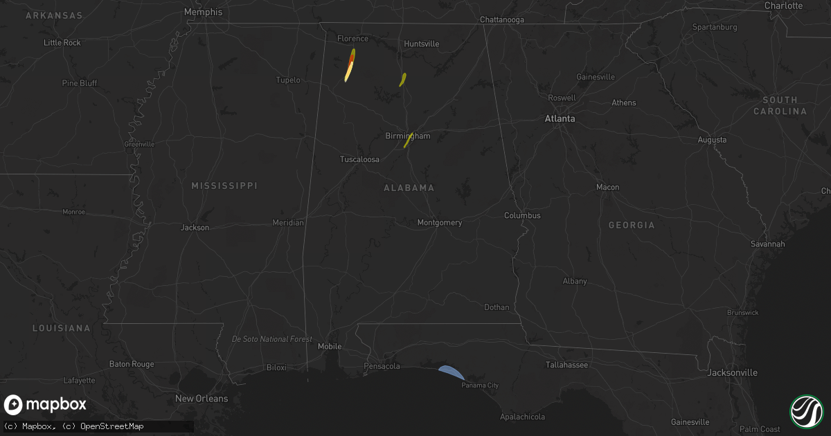
Hail Map in Alabama on February 12, 2024
Get this storm
February 12 map
$229
one time, instant access
Download today. No call, no setup
Keep the $229
Bought the map and want the full workflow? Apply the entire $229 to a subscription within 7 days. None of it is wasted.
Every map, not just this one
This buys you this map. Subscription and you get every map we run, in the markets you choose from a few cities to whole states to nationwide. Plus real-time alerts the moment a storm fires.
Contact data
Name, contact info, occupancy, even credit band for addresses in the footprint. You go from where it hit to who to call.
Become the source they trust
Unlimited branding weather history reports on demand. You already have the documented answer ready for the property owner, and you are the one who showed up with it.
Property data and RoofTrace estimates
Pull up any address you have got, its value and the exact code rules for that jurisdiction, straight from One Click Code. Then RoofTrace estimates the squares, pitch, and roof value, priced the way you price.
Storm reports in Alabama
Alabama
| Date | Description |
|---|---|
| 02/12/20244:35 PM CST | Tin roof blown off of an abandoned barn structure in the moores crossroads community at the intersection of al highway 75 and cr 72. Time estimated by radar. |
| 02/12/20244:35 PM CST | Minor damage to a tin roof of an abandoned structure in the lakeview community. Time estimated from radar. |
| 02/12/20244:01 PM CST | Reports of trees down on cogswell ave... Avondale dr... And dickey dr. |
| 02/12/20243:58 PM CST | Four reports of downed trees on mount moriah rd... Trent ln... And eden acres. |
| 02/12/20243:19 PM CST | Trees blocking roadways along overton rd... Cherokee rd... And old leeds rd. |
| 02/12/202412:50 PM CST | Nickel to quarter size hail in hoover. |
| 02/12/202412:46 PM CST | Quarter size hail in vinemont time estimated from radar. |
| 02/12/202412:24 PM CST | Quarter to ping pong ball size hail near russellville. Time estimated from radar. |
| 02/12/202412:15 PM CST | Quarter to golfball size hail in the spruce pine community. Time estimated from radar. |
| 02/12/202412:10 PM CST | Quarter to ping pong ball size hail in the phil campbell community. Time estimated from radar. |


