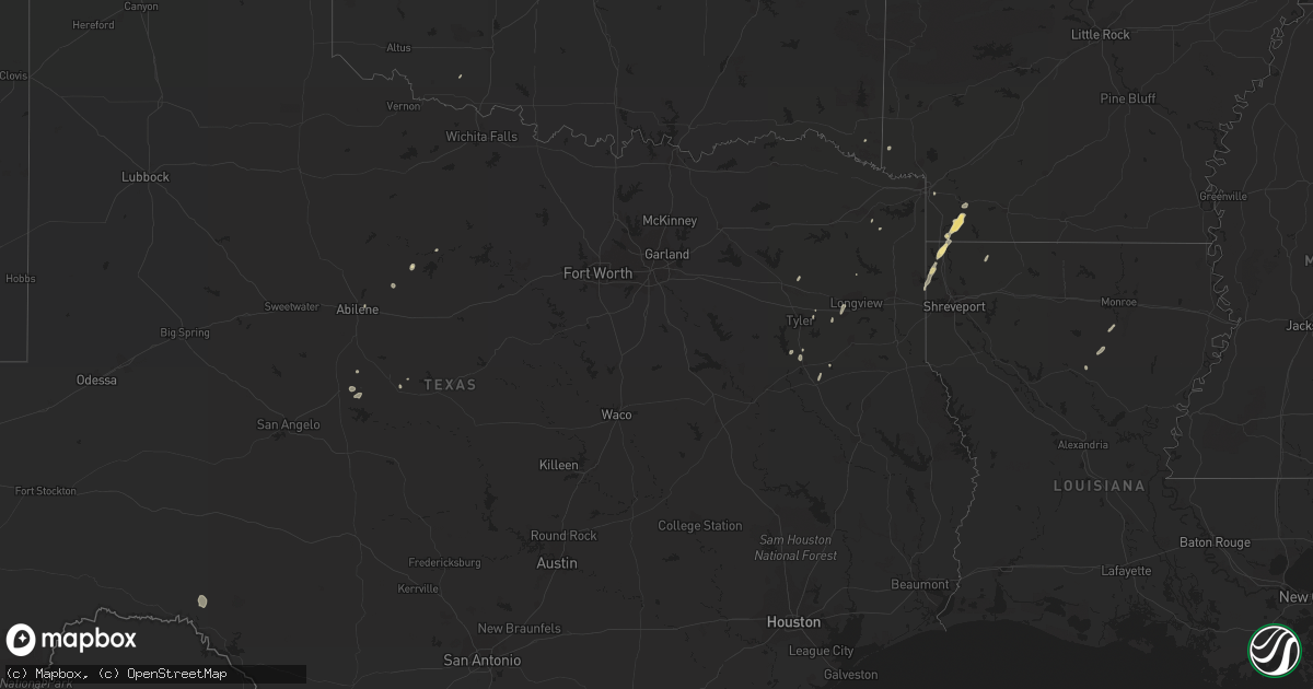
Hail Map in Texas on January 31, 2011
Get this storm
January 31 map
$229
one time, instant access
Download today. No call, no setup
Keep the $229
Bought the map and want the full workflow? Apply the entire $229 to a subscription within 7 days. None of it is wasted.
Every map, not just this one
This buys you this map. Subscription and you get every map we run, in the markets you choose from a few cities to whole states to nationwide. Plus real-time alerts the moment a storm fires.
Contact data
Name, contact info, occupancy, even credit band for addresses in the footprint. You go from where it hit to who to call.
Become the source they trust
Unlimited branding weather history reports on demand. You already have the documented answer ready for the property owner, and you are the one who showed up with it.
Property data and RoofTrace estimates
Pull up any address you have got, its value and the exact code rules for that jurisdiction, straight from One Click Code. Then RoofTrace estimates the squares, pitch, and roof value, priced the way you price.
Storm reports in Texas
Texas
| Date | Description |
|---|---|
| 01/31/20115:59 AM CST | Large tree down blocking road in huntsville. |
| 01/31/20115:30 AM CST | Tin roof damaged on home on loma road. |
| 01/31/20115:05 AM CST | Numerous trees downed - estimated 60-70 mph winds. |
| 01/31/20115:00 AM CST | Numerous trees down within grimes county. |
| 01/31/20114:40 AM CST | Media reported a roof was blown off a mobile home. |
| 01/31/20113:15 AM CST | Reported on the frontal passage with thunderstorms in the area. Other gusts to 50 recorded. |
| 01/31/20112:10 AM CST | Associated with frontal passage. Tstms in area. |
Cities Impacted by Hail Map on January 31, 2011
- Olla, LA
- Lewisville, AR
- Bradley, AR
- Garland City, AR
- Fouke, AR
- Foreman, AR
- Mineola, TX
- Diana, TX
- Albany, TX
- Ida, LA
- Hosston, LA
- Comstock, TX
- Monroe, LA
- West Monroe, LA
- Columbia, LA
- Kilgore, TX
- Overton, TX
- Oil City, LA
- Talpa, TX
- Ballinger, TX
- Haworth, OK
- Bullard, TX
- Jacksonville, TX
- Vivian, LA
- Plain Dealing, LA
- Loveland, OK
- Doddridge, AR
- Tyler, TX
- Texarkana, AR
- Breckenridge, TX
- Abilene, TX
- Longview, TX
- Grayson, LA
- Santa Anna, TX
- Rusk, TX
- Cotton Valley, LA
- Sarepta, LA
- Mooringsport, LA
- Naples, TX
- Ore City, TX
- Marietta, TX
- Karnack, TX


