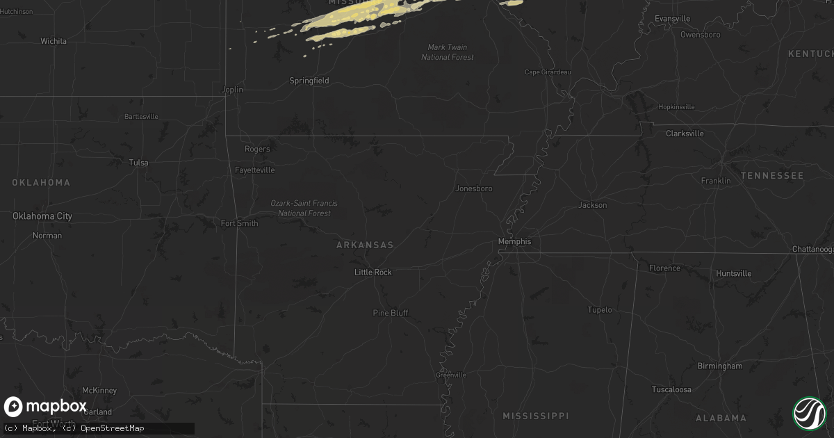
Hail Map in Indiana on January 16, 2012
Get this storm
January 16 map
$229
one time, instant access
Download today. No call, no setup
Keep the $229
Bought the map and want the full workflow? Apply the entire $229 to a subscription within 7 days. None of it is wasted.
Every map, not just this one
This buys you this map. Subscription and you get every map we run, in the markets you choose from a few cities to whole states to nationwide. Plus real-time alerts the moment a storm fires.
Contact data
Name, contact info, occupancy, even credit band for addresses in the footprint. You go from where it hit to who to call.
Become the source they trust
Unlimited branding weather history reports on demand. You already have the documented answer ready for the property owner, and you are the one who showed up with it.
Property data and RoofTrace estimates
Pull up any address you have got, its value and the exact code rules for that jurisdiction, straight from One Click Code. Then RoofTrace estimates the squares, pitch, and roof value, priced the way you price.
Storm reports in Indiana
Indiana
| Date | Description |
|---|---|
| 01/16/20125:39 AM CST | Utility lines down on county road 825 e and hendricks county road |
| 01/16/20125:35 AM CST | Three trees were blown down along state route 45...two at russel road...the other was further out of town to the southwest but at the second interesection of sr 45 and |
| 01/16/20125:30 AM CST | Trees downed on boy scout road. |
| 01/16/20125:20 AM CST | Several trees blow down |
| 01/16/20125:20 AM CST | Trees downed on boy scout road. |
| 01/16/20125:20 AM CST | Siding removed from the south side of a home in a neighborhood off of smith valley road. |
| 01/16/20125:16 AM CST | Tree or tree limbs were blown down on sherfield road. Time is estimated. |
Cities Impacted by Hail Map on January 16, 2012
- Brinktown, MO
- Dixon, MO
- Olney, IL
- Sumner, IL
- Claremont, IL
- Preston, MO
- Bruceville, IN
- Noble, IL
- Lawrenceville, IL
- Clay City, IL
- Bridgeport, IL
- Vincennes, IN
- Calhoun, IL
- Oaktown, IN
- Linn Creek, MO
- Tunas, MO
- Bland, MO
- Kaiser, MO
- Macks Creek, MO
- Urbana, MO
- Camdenton, MO
- Vichy, MO
- Belle, MO
- Roach, MO
- Richland, MO
- Vienna, MO
- Eldridge, MO
- Brumley, MO
- Stoutland, MO
- Montreal, MO
- Rolla, MO
- Hermitage, MO
- Iberia, MO
- Argyle, MO
- Ulman, MO
- Osage Beach, MO
- Owensville, MO
- Meta, MO
- Saint Elizabeth, MO
- Newburg, MO
- Pocahontas, IL
- Trenton, IL
- Germantown, IL
- Summerfield, IL
- Sandoval, IL
- Bartelso, IL
- Carlyle, IL
- New Baden, IL
- Highland, IL
- Breese, IL
- Beckemeyer, IL
- Lebanon, IL
- Saint Jacob, IL
- Aviston, IL
- Saint James, MO
- Wright City, MO
- Warrenton, MO
- Jonesburg, MO
- Truesdale, MO
- Augusta, MO
- Villa Ridge, MO
- Greenville, IL
- Maryland Heights, MO
- Maryville, IL
- Saint Louis, MO
- Ballwin, MO
- Saint Ann, MO
- Granite City, IL
- Marine, IL
- Chesterfield, MO
- Bridgeton, MO
- Troy, IL
- Glen Carbon, IL
- Edwardsville, IL
- Collinsville, IL
- Pacific, MO
- Winfield, MO
- Old Monroe, MO
- Saint Clair, MO
- Bourbon, MO
- Grubville, MO
- Hillsboro, MO
- Lonedell, MO
- Dittmer, MO
- Luebbering, MO
- Robertsville, MO
- Sullivan, MO
- Cedar Hill, MO
- Wildwood, MO
- O'Fallon, IL
- Lebanon, MO
- Eugene, MO
- Fults, IL
- Evansville, IL
- Red Bud, IL
- Prairie Du Rocher, IL
- El Dorado Springs, MO
- Dundas, IL
- Crocker, MO
- Waynesville, MO
- Labadie, MO
- Saint Albans, MO
- Okawville, IL
- Addieville, IL
- Mascoutah, IL
- Smithton, IL
- Freeburg, IL
- Belleville, IL
- Rosebud, MO
- Tuscumbia, MO
- Pittsburg, MO
- Sunrise Beach, MO
- Eureka, MO
- New Athens, IL
- Millstadt, IL
- Waterloo, IL
- Columbia, IL
- Flat Rock, IL
- Edwardsport, IN
- Freelandville, IN
- Defiance, MO
- Cuba, MO
- Flemington, MO
- Humansville, MO
- East Carondelet, IL
- East Saint Louis, IL
- Dupo, IL
- Madison, IL
- Scott Air Force Base, IL
- Fenton, MO
- Catawissa, MO
- Hartford, IL
- Saint Peters, MO
- Albers, IL
- Patoka, IL
- Venice, IL
- East Alton, IL
- Saint Charles, MO
- High Ridge, MO
- House Springs, MO
- Hazelwood, MO
- Union, MO
- Fairview Heights, IL
- Florissant, MO
- Odin, IL
- Valley Park, MO
- Alhambra, IL
- Stockton, MO
- Willow Hill, IL
- Oblong, IL
- Hermann, MO
- Troy, MO
- Marthasville, MO
- Foristell, MO
- Wentzville, MO
- Hawk Point, MO
- Moscow Mills, MO
- Liberal, MO
- Half Way, MO
- Louisburg, MO
- Buffalo, MO
- Windyville, MO
- Leslie, MO
- Richwoods, MO
- Xenia, IL
- Kinmundy, IL
- Bolivar, MO
- Saint Robert, MO
- Brownstown, IL
- Wheatland, MO
- Montalba, TX
- Tennessee Colony, TX
- Truxton, MO
- Bellflower, MO
- Valmeyer, IL
- Marissa, IL
- Lenzburg, IL
- Eldon, MO
- Vandalia, IL
- Dieterich, IL
- Wheeler, IL
- Barnhart, MO
- Washington, MO
- Bicknell, IN
- Weaubleau, MO
- Newton, IL
- Watson, IL
- Edgewood, IL
- Mason, IL
- Gerald, MO
- New Haven, MO
- Long Lane, MO
- Polk, MO
- Brighton, MO
- Keyesport, IL
- Beaufort, MO
- Vernon, IL
- Mulberry Grove, IL
- Arnold, MO
- Climax Springs, MO
- Smithboro, IL
- Centralia, IL
- Shobonier, IL
- Caseyville, IL
- Earth City, MO
- Cross Timbers, MO
- Imperial, MO
- Brussels, IL
- Batchtown, IL
- Sheldon, MO
- Richards, MO
- Ingraham, IL
- Flora, IL


