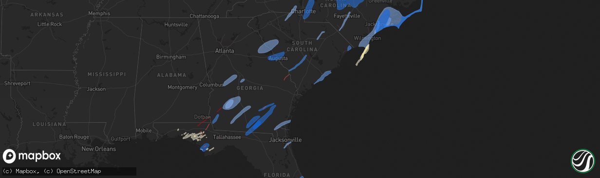
Hail Map in Alabama on January 9, 2024
The weather event in Alabama on January 9, 2024 includes Wind, Tornado, and Hail maps. 9 states and 541 cities were impacted and suffered possible damage. The total estimated number of properties impacted is 0.
Want more than just the map?
Turn this storm into a full workflow.
- Owner + property data so you know who to knock
- OnDemand branded weather history reports to win the "did we even have hail?" argument
- RoofTrace estimate so reps stop guessing numbers at the door
Bought this map? Upgrade within 7 days and we'll credit the $230. (10-15 min setup call)
Wind
Tornado
Hail
0
Estimated number of impacted properties by a 1.00" hail or larger0
Estimated number of impacted properties by a 1.75" hail or larger0
Estimated number of impacted properties by a 2.50" hail or largerStorm reports in Alabama
Alabama
| Date | Description |
|---|---|
| 01/09/20248:15 AM CST | Minor roof damage was reported in ashford. |
| 01/09/20248:12 AM CST | Tds on keox radar east of cottonwood. |
| 01/09/20248:10 AM CST | *** 1 fatal *** extensive damage in cottonwood... Al. Numerous brick and frame structures affected. One fatality confirmed. Additional search/rescue and damage assessme |
| 01/09/20247:45 AM CST | Roof damage to a home in slocomb. |
| 01/09/20247:25 AM CST | Several trees down in dale county. |
| 01/09/20247:23 AM CST | Dozens of downed trees and power lines in geneva county. |
| 01/09/20246:40 AM CST | Several trees down across coffee county. |
| 01/09/20246:05 AM CST | Several trees and powerlines snapped along dunns bridge rd. |
| 01/09/20246:05 AM CST | Major structural damage to a home with several trees and power lines down nearby. |
All States Impacted by Hail Map on January 9, 2024
Cities Impacted by Hail Map on January 9, 2024
- Tibbie, AL
- Deer Park, AL
- Chatom, AL
- Wagarville, AL
- Millry, AL
- Frankville, AL
- Saint Stephens, AL
- Jackson, AL
- Leroy, AL
- Grove Hill, AL
- Coffeeville, AL
- Thomasville, AL
- Gainestown, AL
- Whatley, AL
- Franklin, AL
- Citronelle, AL
- McIntosh, AL
- Sunflower, AL
- Vredenburgh, AL
- Beatrice, AL
- Dickinson, AL
- Lower Peach Tree, AL
- Coy, AL
- Camden, AL
- Frisco City, AL
- Peterman, AL
- Monroeville, AL
- Navarre, FL
- Gulf Breeze, FL
- Pensacola, FL
- Milton, FL
- Eglin Afb, FL
- Bagdad, FL
- Holt, FL
- Lucedale, MS
- Mobile, AL
- Semmes, AL
- Theodore, AL
- Coden, AL
- Santa Rosa Beach, FL
- Loxley, AL
- Freeport, FL
- Stapleton, AL
- Fairhope, AL
- Silverhill, AL
- Defuniak Springs, FL
- Ponce De Leon, FL
- Westville, FL
- Irvington, AL
- Dauphin Island, AL
- Bayou La Batre, AL
- Daphne, AL
- Summerdale, AL
- Gulf Shores, AL
- Foley, AL
- Bon Secour, AL
- Magnolia Springs, AL
- Panama City, FL
- Panama City Beach, FL
- Lynn Haven, FL
- Youngstown, FL
- Fountain, FL
- Biloxi, MS
- Cleveland, TX
- Coldspring, TX
- Dothan, AL
- Alford, FL
- Marianna, FL
- Greenwood, FL
- Bascom, FL
- Donalsonville, GA
- Iron City, GA
- Colquitt, GA
- Damascus, GA
- Wewahitchka, FL
- Morgan, GA
- Arlington, GA
- Graceville, FL
- Slocomb, AL
- Cottonwood, AL
- Ashford, AL
- Pansey, AL
- Blakely, GA
- Bristol, FL
- Port Saint Joe, FL
- Rupert, GA
- Junction City, GA
- Buena Vista, GA
- Mauk, GA
- Butler, GA
- Reynolds, GA
- Roberta, GA
- Knoxville, GA
- Musella, GA
- Fort Valley, GA
- Lizella, GA
- Tallahassee, FL
- Warner Robins, GA
- Bonaire, GA
- Dry Branch, GA
- Macon, GA
- Cowarts, AL
- Webb, AL
- Albany, GA
- Bronwood, GA
- Leesburg, GA
- Dawson, GA
- Smithville, GA
- Leslie, GA
- De Soto, GA
- Warwick, GA
- Cobb, GA
- Oakfield, GA
- Vienna, GA
- Cordele, GA
- Arabi, GA
- Sylvester, GA
- Ashburn, GA
- Ochlocknee, GA
- Meigs, GA
- Coolidge, GA
- Moultrie, GA
- Hartsfield, GA
- Funston, GA
- Doerun, GA
- Norman Park, GA
- Chula, GA
- Ty Ty, GA
- Sumner, GA
- Omega, GA
- Tifton, GA
- Ocilla, GA
- Fitzgerald, GA
- Wray, GA
- Broxton, GA
- Ambrose, GA
- Douglas, GA
- Nicholls, GA
- Pacolet, SC
- Jonesville, SC
- Gaffney, SC
- Smyrna, SC
- Blacksburg, SC
- Hickory Grove, SC
- Lincolnton, GA
- Tignall, GA
- Washington, GA
- Rayle, GA
- Mount Carmel, SC
- Elberton, GA
- Troy, SC
- McCormick, SC
- Plum Branch, SC
- Bradley, SC
- Calhoun Falls, SC
- Abbeville, SC
- Modoc, SC
- Greenwood, SC
- Ninety Six, SC
- Saluda, SC
- Kings Mountain, NC
- Grover, NC
- Gastonia, NC
- Clover, SC
- Dallas, NC
- Bessemer City, NC
- Lincolnton, NC
- Iron Station, NC
- Chipley, FL
- Crestview, FL
- Niceville, FL
- Eastpoint, FL
- Vernon, FL
- Altha, FL
- Clarksville, FL
- Ebro, FL
- West Green, GA
- Alma, GA
- Baxley, GA
- Surrency, GA
- Appling, GA
- Harlem, GA
- Grovetown, GA
- Evans, GA
- Augusta, GA
- Dearing, GA
- Thomson, GA
- North Augusta, SC
- Hephzibah, GA
- Beech Island, SC
- Clarks Hill, SC
- Graniteville, SC
- Warrenville, SC
- Trenton, SC
- Aiken, SC
- Gloverville, SC
- Ridge Spring, SC
- Madison, FL
- Pinetta, FL
- Quitman, GA
- Valdosta, GA
- Lee, FL
- Jennings, FL
- Lake Park, GA
- Du Pont, GA
- Naylor, GA
- Statenville, GA
- Stockton, GA
- Hahira, GA
- Lakeland, GA
- Moody Afb, GA
- Ray City, GA
- Nashville, GA
- Willacoochee, GA
- Pearson, GA
- Homerville, GA
- Fargo, GA
- Millwood, GA
- Argyle, GA
- Blackshear, GA
- Waycross, GA
- Manor, GA
- Statesboro, GA
- Rocky Ford, GA
- Bristol, GA
- Mershon, GA
- Odum, GA
- Catawba, NC
- Statesville, NC
- Indian Trail, NC
- Charlotte, NC
- Matthews, NC
- Waxhaw, NC
- Fort Mill, SC
- Monroe, NC
- Lancaster, SC
- Mount Pleasant, NC
- Midland, NC
- Concord, NC
- Stanfield, NC
- Harrisburg, NC
- Locust, NC
- Kannapolis, NC
- Rockwell, NC
- Salisbury, NC
- Landis, NC
- China Grove, NC
- Gold Hill, NC
- Spencer, NC
- Hilliard, FL
- Saint George, GA
- Folkston, GA
- Kingsland, GA
- White Oak, GA
- Woodbine, GA
- Waverly, GA
- Jekyll Island, GA
- Brunswick, GA
- Martin, SC
- Allendale, SC
- Ulmer, SC
- Olar, SC
- Bamberg, SC
- Cope, SC
- Branchville, SC
- Cordova, SC
- Rowesville, SC
- Orangeburg, SC
- Cameron, SC
- Fairmont, NC
- Lumberton, NC
- Saint Pauls, NC
- Green Cove Springs, FL
- Saint Augustine, FL
- Saint Johns, FL
- Jacksonville, FL
- Parkton, NC
- Hope Mills, NC
- Fayetteville, NC
- Wade, NC
- Godwin, NC
- Saint Petersburg, FL
- Lamar, SC
- Bishopville, SC
- Hartsville, SC
- Ponte Vedra Beach, FL
- Jacksonville Beach, FL
- Linden, NC
- Sarasota, FL
- Bradenton, FL
- Edisto Island, SC
- Johns Island, SC
- Wadmalaw Island, SC
- Charleston, SC
- Folly Beach, SC
- Mount Pleasant, SC
- North Charleston, SC
- Sullivans Island, SC
- Awendaw, SC
- Isle Of Palms, SC
- Hampstead, NC
- Holly Ridge, NC
- Sneads Ferry, NC
- Jacksonville, NC
- Orlando, FL
- Rowland, NC
- Shannon, NC
- Oviedo, FL
- Myakka City, FL
- Pittsboro, NC
- Siler City, NC
- Bear Creek, NC
- Sanford, NC
- Moncure, NC
- Goldston, NC
- Carthage, NC
- Cameron, NC
- Graham, NC
- Chapel Hill, NC
- Carrboro, NC
- New Hill, NC
- Broadway, NC
- Lillington, NC
- Apex, NC
- Holly Springs, NC
- Fuquay Varina, NC
- Willow Spring, NC
- Durham, NC
- Cary, NC
- Morrisville, NC
- Raleigh, NC
- Garner, NC
- Geneva, FL
- Creedmoor, NC
- Wake Forest, NC
- Clayton, NC
- Knightdale, NC
- Youngsville, NC
- Franklinton, NC
- Wendell, NC
- Zebulon, NC
- Rolesville, NC
- Southport, NC
- Englewood, FL
- Port Charlotte, FL
- Punta Gorda, FL
- Swansboro, NC
- Hubert, NC
- Newport, NC
- Emerald Isle, NC
- Stella, NC
- New Bern, NC
- Havelock, NC
- Angier, NC
- Smithfield, NC
- Louisburg, NC
- Christmas, FL
- Titusville, FL
- Mims, FL
- Oak Hill, FL
- Osteen, FL
- Edgewater, FL
- Coats, NC
- Benson, NC
- Dunn, NC
- Four Oaks, NC
- Blackstone, VA
- Amelia Court House, VA
- Jetersville, VA
- Crewe, VA
- Dundas, VA
- South Hill, VA
- Kenbridge, VA
- La Crosse, VA
- Brodnax, VA
- Alberta, VA
- Powhatan, VA
- Rawlings, VA
- Lawrenceville, VA
- Dolphin, VA
- Warfield, VA
- McKenney, VA
- Wilsons, VA
- Ford, VA
- Moseley, VA
- Manakin Sabot, VA
- Dewitt, VA
- Midlothian, VA
- Chesterfield, VA
- Dinwiddie, VA
- Church Road, VA
- Richmond, VA
- Henrico, VA
- Sutherland, VA
- Chester, VA
- Petersburg, VA
- Colonial Heights, VA
- Sandston, VA
- Mechanicsville, VA
- Glen Allen, VA
- Selma, NC
- Quinton, VA
- Kenly, NC
- Middlesex, NC
- King William, VA
- Manquin, VA
- New Kent, VA
- Sims, NC
- Bailey, NC
- Spring Hope, NC
- Lucama, NC
- Wilson, NC
- Longs, SC
- Conway, SC
- Myrtle Beach, SC
- North Myrtle Beach, SC
- Little River, SC
- Supply, NC
- Bolivia, NC
- Leland, NC
- Winnabow, NC
- Rocky Point, NC
- Currie, NC
- Wilmington, NC
- Burgaw, NC
- Castle Hayne, NC
- Oak Island, NC
- Carolina Beach, NC
- Kure Beach, NC
- Wrightsville Beach, NC
- Sellers, SC
- Fair Bluff, NC
- Lake Waccamaw, NC
- Lake View, SC
- Riegelwood, NC
- Hallsboro, NC
- Cerro Gordo, NC
- Whiteville, NC
- Nichols, SC
- Florence, SC
- Darlington, SC
- Bolton, NC
- Dillon, SC
- Chadbourn, NC
- Latta, SC
- Society Hill, SC
- Maysville, NC
- Tarawa Terrace, NC
- Midway Park, NC
- Camp Lejeune, NC
- Pollocksville, NC
- Salter Path, NC
- Atlantic Beach, NC
- Morehead City, NC
- Grantsboro, NC
- Aurora, NC
- Arapahoe, NC
- Merritt, NC
- Oriental, NC
- Bayboro, NC
- Edward, NC
- Blounts Creek, NC
- Chocowinity, NC
- Ernul, NC
- Maple Hill, NC
- Cove City, NC
- Vanceboro, NC
- Trenton, NC
- Richlands, NC
- Beaufort, NC
- Gatesville, NC
- Gates, NC
- Sunbury, NC
- Windsor, VA
- Carrollton, VA
- Smithfield, VA
- Suffolk, VA
- Corapeake, NC
- Chesapeake, VA
- Portsmouth, VA
- Norfolk, VA
- Virginia Beach, VA
- Newport News, VA
- Elizabeth City, NC
- Hobbsville, NC
- South Mills, NC
- Knotts Island, NC
- Moyock, NC
- Harkers Island, NC
- Stacy, NC
- Gloucester, NC
- Davis, NC
- Marshallberg, NC
- Atlantic, NC
- Sealevel, NC
- Smyrna, NC
- Cedar Island, NC
- Hobucken, NC
- Vandemere, NC
- Hampton, VA
- Fort Monroe, VA
- Belvidere, NC
- Camden, NC
- Shiloh, NC
- Shawboro, NC
- Corolla, NC
- Aydlett, NC
- Maple, NC
- Currituck, NC
- Barco, NC
- Grandy, NC
- Poplar Branch, NC
- Coinjock, NC
- Ocracoke, NC
- Hatteras, NC
- Buxton, NC
- Avon, NC
- Frisco, NC
- Rodanthe, NC
- Salvo, NC
- Waves, NC
- Tampa, FL
- Longboat Key, FL
- Campbellton, FL
- Gordon, AL
- Sylvania, GA
- Fairfax, SC
- Napoleonville, LA
- Erwin, NC
- Orrum, NC
- Evergreen, NC
- Clarkton, NC
- Elizabethtown, NC
- Council, NC
- Bladenboro, NC
- Harrells, NC
- Tar Heel, NC
- White Oak, NC
- Garland, NC
- Autryville, NC
- Stedman, NC


