Hail Map on December 29, 2022
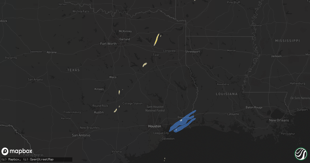
Get this storm
December 29 map
$229
one time, instant access
Download today. No call, no setup
Keep the $229
Bought the map and want the full workflow? Apply the entire $229 to a subscription within 7 days. None of it is wasted.
Every map, not just this one
This buys you this map. Subscription and you get every map we run, in the markets you choose from a few cities to whole states to nationwide. Plus real-time alerts the moment a storm fires.
Contact data
Name, contact info, occupancy, even credit band for addresses in the footprint. You go from where it hit to who to call.
Become the source they trust
Unlimited branding weather history reports on demand. You already have the documented answer ready for the property owner, and you are the one who showed up with it.
Property data and RoofTrace estimates
Pull up any address you have got, its value and the exact code rules for that jurisdiction, straight from One Click Code. Then RoofTrace estimates the squares, pitch, and roof value, priced the way you price.
Storm reports
Louisiana
| Date | Description |
|---|---|
| 12/29/20223:55 AM CST | Metal shed/garage had half of the roof torn off. Time estimated based on report and radar. |
Texas
| Date | Description |
|---|---|
| 12/29/20224:08 PM CST | Photos received of storm damage along fm1943 west of fred... Tx. Several trees knocked down or uprooted... It appears metal sheeting or siding was pulled from an awning |
| 12/29/20224:25 AM CST | At 1025 PM CST, a severe thunderstorm was located over Crystal Beach, or 11 miles northeast of Galveston Pier 21, moving north at 20 mph. HAZARD...60 mph wind gusts. SOURCE...Radar indicated. IMPACT...Expect damage to roofs, siding, and trees. Locations impacted include... Smith Point, Rollover Pass, Bolivar Peninsula and Crystal Beach. |
| 12/29/20224:10 AM CST | At 1009 PM CST, a severe thunderstorm was located near Crystal Beach, or 8 miles northeast of Galveston Pier 21, moving north at 20 mph. HAZARD...60 mph wind gusts. SOURCE...Radar indicated. IMPACT...Expect damage to roofs, siding, and trees. Locations impacted include... Bolivar Peninsula and Crystal Beach. |
| 12/29/20222:45 AM CST | Flagpole snapped and leaning on house. Time estimated based on report and radar. |
| 12/28/20229:52 PM CST | At 352 PM CST, a severe thunderstorm was located 7 miles north of Dime Box, or 9 miles east of Lexington, moving north at 15 mph. HAZARD...60 mph wind gusts. SOURCE...Radar indicated. IMPACT...Expect damage to roofs, siding, and trees. Locations impacted include... Caldwell and Chriesman. |
Cities Impacted by Hail Map on December 29, 2022
- Lincoln, TX
- Lexington, TX
- Beaumont, TX
- Winnsboro, TX
- Quitman, TX
- Burlington, TX
- Giddings, TX
- Paige, TX
- Scroggins, TX
- Cameron, TX
- Rosebud, TX
- Montalba, TX
- Palestine, TX
- Mineola, TX
- Mount Vernon, TX
- Bremond, TX
- Calvert, TX
- Athens, TX
- Larue, TX
- Caldwell, TX
- Leesburg, TX
- Pittsburg, TX
- Amity, AR
- Starks, LA
- Port Neches, TX
- Orange, TX
- Hamshire, TX
- Anahuac, TX
- Port Arthur, TX
- Nederland, TX
- Bridge City, TX
- Vidor, TX
- Winnie, TX
- Vinton, LA
- Cameron, LA
- Port Bolivar, TX
- Hackberry, LA