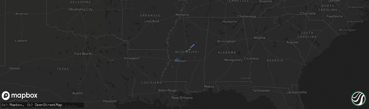
Hail Map on December 29, 2019
The weather event on December 29, 2019 includes Hail, Wind, and Tornado maps. 1 state and 16 cities were impacted and suffered possible damage. The total estimated number of properties impacted is 0.
Want more than just the map?
Turn this storm into a full workflow.
- Owner + property data so you know who to knock
- OnDemand branded weather history reports to win the "did we even have hail?" argument
- RoofTrace estimate so reps stop guessing numbers at the door
Bought this map? Upgrade within 7 days and we'll credit the $230. (10-15 min setup call)
Hail
Wind
Tornado
0
Estimated number of impacted properties by a 1.00" hail or larger0
Estimated number of impacted properties by a 1.75" hail or larger0
Estimated number of impacted properties by a 2.50" hail or largerStates Impacted by Hail Map on December 29, 2019
Storm reports
Mississippi
| Date | Description |
|---|---|
| 12/29/20195:58 PM CST | Trees down on highway 397. Possible tornado. Reported by power company. |
| 12/29/20195:20 PM CST | The truck of an 18-wheeler was flipped over. A section of the roof of a metal building was peeled off with some wall damage and a street sign nearby was also blown over |
| 12/29/20195:15 PM CST | Numerous trees down along hwy 489 near brewer mcmullan rd. |
| 12/29/20194:50 PM CST | Report from mping: 1-inch tree limbs broken; shingles blown off. |
| 12/29/20194:32 PM CST | A weak ef0 tornado touched down near the intersection of self creek road and j y turner road. The tornado moved northeast... Causing scattered tree damage and minor dam |
| 12/29/20194:30 PM CST | Trees down on self creek rd. Possible tornado. Reported by ema. |
| 12/29/20194:19 PM CST | Powerlines down on hwy 12. |
| 12/29/20194:18 PM CST | Power lines down on phillips-gammill rd and on henson rd. A couple small outbuildings damaged as well. |
| 12/29/20194:13 PM CST | A weak ef1 tornado touched down near weir-highpoint road on the east side of weir. The tornado moved northeast... Toppling multiple trees along henson road. The tornado |
| 12/29/20194:10 PM CST | Numerous trees downed along highway 12. Reported via social media. |
| 12/29/20194:03 PM CST | Numerous trees downed and snapped. Home damaged on attala county road 2120. Pictures posted on social media. |
| 12/29/20194:03 PM CST | An ef1 tornado touched down on the north side of state highway 12... With minor tree damage. The tornado paralleled highway 12... Crossing morris road... Widening and i |
| 12/29/20193:53 PM CST | An ef1 tornado started just north of the attala county airport... Damaging a barn roof and uprooting trees before moving northeast... Crossing the natchez trace parkway |
| 12/29/20193:44 PM CST | Trees down in the shiloh community. Reported by ema. |
| 12/29/20193:43 PM CST | Trees down in the newport commnunity. |
| 12/29/20193:35 PM CST | Corrects previous tornado report from 4 ssw newport. A brief ef1 tornado developed along cain road west of thomastown... In extreme northeast madison county and continu |
| 12/29/20193:06 PM CST | Tree down on warrior lane in clinton. Reported via social media. |
| 12/29/20193:06 PM CST | Tree down on abernathy road near brownsville. Reported via social media. |
| 12/29/20192:59 PM CST | Trees down. Possible tornado. Reported by ema. |
| 12/29/20192:51 PM CST | Several trees down near bolton. Reported by ema. |
| 12/29/20192:49 PM CST | A short lived tornado touched down in hinds county... Northwest of bolton. This tornado spawned just south of interstate 20 where it caused minor damage. The tornado pr |
| 12/28/201911:12 PM CST | At 512 PM CST, a severe thunderstorm was located near Stratton, or near Prospect, moving northeast at 45 mph. HAZARD...60 mph wind gusts and quarter size hail. SOURCE...Radar indicated. IMPACT...Hail damage to vehicles is expected. Expect wind damage to roofs, siding, and trees. This severe thunderstorm will be near... Neshoba around 520 PM CST. Little Rock around 525 PM CST. House and Bethsaida around 530 PM CST. Herbert Springs around 535 PM CST. Damascus and Forestdale around 540 PM CST. Liberty around 545 PM CST. Bluff Springs around 550 PM CST.Other locations impacted by this severe thunderstorm include Tucker. |
| 12/28/201911:08 PM CST | At 507 PM CST, severe thunderstorms were located along a line extending from near Evergreen to 7 miles north of Kolola Springs to near Tibbee, moving northeast at 60 mph. HAZARD...60 mph wind gusts and penny size hail. SOURCE...Radar indicated. IMPACT...Expect damage to roofs, siding, and trees. Locations impacted include... Hamilton, Vernon, Sulligent, Detroit, Beaverton, Blooming Grove, Lamar County Airport, Weston, Crews, Bedford, Henson Springs, Shottsville, Lamar County Public Lake, Rankin Fite Airport, Star, Byrd, Pine Springs, Bexar, Marion County Public Lake and Hightogy. |
| 12/28/201910:52 PM CST | At 451 PM CST, a severe thunderstorm was located near West Point, moving northeast at 75 mph. HAZARD...60 mph wind gusts. SOURCE...Radar indicated. IMPACT...Expect damage to roofs, siding, and trees. Locations impacted include... Amory, Aberdeen, Okolona, Smithville, Prairie, New Wren, Nettleton, Hatley, Gattman, Quincy, Egypt, Wise Gap, Wren, Strong, Muldon, Binford, Sipsey Fork, New Hamilton, Becker and Splunge. |
| 12/28/20199:46 PM CST | At 346 PM CST, severe thunderstorms were located along a line extending from near Kilmichael to near Hesterville, moving northeast at 50 mph. HAZARD...60 mph wind gusts and quarter size hail. SOURCE...Radar indicated. IMPACT...Hail damage to vehicles is expected. Expect wind damage to roofs, siding, and trees. Severe thunderstorms will be near... Kilmichael around 350 PM CST. Eupora around 410 PM CST. Ackerman, Chester and Bellefontaine around 415 PM CST. Mathiston, Reform and Clarkson around 420 PM CST. Cumberland and Sherwood around 425 PM CST.Other locations impacted by these severe thunderstorms includeMccool, Walthall, French Camp, Mantee and Weir. |
| 12/28/20199:11 PM CST | At 311 PM CST, severe thunderstorms were located along a line extending from near Myrleville to near Annandale, moving northeast at 60 mph. HAZARD...60 mph wind gusts and quarter size hail. SOURCE...Radar indicated. IMPACT...Hail damage to vehicles is expected. Expect wind damage to roofs, siding, and trees. Severe thunderstorms will be near... Canton and Way around 320 PM CST. Vaughan around 325 PM CST. Pickens, Sharon and Cameron around 330 PM CST. Goodman and Farmhaven around 335 PM CST. Camden and Newport around 340 PM CST. Durant around 345 PM CST. Kosciusko, Thomastown, Mcadams and Possumneck around 350 PM CST. Hesterville around 355 PM CST.Other locations impacted by these severe thunderstorms include Lena,Sallis and Redwater. |
| 12/28/20199:03 PM CST | At 303 PM CST, a severe thunderstorm was located near Red Lick, or 31 miles northeast of Natchez, moving northeast at 60 mph. HAZARD...60 mph wind gusts and quarter size hail. SOURCE...Radar indicated. IMPACT...Hail damage to vehicles is expected. Expect wind damage to roofs, siding, and trees. This severe thunderstorm will be near... Peyton around 310 PM CST. Hermanville around 315 PM CST. Carpenter around 325 PM CST. Utica and Dentville around 330 PM CST. |
| 12/28/20198:36 PM CST | At 236 PM CST, a severe thunderstorm was located near Peyton, or 23 miles west of Hazlehurst, moving northeast at 50 mph. HAZARD...60 mph wind gusts and quarter size hail. SOURCE...Radar indicated. IMPACT...Hail damage to vehicles is expected. Expect wind damage to roofs, siding, and trees. This severe thunderstorm will be near... Carpenter around 250 PM CST. Utica and Dentville around 255 PM CST.Other locations impacted by this severe thunderstorm include Learned. |
| 12/28/20198:16 PM CST | At 216 PM CST, a severe thunderstorm was located over Ferriday, moving northeast at 60 mph. HAZARD...60 mph wind gusts and quarter size hail. SOURCE...Radar indicated. IMPACT...Hail damage to vehicles is expected. Expect wind damage to roofs, siding, and trees. This severe thunderstorm will be near... Natchez, Vidalia and Clayton around 220 PM CST. Spokane around 225 PM CST. Waterproof and Church Hill around 235 PM CST.Other locations impacted by this severe thunderstorm includeRidgecrest. |
| 12/28/20197:45 PM CST | At 144 PM CST, a severe thunderstorm was located near Brouillette, or 7 miles southwest of Larto, moving northeast at 45 mph. HAZARD...60 mph wind gusts and quarter size hail. SOURCE...Radar indicated. IMPACT...Hail damage to vehicles is expected. Expect wind damage to roofs, siding, and trees. This severe thunderstorm will be near... Larto and Acme around 155 PM CST. New Era and Mayna around 200 PM CST. Monterey around 210 PM CST. Deer Park and Frogmore around 220 PM CST. |
Louisiana
| Date | Description |
|---|---|
| 12/28/20198:43 PM CST | At 243 PM CST, a severe thunderstorm was located near Deer Park, or 10 miles southeast of Monterey, moving northeast at 55 mph. HAZARD...60 mph wind gusts and quarter size hail. SOURCE...Radar indicated. IMPACT...Hail damage to vehicles is expected. Expect wind damage to roofs, siding, and trees. This severe thunderstorm will be near... Sibley around 255 PM CST. Kingston around 300 PM CST. Cranfield and Stanton around 310 PM CST. Hamburg and Kirby around 320 PM CST.Other locations impacted by this severe thunderstorm include Roxie. |
Tennessee
| Date | Description |
|---|---|
| 12/29/20192:34 AM CST | At 834 PM CST, a severe thunderstorm was located over Algood, or near Cookeville, moving northeast at 55 mph. HAZARD...60 mph wind gusts. SOURCE...Radar indicated. IMPACT...Expect damage to roofs, siding, and trees. Locations impacted include... Cookeville, Livingston, Algood, Monterey, Grimsley, Crawford and Rickman.This includes Interstate 40 between mile markers 288 and 302. |
| 12/29/201912:43 AM CST | Thunderstorm winds knocked down a large tree... Blocking brotherton rd. |
| 12/29/201912:27 AM CST | Thunderstorm winds downed a tree and utility pole... Closing old walland highway south of walland. |
| 12/29/201912:18 AM CST | Ham antenna downed and gazebo damaged by thunderstorm winds. |
| 12/29/201912:10 AM CST | Measured 72 mph thunderstorm wind gust. |
| 12/29/201912:10 AM CST | Spotter estimated 60 mph thunderstorm wind gust. |
| 12/28/201911:16 PM CST | Spotter reported trees down and power outage in charleston and had a wind gust of 48 mph at his house. |
| 12/28/201911:02 PM CST | *** 2 inj *** thunderstorm winds rolled a mobile home with two occupants... Both suffered minor injuries. |
Georgia
| Date | Description |
|---|---|
| 12/29/201912:10 AM CST | The roof was blown off of a tractor shed at the green valley greens golf course. |
Alabama
| Date | Description |
|---|---|
| 12/28/201911:30 PM CST | At 530 PM CST, a severe thunderstorm was located 7 miles northeast of Tremont, or 8 miles south of Red Bay, moving northeast at 65 mph. HAZARD...60 mph wind gusts. SOURCE...Radar indicated. IMPACT...Expect damage to roofs, siding, and trees. Locations impacted include... Russellville, Moulton, Red Bay, Phil Campbell, Town Creek, Littleville, Leighton, Courtland, Belgreen and North Courtland. |
| 12/28/20197:03 PM CST | Partial roof damage of a gas station. Report relayed via twitter. Time estimated based on radar. |
| 12/28/20197:02 PM CST | U-haul trailer toppled and metal roof blown off of garage. Report relayed via twitter. Time estimated based on radar. |
| 12/28/20197:01 PM CST | Two mobile homes damaged on ham road in athens... Al. Time estimated based on radar. |
| 12/28/20196:55 PM CST | Corrects time of previous tstm wnd dmg report from 3 w athens. Partial roof damage of a gas station. Report relayed via twitter. Time estimated based on radar. |
| 12/28/20196:54 PM CST | Corrects time of previous tstm wnd dmg report from 3 w athens. U-haul trailer toppled and metal roof blown off of garage. Report relayed via twitter. Time estimated bas |
| 12/28/20196:52 PM CST | Corrects time of previous tstm wnd dmg report from 5 wsw athens. Two mobile homes damaged on ham road in athens... Al. Time estimated based on radar. |
| 12/28/20196:02 PM CST | Trees and power lines down with a tree on a home near mahan ave. And liberty ave. Report relayed via social media. Time estimated based on radar. |
| 12/28/20196:00 PM CST | Trees and power lines down on duncan creek road past the football stadium. Reported via scanner. Timing estimated using radar. |
West Virginia
| Date | Description |
|---|---|
| 12/29/20195:05 AM CST | At 1105 PM EST, severe thunderstorms were located along a line extending from Gullett to Carver Station to near Vail, moving northeast at 55 mph. HAZARD...60 mph wind gusts. SOURCE...Radar indicated. IMPACT...Expect damage to roofs, siding, and trees. Locations impacted include... Paintsville, Prestonsburg, Salyersville, Inez, Mason, Martin, Allen, Oaklawn Estates, Bammer, Vail, Handshoe and Davella. |