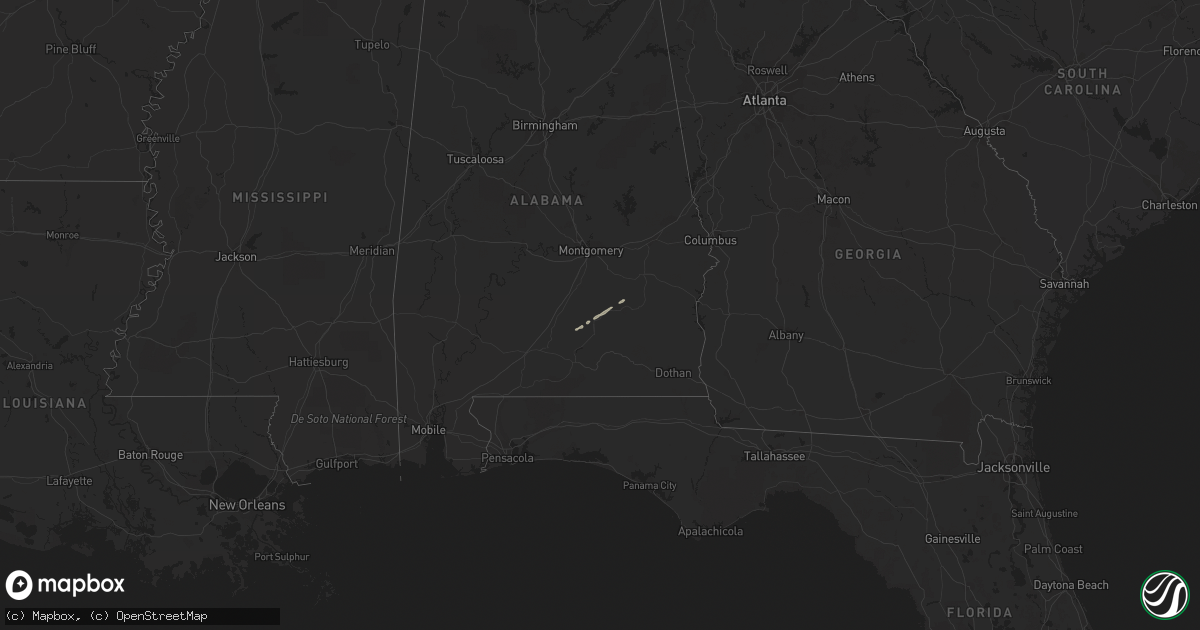
Hail Map on December 22, 2011
Get this storm
December 22 map
$229
one time, instant access
Download today. No call, no setup
Keep the $229
Bought the map and want the full workflow? Apply the entire $229 to a subscription within 7 days. None of it is wasted.
Every map, not just this one
This buys you this map. Subscription and you get every map we run, in the markets you choose from a few cities to whole states to nationwide. Plus real-time alerts the moment a storm fires.
Contact data
Name, contact info, occupancy, even credit band for addresses in the footprint. You go from where it hit to who to call.
Become the source they trust
Unlimited branding weather history reports on demand. You already have the documented answer ready for the property owner, and you are the one who showed up with it.
Property data and RoofTrace estimates
Pull up any address you have got, its value and the exact code rules for that jurisdiction, straight from One Click Code. Then RoofTrace estimates the squares, pitch, and roof value, priced the way you price.
States Impacted by Hail Map on December 22, 2011
Storm reports
Georgia
| Date | Description |
|---|---|
| 12/22/20115:35 PM CST | A couple of trees down around mcdonough. |
| 12/22/20115:30 PM CST | Couple of trees down in hampton. |
| 12/22/20115:25 PM CST | Trees down 2 se of jonesboro. |
| 12/22/20115:21 PM CST | One tree down on panhandle road at woolsey road. |
| 12/22/20115:20 PM CST | Emergency manager reported roof damage to residence along mud bridge road along with a large barn and two out buildings destroyed. |
| 12/22/20115:18 PM CST | A nws damage survey concluded a weak tornado...rated ef0 with maximum winds of 80 mph...touched down near lees mill rd just west of hwy 92 in northern fayette county. T |
| 12/22/20115:16 PM CST | Em relayed a report of a tree on a house in cummung. |
| 12/22/20115:16 PM CST | An nws assessment team determined that a weak tornado with winds of 95 mph touched down around 616 pm est on the northeast shore of lake horton near the end of woolsey |
| 12/22/20114:53 PM CST | One tree reported down. |
| 12/22/20114:50 PM CST | Power lines down on martin mill rd. |
| 12/22/20114:45 PM CST | Power lines down on west grantville rd. |
| 12/22/20114:44 PM CST | 911 relayes a report of three trees down in the primrose community. |
| 12/22/20114:44 PM CST | A national weather service assessment team determined that as the storm progressed northeast...a circulation developed and tightened between grantville and moreland res |
| 12/22/20114:39 PM CST | Three trees down in the winston area. |
| 12/22/20114:37 PM CST | Power lines down on mt carmel rd. |
| 12/22/20114:36 PM CST | Ema relayed a report of numerous trees down in the southern part of the county. |
| 12/22/20114:34 PM CST | 911 relayed a report of several trees down in the hogansville area. |
| 12/22/20114:32 PM CST | A national weather service and emergency management assessment team determined that a weak tornado with maximum winds of 80 mph touched down around 532 pm est in far so |
| 12/22/20114:25 PM CST | Bartow 911 relays a report of i75 blocked by downed trees between exits 306 and 315. |
| 12/22/20114:25 PM CST | Relayed from cherokee county ema...major structural damage in southern gordon county. Many homes with damage and one house at least was destroyed. |
| 12/22/20114:19 PM CST | Bartow 911 relayed a report that many trees are down and damage to homes around sr 140 and oak grove road. |
| 12/22/20114:06 PM CST | *** 4 inj *** continuation of tornado from floyd county...a national weather service assessment team determined tornado strengthened to an ef1 along emily lane just eas |
| 12/22/20114:03 PM CST | A national weather service assessment team determined that ef0 damage began in far northeast floyd county near highway 140 north of shannon and continued into gordon co |
| 12/22/20114:00 PM CST | *** 4 inj *** more than 6 trees down all across the county. Ema also relayed a report of multiple injuries at this time. |
| 12/22/20113:50 PM CST | *** 3 inj *** national weather service assessment team determined that ef1 damage began west of rome and strengthened to ef2 as the storm progressed northeast toward th |
| 12/22/20113:40 PM CST | Polk county 911 relayed a report of two trees down in far western polk county. |
| 12/22/20113:40 PM CST | Haralson 911 relayed a report of a tree down in far western haralson county. |
Mississippi
| Date | Description |
|---|---|
| 12/22/201111:40 AM CST | House on williamson road had damaged shingles. Big limbs broke off trees and a barn roof was destroyed. |
| 12/22/201111:40 AM CST | Possible funnel cloud spotted by public. |
| 12/22/201111:40 AM CST | One tree and large limbs down on county road 358 |
| 12/22/201111:18 AM CST | Roof damage at park place apartments and windows blown out of vehicles at turtlecreek mall. Siding and shingle damage also reported by wdam at interstate 59 and hardy s |
| 12/22/20119:51 AM CST | Trees down at kirklin road and us highway 198 |
| 12/22/20118:45 AM CST | Tree down on old highway 27 number 1 and a tree down on damascus road. |
Louisiana
| Date | Description |
|---|---|
| 12/22/201110:40 AM CST | Power lines downed in the bonnabel and west end areas. |
| 12/22/201110:32 AM CST | Awning blown onto a car in a residential area in st. Rose |
| 12/22/20119:32 AM CST | Large oak tree downed on black cat road |
| 12/22/20119:30 AM CST | Trees and power lines down on highway 444 east of king george bay road and highway 22 5 miles southeast of french settlement. |
| 12/22/20118:30 AM CST | Several power lines down in clinton. |
| 12/22/20118:27 AM CST | Trees and power lines downed on highway 19 in norwood. Highway closed for a period of time. |
| 12/22/20118:23 AM CST | Trees and power lines downed on highway 956 near intersection of hwy 10 and hwy 19 south of wilson. |
| 12/22/20118:15 AM CST | Weak tornado touched down near holly drive area just west of slaughter la and tracked northeast on an intermittent path to just north of the intersection of la highway |
| 12/22/20118:15 AM CST | Roof blown off house on highway 412 west between slaughter and jackson. |
| 12/22/20117:15 AM CST | Port barre police confirm damage at the old fruit of the loom plant. Additional damage reported to a subway at kings truck stop on hwy 190. Possible tornado. |
| 12/22/20117:15 AM CST | Fireworks tent blown apart along i-10 at ambassador. |
| 12/22/20116:15 AM CST | Jennings sheriff reports the roof completely torn off of jennings fine jewelry along lake arthur ave. The buildings cinderblocks were also repordedly cracked. |
| 12/22/20116:00 AM CST | Several buildings damaged by winds in jennings. |
Alabama
| Date | Description |
|---|---|
| 12/22/20115:55 PM CST | Spotter reported gusts of 40-50 mph with a peak gust of 60 mph. Spotter also reported heavy rain. There was also intense lightning and a power outage. No downed lines r |
| 12/22/20113:52 PM CST | Minor damage reported to a metal barn with several small trees blown down. |
| 12/22/20112:39 PM CST | A local report indicates 58 MPH wind near TALLADEGA |
| 12/22/20112:32 PM CST | Trees and powerlines down along highway 231 at county road 14. Trees also reported down along county road 40...and highway 22 and highway 9 near cottage grove. Possible |
| 12/22/20112:30 PM CST | Tree down on woolfolk road and water partially blocking lake jones circle. |
| 12/22/20112:24 PM CST | An ef1 tornado with winds of 90-100 mph moved across elmore...coosa...and west tallapoosa counties. The tornaod first touched down on grey ferry rd in elmore county sna |
| 12/22/20112:23 PM CST | Tree down along law road. Possible tornado. |
| 12/22/20112:16 PM CST | Large tree down near rollins. |
| 12/22/20112:16 PM CST | A tree was blown down along tyler road. |
| 12/22/20112:15 PM CST | A barn and outbuildings were damaged along county road 193. Possible tornado. |
| 12/22/20112:11 PM CST | Tree down on road near junction of u s highway 80 and albama highway 41. |
| 12/22/20112:11 PM CST | Tree down near jucntion county rds 59 and 19 on northeast side of town. |
| 12/22/20112:10 PM CST | Trees dowm along al hwy 143 and county rd 68. |
| 12/22/20112:00 PM CST | Damage to two mobile homes along county road 57. Possible tornado. |
| 12/22/20111:50 PM CST | Tree down across alabama highway 14 near starksville. |
| 12/22/20111:50 PM CST | Tree down on power lines along al hwy 25. |
| 12/22/20111:40 PM CST | Tree down on house in downtown columbiana near lester street. |
| 12/22/20111:33 PM CST | Trees down and wind damage to roofs on homes along county road 306. |
| 12/22/20111:25 PM CST | An ef0 tornado with winds of 70-80 mph briefly touched down between lawley and randolph in se bibb county. Damage began along hwy 82 with large limbs broken for 50 yard |
| 12/22/20111:25 PM CST | Trees down bwtween lawley and randolph. |
| 12/22/20111:10 PM CST | Structure damage to mobile home on cr 340 |
| 12/22/20111:00 PM CST | Trees down and wind damage to roofs on homes along county road 306. |
| 12/22/201112:57 PM CST | An ef0 tornado with winds of 70-80 mph briefly touched down 2 miles south of centreville. Several large pine trees were uprooted at this location. No other damage was n |
| 12/22/201112:56 PM CST | An ef0 tornado with winds of 70-80 mph briefly touched down 2 miles south of centreville. Several large pine trees were uprooted at this location. No other damage was n |