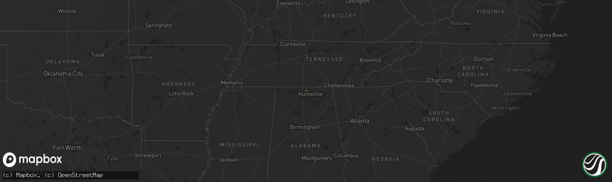
Hail Map on December 20, 2017
The weather event on December 20, 2017 includes Hail map. 1 state and 2 cities were impacted and suffered possible damage. The total estimated number of properties impacted is 467.
Want more than just the map?
Turn this storm into a full workflow.
- Owner + property data so you know who to knock
- OnDemand branded weather history reports to win the "did we even have hail?" argument
- RoofTrace estimate so reps stop guessing numbers at the door
Bought this map? Upgrade within 7 days and we'll credit the $230. (10-15 min setup call)
Hail
467
Estimated number of impacted properties by a 1.00" hail or larger0
Estimated number of impacted properties by a 1.75" hail or larger0
Estimated number of impacted properties by a 2.50" hail or largerStates Impacted by Hail Map on December 20, 2017
Storm reports
Georgia
| Date | Description |
|---|---|
| 12/20/201712:58 PM CST | Damage to a structure near the intersection of mckee rd and county line rd. Chimney blown off into pool; small trailer blown about 20 feet; 2 trees down near the proper |
| 12/20/201712:47 PM CST | Two trees reported down in midland community. Metal furniture also blown off of a deck at the same location. |
| 12/20/201712:15 PM CST | Fruit stand destroyed along imlac rd near intersection walnut creek rd. Damage was from possible tornado. |
| 12/20/201712:15 PM CST | Several trees down on carroll chunn rd. South of the intersection with imlac rd. Possible that damage was from a tornado. |
| 12/20/201712:15 PM CST | Ef0 tornado with max winds of 80 to 85 mph touched down near imlac road. The tornado was on the ground for 3.1 miles damaging numerous trees. 1 fruit stand was destroye |
| 12/20/201711:38 AM CST | Two pine trees were reported down and two trampolines were damaged near chase wood lane and fire creek trail. |
Alabama
| Date | Description |
|---|---|
| 12/20/201710:45 AM CST | Damage to at least one tree along county road 59 north of roanoke. Possible tornado. |
| 12/20/201710:43 AM CST | Tree damage reported along u.s. Highway 431 north of roanoke. Possible tornado. |
| 12/20/201710:40 AM CST | A brief... Bottom-of-the-barrel ef-0 tornado moved along an eastward track just north of county road 22 in southern randolph county... Resulting in roofing damage to a |
Mississippi
| Date | Description |
|---|---|
| 12/20/20176:39 AM CST | Storm survey indicated an occupied mobile home was moved off its foundation about 3 feet...and storage shed was overtuned and destroyed. A large pine tree was snapped n |
| 12/20/20176:39 AM CST | Sheriffs office reported public sightings of a tornado in the vicinity of thornill road and james ratcliff road. Broadcast media twitter post shows an overturned and de |
| 12/20/20176:35 AM CST | Large tree limbs snapped from a stand of trees along highway 583. Time estimated by radar srm. |