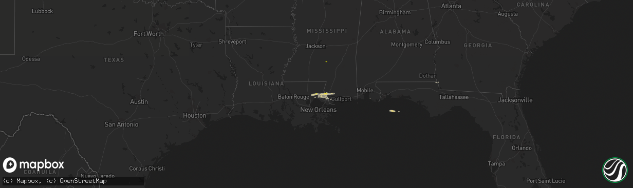
Hail Map on December 13, 2016
The weather event on December 13, 2016 includes Hail map. 4 states and 20 cities were impacted and suffered possible damage. The total estimated number of properties impacted is 644.
Want more than just the map?
Turn this storm into a full workflow.
- Owner + property data so you know who to knock
- OnDemand branded weather history reports to win the "did we even have hail?" argument
- RoofTrace estimate so reps stop guessing numbers at the door
Bought this map? Upgrade within 7 days and we'll credit the $230. (10-15 min setup call)
Hail
644
Estimated number of impacted properties by a 1.00" hail or larger0
Estimated number of impacted properties by a 1.75" hail or larger0
Estimated number of impacted properties by a 2.50" hail or largerStates Impacted by Hail Map on December 13, 2016
Storm reports
Louisiana
| Date | Description |
|---|---|
| 12/13/20162:20 PM CST | Hail reported in talisheek. Delayed transmission. |
Georgia
| Date | Description |
|---|---|
| 12/13/20161:30 PM CST | Seminole county dispatch reports several trees down along highway 39. |
Mississippi
| Date | Description |
|---|---|
| 12/13/20163:21 PM CST | Roof damage to a structure along bell creek road near the harrison/hancock county line... Possible tornado. Time estimated by radar. |
| 12/13/20162:50 PM CST | Delayed transmission |