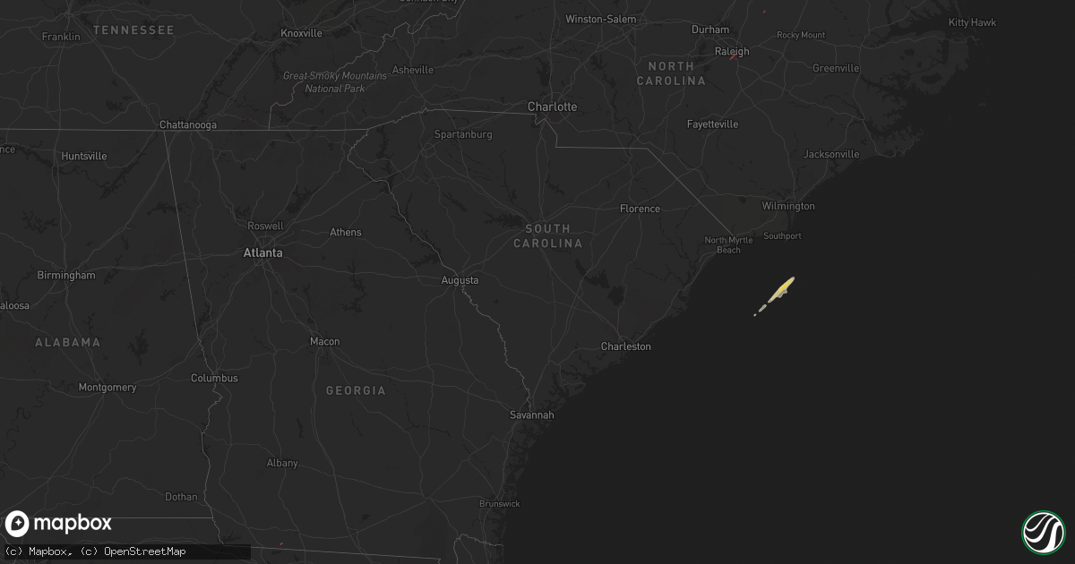
Hail Map on December 10, 2023
Get this storm
December 10 map
$229
one time, instant access
Download today. No call, no setup
Keep the $229
Bought the map and want the full workflow? Apply the entire $229 to a subscription within 7 days. None of it is wasted.
Every map, not just this one
This buys you this map. Subscription and you get every map we run, in the markets you choose from a few cities to whole states to nationwide. Plus real-time alerts the moment a storm fires.
Contact data
Name, contact info, occupancy, even credit band for addresses in the footprint. You go from where it hit to who to call.
Become the source they trust
Unlimited branding weather history reports on demand. You already have the documented answer ready for the property owner, and you are the one who showed up with it.
Property data and RoofTrace estimates
Pull up any address you have got, its value and the exact code rules for that jurisdiction, straight from One Click Code. Then RoofTrace estimates the squares, pitch, and roof value, priced the way you price.
States Impacted by Hail Map on December 10, 2023
Storm reports
Florida
| Date | Description |
|---|---|
| 12/10/202310:00 AM CST | Fallen trees and limbs resulted in a power outage along woodville highway via the duke energy outage map. |
| 12/10/20239:10 AM CST | Power pole broke on whitehouse rd in jefferson county. |
| 12/10/20238:45 AM CST | Tree down in the woodville area in wakulla county. |
| 12/10/20238:45 AM CST | A tempest weather station gusted to 61 mph between 945 am and 10 am. |
| 12/10/20237:29 AM CST | Brief tds on tlh radar at this location. No structural damage reported at this time. |
Georgia
| Date | Description |
|---|---|
| 12/10/20239:26 AM CST | 911 call center reported a tree down on russel rd and hwy 84e. |
| 12/10/20239:26 AM CST | 911 call center reported a tree down on594 county farmers rd. |
| 12/10/20239:20 AM CST | Pictures of trees and power lines down along old monticello road in the thomasville area. |
| 12/10/20238:55 AM CST | Tds on tlh radar. No structural damage reported at this time. |
Alabama
| Date | Description |
|---|---|
| 12/10/20236:39 AM CST | Tds on eox radar. No structural damage reported at this time. |
North Carolina
| Date | Description |
|---|---|
| 12/10/20233:28 PM CST | Powerlines down. |
| 12/10/20232:38 PM CST | Trees and powerlines down. |
| 12/10/202311:31 AM CST | A few trees down along buck branch dr. |
| 12/10/202311:30 AM CST | Numerous trees 4-12 inches in diameter and power lines down at the intersection of timber dr and woodland rd. There was also severe roof damage on at least one home. |
| 12/10/202311:30 AM CST | Numerous trees snapped about halfway up or uprooted... Along with 4-6 homes with roof damage... At emerald glade ct and buckhorn rd. |
| 12/10/20231:00 AM CST | Local weather station via weatherflow... Forte shores dr... Reported 57.4kt gust. |