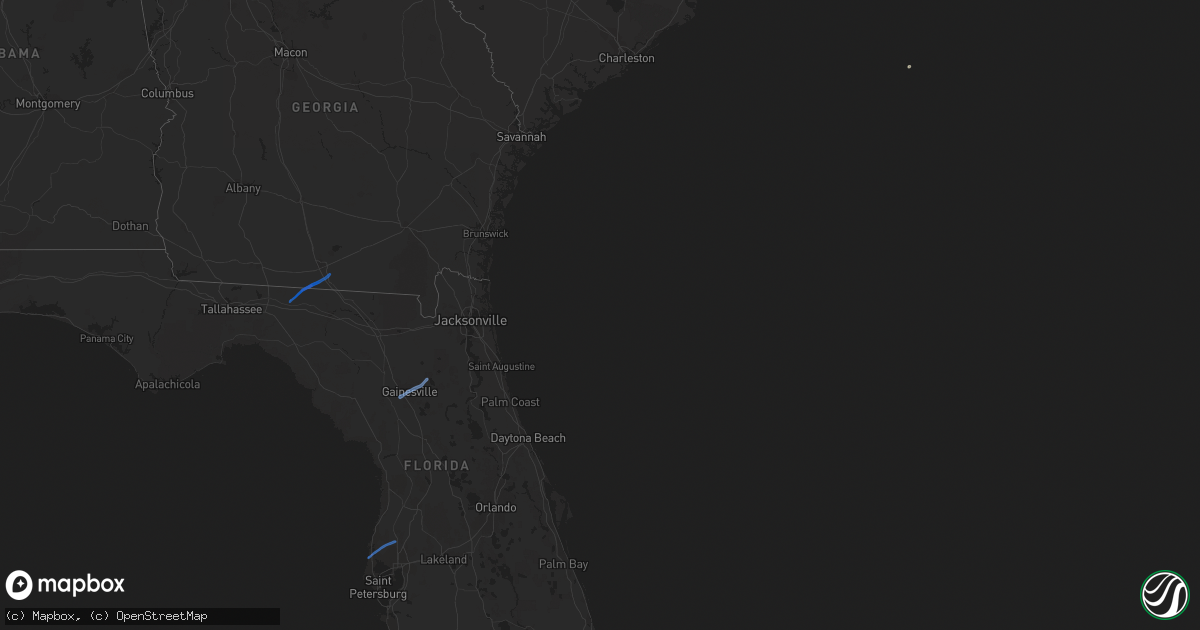
Hail Map on November 29, 2020
Get this storm
November 29 map
$229
one time, instant access
Download today. No call, no setup
Keep the $229
Bought the map and want the full workflow? Apply the entire $229 to a subscription within 7 days. None of it is wasted.
Every map, not just this one
This buys you this map. Subscription and you get every map we run, in the markets you choose from a few cities to whole states to nationwide. Plus real-time alerts the moment a storm fires.
Contact data
Name, contact info, occupancy, even credit band for addresses in the footprint. You go from where it hit to who to call.
Become the source they trust
Unlimited branding weather history reports on demand. You already have the documented answer ready for the property owner, and you are the one who showed up with it.
Property data and RoofTrace estimates
Pull up any address you have got, its value and the exact code rules for that jurisdiction, straight from One Click Code. Then RoofTrace estimates the squares, pitch, and roof value, priced the way you price.
Storm reports
Delaware
| Date | Description |
|---|---|
| 11/29/20202:30 AM CST | Several trees down across the northern parts of kent county. Time estimated from radar. |
Pennsylvania
| Date | Description |
|---|---|
| 11/29/20202:46 AM CST | Drone footage showing damage to what appears to be a couple hotels and cars shifted around in a parking lot. Time estimated from radar. |
Florida
| Date | Description |
|---|---|
| 11/29/20205:20 AM CST | Spotter report of a tornado between 620-625 am near state road 54 and suncoast parkway. Family received warning on mobile phone alert and took shelter in bathroom. Spot |
| 11/29/20205:02 AM CST | Public reported tornado forming over cambridge blvd. In palm harbor. Time estimated by radar. |
| 11/29/20204:12 AM CST | Nws storm survey...staight line winds estimated to be near 80 mph downed numerous trees... Some onto structures. The damage was centered near the intersection of nw 39t |
| 11/29/20204:12 AM CST | Trees were blown down and blocking roads along and near nw 39th avenue in gainesville. There was a heavy concerntration of trees down near the 2700 block of nw 39th str |
| 11/29/20204:11 AM CST | Mulitple trees were blown down and/or snapped in the springtree subdivision. Many homes suffered damage due to downed trees and tree limbs. The time of damage was based |
| 11/29/20204:10 AM CST | A large tree was blown down and blocked a walking path and fell on fences near the intersection of nw 45th ave and nw 25th ave. The time of damage was based on radar. |
| 11/29/20204:05 AM CST | At 1004 PM EST/904 PM CST/, a severe thunderstorm was located 9 miles southeast of Port St. Joe, moving northeast at 40 mph. HAZARD...60 mph wind gusts. SOURCE...Radar indicated. IMPACT...Expect damage to roofs, siding, and trees. Locations impacted include... Eastpoint, Apalachicola, Port St. Joe, Franklin, Nine Mile, Buck Siding, High Bluff, Eleven Mile, Thirteen Mile, Odena, Indian Pass, Tilton, Beverly, Jones Homestead, Ward Ridge, Green Point, Bay City, Howard Creek, Apalachicola Airport and Creels. |
| 11/29/20203:54 AM CST | At 953 PM EST/853 PM CST/, Doppler radar indicated a severe thunderstorm capable of producing damaging winds in excess of 60 mph. This storm was located over Wewahitchka, or 20 miles east of Callaway, and moving northeast at 25 mph. Locations impacted include... Stonemill Creek, Orange, Wewahitchka, Marysville, Scotts Ferry, Lewis, Chipola Cutoff, Chipola Park and Red Hill. |
| 11/29/20203:30 AM CST | Tree reported down north of white springs. Timing of event approximated via radar. |
| 11/29/20202:20 AM CST | Reports of structural damage as well as power lines and trees down. |
| 11/29/20202:18 AM CST | End point of ef1 tornado. Max winds are estimated to be 105 mph with a max width of 475 yards. |
| 11/29/20202:10 AM CST | Beginning point of ef1 tornado. Max winds are estimated to be 105 mph with a max width of 475 yards. |
| 11/29/20202:00 AM CST | A tree blocked the right lane and partially the left lane of i-10 eastbound near mm236 during the overnight storms. |