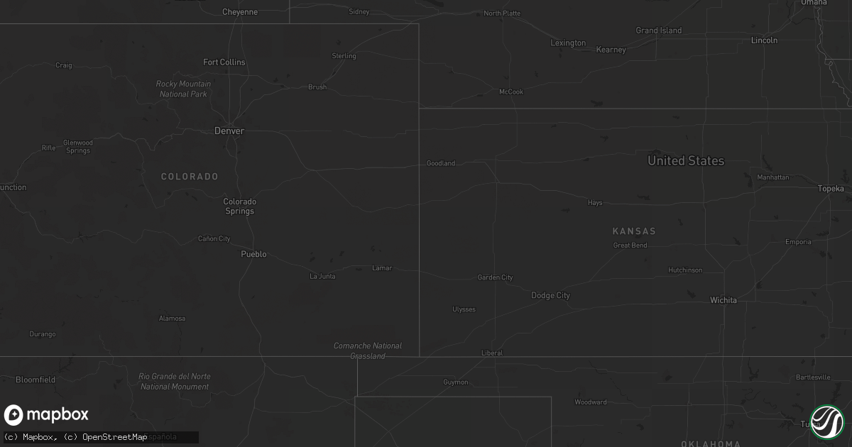
Hail Map on November 23, 2014
Get this storm
November 23 map
$229
one time, instant access
Download today. No call, no setup
Keep the $229
Bought the map and want the full workflow? Apply the entire $229 to a subscription within 7 days. None of it is wasted.
Every map, not just this one
This buys you this map. Subscription and you get every map we run, in the markets you choose from a few cities to whole states to nationwide. Plus real-time alerts the moment a storm fires.
Contact data
Name, contact info, occupancy, even credit band for addresses in the footprint. You go from where it hit to who to call.
Become the source they trust
Unlimited branding weather history reports on demand. You already have the documented answer ready for the property owner, and you are the one who showed up with it.
Property data and RoofTrace estimates
Pull up any address you have got, its value and the exact code rules for that jurisdiction, straight from One Click Code. Then RoofTrace estimates the squares, pitch, and roof value, priced the way you price.
States Impacted by Hail Map on November 23, 2014
Storm reports
Alabama
| Date | Description |
|---|---|
| 11/23/20142:15 PM CST | A tornado crossed into stewart county from alabama and tracked northeast on a semi-continuous 119 mile path. The tornado was an ef-2 at its peak...but caused ef-1 damag |
| 11/23/20142:10 PM CST | Damage to a metal building and tree limbs down in crawford near hwy 80. Possible tornado. Per social media. |
| 11/23/20142:03 PM CST | Trees down near lakepoint resort. Possible tornado. Per social media. |
| 11/23/20142:03 PM CST | The tornado touched down about 1.8 miles southeast of lakepoint resort state park...near where cowickee creek empties into walter f george reservoir. From there it move |
| 11/23/20141:29 PM CST | Tree down at the intersection of womack and hickory grove roads. |
| 11/23/20141:20 PM CST | Widespread trees down across the county. |
| 11/23/20141:10 PM CST | Photo of a large tree snapped in level plains... Relayed by wtvy meteorologist. |
| 11/23/20141:05 PM CST | Tree down on highway 27 north in fort rucker. |
| 11/23/20141:03 PM CST | Tree down at the intersection of sandbed road and highway 92. |
| 11/23/201412:50 PM CST | Tree down on virginia street and another on highway 92 in enterprise. |
| 11/23/201411:35 AM CST | A tornado began about 2.4 miles east-southeast of forkland...just south of county road 20 near the northern edge of catfish ponds...where a person observed the tornado. |
North Carolina
| Date | Description |
|---|---|
| 11/22/20147:50 PM CST | Charlotte meck warning point reports power lines down across yard on oak forest drive. |
Washington
| Date | Description |
|---|---|
| 11/23/201411:30 AM CST | Pacific county sheriff office took photographs of very large hail that fell at naselle-grays river school district. |
Virginia
| Date | Description |
|---|---|
| 11/22/201410:04 PM CST | Tree down on irish creek road. |
| 11/22/201410:00 PM CST | Tree down on longhollow road. |
| 11/22/20149:58 PM CST | Tin roof off the back of a house on burch avenue in buena vista. Roof landed in the alley. |
| 11/22/20149:53 PM CST | Tree down on route 56...tye river road. |
Missouri
| Date | Description |
|---|---|
| 11/23/20145:32 PM CST | Public reported at least 60 mph wind gusts |
| 11/23/20145:30 PM CST | Several trees blown down in pierce city |
Indiana
| Date | Description |
|---|---|
| 11/23/20145:20 AM CST | A 24 inch diameter tree was downed across 450 highway just west of williams. Time estimated based on radar. |
Georgia
| Date | Description |
|---|---|
| 11/23/20145:59 PM CST | Columbia county emergency manager reported trees on csx railroad track at the intersection of hightower drive and roberts road. |
| 11/23/20145:59 PM CST | Columbia county sheriff reported multiple trees down across the county. |
| 11/23/20145:59 PM CST | Columbia county emergency manager reported vehicle damaged by tree on hampstead place. |
| 11/23/20145:59 PM CST | Columbia county ema reported damaged railroad crossing arms at the intersection of old evans road and martinez blvd. |
| 11/23/20145:45 PM CST | Numerous trees down at the intersection of powell rd and belair rd. |
| 11/23/20145:37 PM CST | Powerlines reported down in emanuel county. |
| 11/23/20145:25 PM CST | Multiple trees were blown down in wrens and louisville. One tree fell on a house in louisville. |
| 11/23/20145:20 PM CST | Trained spotter reported trees down along u.s. Highway 441. Winds were estimated at 40 to 45 mph. |
| 11/23/20145:12 PM CST | Several trees were blown down across warren county. |
| 11/23/20145:12 PM CST | Trees were uprooted and a home had windows blown out along with other damage. |
| 11/23/20145:10 PM CST | Several trees were blown down in treutlen county. |
| 11/23/20145:05 PM CST | Several trees were blown down in wheeler county. |
| 11/23/20145:05 PM CST | Trees down across johnson county. An outbuilding was also destroyed. |
| 11/23/20145:00 PM CST | Numerous trees and powerlines down across laurens county...some roads blocked. |
| 11/23/20144:55 PM CST | Multiple trees down across washington county. |
| 11/23/20144:36 PM CST | Tree fell on car |
| 11/23/20144:36 PM CST | Tree fell on building |
| 11/23/20144:36 PM CST | Tree down on roadway |
| 11/23/20144:35 PM CST | Trees and powerlines were reported down all across the county. |
| 11/23/20144:35 PM CST | Trees and powerlines were reported down over the western portions of the county. |
| 11/23/20144:30 PM CST | Numerous trees and powerlines down all over the county. |
| 11/23/20144:25 PM CST | This is a continuation of the tornado that formed in alabama and moved into stewart county and northeast for greater than 100 miles. Numerous trees in the area were sna |
| 11/23/20144:20 PM CST | Numerous trees and power lines down county wide. |
| 11/23/20144:15 PM CST | Trees down on highway 83 south of monticello. |
| 11/23/20144:15 PM CST | Trees were reported down along zebulon road. |
| 11/23/20144:15 PM CST | Trees reported down near the clinton area. |
| 11/23/20144:15 PM CST | Trees and powerlines were reported down along macedonia church road. |
| 11/23/20144:13 PM CST | This is a continuation of the tornado damage that started in far eastern houston county. |
| 11/23/20144:10 PM CST | A mobile home was deroofed and blown 25 ft off its foundation on pitts rd. |
| 11/23/20144:10 PM CST | A tornado formed across extreme southeast houston county and moved into far northwest pulaski county. The tornado pushed a double wide trailer off its foundation along |
| 11/23/20144:05 PM CST | Trees and powerlines down extending from russellville to smarr to juliette. |
| 11/23/20144:01 PM CST | This damage report is for the tornado that formed near dyas and continued across the county. |
| 11/23/20143:50 PM CST | A billboard was blown down at mile marker 182 on i-75. |
| 11/23/20143:50 PM CST | This is a continuation of the tornado that formed in alabama and moved into stewart county and northeast for greater than 100 miles. A metal building system had its roo |
| 11/23/20143:48 PM CST | One tree down on 1st avenue southwest in moultrie. |
| 11/23/20143:40 PM CST | A tornado tracked from the southwest to the northeast across monroe county. The tornado caused a barn collapse...peeled a roof off of a second barn...destroyed a shed a |
| 11/23/20143:40 PM CST | Path of wind damage starts near culloden on hwy 74 and continues northeast. Multiple trees down and tree tops snapped. |
| 11/23/20143:40 PM CST | This is a continuation of the tornado that formed in alabama and moved into stewart county and northeast for greater than 100 miles. A metal building system had its roo |
| 11/23/20143:35 PM CST | Numerous trees and powerlines reported down in crawford county. |
| 11/23/20143:27 PM CST | This is a continuation of the tornado that formed in alabama and moved into stewart county and northeast for over 100 miles. A home was damaged by a falling tree at ada |
| 11/23/20143:27 PM CST | A home was damaged by a falling tree at adams rd and delray rd. |
| 11/23/20143:25 PM CST | Trees and powerlines down across the county. |
| 11/23/20143:25 PM CST | Trees snapped and power lines downed at emmaus church rd and mill race rd. |
| 11/23/20143:22 PM CST | Trees and power lines down across the county. |
| 11/23/20143:10 PM CST | Numerous trees down...some twisted... In an area along highway 80 between geneva and talbotton. |
| 11/23/20143:10 PM CST | This is a continuation of the tornado that formed in alabama and moved into stewart county and northeast for over 100 miles. Numerous trees down...some twisted... In an |
| 11/23/20143:00 PM CST | Large tree blown down blocking kennedy pond road. Relayed by walb-tv. |
| 11/23/20142:48 PM CST | Tree down on home on floyd court. |
| 11/23/20142:45 PM CST | Tree blown into the road at highway 262n and open pond road in decatur county. |
| 11/23/20142:40 PM CST | This is a continuation of the tornado that formed in alabma and moved across stewart county into chattahoochee county producing widespread tree damage near cussetta. |
| 11/23/20142:30 PM CST | Multiple trees were blown down on wellborn drive. |
| 11/23/20142:20 PM CST | Tree blown into the road at john rich road and highway 310 in western decatur county. |
| 11/23/20142:15 PM CST | A tornado crossed into stewart county from alabama and tracked northeast on a semi-continuous 119 mile path. The tornado was an ef-2 at its peak...but caused ef-1 damag |
| 11/22/20147:50 PM CST | A trained weather spotter reported a tree blocking the road near the diamond causeway. Time estimated based on radar. |
| 11/22/20147:29 PM CST | Effingham county georgia 911 reported a tree blown down on top of powerlines along 8th street in meldrim. |
| 11/22/20147:06 PM CST | Warning point reported three trees down at the intersection of talmadge road and oglethorpe highway. |
Florida
| Date | Description |
|---|---|
| 11/23/20142:30 PM CST | Wind damage in the drake acres area. |
| 11/23/20142:30 PM CST | Delayed report. Numerous trees snapped off at trunk. 2 large pine trees fell and knocked down power lines. Carport demolished. |
| 11/23/20141:45 PM CST | Trees downed and fence damage near wewahitchka along highway 22. Posted to wmbb-tv facebook page. |
| 11/23/20141:25 PM CST | Three pine trees blown across a road in the mossy pond area. Posted to wmbb-tv facebook page. |
| 11/23/201412:40 PM CST | Several trees down |
| 11/23/201412:35 PM CST | Power lines down |
| 11/23/201412:28 PM CST | Damage to trees and an outbuilding structure. Report posted to the wjhg-tv facebook page. |
| 11/23/201412:25 PM CST | Large tree limbs down and roofing material blown off panhandle bolt and industrial building. Pictures posted to wjhg-tv facebook page. |
| 11/23/201412:15 PM CST | Tree blown down in the vicinity of de funiak springs. Reported to wjhg-tv facebook page. |
| 11/23/201412:02 PM CST | Roof damaged by winds |
South Carolina
| Date | Description |
|---|---|
| 11/22/20148:58 PM CST | A trained weather spotter reported a tree blown down onto powerlines near the intersection of midland park road and townsend road. Time estimated based on radar. |
| 11/22/20147:03 PM CST | The allendale warning point reported a few trees down on highway 125 between martin and appleton. |
| 11/22/20147:00 PM CST | Sc highway patrol reported trees down along us 321 near blythewood road. |
| 11/22/20147:00 PM CST | Richland county dispatch reported power lines down on coogler road in irmo. |
| 11/22/20146:50 PM CST | Large limbs across kennel dr and across steer dr near blackville. |
| 11/22/20146:30 PM CST | Sc highway patrol reported trees down at the intersection of wagener road and south dixie road. |
| 11/22/20146:30 PM CST | Richland county dispatch reported power lines down in downtown columbia at the intersection of maple and blossom street. |
| 11/22/20146:13 PM CST | Trees down on the savannah river site on state road 125 near allendale line |
| 11/22/20146:05 PM CST | A large pine tree fell onto a pickup truck. |
Texas
| Date | Description |
|---|---|
| 11/22/20146:30 PM CST | Hen egg size hail estimated at a residence |