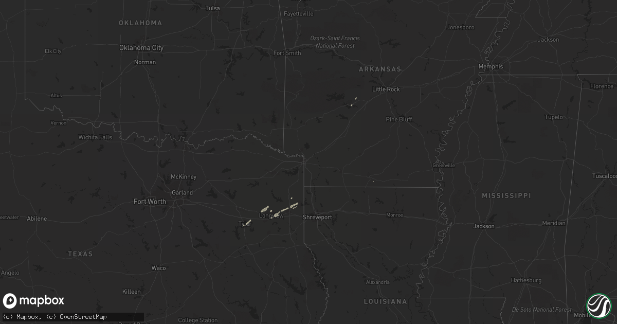
Hail Map on November 11, 2012
Get this storm
November 11 map
$229
one time, instant access
Download today. No call, no setup
Keep the $229
Bought the map and want the full workflow? Apply the entire $229 to a subscription within 7 days. None of it is wasted.
Every map, not just this one
This buys you this map. Subscription and you get every map we run, in the markets you choose from a few cities to whole states to nationwide. Plus real-time alerts the moment a storm fires.
Contact data
Name, contact info, occupancy, even credit band for addresses in the footprint. You go from where it hit to who to call.
Become the source they trust
Unlimited branding weather history reports on demand. You already have the documented answer ready for the property owner, and you are the one who showed up with it.
Property data and RoofTrace estimates
Pull up any address you have got, its value and the exact code rules for that jurisdiction, straight from One Click Code. Then RoofTrace estimates the squares, pitch, and roof value, priced the way you price.
Storm reports
Louisiana
| Date | Description |
|---|---|
| 11/11/20125:40 PM CST | Trees down on butler hill road |
| 11/11/20125:35 PM CST | Trees down on old plain dealing road |
| 11/11/20125:31 PM CST | Large pine tree limbs were downed on the west side of highway 3 near alden bridge about a half mile south of highway 160. |
| 11/11/20125:27 PM CST | Large limbs were downed on peace lane. |
| 11/11/20125:25 PM CST | Large limbs were downed on belcher river road near the levee. |
| 11/11/20125:20 PM CST | This is a continuation of the weak ef-0 tornado from eastern caddo parish. This tornado remained sporatically on the ground crossing old plain dealing road to highway 3 |
| 11/11/20125:15 PM CST | A weak ef-0 tornado touched down in an open field between highway 71 and 3049 on the north side of belcher. This tornado continued east northeast across open farmland t |
| 11/11/20122:35 PM CST | Trees down on old plain dealing road |
Arkansas
| Date | Description |
|---|---|
| 11/11/20125:20 PM CST | Tree reported down on county road. |
| 11/11/20124:35 PM CST | Trees down near the community of bright star |
| 11/11/20124:10 PM CST | Tree down along cr 13 near genoa |
| 11/11/20122:11 PM CST | Numerous trees down in the city. A home in downtown sustained major damage due to a fallen tree. |
| 11/11/20122:05 PM CST | Limbs down around city |
Texas
| Date | Description |
|---|---|
| 11/11/20124:45 PM CST | 4 trees reported down in harrison county. |
| 11/11/20124:15 PM CST | Powerlines reported down. |
| 11/11/20122:45 PM CST | Large tree down on fm 1650 |