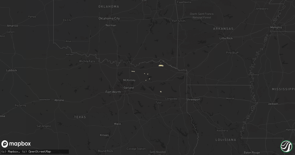
Hail Map on November 6, 2018
Get this storm
November 6 map
$229
one time, instant access
Download today. No call, no setup
Keep the $229
Bought the map and want the full workflow? Apply the entire $229 to a subscription within 7 days. None of it is wasted.
Every map, not just this one
This buys you this map. Subscription and you get every map we run, in the markets you choose from a few cities to whole states to nationwide. Plus real-time alerts the moment a storm fires.
Contact data
Name, contact info, occupancy, even credit band for addresses in the footprint. You go from where it hit to who to call.
Become the source they trust
Unlimited branding weather history reports on demand. You already have the documented answer ready for the property owner, and you are the one who showed up with it.
Property data and RoofTrace estimates
Pull up any address you have got, its value and the exact code rules for that jurisdiction, straight from One Click Code. Then RoofTrace estimates the squares, pitch, and roof value, priced the way you price.
States Impacted by Hail Map on November 6, 2018
Storm reports
Maryland
| Date | Description |
|---|---|
| 11/06/20185:52 AM CST | At 1152 AM EST, severe thunderstorms were located along a line extending from near Dunkirk to near Loretto, moving northeast at 75 mph. HAZARD...60 mph wind gusts. SOURCE...Radar indicated. IMPACT...Damaging winds will cause some trees and large branches to fall. This could injure those outdoors, as well as damage homes and vehicles. Roadways may become blocked by downed trees. Localized power outages are possible. Unsecured light objects may become projectiles. Locations impacted include... Lexington Park, Chesapeake Ranch Estates, Chesapeake Beach, Deale, Leonardtown, Prince Frederick, Piney Point, Tall Timbers, Greenwell State Park, Hallowing Point, Saint Leonard Creek, Breezy Point, Town Creek, Wicomico River, White Point Beach, Cuckold Creek, Sheridan Point, Calvert Cliffs, Saint Clements Bay and Flag Harbor. |
| 11/05/20187:48 PM CST | At 147 PM EST, severe thunderstorms were located along a line extending from near Andrewsville to near Vienna in Maryland, moving east at 35 mph. HAZARD...60 mph wind gusts. SOURCE...Radar indicated. IMPACT...Damage to roofs, siding, trees, and power lines is possible. Locations impacted include... Georgetown, Milford, Seaford, Laurel, Milton, Bridgeville, Delmar, Ellendale, Sycamore, Blades, Greenwood and Bethel. |
New York
| Date | Description |
|---|---|
| 11/06/20184:35 PM CST | Trees and wires down. |
Texas
| Date | Description |
|---|---|
| 11/06/20182:15 AM CST | Tree reported down near 37 n and dimple blocking a road. |
Mississippi
| Date | Description |
|---|---|
| 11/06/20186:36 AM CST | At 1235 AM CST, a severe thunderstorm was located 9 miles southeast of Poplar Creek, or 19 miles northeast of Kosciusko, moving east at 50 mph. HAZARD...60 mph wind gusts. SOURCE...Radar indicated. IMPACT...Expect damage to roofs, siding, and trees. This severe thunderstorm will be near... Ackerman and Chester around 1250 AM CST. Longview and Craig Springs around 110 AM CST.Other locations impacted by this severe thunderstorm include FrenchCamp, Sturgis and Weir. |
| 11/06/20186:13 AM CST | At 1213 AM CST, severe thunderstorms were located along a line extending from near Mcmillan to near Benton, moving east at 45 mph. HAZARD...60 mph wind gusts. SOURCE...Radar indicated. IMPACT...Expect damage to roofs, siding, and trees. Severe thunderstorms will be near... Durant around 1220 AM CST. Brozville around 1225 AM CST. Possumneck around 1230 AM CST. Franklin, Pickens and Hesterville around 1235 AM CST. Goodman around 1240 AM CST. Newport around 1250 AM CST. Mcadams around 1255 AM CST. Kosciusko around 105 AM CST.Other locations impacted by these severe thunderstorms include Etheland Sallis. |
| 11/05/20187:59 PM CST | At 159 AM CST, a severe thunderstorm was located near Stallo, or near Nanih Waiya, moving east at 35 mph. HAZARD...60 mph wind gusts. SOURCE...Radar indicated. IMPACT...Expect damage to roofs, siding, and trees. This severe thunderstorm will be near... Nanih Waiya around 210 AM CST. Preston around 220 AM CST. Gholson around 230 AM CST.Other locations impacted by this severe thunderstorm includeNoxapater. |
| 11/05/20187:43 PM CST | At 143 AM CST, a severe thunderstorm was located over Betheden, or 7 miles northeast of Louisville, moving east at 30 mph. HAZARD...60 mph wind gusts. SOURCE...Radar indicated. IMPACT...Expect damage to roofs, siding, and trees. This severe thunderstorm will be near... Brooksville around 230 AM CST. |
Georgia
| Date | Description |
|---|---|
| 11/06/20181:04 AM CST | At 704 AM EST, a severe thunderstorm was located near Hightower, or 9 miles northwest of Cumming, moving east at 40 mph. HAZARD...60 mph wind gusts. SOURCE...Radar indicated. IMPACT...Expect damage to roofs, siding, and trees. Locations impacted include... Gainesville, Cumming, Free Home, Dougherty, Coal Mountain, Hightower, Matt, Aqualand Park, Silver City, Chestatee, Oscarville, Lathemtown, Ducktown and War Hill Park. |
| 11/05/201811:14 PM CST | At 513 AM EST, severe thunderstorms were located along a line extending from 13 miles west of Smoky Mountains-Twentymile Creek to 15 miles east of Etowah to 9 miles southwest of Ducktown, moving east at 50 mph. HAZARD...60 mph wind gusts. SOURCE...Radar indicated. IMPACT...Expect damage to roofs, siding, and trees. Locations impacted include... Andrews, Murphy, Hayesville, Tellico Plains, Tusquitee, Coker Creek, Violet, Tariffville, Hiawasse Dam, Marble, Brasstown, Shooting Creek, Citico Beach, Citico, Talassee, Hot House, Topton, Unaka and Copperhill. |
Louisiana
| Date | Description |
|---|---|
| 11/05/20188:12 PM CST | At 212 AM CST, a severe thunderstorm was located 8 miles east of Lake Bruin, or 27 miles southwest of Vicksburg, moving east at 40 mph. HAZARD...60 mph wind gusts and quarter size hail. SOURCE...Radar indicated. IMPACT...Hail damage to vehicles is expected. Expect wind damage to roofs, siding, and trees. This severe thunderstorm will be near... Port Gibson around 225 AM CST. Pattison around 235 AM CST. Hermanville and Rocky Springs around 240 AM CST. Carpenter around 250 AM CST. Utica around 255 AM CST. Dentville around 305 AM CST. |
Alabama
| Date | Description |
|---|---|
| 11/06/20186:56 AM CST | At 1255 AM CST, severe thunderstorms were located along a line extending from near Rogersville to 8 miles northeast of Needmore, moving east at 45 mph. HAZARD...60 mph wind gusts. SOURCE...Radar indicated. IMPACT...Expect damage to roofs, siding, and trees. Locations impacted include... Decatur, Athens, Hartselle, Moulton, Trinity, Town Creek, Courtland, Tanner, North Courtland and Hillsboro. |
| 11/06/20186:39 AM CST | At 1238 AM CST, severe thunderstorms were located along a line extending from 6 miles southwest of Shelbyville to near Ardmore, moving east at 45 mph. HAZARD...60 mph wind gusts. SOURCE...Radar indicated. IMPACT...Expect damage to roofs, siding, and trees. Locations impacted include... Winchester, Fayetteville, Lynchburg, Decherd, Estill Springs, Huntland, Petersburg, Tims Ford Lake, Lincoln and Howell. |
| 11/06/20186:22 AM CST | At 1222 AM CST, severe thunderstorms were located along a line extending from near Lewisburg to 6 miles west of Ardmore, moving east at 45 mph. HAZARD...60 mph wind gusts. SOURCE...Radar indicated. IMPACT...Expect damage to roofs, siding, and trees. Locations impacted include... Fayetteville, Ardmore, Petersburg, Chestnut Ridge, Howell, Belleville, Dellrose, Belleview, Mimosa and Booneville. |
| 11/06/20186:10 AM CST | At 1209 AM CST, severe thunderstorms were located along a line extending from 7 miles north of Belgreen to 8 miles south of Red Bay, moving east at 65 mph. HAZARD...60 mph wind gusts. SOURCE...Radar indicated. IMPACT...Expect damage to roofs, siding, and trees. Locations impacted include... Russellville, Phil Campbell, Town Creek, Littleville, Belgreen, Vina, Hodges, Mt Hope, Cedar Creek Reservoir and Atwood. |
| 11/05/20189:58 PM CST | At 358 AM EST, severe thunderstorms were located along a line extending from near Fabius to near Dutton, moving east at 50 mph. HAZARD...Up to 70 mph wind gusts. SOURCE...Radar indicated. IMPACT...Expect considerable tree damage. Damage is likely to mobile homes, roofs, and outbuildings. Locations impacted include... Dalton, Lafayette, Ringgold, Trenton, Fort Oglethorpe, Rossville, Chickamauga, Trion, Varnell, Lookout Mountain, Tunnel Hill, Cohutta, Center Post, Blue Spring, Fairview, Linwood, Beaverdale, Villanow, Chattanooga Valley and Cloudland Canyon State Park. |
| 11/05/20188:40 PM CST | At 240 AM CST, a severe thunderstorm was located near Macon, or 18 miles northeast of Preston, moving east at 40 mph. HAZARD...60 mph wind gusts. SOURCE...Radar indicated. IMPACT...Expect damage to roofs, siding, and trees. This severe thunderstorm will be near... Paulette around 250 AM CST. Cooksville around 255 AM CST.Other locations impacted by this severe thunderstorm includeShuqualak. |
| 11/05/20187:54 PM CST | At 154 AM CST, severe thunderstorms were located along a line extending from 6 miles south of Huntland to near Falkville, moving east at 50 mph. HAZARD...60 mph wind gusts. SOURCE...Radar indicated. IMPACT...Expect damage to roofs, siding, and trees. Locations impacted include... Huntsville, Scottsboro, Guntersville, Arab, Moores Mill, Meridianville, Redstone Arsenal, Hazel Green, Stevenson and Owens Cross Roads. |
| 11/05/20187:27 PM CST | At 126 AM CST, severe thunderstorms were located along a line extending from near Athens to 6 miles northeast of Sardis, moving east at 60 mph. HAZARD...60 mph wind gusts. SOURCE...Radar indicated. IMPACT...Expect damage to roofs, siding, and trees. Locations impacted include... Huntsville, Decatur, Madison, Athens, Hartselle, Arab, Moores Mill, Redstone Arsenal, Meridianville and Priceville. |
North Carolina
| Date | Description |
|---|---|
| 11/06/20181:04 AM CST | At 701 AM EST, a line of showers was extending from near Chilhowie to near Mountain City to 6 miles southeast of Hampton, moving northeast at 50 mph. Trees were reported blown down in Washington County Tennessee as the line of showers crossed that region. HAZARD...60 mph wind gusts. SOURCE...Law enforcement. IMPACT...Expect damage to roofs, siding, and trees. Locations impacted include... Boone... Marion... Jefferson... West Jefferson... and Blowing Rock.This includes The following Location Appalachian State University. |
| 11/06/201812:43 AM CST | At 642 AM EST, severe thunderstorms were located along a line extending from 9 miles southeast of Bristol Tn to 9 miles north of Bakersville, moving east at 40 mph. HAZARD...60 mph wind gusts. SOURCE...Radar indicated. IMPACT...Expect damage to roofs, siding, and trees. Locations impacted include... Mountain City, Trade, Doeville, Roane Mountain State Park, Neva, Hampton Creek Cove State Park, Sadie, Shady Valley, Elk Mills and Roan Mountain. |
| 11/05/201811:58 PM CST | At 556 AM EST, severe thunderstorms were located along a line extending from near Tusculum to near Hot Springs, moving northeast at 65 mph. HAZARD...60 mph wind gusts. SOURCE...Radar indicated. IMPACT...Expect damage to roofs, siding, and trees. Locations impacted include... Johnson City, Greeneville, Elizabethton, Erwin, Jonesborough, Tusculum, Banner Hill, Central, Midway, Pine Crest, Oak Grove, Hampton, Unicoi, Bluff City, Watauga, Leesburg, Chucky, Limestone, Limestone Cove and Rocky Fork. |
| 11/05/201810:44 PM CST | At 444 AM EST, severe thunderstorms were located along a line extending from Charleston to near Cohutta, moving east at 45 mph. HAZARD...60 mph wind gusts. SOURCE...Radar indicated. IMPACT...Expect damage to roofs, siding, and trees. Locations impacted include... Cleveland, Benton, Ducktown, Etowah, Charleston, South Cleveland, East Cleveland, Wildwood Lake, Tellico Plains, Calhoun, William L. Davenport Refuge, Waterville, Big Frog Mountain, Parksville, Red Clay State Park, Bullet Creek, Copperhill, Flint Springs, Archville and McDonald. |
Kentucky
| Date | Description |
|---|---|
| 11/06/20186:21 AM CST | At 1221 AM EST, severe thunderstorms were located along a line extending from 8 miles west of Liberty to near Jamestown, moving east at 40 mph. HAZARD...60 mph wind gusts. SOURCE...Radar indicated. IMPACT...Expect damage to roofs, siding, and trees. Locations impacted include... Somerset, Mount Vernon, Science Hill, Burnside, Cains Store, Donaro, Bummer, Sloans Valley, Robinet, Gum Sulphur, Bandy and Bronston. |
| 11/05/20187:48 PM CST | At 147 AM CST, a severe thunderstorm was located 10 miles east of Livingston, moving northeast at 60 mph. HAZARD...60 mph wind gusts. SOURCE...Radar indicated. IMPACT...Expect damage to roofs, siding, and trees. Locations impacted include... Jamestown, Allardt, Crawford, Grimsley, Pall Mall and Pickett State Park. |
Virginia
| Date | Description |
|---|---|
| 11/05/201811:29 PM CST | At 529 AM EST, severe thunderstorms were located along a line extending from 9 miles east of Tazewell to near Jefferson City, moving east at 55 mph. HAZARD...60 mph wind gusts. SOURCE...Radar indicated. IMPACT...Expect damage to roofs, siding, and trees. Locations impacted include... Morristown, Rogersville, Sneedville, Bean Station, Surgoinsville, Russellville, Church Hill, Bulls Gap, Duffield, Clinchport, Thorn Hill, Evanston, Panther Creek State Park, McCloud, Treadway, Mooresburg, Okolona, Alpha, St. Clair and Kepler. |
| 11/05/201810:49 PM CST | At 449 AM EST, severe thunderstorms were located along a line extending from 10 miles southeast of La Follette to near Knoxville, moving northeast at 55 mph. HAZARD...60 mph wind gusts. SOURCE...Radar indicated. IMPACT...Expect damage to roofs, siding, and trees. Locations impacted include... Maynardville, Rutledge, New Tazewell, Bean Station, Tazewell, Plainview, Blaine, Luttrell, Springdale, Lone Mountain, Howard Quarter, Thorn Hill, Paulette, Rose Hill, Buffalo Springs, Big Ridge State Park, Sharps Chapel, Sandlick, House Mountain State Park and Maloneyville. |
Tennessee
| Date | Description |
|---|---|
| 11/06/20186:47 AM CST | At 1247 AM CST, a severe thunderstorm was located over Shelbyville, moving east at 65 mph. HAZARD...60 mph wind gusts. SOURCE...Radar indicated. IMPACT...Expect damage to roofs, siding, and trees. Locations impacted include... Shelbyville, Manchester, Tullahoma, Wartrace, Bell Buckle, Normandy, Beechgrove, Raus, Summitville, Deason, Hillsboro, Arnold AFB and Woods Reservoir.This includes Interstate 24 between mile markers 97 and 127. |
| 11/06/20186:26 AM CST | At 1226 AM CST, severe thunderstorms were located along a line extending from 7 miles southwest of Loretto to near Littleville, moving east at 60 mph. HAZARD...60 mph wind gusts. SOURCE...Radar indicated. IMPACT...Expect damage to roofs, siding, and trees. Locations impacted include... Rogersville, Killen, Town Creek, Lexington, Leighton, Courtland, North Courtland, Anderson, Lester and Good Springs. |
| 11/06/201812:20 AM CST | At 620 AM EST, a severe thunderstorm was located near Kingsport, moving east at 50 mph. HAZARD...60 mph wind gusts. SOURCE...Radar indicated. IMPACT...Expect damage to roofs, siding, and trees. Locations impacted include... Kingsport, Bristol Tn, Bristol Va, Walnut Hill, Spurgeon, Colonial Heights, Oak Grove, Bluff City, Tri-City Airport, Blountville, South Holston Dam, Sullivan Gardens, Warriors Path State Park, Hilander Park, Benhams, Bloomingdale, Bays Mountain Park and Fall Branch. |
| 11/05/201811:26 PM CST | At 525 AM EST, a severe thunderstorm was located 15 miles west of Robbinsville, or 11 miles west of Town Of Santeetlah, moving east at 55 mph. HAZARD...60 mph wind gusts. SOURCE...Radar indicated. IMPACT...Expect damage to trees and power lines. Locations impacted include... Bryson City, Robbinsville, Town Of Santeetlah, Smoky Mountains-Fontana Area, Lake Santeetlah, Fontana Lake, Fontana Village, Smoky Mountains-Twentymile Creek, Wesser and Stecoah. |
| 11/05/201811:21 PM CST | At 519 AM EST, severe thunderstorms were located along a line extending from near Morristown to 9 miles northeast of Gatlinburg, moving east at 65 mph. HAZARD...60 mph wind gusts. SOURCE...Radar indicated. IMPACT...Expect damage to roofs, siding, and trees. Locations impacted include... Morristown, Greeneville, Newport, Tusculum, White Pine, Baneberry, Parrottsville, Mosheim, Bulls Gap, Pittman Center, Baileyton, Caney Branch, Del Rio, Chucky, Cosby, Camp Creek, Lowland, Davy Crockett Birthplace, Jearoldstown and Cedar Creek. |
| 11/05/201811:21 PM CST | At 521 AM EST, severe thunderstorms were located along a line extending from Cohutta Wilderness to Chatsworth to Everett Springs, moving east at 25 mph. HAZARD...60 mph wind gusts. SOURCE...Radar indicated. IMPACT...Expect damage to roofs, siding, and trees. Locations impacted include... Calhoun, Chatsworth, Ellijay, Blue Ridge, East Ellijay, Resaca, Morganton, Talking Rock, Ranger, Jones Mill, Higdon, Redbud, Loving, Cohutta Wilderness, Epworth, Conasauga Lake, Cartecay, Pisgah, Mineral Bluff and Cherry Log. |
| 11/05/201810:52 PM CST | At 452 AM EST, severe thunderstorms were located along a line extending from near Flint Springs to Rocky Face to near Naomi, moving east at 50 mph. HAZARD...60 mph wind gusts. SOURCE...Radar indicated. IMPACT...Expect damage to roofs, siding, and trees. Locations impacted include... Dalton, Chatsworth, Ellijay, Blue Ridge, Varnell, Eton, Cohutta, East Ellijay, Morganton, Crandall, Sumac, Jones Mill, Higdon, Gregory, Cohutta Wilderness, Epworth, Conasauga Lake, Beaverdale, Mineral Bluff and Villanow. |
| 11/05/201810:52 PM CST | At 452 AM EST, severe thunderstorms were located along a line extending from 8 miles east of Knoxville to 11 miles southeast of Eagleton Village, moving northeast at 65 mph. HAZARD...60 mph wind gusts. SOURCE...Radar indicated. IMPACT...Expect damage to roofs, siding, and trees. Locations impacted include... Knoxville, Morristown, Sevierville, Jefferson City, Gatlinburg, Dandridge, Pigeon Forge, White Pine, New Market, Strawberry Plains, Pittman Center, Townsend, Panther Creek State Park, Bird Crossing, Fairgarden, Kimberlin Heights, Mascot, Harrisburg, Seymour and Kodak. |
| 11/05/201810:16 PM CST | At 415 AM EST, severe thunderstorms were located along a line extending from 6 miles southwest of Oak Ridge to 8 miles east of Madisonville, moving northeast at 65 mph. HAZARD...60 mph wind gusts. SOURCE...Radar indicated. At 353 AM EST, damaging wind was reported in Athens. IMPACT...Expect damage to roofs, siding, and trees. Locations impacted include... Knoxville, Oak Ridge, Maryville, Clinton, Lenoir City, Alcoa, Loudon, Farragut, Louisville, Rockford, Eagleton Village, Halls, Vonore, Greenback, Friendsville, Townsend, McGee Carson Peninsula, Walland, Karns and Clover Hill. |
| 11/05/201810:00 PM CST | At 358 AM EST, severe thunderstorms were located along a line extending from Soddy-Daisy to near Lookout Mountain, moving east at 50 mph. HAZARD...60 mph wind gusts. SOURCE...Emergency management. IMPACT...Expect damage to roofs, siding, and trees. Locations impacted include... Chattanooga, Cleveland, Lakesite, Charleston, Ridgeside, South Cleveland, Harrison, East Cleveland, Wildwood Lake, Collegedale, Waterville, East Brainerd, Lookout Mountain, Hopewell, Red Clay State Park, Harrison Bay State Park, Flint Springs, East Ridge, Tasso and Ooltewah. |
| 11/05/20189:43 PM CST | At 343 AM EST, severe thunderstorms were located along a line extending from near Spring City to 8 miles south of Decatur, moving east at 45 mph. HAZARD...60 mph wind gusts. SOURCE...Radar indicated. IMPACT...Expect damage to roofs, siding, and trees. Locations impacted include... Oak Ridge, Athens, Lenoir City, Kingston, Sweetwater, Rockwood, Loudon, Madisonville, Decatur, Fairview, Etowah, Midtown, Harriman, Englewood, Tellico Plains, Niota, Philadelphia, Hillsview, Clear Water and Murray Store. |
| 11/05/20189:27 PM CST | At 326 AM EST/226 AM CST/, severe thunderstorms were located along a line extending from 7 miles southeast of Tracy City to 6 miles west of Stevenson, moving east at 55 mph. HAZARD...60 mph wind gusts. SOURCE...Radar indicated. IMPACT...Expect damage to roofs, siding, and trees. Locations impacted include... Chattanooga, Jasper, Soddy-Daisy, Signal Mountain, South Pittsburg, Walden, Lakesite, Whitwell, Kimball, Fairmount, Red Bank, Powells Crossroads, Orme, Cartwright, Flat Top Mountain, Lookout Mountain, North Chickamauga Creek Gorge, Chimneys State Park, Middle Valley and New Hope. |
| 11/05/20189:12 PM CST | At 312 AM EST, a severe thunderstorm was located 8 miles west of Dayton, moving east at 60 mph. HAZARD...60 mph wind gusts. SOURCE...Radar indicated. IMPACT...Expect damage to roofs, siding, and trees. Locations impacted include... Athens, Dayton, Decatur, Spring City, Graysville, Evensville, Peakland, Clear Water, Old Washington, Grandview, Piney Falls State Park and Sale Creek. |
| 11/05/20188:54 PM CST | At 253 AM CST, severe thunderstorms were located along a line extending from near South Pittsburg to near Section, moving east at 65 mph. HAZARD...60 mph wind gusts. SOURCE...Radar indicated. IMPACT...Expect damage to roofs, siding, and trees. Locations impacted include... Fort Payne, Rainsville, Bridgeport, Henagar, Stevenson, Sylvania, Powell, Section, Ider and Pisgah. |
| 11/05/20188:27 PM CST | At 226 AM CST, severe thunderstorms were located along a line extending from 7 miles northwest of Stevenson to near Owens Cross Roads, moving east at 40 mph. HAZARD...60 mph wind gusts. SOURCE...Radar indicated. IMPACT...Expect damage to roofs, siding, and trees. Locations impacted include... Scottsboro, Bridgeport, Stevenson, Hollywood, Powell, Grant, Skyline, Section, Woodville and Pisgah. |
| 11/05/20187:23 PM CST | At 122 AM CST, a severe thunderstorm was located near Baxter, moving east at 60 mph. HAZARD...60 mph wind gusts. SOURCE...Radar indicated. IMPACT...Expect damage to roofs, siding, and trees. Locations impacted include... Cookeville, Livingston, Algood, Monterey, Baxter, Crawford, Rickman and Cummins Falls State Park.This includes Interstate 40 between mile markers 279 and 303. |
| 11/05/20187:14 PM CST | At 114 AM CST, severe thunderstorms were located along a line extending from Manchester to Tims Ford Lake to 9 miles west of Huntland, moving east at 55 mph. HAZARD...60 mph wind gusts. SOURCE...Radar indicated. IMPACT...Expect damage to roofs, siding, and trees. Locations impacted include... Winchester, Decherd, Estill Springs, Cowan, Huntland, Sewanee, Tims Ford Lake, Lexie Crossroads, Harmony and Hurdlow. |