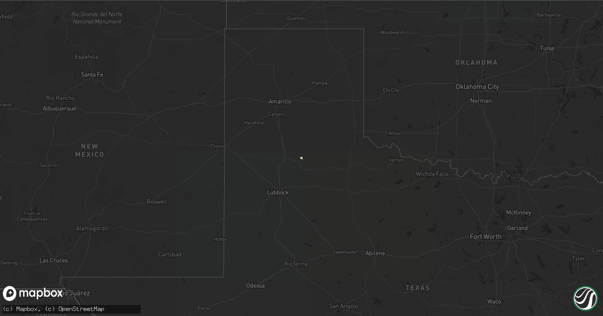
Hail Map on November 1, 2018
Get this storm
November 1 map
$229
one time, instant access
Download today. No call, no setup
Keep the $229
Bought the map and want the full workflow? Apply the entire $229 to a subscription within 7 days. None of it is wasted.
Every map, not just this one
This buys you this map. Subscription and you get every map we run, in the markets you choose from a few cities to whole states to nationwide. Plus real-time alerts the moment a storm fires.
Contact data
Name, contact info, occupancy, even credit band for addresses in the footprint. You go from where it hit to who to call.
Become the source they trust
Unlimited branding weather history reports on demand. You already have the documented answer ready for the property owner, and you are the one who showed up with it.
Property data and RoofTrace estimates
Pull up any address you have got, its value and the exact code rules for that jurisdiction, straight from One Click Code. Then RoofTrace estimates the squares, pitch, and roof value, priced the way you price.
States Impacted by Hail Map on November 1, 2018
Storm reports
Florida
| Date | Description |
|---|---|
| 11/01/20184:40 PM CDT | Viewer sent in pictures of a couple of small trees down in the monticello area. |
| 11/01/20183:40 PM CDT | Fallen trees or limbs resulted in a power outage to 225 customers in the wakulla springs area via duke energy. |
| 11/01/201810:35 AM CDT | Local news reports tree down on turkey creek drive. Time estimated by radar. |
| 11/01/20186:29 AM CDT | At 1129 AM CDT, a severe thunderstorm was located 4 miles east of Destin, moving east at 60 mph. HAZARD...60 mph wind gusts. SOURCE...Radar indicated. IMPACT...Expect damage to roofs, siding, and trees. Locations impacted include... Wright, Fort Walton Beach, Niceville, Destin, Eglin AFB, Valparaiso, Ocean City, Lake Lorraine, Shalimar and Cinco Bayou. |
| 11/01/20185:43 AM CDT | At 1042 AM CDT, severe thunderstorms were located along a line extending from 3 miles northeast of Navarre Beach to 9 miles south of Navarre to 18 miles southeast of Oriole Beach, moving east at 35 mph. HAZARD...60 to 70 mph wind gusts. The line of storms appears to be accelerating. SOURCE...Radar indicated. IMPACT...Expect considerable tree damage. Damage is likely to mobile homes, roofs, and outbuildings. Locations impacted include... Wright, Fort Walton Beach, Niceville, Destin, Eglin AFB, Valparaiso, Mary Esther, Ocean City, Lake Lorraine, Navarre, Shalimar, Cinco Bayou and Navarre Beach. |
| 11/01/20185:18 AM CDT | At 1017 AM CDT, severe thunderstorms were located along a line extending from 4 miles south of Warrington to 9 miles south of Pensacola Beach, moving northeast at 45 mph. HAZARD...60 to 70 mph wind gusts. SOURCE...Radar indicated. IMPACT...Expect considerable tree damage. Damage is likely to mobile homes, roofs, and outbuildings. Locations impacted include... Pensacola, Warrington, Gulf Breeze, Goulding, Oriole Beach, Navarre, Navarre Beach and Pensacola Beach. |
| 11/01/20183:39 AM CDT | At 839 AM CDT, severe thunderstorms were located along a line extending from 7 miles east of I65 And AL 113 to Jay to 5 miles northeast of Molino, moving northeast at 40 mph. HAZARD...60 mph wind gusts. SOURCE...Radar indicated. IMPACT...Expect damage to roofs, siding, and trees. Locations impacted include... Brewton, East Brewton, Castleberry, Jay, Pollard and Riverview. |
| 11/01/20183:03 AM CDT | At 803 AM CDT, severe thunderstorms were located along a line extending from near Uriah to 12 miles west of Molino, moving northeast at 50 mph. HAZARD...60 mph wind gusts. SOURCE...Radar indicated. IMPACT...Expect damage to roofs, siding, and trees. Locations impacted include... Atmore, Brewton, Century, Flomaton, McCullough, East Brewton, Jay, Pollard, Riverview, Bratt, I65 And CR 1, I65 And AL 113, I65 And AL 21 and Poarch Creek Reservation. |
| 11/01/20182:30 AM CDT | At 730 AM CDT, severe thunderstorms were located along a line extending from 10 miles east of McIntosh to 6 miles east of Alabama Port, moving east at 50 mph. HAZARD...60 mph wind gusts. SOURCE...Radar indicated. IMPACT...Expect damage to roofs, siding, and trees. Locations impacted include... Daphne, Fairhope, Bay Minette, Atmore, Foley, Spanish Fort, Robertsdale, Point Clear, Loxley, Lillian, Stockton, McCullough, Magnolia Springs, Stapleton, Bon Secour, Uriah, Summerdale, Silverhill, Perdido Beach and Elberta. |
| 10/31/201811:23 PM CDT | At 423 PM EDT, a severe thunderstorm was located near Crawfordville, moving northeast at 35 mph. HAZARD...60 mph wind gusts. SOURCE...Radar indicated. IMPACT...Expect damage to roofs, siding, and trees. Locations impacted include... Crawfordville, Woodville, Wakulla, Shadeville, Hyde Park, Wakulla Springs, Arran and Bethel. |
South Dakota
| Date | Description |
|---|---|
| 11/01/20185:39 PM CDT | No lightning... But winds were a result of convective showers |
| 11/01/20185:09 PM CDT | No lightning... But winds were a result of convective showers |
| 11/01/20185:08 PM CDT | Peak wind. No lightning... But winds were a result of convective showers. |
| 11/01/20185:05 PM CDT | No lightning... But winds were a result of convective showers |
| 11/01/20184:57 PM CDT | No lightning observed... But winds were a result of convective showers |
Mississippi
| Date | Description |
|---|---|
| 11/01/20187:59 AM CDT | At 1259 AM CDT, severe thunderstorms were located along a line extending from near Deville to Bunkie, moving east at 40 mph. HAZARD...60 mph wind gusts. SOURCE...Radar indicated. IMPACT...Expect damage to roofs, siding, and trees. Locations impacted include... Ferriday, Larto, Monterey, Mayna, West Ferriday, Acme, Deer Park, New Era, Frogmore, Black Hawk and Slocum. |
| 11/01/20181:50 AM CDT | At 649 AM CDT, severe thunderstorms were located along a line extending from 5 miles northwest of Citronelle to near Moss Point, moving northeast at 45 mph. HAZARD...60 mph wind gusts. SOURCE...Radar indicated. IMPACT...Expect damage to roofs, siding, and trees. Locations impacted include... Midtown Mobile, Downtown Mobile, Prichard, Daphne, Tillmans Corner, Fairhope, Saraland, Theodore, Chickasaw, Satsuma, Spanish Fort, Grand Bay, Citronelle, Bayou La Batre, Creola, Point Clear, Chunchula, Stockton, Stapleton and Gulfcrest. |
| 11/01/20181:33 AM CDT | At 632 AM CDT, severe thunderstorms were located along a line extending from near Alamucha to 7 miles south of Crandall to 5 miles north of Leakesville, moving northeast at 50 mph. HAZARD...70 mph wind gusts. SOURCE...Radar indicated. IMPACT...Expect considerable tree damage. Damage is likely to mobile homes, roofs, and outbuildings. Locations impacted include... Jackson, Thomasville, Butler, Grove Hill, Chatom, Saint Stephens, Wagarville, Leroy, Whatley, Tibbie, Lisman, Millry, Silas, Fruitdale, Coffeeville, Pennington, Fulton, Gilbertown and Toxey. |
| 11/01/20181:19 AM CDT | At 618 AM CDT, severe thunderstorms were located along a line extending from 3 miles northwest of Leakesville to 8 miles northwest of Wade, moving east at 45 mph. HAZARD...60 mph wind gusts. SOURCE...Radar indicated. IMPACT...Expect damage to roofs, siding, and trees. Locations impacted include... Citronelle, Lucedale, Leakesville, Chunchula, Gulfcrest, Deer Park, Semmes and Wilmer. |
| 11/01/20181:08 AM CDT | At 608 AM CDT, severe thunderstorms were located along a line extending from Walnut Grove to 8 miles southeast of Red Bay, moving east at 50 mph. HAZARD...60 mph wind gusts. SOURCE...Radar indicated. IMPACT...Expect damage to roofs, siding, and trees. Locations impacted include... Florence, Muscle Shoals, Russellville, Sheffield, Tuscumbia, Red Bay, Phil Campbell, Killen, Town Creek and Cherokee. |
| 11/01/20181:00 AM CDT | At 600 AM CDT, severe thunderstorms were located along a line extending from near Lyman to Gulfport to 8 miles southeast of Bay St. Louis, moving northeast at 55 mph. HAZARD...60 mph wind gusts. SOURCE...Radar indicated. IMPACT...Expect damage to roofs, siding, and trees. Locations impacted include... Gulfport, Biloxi, Ocean Springs, St. Martin, D'iberville, Wade, Latimer, Gulf Hills, Vancleave, Lyman, Hurley, Gulf Park Estates and Gulfport Airport. |
| 11/01/201812:45 AM CDT | At 545 AM CDT, severe thunderstorms were located along a line extending from near Saucier to near Lyman to 6 miles east of Diamondhead, moving east at 40 mph. HAZARD...60 mph wind gusts. SOURCE...Radar indicated. IMPACT...Expect damage to roofs, siding, and trees. Locations impacted include... Gulfport, Biloxi, Long Beach, Bay St. Louis, Waveland, Diamondhead, Saucier, Kiln, Lyman, Shoreline Park and Gulfport Airport. |
| 11/01/201812:44 AM CDT | At 544 AM CDT, severe thunderstorms were located along a line extending from Pineflat to near Tremont, moving east at 50 mph. HAZARD...60 mph wind gusts. SOURCE...Radar indicated. IMPACT...Expect damage to roofs, siding, and trees. Locations impacted include... Russellville, Red Bay, Cherokee, Belgreen, Vina, Hodges, Waterloo, Malone, Posey Loop and Atwood. |
| 11/01/201812:42 AM CDT | At 542 AM CDT, a severe thunderstorm was located 7 miles northeast of Wiggins, moving northeast at 50 mph. HAZARD...70 mph wind gusts. SOURCE...Radar indicated. IMPACT...Expect considerable tree damage. Damage is likely to mobile homes, roofs, and outbuildings. Locations impacted include... Wiggins, Perkinston, McHenry and McLain. |
| 11/01/201812:28 AM CDT | At 527 AM CDT, severe thunderstorms were located along a line extending from 13 miles west of Saucier to 6 miles north of Diamondhead to near Kiln, moving east at 40 mph. HAZARD...60 mph wind gusts. SOURCE...Radar indicated. IMPACT...Expect damage to roofs, siding, and trees. Locations impacted include... Gulfport, Biloxi, Long Beach, Bay St. Louis, Diamondhead, Saucier, Kiln, Lyman, Shoreline Park and Gulfport Airport. |
| 11/01/201812:22 AM CDT | At 521 AM CDT, severe thunderstorms were located along a line extending from 5 miles north of Macedonia to Mclaurin to near Rock Hill to 8 miles southeast of Lumberton, moving northeast at 55 mph. HAZARD...60 mph wind gusts. SOURCE...Radar indicated. IMPACT...Expect damage to roofs, siding, and trees. Locations impacted include... Richton, Beaumont and New Augusta. |
| 11/01/201812:12 AM CDT | At 512 AM CDT, severe thunderstorms were located along a line extending from near Craig Springs to near Vernon, moving east at 65 mph. HAZARD...60 mph wind gusts. SOURCE...Radar indicated. IMPACT...Expect damage to roofs, siding, and trees. Severe thunderstorms will be near... Gholson and Mashulaville around 520 AM CDT. Macon and Brooksville around 530 AM CDT. Paulette and Deerbrook around 535 AM CDT. Cooksville around 540 AM CDT. Bigbee Valley around 545 AM CDT.Other locations impacted by these severe thunderstorms includeShuqualak and Noxapater. |
| 11/01/201812:08 AM CDT | At 508 AM CDT, severe thunderstorms were located along a line extending from near Pheba to Craig Springs, moving east at 40 mph. HAZARD...60 mph wind gusts. SOURCE...Radar indicated. IMPACT...Expect damage to roofs, siding, and trees. Severe thunderstorms will be near... Griffith around 515 AM CDT. Muldrow and Oktoc around 525 AM CDT. West Point around 530 AM CDT. Crawford and Tibbee around 535 AM CDT. Bent Oak around 540 AM CDT. Waverly around 545 AM CDT. Columbus and Columbus AFB around 550 AM CDT. Steens around 600 AM CDT.Other locations impacted by these severe thunderstorms includeArtesia. |
| 11/01/201812:05 AM CDT | At 504 AM CDT, a severe thunderstorm was located 7 miles east of Mcneil, or 11 miles south of Poplarville, moving east at 50 mph. HAZARD...60 mph wind gusts. SOURCE...Radar indicated. IMPACT...Expect damage to roofs, siding, and trees. Locations impacted include... Wiggins, Perkinston and McHenry. |
| 11/01/201812:04 AM CDT | At 504 AM CDT, severe thunderstorms were located along a line extending from near Taylorsville to Sumrall, moving east at 40 mph. HAZARD...60 mph wind gusts. SOURCE...Radar indicated. IMPACT...Expect damage to roofs, siding, and trees. Severe thunderstorms will be near... Eastabuchie, Moss and Moselle around 530 AM CDT. Sandersville around 540 AM CDT. Mill Creek around 545 AM CDT. Ovett around 550 AM CDT.Other locations impacted by these severe thunderstorms include Soso. |
| 11/01/201812:03 AM CDT | At 503 AM CDT, severe thunderstorms were located along a line extending from near Pineville to near Bay Springs to near Taylorsville, moving east at 40 mph. HAZARD...60 mph wind gusts. SOURCE...Radar indicated. IMPACT...Expect damage to roofs, siding, and trees. Severe thunderstorms will be near... Bay Springs around 510 AM CDT. Turnerville around 515 AM CDT. Stringer and Garlandville around 525 AM CDT. Moss and Paulding around 530 AM CDT. Vernon and Rose Hill around 535 AM CDT. Orange around 540 AM CDT. Heidelberg around 550 AM CDT. Stafford Springs around 555 AM CDT.Other locations impacted by these severe thunderstorms includeMontrose and Louin. |
| 10/31/201811:54 PM CDT | At 454 AM CDT, severe thunderstorms were located along a line extending from 7 miles southeast of Zama to near Prospect, moving east at 50 mph. HAZARD...60 mph wind gusts. SOURCE...Radar indicated. IMPACT...Expect damage to roofs, siding, and trees. Severe thunderstorms will be near... Neshoba, Stallo, Burnside and Stratton around 505 AM CDT. Bethsaida around 510 AM CDT. Little Rock, House and Forestdale around 515 AM CDT. Herbert Springs and Duffee around 520 AM CDT. Preston, Martin, Damascus, Bluff Springs and Suqualena around 525 AM CDT. Liberty and Prismatic around 530 AM CDT. Blackwater around 535 AM CDT.Other locations impacted by these severe thunderstorms includeTucker, Chunky and Hickory. |
| 10/31/201811:53 PM CDT | At 452 AM CDT, severe thunderstorms were located along a line extending from 7 miles southeast of Sandy Hook to 6 miles west of Poplarville to near Mcneil, moving east at 35 mph. HAZARD...60 mph wind gusts. SOURCE...Radar indicated. IMPACT...Expect damage to roofs, siding, and trees. Locations impacted include... Poplarville and Mcneil. |
| 10/31/201811:50 PM CDT | At 449 AM CDT, a severe thunderstorm was located near Pontotoc, moving northeast at 50 mph. HAZARD...60 mph wind gusts. SOURCE...Radar indicated. IMPACT...Expect damage to roofs, siding, and trees. Locations impacted include... Tupelo, Pontotoc, Verona, Okolona, Trace State Park, Tombigbee State Park, Saltillo, Shannon, Plantersville, Ecru, Troy, Furrs, Houlka, Sherman, New Houlka, Algoma, Hortontown, Endville, Cherry Creek and Chiwapa. |
| 10/31/201811:40 PM CDT | At 440 AM CDT, severe thunderstorms were located along a line extending from near Mount Olive to near Carson, moving east at 35 mph. HAZARD...60 mph wind gusts. SOURCE...Radar indicated. IMPACT...Expect damage to roofs, siding, and trees. Severe thunderstorms will be near... Mount Olive around 445 AM CDT. Sanford around 515 AM CDT.Other locations impacted by these severe thunderstorms includeSeminary. |
| 10/31/201811:34 PM CDT | At 433 AM CDT, severe thunderstorms were located along a line extending from near Chester to near Zama, moving east at 40 mph. HAZARD...60 mph wind gusts. SOURCE...Radar indicated. IMPACT...Expect damage to roofs, siding, and trees. Severe thunderstorms will be near... Louisville and Mcmillan around 455 AM CDT. Betheden and Millcreek around 505 AM CDT.Other locations impacted by these severe thunderstorms includeNoxapater, Mccool and Weir. |
| 10/31/201811:26 PM CDT | At 425 AM CDT, severe thunderstorms were located along a line extending from near Bellefontaine to 6 miles west of Chester, moving northeast at 40 mph. HAZARD...60 mph wind gusts. SOURCE...Radar indicated. IMPACT...Expect damage to roofs, siding, and trees. Severe thunderstorms will be near... Eupora and Reform around 440 AM CDT. Sherwood around 445 AM CDT. Mathiston around 450 AM CDT. Maben and Clarkson around 455 AM CDT. Cumberland around 500 AM CDT.Other locations impacted by these severe thunderstorms include FrenchCamp, Mantee and Walthall. |
| 10/31/201811:25 PM CDT | At 425 AM CDT, severe thunderstorms were located along a line extending from near Folsom to Covington to near Madisonville, moving east at 40 mph. HAZARD...60 mph wind gusts. SOURCE...Radar indicated. IMPACT...Expect damage to roofs, siding, and trees. Locations impacted include... Slidell, Picayune, Covington, Pearl River, Abita Springs, Madisonville, Folsom, Sun, Bush, Lacombe and Slidell Airport. |
| 10/31/201811:22 PM CDT | At 422 AM CDT, severe thunderstorms were located along a line extending from 7 miles east of Franklinton to 6 miles west of Bogalusa to near Enon, moving east at 50 mph. HAZARD...60 mph wind gusts. SOURCE...Radar indicated. IMPACT...Expect damage to roofs, siding, and trees. Locations impacted include... Bogalusa, Poplarville, Varnado, Sun, Crossroads and Angie. |
| 10/31/201811:19 PM CDT | At 419 AM CDT, a severe thunderstorm was located 8 miles north of Baxterville, or 12 miles southwest of West Hattiesburg, moving northeast at 55 mph. HAZARD...60 mph wind gusts. SOURCE...Radar indicated. IMPACT...Expect damage to roofs, siding, and trees. This severe thunderstorm will be near... Hattiesburg around 425 AM CDT. Oak Grove around 430 AM CDT. West Hattiesburg around 435 AM CDT. |
| 10/31/201810:58 PM CDT | At 358 AM CDT, severe thunderstorms were located along a line extending from Wilmer to 7 miles west of Folsom to near Natalbany, moving east at 40 mph. HAZARD...60 mph wind gusts. SOURCE...Radar indicated. IMPACT...Expect damage to roofs, siding, and trees. Locations impacted include... Hammond, Bogalusa, Covington, Franklinton, Folsom, Sun, Natalbany, Robert, Bush, Enon, Wilmer and Tickfaw. |
| 10/31/201810:53 PM CDT | At 353 AM CDT, severe thunderstorms were located along a line extending from near Newport to near Rockport, moving east at 40 mph. HAZARD...60 mph wind gusts. SOURCE...Radar indicated. IMPACT...Expect damage to roofs, siding, and trees. Locations impacted include... Forest, Carthage, Morton, Edinburg, Harperville, Raleigh, Taylorsville, Homewood, Ludlow, Renfroe, Pulaski, Forkville, Branch, Thomastown, White Oak, Tuscola, Steele, Hillsboro, Madden and Singleton. |
| 10/31/201810:32 PM CDT | At 332 AM CDT, severe thunderstorms were located along a line extending from near Terry to Wesson to near Center Point, moving east at 30 mph. HAZARD...60 mph wind gusts. SOURCE...Radar indicated. IMPACT...Expect damage to roofs, siding, and trees. Locations impacted include... Magee, Mendenhall, Pinola, Union, Monticello, Prentiss, Topeka, Clem, Sanatorium, Robinwood, Jayess, Shivers, Sontag, Melba, Wanilla, Progress, Oma, Martinville, Tilton and Harrisville. |
| 10/31/201810:28 PM CDT | At 328 AM CDT, severe thunderstorms were located along a line extending from near Emory to near Vaughan, moving east at 40 mph. HAZARD...60 mph wind gusts. SOURCE...Radar indicated. IMPACT...Expect damage to roofs, siding, and trees. Severe thunderstorms will be near... Bowling Green around 335 AM CDT. Newport around 355 AM CDT. Mcadams around 405 AM CDT. Kosciusko around 410 AM CDT. Smyrna around 420 AM CDT. Zama around 430 AM CDT.Other locations impacted by these severe thunderstorms includeMccool, Ethel, Sallis and West. |
| 10/31/201810:24 PM CDT | At 324 AM CDT, a severe thunderstorm was located near North Carrollton, or 8 miles west of Winona, moving northeast at 55 mph. HAZARD...60 mph wind gusts. SOURCE...Radar indicated. IMPACT...Expect damage to roofs, siding, and trees. This severe thunderstorm will be near... Winona around 330 AM CDT. Duck Hill and Elliott around 340 AM CDT. Sweatman around 345 AM CDT. Misterton and Gore Springs around 350 AM CDT.Other locations impacted by this severe thunderstorm include FrenchCamp. |
| 10/31/201810:21 PM CDT | At 320 AM CDT, severe thunderstorms were located along a line extending from near Yazoo City to near Utica, moving east at 35 mph. HAZARD...60 mph wind gusts. SOURCE...Radar indicated. IMPACT...Expect damage to roofs, siding, and trees. Locations impacted include... Jackson, Pearl, Madison, Ridgeland, Brandon, Canton, Flowood, Richland, Star, Florence, Pelahatchie, Leesburg, Farmhaven, Goshen Springs, Sharon, Cameron, Way, Piney Woods, Pisgah and Camden. |
| 10/31/20189:56 PM CDT | At 256 AM CDT, a severe thunderstorm was located near Franklinton, moving northeast at 40 mph. HAZARD...60 mph wind gusts. SOURCE...Radar indicated. IMPACT...Expect damage to roofs, siding, and trees. Locations impacted include... Franklinton and Dexter. |
| 10/31/20189:39 PM CDT | At 239 AM CDT, severe thunderstorms were located along a line extending from near Midnight to near Newman, moving northeast at 45 mph. HAZARD...60 mph wind gusts. SOURCE...Radar indicated. IMPACT...Expect damage to roofs, siding, and trees. Severe thunderstorms will be near... Youngton around 300 AM CDT. Flora around 325 AM CDT.Other locations impacted by these severe thunderstorms include Eden,Satartia and Bentonia. |
| 10/31/20189:37 PM CDT | At 237 AM CDT, severe thunderstorms were located along a line extending from near Itta Bena to near Thornton, moving northeast at 45 mph. HAZARD...60 mph wind gusts. SOURCE...Radar indicated. IMPACT...Expect damage to roofs, siding, and trees. Severe thunderstorms will be near... Itta Bena around 240 AM CDT. Howard around 250 AM CDT. Tchula and Money around 255 AM CDT. Avalon around 300 AM CDT. Leflore around 305 AM CDT. Seven Pines around 310 AM CDT. Black Hawk, Holcomb and Emory around 315 AM CDT. Coila and Bew Springs around 320 AM CDT.Other locations impacted by these severe thunderstorms includeCarrollton, Schlater, Morgan City and Cruger. |
| 10/31/20189:34 PM CDT | At 233 AM CDT, severe thunderstorms were located along a line extending from Redwood to near Garden City, moving east at 40 mph. HAZARD...60 mph wind gusts. SOURCE...Radar indicated. IMPACT...Expect damage to roofs, siding, and trees. Locations impacted include... Jackson, Clinton, Brookhaven, Byram, Crystal Springs, Hazlehurst, Raymond, Wesson, Terry, Edwards, Utica, Bolton, Enterprise, Caseyville, Pocahontas, Bogue Chitto, Brownsville, West Lincoln, Center Point and Martinsville. |
| 10/31/20188:46 PM CDT | At 145 AM CDT, severe thunderstorms were located along a line extending from 8 miles southwest of Shaw to Rolling Fork, moving northeast at 35 mph. HAZARD...60 mph wind gusts. SOURCE...Radar indicated. IMPACT...Expect damage to roofs, siding, and trees. Severe thunderstorms will be near... Panther Burn around 155 AM CDT. Shaw around 200 AM CDT. Delta City around 205 AM CDT. Murphy around 215 AM CDT. Blaine around 225 AM CDT. Ruleville around 230 AM CDT.Other locations impacted by these severe thunderstorms include Arcolaand Doddsville. |
| 10/31/20188:31 PM CDT | At 130 AM CDT, severe thunderstorms were located along a line extending from near New Era to near Big Bend to near Goudeau, moving east at 40 mph. HAZARD...60 mph wind gusts. SOURCE...Radar indicated. IMPACT...Expect damage to roofs, siding, and trees. Locations impacted include... Woodville, Fort Adams, Dolorosa, Lettsworth, Spillman and Crosby. |
| 10/31/20188:30 PM CDT | At 129 AM CDT, severe thunderstorms were located along a line extending from near Crowville to Jonesville, moving east at 30 mph. HAZARD...60 mph wind gusts. SOURCE...Radar indicated. IMPACT...Expect damage to roofs, siding, and trees. Locations impacted include... Natchez, Vidalia, Alcorn, Fayette, Port Gibson, Newellton, St. Joseph, Clayton, Waterproof, Stanton, Kingston, Lorman, Sibley, Spokane, Cranfield, Stampley, Newlight, Helena, Lake Bruin and Church Hill. |
Louisiana
| Date | Description |
|---|---|
| 11/01/20187:59 AM CDT | At 1259 AM CDT, severe thunderstorms were located along a line extending from near Holloway to near Evergreen to near Chataignier, moving east at 35 mph. HAZARD...60 mph wind gusts. SOURCE...Radar indicated. IMPACT...Expect damage to roofs, siding, and trees. Locations impacted include... Ville Platte, Marksville, Bunkie, Mamou, Simmesport, Melville, Moreauville, Palmetto, Bordelonville, Bayou Current, Morrow, Effie, Cottonport, Mansura, Hessmer, Evergreen, Plaucheville, Bayou Chicot, Goudeau and Lake Ophelia National Wildlife Refuge. |
| 11/01/20187:48 AM CDT | At 1247 AM CDT, severe thunderstorms were located along a line extending from near Duralde to near Hayes, moving east at 45 mph. HAZARD...60 mph wind gusts. SOURCE...Radar indicated. IMPACT...Expect damage to roofs, siding, and trees. Locations impacted include... Opelousas, Crowley, Eunice, Jennings, Rayne, Church Point, Mamou, Welsh, Lake Arthur, Basile, Iota, Leonville, Mermentau, Evangeline, Sunset, Port Barre, Washington, Grand Coteau, Morse and Cankton. |
| 11/01/20187:32 AM CDT | At 1232 AM CDT, severe thunderstorms were located along a line extending from near Liddieville to 6 miles west of Aimwell to Tioga, moving northeast at 50 mph. HAZARD...60 mph wind gusts. SOURCE...Radar indicated. IMPACT...Expect damage to roofs, siding, and trees. Locations impacted include... Winnsboro, Jonesville, Wisner, Rosefield, Aimwell, Manifest, Sherwood, Wallace Ridge, Jigger, Archie, Liddieville, Walters, Enterprise, Crowville, Sicily Island, Gilbert and Harrisonburg. |
| 11/01/20187:31 AM CDT | At 1231 AM CDT, severe thunderstorms were located along a line extending from near Hacketts Corner to near Cameron, moving east at 35 mph. HAZARD...60 mph wind gusts. SOURCE...Radar indicated. IMPACT...Expect damage to roofs, siding, and trees. Locations impacted include... Cameron, Lake Arthur, Grand Chenier, Lacassine National Wildlife Refuge, Rockefeller Wildlife Range, Klondike, Hacketts Corner, Lowry, Creole, Sweet Lake, Gibbstown and Rutherford Beach. |
| 11/01/20187:21 AM CDT | At 1221 AM CDT, severe thunderstorms were located along a line extending from 13 miles northeast of Colfax to 8 miles north of Ball to near Timber Trails, moving northeast at 35 mph. HAZARD...60 mph wind gusts. SOURCE...Radar indicated. IMPACT...Expect damage to roofs, siding, and trees. Locations impacted include... Jena, Midway, Pollock, Dry Prong, Georgetown, Nebo, Zenoria, Rogers, Catahoula Lake, Fishville and Bentley. |
| 11/01/20187:13 AM CDT | At 1212 AM CDT, a severe thunderstorm was located over Jones, or 9 miles southwest of Wilmot, moving northeast at 45 mph. HAZARD...60 mph wind gusts. SOURCE...Radar indicated. IMPACT...Expect damage to roofs, siding, and trees. This severe thunderstorm will be near... Wilmot around 1225 AM CDT. Parkdale around 1230 AM CDT. Eudora around 1245 AM CDT. Chicot Junction around 1250 AM CDT.Other locations impacted by this severe thunderstorm include Bonita. |
| 11/01/20187:09 AM CDT | At 1209 AM CDT, severe thunderstorms were located along a line extending from near Boyce to 8 miles west of Glenmora to near Oberlin, moving east at 40 mph. HAZARD...60 mph wind gusts. SOURCE...Radar indicated. IMPACT...Expect damage to roofs, siding, and trees. Locations impacted include... Alexandria, Pineville, Oakdale, Ville Platte, Marksville, Bunkie, Mamou, Glenmora, Boyce, Cheneyville, Elizabeth, Turkey Creek, Hineston, Mittie, Alexandria International Airport, Effie, Ball, Pine Prairie, Lecompte and Hessmer. |
| 11/01/20181:35 AM CDT | At 634 AM CDT, a severe thunderstorm was located 11 miles southwest of Empire, or 12 miles south of Port Sulphur, moving east at 45 mph. HAZARD...60 mph wind gusts. SOURCE...Radar indicated. IMPACT...Expect damage to roofs, siding, and trees. Locations impacted include... Port Sulphur, Boothville-venice, Boothville, Empire, Buras, Buras-triumph, Venice and Boothville Asos. |
| 10/31/201811:54 PM CDT | At 454 AM CDT, severe thunderstorms were located along a line extending from near Picayune to near Pearl River to near Lacombe, moving east at 50 mph. HAZARD...60 mph wind gusts. SOURCE...Radar indicated. IMPACT...Expect damage to roofs, siding, and trees. Locations impacted include... Slidell, Picayune, Diamondhead, Pearl River, Kiln, Lacombe, Mcneil, Stennis Space Center and Slidell Airport. |
| 10/31/201811:23 PM CDT | At 422 AM CDT, severe thunderstorms were located along a line extending from Tilton to near Dexter, moving east at 30 mph. HAZARD...60 mph wind gusts. SOURCE...Radar indicated. IMPACT...Expect damage to roofs, siding, and trees. Severe thunderstorms will be near... Morgantown around 430 AM CDT. Goss around 435 AM CDT. Sandy Hook and Bunker Hill around 445 AM CDT. Improve around 455 AM CDT. |
| 10/31/201811:15 PM CDT | At 414 AM CDT, severe thunderstorms were located along a line extending from Morgan City to 19 miles south of Amelia, moving northeast at 45 mph. HAZARD...60 mph wind gusts and penny size hail. SOURCE...Radar indicated. IMPACT...Expect damage to roofs, siding, and trees. Locations impacted include... Houma, Thibodaux, Schriever, Gray, Labadieville, Bayou Cane, Chackbay, South Vacherie and Raceland. |
| 10/31/201811:11 PM CDT | At 411 AM CDT, a severe thunderstorm was located 7 miles southwest of Leeville, or 16 miles south of Galliano, moving northeast at 35 mph. HAZARD...60 mph wind gusts and penny size hail. SOURCE...Radar indicated. IMPACT...Expect damage to roofs, siding, and trees. Locations impacted include... Golden Meadow and Leeville. |
| 10/31/201810:55 PM CDT | At 355 AM CDT, severe thunderstorms were located along a line extending from Hammond to near Springfield to 8 miles northeast of Whitehall, moving east at 40 mph. HAZARD...70 mph wind gusts. SOURCE...Radar indicated. IMPACT...Expect considerable tree damage. Damage is likely to mobile homes, roofs, and outbuildings. Locations impacted include... Hammond, Covington, Ponchatoula, Abita Springs, Madisonville, Springfield, Natalbany, Robert, Killian and Tickfaw. |
| 10/31/201810:33 PM CDT | At 333 AM CDT, severe thunderstorms were located along a line extending from near Pierre Part to Ellerslie, moving east at 35 mph. HAZARD...60 mph wind gusts. SOURCE...Radar indicated. IMPACT...Expect damage to roofs, siding, and trees. Locations impacted include... Morgan City, Franklin, Patterson, Berwick, Stephensville, Burns Point, Bayou Vista, Ellerslie, Patterson Memorial Airport, Amelia, Pierre Part and Centerville. |
| 10/31/201810:27 PM CDT | At 327 AM CDT, severe thunderstorms were located along a line extending from near Easleyville to near Montpelier to near Livingston, moving east at 40 mph. HAZARD...60 mph wind gusts. SOURCE...Radar indicated. IMPACT...Expect damage to roofs, siding, and trees. Locations impacted include... Hammond, Greensburg, Amite, Ponchatoula, Walker, Amite City, Kentwood, Livingston, Independence, Roseland, Albany, Springfield, Montpelier, Wilmer, Natalbany, Robert, Easleyville, Tangipahoa and Tickfaw. |
| 10/31/201810:05 PM CDT | At 304 AM CDT, severe thunderstorms were located along a line extending from Felps to 6 miles east of Pride to Watson, moving east at 50 mph. HAZARD...60 mph wind gusts. SOURCE...Radar indicated. IMPACT...Expect damage to roofs, siding, and trees. Locations impacted include... Hammond, Denham Springs, Greensburg, Amite, Walker, Amite City, Kentwood, Livingston, Independence, Roseland, Albany, Osyka, Montpelier, Watson, Darlington, Wilmer, Natalbany, Greenwell Spring, Easleyville and Gillsberg. |
| 10/31/20189:06 PM CDT | At 205 AM CDT, severe thunderstorms were located along a line extending from near Afton to near Church Hill to 6 miles southeast of Kingston, moving east at 55 mph. HAZARD...60 mph wind gusts. SOURCE...Radar indicated. IMPACT...Expect damage to roofs, siding, and trees. Severe thunderstorms will be near... Yokena around 220 AM CDT. Red Lick around 230 AM CDT. Bude and Blue Hill around 235 AM CDT. Peyton, Little Springs, Mcbride and Pattison around 240 AM CDT. Mccall Creek around 245 AM CDT.Other locations impacted by these severe thunderstorms include Roxieand Meadville. |
| 10/31/20188:42 PM CDT | At 142 AM CDT, severe thunderstorms were located along a line extending from 6 miles east of Monticello to near Afton, moving northeast at 50 mph. HAZARD...60 mph wind gusts. SOURCE...Radar indicated. IMPACT...Expect damage to roofs, siding, and trees. Severe thunderstorms will be near... Alsatia, Sondheimer and Omega around 150 AM CDT. Transylvania and Mansford around 155 AM CDT. Fitler and Eagle Bend around 205 AM CDT. Valley Park and Onward around 210 AM CDT. Redwood around 220 AM CDT. Oak Ridge around 225 AM CDT.Other locations impacted by these severe thunderstorms include Mound,Cary, Delta and Richmond. |
| 10/31/20188:08 PM CDT | At 108 AM CDT, severe thunderstorms were located along a line extending from Lowry to near Grand Chenier, moving east at 35 mph. HAZARD...60 mph wind gusts. SOURCE...Radar indicated. IMPACT...Expect damage to roofs, siding, and trees. Locations impacted include... Lafayette, Abbeville, Kaplan, Gueydan, Rockefeller Wildlife Range, Forked Island, Pecan Island, Klondike, Maurice, Riceville, Meaux, Wright, Indian Bayou, Florence Landing and Milton. |
Missouri
| Date | Description |
|---|---|
| 11/01/20185:25 PM CDT | An nws survey determined that an ef-0 landspout tornado briefly touched down 2 miles south of iberia near pear orchard road. A large tree was broken off near its base.. |
Alabama
| Date | Description |
|---|---|
| 11/01/201812:12 PM CDT | Nws birmingham surveyed minor damage in extreme southern chambers county... Near the wooshin usa plant and northeastward... And determined findings were consistent with |
| 11/01/201812:10 PM CDT | Chambers county ema relayed reports of structural damage at wooshin usa... Nearby ajin usa... And shelton fireworks. Possible qlcs tornado damage. Time estimated by rad |
| 11/01/201811:05 AM CDT | Tree down on county road 108. |
| 11/01/201810:53 AM CDT | Tree down on lazy creek circle. |
| 11/01/201810:45 AM CDT | Power lines reported down due to tree limb fallen onto lines. Likely due to sub-severe winds. |
| 11/01/201810:37 AM CDT | Trees and limbs down on a power line resulting in a power outage along county road 603. |
| 11/01/201810:30 AM CDT | Trees and limbs down on a power line resulting in a power outage along county road 372. |
| 11/01/201810:16 AM CDT | Tree down at new friendship rd and mobbs school rd. |
| 11/01/20188:15 AM CDT | carport flipped at a sporting goods store in monroeville. Pictures via social media. |
| 11/01/20187:55 AM CDT | Tree down likely due to sub-severe wind. |
| 11/01/20187:40 AM CDT | Several trees down and fences blown over along highway 59 north of bay minette. |
| 11/01/20187:35 AM CDT | Tree down on power lines along county rd 21. |
| 11/01/20187:21 AM CDT | Al state port authority reports the terminal cranes on pinto island recorded a wind gust of 90 mph |
| 11/01/20187:09 AM CDT | An nws storm survey found damage consistent with straight line winds of 60 to 70 mph in the lansdowne and vista ridge areas near knollwood dr and government blvd. Sever |
| 11/01/20187:09 AM CDT | Multiple reports of trees and branches down along the knollwood... Lansdowne... And vista ridge areas near tillmans corner. Reports... Pictures... And videos via social |
| 11/01/20187:07 AM CDT | Report of topped trees near three notch rd and fences blown over. Large garage door blown in. |
| 11/01/20187:06 AM CDT | An nws storm survey found sporadic damage consistent with 60 to 70 mph straight line winds south of three notch road between airport rd and mcdonald rd. A few homes in |
| 11/01/20187:05 AM CDT | Trees on power lines with debris in the road between the gilbertown and silas communities. |
| 11/01/20185:24 AM CDT | At 1024 AM CDT, severe thunderstorms were located along a line extending from 6 miles south of Glenwood to 7 miles southeast of Opp, moving northeast at 45 mph. HAZARD...60 mph wind gusts. SOURCE...Radar indicated. IMPACT...Expect damage to roofs, siding, and trees. Locations impacted include... Elba, Enterprise, Fort Rucker, New Brockton, Lee, Kinston, Mixons Crossroads, Curtis, Carl Folsom A/p, Central City, Camp Humming Hills, Clintonville, Roeton, Camp Alaflo Bsa, Arcus, Enterprise Municipal A/P, Alberton, Richburg, Victoria and Danleys Crossroads. |
| 11/01/20184:55 AM CDT | At 955 AM CDT, a severe thunderstorm was located near Andalusia, moving northeast at 40 mph. HAZARD...60 mph wind gusts. SOURCE...Radar indicated. IMPACT...Expect damage to roofs, siding, and trees. Locations impacted include... Andalusia, Opp, Brantley, Dozier, Heath and Gantt. |
| 11/01/20184:20 AM CDT | At 919 AM CDT, severe thunderstorms were located along a line extending from 11 miles southeast of Evergreen to 16 miles north of Baker to 8 miles northeast of Roeville, moving east at 40 mph. HAZARD...60 mph wind gusts. SOURCE...Radar indicated. IMPACT...Expect damage to roofs, siding, and trees. Locations impacted include... Crestview, Andalusia, Opp, Florala, Baker, River Falls, Red Level, Laurel Hill, Lockhart, Dozier, Heath and Gantt. |
| 11/01/20183:07 AM CDT | At 807 AM CDT, severe thunderstorms were located along a line extending from 10 miles west of Molino to 3 miles east of Summerdale to Fort Morgan, moving east at 40 mph. HAZARD...60 mph wind gusts. SOURCE...Radar indicated. IMPACT...Expect damage to roofs, siding, and trees. Locations impacted include... Pensacola, Ferry Pass, Brent, West Pensacola, Ensley, Warrington, Gonzalez, Gulf Shores, Foley, Pace, Orange Beach, Goulding, Robertsdale, Lillian, Myrtle Grove, Magnolia Springs, Bon Secour, Molino, Summerdale and Silverhill. |
| 11/01/20183:00 AM CDT | At 759 AM CDT, severe thunderstorms were located along a line extending from 6 miles southeast of Fulton to 11 miles west of Monroeville to 6 miles west of Frisco City, moving northeast at 50 mph. HAZARD...60 mph wind gusts. SOURCE...Radar indicated. IMPACT...Expect damage to roofs, siding, and trees. Locations impacted include... Monroeville, Thomasville, Evergreen, Camden, Frisco City, Peterman, Uriah, Whatley, Pine Hill, Castleberry, Excel, Beatrice, Vredenburgh, Fulton, Repton, Yellow Bluff, Pine Apple, I65 And US 84 and Shawnee. |
| 11/01/20182:15 AM CDT | At 715 AM CDT, severe thunderstorms were located along a line extending from 7 miles west of Pennington to 6 miles east of Gilbertown to 3 miles northwest of McIntosh, moving east at 40 mph. HAZARD...60 mph wind gusts. SOURCE...Radar indicated. IMPACT...Expect damage to roofs, siding, and trees. Locations impacted include... Jackson, Thomasville, Butler, Grove Hill, Saint Stephens, Wagarville, Leroy, Whatley, Coffeeville and Fulton. |
| 11/01/20181:25 AM CDT | At 625 AM CDT, severe thunderstorms were located along a line extending from near Latimer to Gulf Park Estates to 11 miles south of Biloxi, moving east at 55 mph. HAZARD...60 mph wind gusts. SOURCE...Radar indicated. IMPACT...Expect damage to roofs, siding, and trees. Locations impacted include... Ocean Springs, Moss Point, Escatawpa, Gautier, Wade, Big Point, Helena, Hurley, Vancleave, Gulf Park Estates, Hickory Hills, Gulf Hills and Latimer. |
| 11/01/20181:24 AM CDT | At 623 AM CDT, severe thunderstorms were located along a line extending from 9 miles southwest of Lucedale to near Wade to near Latimer, moving northeast at 50 mph. HAZARD...60 mph wind gusts. SOURCE...Radar indicated. IMPACT...Expect damage to roofs, siding, and trees. Locations impacted include... St. Martin, Hurley, Big Point, Vancleave, Wade and Gulf Hills. |
| 11/01/201812:53 AM CDT | At 552 AM CDT, severe thunderstorms were located along a line extending from 5 miles east of Sandersville to 4 miles southeast of Tuckers Crossing to near Ovett to 4 miles west of New Augusta, moving northeast at 40 mph. HAZARD...60 mph wind gusts. SOURCE...Radar indicated. IMPACT...Expect damage to roofs, siding, and trees. Locations impacted include... Waynesboro, Richton, Clara, Beaumont, New Augusta, State Line and Buckatunna. |
| 11/01/201812:52 AM CDT | At 552 AM CDT, severe thunderstorms were located along a line extending from near Gholson to Savoy, moving east at 25 mph. HAZARD...60 mph wind gusts. SOURCE...Radar indicated. IMPACT...Expect damage to roofs, siding, and trees. Severe thunderstorms will be near... Zero around 610 AM CDT. Increase around 620 AM CDT. Alamucha and Toomsuba around 635 AM CDT. Kewanee around 640 AM CDT.Other locations impacted by these severe thunderstorms includeScooba. |
| 11/01/201812:50 AM CDT | At 550 AM CDT, a severe thunderstorm was located near Fairview, or 8 miles west of Red Bay, moving northeast at 55 mph. HAZARD...60 mph wind gusts. SOURCE...Radar indicated. IMPACT...Expect damage to roofs, siding, and trees. Locations impacted include... Red Bay, Tishomingo State Park, Belmont, Fairview, Sandy Springs, Golden, Eastman, Dennis, Moores Mill, Bloody Springs and Neil. |
| 11/01/201812:41 AM CDT | At 541 AM CDT, severe thunderstorms were located along a line extending from near Rose Hill to near Paulding to near Sandersville, moving east at 40 mph. HAZARD...60 mph wind gusts. SOURCE...Radar indicated. IMPACT...Expect damage to roofs, siding, and trees. Severe thunderstorms will be near... Stonewall and Barnett around 550 AM CDT. Sable and Goodwater around 600 AM CDT. Quitman, De Soto and Middleton around 605 AM CDT. Snell and Sykes around 615 AM CDT. Crandall around 620 AM CDT.Other locations impacted by these severe thunderstorms includePachuta and Shubuta. |