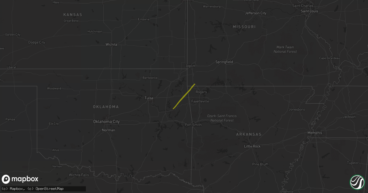
Hail Map on October 29, 2019
Get this storm
October 29 map
$229
one time, instant access
Download today. No call, no setup
Keep the $229
Bought the map and want the full workflow? Apply the entire $229 to a subscription within 7 days. None of it is wasted.
Every map, not just this one
This buys you this map. Subscription and you get every map we run, in the markets you choose from a few cities to whole states to nationwide. Plus real-time alerts the moment a storm fires.
Contact data
Name, contact info, occupancy, even credit band for addresses in the footprint. You go from where it hit to who to call.
Become the source they trust
Unlimited branding weather history reports on demand. You already have the documented answer ready for the property owner, and you are the one who showed up with it.
Property data and RoofTrace estimates
Pull up any address you have got, its value and the exact code rules for that jurisdiction, straight from One Click Code. Then RoofTrace estimates the squares, pitch, and roof value, priced the way you price.
Storm reports
North Carolina
| Date | Description |
|---|---|
| 10/28/201910:59 PM CDT | Several trees down across the southern part of the county. On tree on a power line sparked a fire on rock corner road near forest city. Time estimated on radar. |
Texas
| Date | Description |
|---|---|
| 10/29/20194:50 PM CDT | Multiple trees blew down along fm 1004 north of buna. A barn lost some tin from its roof. |
| 10/29/20194:21 PM CDT | Public pictures of trees snapped on fm 418 near silsbee with additional reports of trees down on fm 418 between silsbee and kountze. Time estimated by radar. |
| 10/29/20194:15 PM CDT | *** 1 inj *** public post of hardin county sheriff reporting winds blowing a small building off of hwy 327 on the road leading to hawthorne field / hardin county airpor |
| 10/29/20194:15 PM CDT | Public pictures of damage to the kountze intermediate school gym... With part of the roof peeled back... And a section of the roof peeled off. Time estimated by radar. |
| 10/29/20194:15 PM CDT | Report of several trees blown down along hwy 326 in kountze. Time estimated by radar. |
| 10/29/20191:55 PM CDT | 20-25 trees blown down. Relayed by em from the police chief. |
| 10/29/20191:20 PM CDT | Late report of some trees down and power outages in the lexington woods neightborhood. |
| 10/29/201912:58 AM CDT | At 557 PM CDT, severe thunderstorms were located along a line extending from near Merryville to near Oretta, moving northeast at 30 mph. HAZARD...60 mph wind gusts and quarter size hail. SOURCE...Radar indicated. IMPACT...Hail damage to vehicles is expected. Expect wind damage to roofs, siding, and trees. Locations impacted include... Rosepine, Merryville, Dry Creek, Singer, De Ridder, Sugartown, Deridder, Dequincy, Longville, Bivens, Tulla, Oretta, Cravens and Bundick Lake. |
Florida
| Date | Description |
|---|---|
| 10/29/20196:13 PM CDT | Local broadcast media relayed a public video of thunderstorm winds near 45 mph along plummers creek drive near interstate 95 and state road 200 in nassau county. The pu |
Louisiana
| Date | Description |
|---|---|
| 10/29/201912:01 AM CDT | At 500 PM CDT, severe thunderstorms were located along a line extending from near Buna to near Wrights Settlement, moving east at 25 mph. HAZARD...60 mph wind gusts and penny size hail. SOURCE...Radar indicated. IMPACT...Expect damage to roofs, siding, and trees. Locations impacted include... Singer, Call, Fields, De Quincy, Dequincy, Wrights Settlement, Devils Pocket, Trout Creek, Bivens, Bancroft, Oretta and Old Salem. |