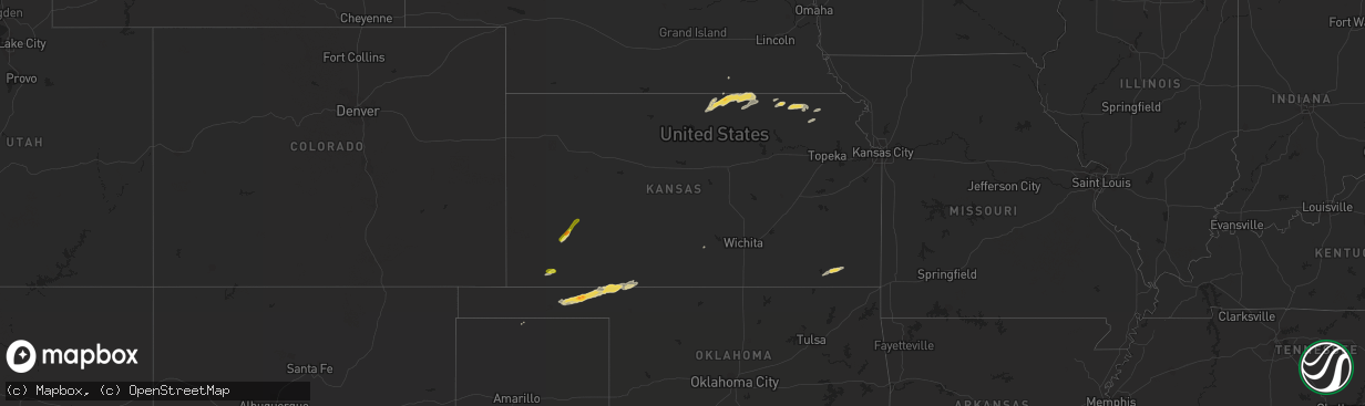
Hail Map on October 28, 2013
The weather event on October 28, 2013 includes Hail map. 3 states and 55 cities were impacted and suffered possible damage. The total estimated number of properties impacted is 217.
Want more than just the map?
Turn this storm into a full workflow.
- Owner + property data so you know who to knock
- OnDemand branded weather history reports to win the "did we even have hail?" argument
- RoofTrace estimate so reps stop guessing numbers at the door
Bought this map? Upgrade within 7 days and we'll credit the $230. (10-15 min setup call)
Hail
217
Estimated number of impacted properties by a 1.00" hail or larger0
Estimated number of impacted properties by a 1.75" hail or larger0
Estimated number of impacted properties by a 2.50" hail or largerStorm reports
Kansas
| Date | Description |
|---|---|
| 10/27/20137:47 PM CDT | A local report indicates 1.00 inch wind near 10 SSE GARDEN CITY |
Wyoming
| Date | Description |
|---|---|
| 10/28/20136:10 PM CDT | Damage to roof at a cafe. Tree branches blown down in town. |
Oklahoma
| Date | Description |
|---|---|
| 10/28/201312:05 AM CDT | A local report indicates 70 MPH wind near 9 W KNOWLES |
| 10/27/201311:00 PM CDT | A local report indicates 1.75 inch wind near BEAVER |
Cities Impacted by Hail Map on October 28, 2013
- Soldier, KS
- Goff, KS
- Havensville, KS
- Home, KS
- Marysville, KS
- Buffalo, OK
- Beaver, OK
- Baileyville, KS
- Vermillion, KS
- Centralia, KS
- Frankfort, KS
- Axtell, KS
- Sublette, KS
- Garden City, KS
- Forgan, OK
- Hugoton, KS
- Gate, OK
- Rosston, OK
- Turpin, OK
- Scandia, KS
- Belleville, KS
- Cherryvale, KS
- Dennis, KS
- Mound Valley, KS
- Courtland, KS
- Munden, KS
- Balko, OK
- Morrowville, KS
- Haddam, KS
- Mahaska, KS
- Narka, KS
- Washington, KS
- Webber, KS
- Jewell, KS
- Formoso, KS
- Moscow, KS
- Seneca, KS
- Ashland, KS
- Hooker, OK
- Allen, KS
- Reading, KS
- Sabetha, KS
- Wetmore, KS
- Independence, KS
- Parsons, KS
- Harveyville, KS
- Republic, KS
- Carleton, NE
- Hebron, NE
- Wakeeney, KS
- Collyer, KS
- Protection, KS
- Kingman, KS
- Ulysses, KS
- Pierceville, KS