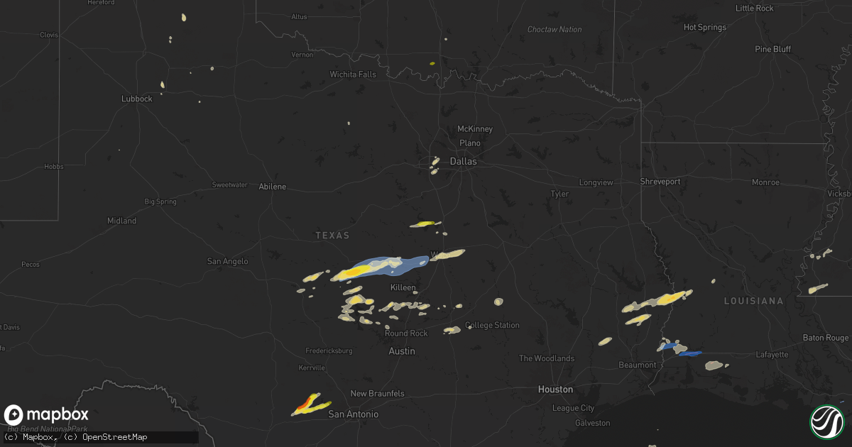
Hail Map on October 25, 2025
Get this storm
October 25 map
$229
one time, instant access
Download today. No call, no setup
Keep the $229
Bought the map and want the full workflow? Apply the entire $229 to a subscription within 7 days. None of it is wasted.
Every map, not just this one
This buys you this map. Subscription and you get every map we run, in the markets you choose from a few cities to whole states to nationwide. Plus real-time alerts the moment a storm fires.
Contact data
Name, contact info, occupancy, even credit band for addresses in the footprint. You go from where it hit to who to call.
Become the source they trust
Unlimited branding weather history reports on demand. You already have the documented answer ready for the property owner, and you are the one who showed up with it.
Property data and RoofTrace estimates
Pull up any address you have got, its value and the exact code rules for that jurisdiction, straight from One Click Code. Then RoofTrace estimates the squares, pitch, and roof value, priced the way you price.
States Impacted by Hail Map on October 25, 2025
Storm reports
Louisiana
| Date | Description |
|---|---|
| 10/24/202511:56 PM CDT | Numerous reports of limbs down in lake charles. |
| 10/24/202511:45 PM CDT | Wind gust from a severe thunderstorm broke a large limb off a tree and blocked part of 9th street. |
| 10/24/202511:45 PM CDT | An ef-0 tornado touched down near the intersection of palermo drive and evangeline street in sulphur. The tornado then tracked across mcmurry park and into the maplewoo |
| 10/24/202511:42 PM CDT | Seeing considerable damage in the hollywood community of sulphur. This is likely from the tornado. |
Idaho
| Date | Description |
|---|---|
| 10/25/20256:20 PM CDT | Power outage for 1053 customers. |
| 10/24/20257:16 PM CDT | Power outage for 3790 customers from crouch... Horsebend to placerville. |
Mississippi
| Date | Description |
|---|---|
| 10/25/20254:12 AM CDT | Report of numerous trees downed across the county; lilly rd... Adams st... Raymond rd... Brownsville rd. |
Oregon
| Date | Description |
|---|---|
| 10/25/20256:13 PM CDT | Asos station kono ontario. |
| 10/24/20258:28 PM CDT | Mesonet station atfo3 antelope. |
Texas
| Date | Description |
|---|---|
| 10/25/20253:55 PM CDT | Kgop. |
| 10/24/202511:07 PM CDT | Photos of large tree limb blown down onto a home in the orange community. Time estimated by radar. |
| 10/24/202510:54 PM CDT | Report of numerous trees down near devils pocket... Texas. Possible tornado. |
Cities Impacted by Hail Map on October 25, 2025
- Sabinal, TX
- D Hanis, TX
- Hondo, TX
- Bandera, TX
- Mico, TX
- Pipe Creek, TX
- Rio Medina, TX
- Spur, TX
- Brady, TX
- Rochelle, TX
- Ralls, TX
- Richland Springs, TX
- Meridian, TX
- Lorenzo, TX
- San Saba, TX
- Morgan, TX
- Whitney, TX
- Clifton, TX
- Goldthwaite, TX
- Hillsboro, TX
- Lometa, TX
- Matador, TX
- Lampasas, TX
- Gatesville, TX
- Copperas Cove, TX
- Evant, TX
- Fort Hood, TX
- Voca, TX
- Purmela, TX
- Aquilla, TX
- Fort Worth, TX
- Burleson, TX
- Mansfield, TX
- Kennedale, TX
- Sarita, TX
- Abbott, TX
- Arlington, TX
- West, TX
- Star, TX
- Jonesboro, TX
- Oglesby, TX
- McGregor, TX
- Crawford, TX
- North Richland Hills, TX
- Hurst, TX
- Haltom City, TX
- Waco, TX
- Woodway, TX
- Lorena, TX
- Silverton, TX
- Cherokee, TX
- Riesel, TX
- Hewitt, TX
- Tow, TX
- Llano, TX
- Lockney, TX
- Mart, TX
- Axtell, TX
- Burnet, TX
- Bertram, TX
- Briggs, TX
- Salado, TX
- Belton, TX
- Bluffton, TX
- Buchanan Dam, TX
- Florence, TX
- Jarrell, TX
- Holland, TX
- Bartlett, TX
- Cameron, TX
- Milano, TX
- Overbrook, OK
- Granger, TX
- Hearne, TX
- Buckholts, TX
- Marble Falls, TX
- Liberty Hill, TX
- Georgetown, TX
- Bryan, TX
- Kingsland, TX
- Saratoga, TX
- North Zulch, TX
- Normangee, TX
- Franklin, TX
- Cleveland, TX
- Kountze, TX
- Loving, TX
- Leander, TX
- Caldwell, TX
- Rockdale, TX
- Thorndale, TX
- Lexington, TX
- Woodville, TX
- Colmesneil, TX
- Jasper, TX
- Warren, TX
- Fred, TX
- Newton, TX
- Burkeville, TX
- Wiergate, TX
- Kirbyville, TX
- Spurger, TX
- Livingston, TX
- Hillister, TX
- Evans, LA
- Leesville, LA
- Deridder, LA
- Seadrift, TX
- Port O'Connor, TX
- Palacios, TX
- Starks, LA
- Orange, TX
- Merryville, LA
- Matagorda, TX
- Woodville, MS
- Dequincy, LA
- Sulphur, LA
- Vinton, LA
- Centreville, MS
- Gloster, MS
- Lacassine, LA
- Bell City, LA
- Cameron, LA
- Lake Arthur, LA
- Iowa, LA
- Natchez, MS
- Roxie, MS
- Lake Charles, LA
- Westlake, LA
- Maurepas, LA
- Hammond, LA
- Loranger, LA