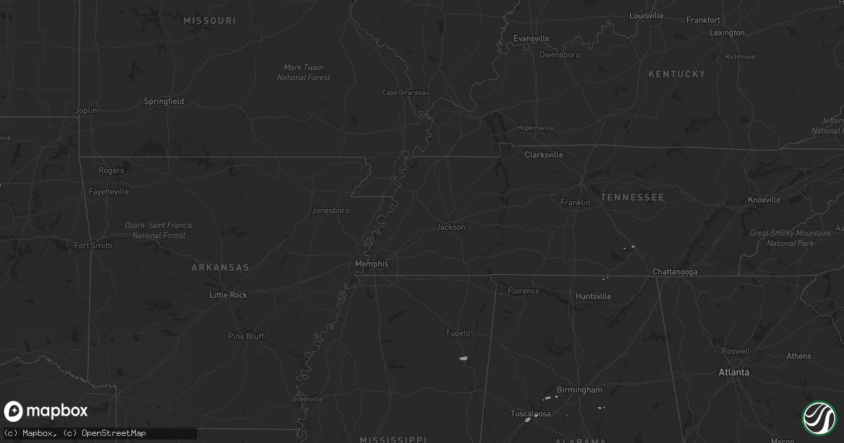
Hail Map on October 14, 2012
Get this storm
October 14 map
$229
one time, instant access
Download today. No call, no setup
Keep the $229
Bought the map and want the full workflow? Apply the entire $229 to a subscription within 7 days. None of it is wasted.
Every map, not just this one
This buys you this map. Subscription and you get every map we run, in the markets you choose from a few cities to whole states to nationwide. Plus real-time alerts the moment a storm fires.
Contact data
Name, contact info, occupancy, even credit band for addresses in the footprint. You go from where it hit to who to call.
Become the source they trust
Unlimited branding weather history reports on demand. You already have the documented answer ready for the property owner, and you are the one who showed up with it.
Property data and RoofTrace estimates
Pull up any address you have got, its value and the exact code rules for that jurisdiction, straight from One Click Code. Then RoofTrace estimates the squares, pitch, and roof value, priced the way you price.
States Impacted by Hail Map on October 14, 2012
Storm reports
Ohio
| Date | Description |
|---|---|
| 10/14/20125:20 PM CDT | Measured wind gust 45 mph |
| 10/14/20125:04 PM CDT | A local report indicates 1.00 inch wind near SIDNEY |
Tennessee
| Date | Description |
|---|---|
| 10/13/20129:45 PM CDT | Thunderstorm winds blew in a large garage door and ripped off a portion of a metal roof from a small hangar at a residence near taft...off ardmore highway 110. Winds es |
Michigan
| Date | Description |
|---|---|
| 10/14/20124:40 PM CDT | A tree was blown down near geiger and walton roads...west of old us 31. |
| 10/14/20124:35 PM CDT | A large tree was reported blown down by thunderstorm winds. Time estimated from radar |
| 10/14/20122:40 PM CDT | Large tree limb blocking washington st near intersection of washington and 3rd. Limb est to be 12 inches in diameter. |
Indiana
| Date | Description |
|---|---|
| 10/14/20123:47 PM CDT | A local report indicates 1.00 inch wind near ANGOLA |
Illinois
| Date | Description |
|---|---|
| 10/14/20123:27 PM CDT | A local report indicates 60 MPH wind near PEOTONE |
| 10/14/20122:28 PM CDT | Tree down on schaumburg and salem road. This tree fell on a private property fence. Possible funnel cloud in the area. This report replaces the previous report of a pos |
| 10/14/20122:25 PM CDT | Large trees uprooted |
| 10/14/20122:16 PM CDT | A local report indicates 1.00 inch wind near SCHAUMBURG |
Kentucky
| Date | Description |
|---|---|
| 10/13/20127:59 PM CDT | Power line down at kentucky state university. |
Mississippi
| Date | Description |
|---|---|
| 10/13/20127:04 PM CDT | Roof removed from home and trees down. Nws storm survey determined the damage to be from thunderstorm winds around 80 mph. |