Hail Map on October 13, 2022
Get this storm
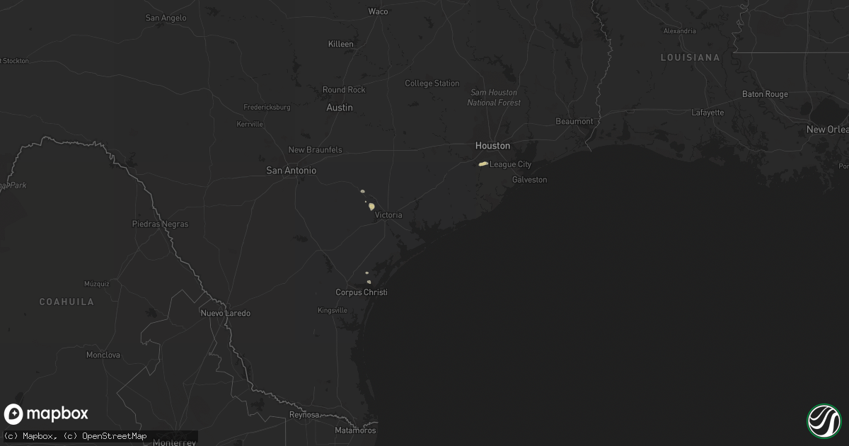
October 13 map
$229
one time, instant access
Download today. No call, no setup
Keep the $229
Bought the map and want the full workflow? Apply the entire $229 to a subscription within 7 days. None of it is wasted.
Every map, not just this one
This buys you this map. Subscription and you get every map we run, in the markets you choose from a few cities to whole states to nationwide. Plus real-time alerts the moment a storm fires.
Contact data
Name, contact info, occupancy, even credit band for addresses in the footprint. You go from where it hit to who to call.
Become the source they trust
Unlimited branding weather history reports on demand. You already have the documented answer ready for the property owner, and you are the one who showed up with it.
Property data and RoofTrace estimates
Pull up any address you have got, its value and the exact code rules for that jurisdiction, straight from One Click Code. Then RoofTrace estimates the squares, pitch, and roof value, priced the way you price.
States Impacted by Hail Map on October 13, 2022
Storm reports
Georgia
| Date | Description |
|---|---|
| 10/13/20227:45 AM CDT | At 1245 AM EDT, a severe thunderstorm was located over Ellabell, moving northeast at 25 mph. HAZARD...60 mph wind gusts. SOURCE...Radar indicated. IMPACT...Expect damage to trees and powerlines. Locations impacted include: Pembroke, Lanier, Eden, Blitchton, Meldrim and Ellabell. This warning includes I-16 between mile markers 141 and 150. |
Mississippi
| Date | Description |
|---|---|
| 10/13/20227:33 AM CDT | At 1232 AM CDT, a severe thunderstorm was located over Durant, moving southeast at 35 mph. HAZARD...60 mph wind gusts and quarter size hail. SOURCE...Radar indicated. IMPACT...Hail damage to vehicles is expected. Expect wind damage to roofs, siding, and trees. This severe thunderstorm will be near... Mcadams and Newport around 1250 AM CDT. Kosciusko around 1255 AM CDT. Thomastown around 100 AM CDT.Other locations impacted by this severe thunderstorm include West andSallis. |
| 10/13/20227:14 AM CDT | At 1213 AM CDT, a severe thunderstorm was located near Steens, or 7 miles west of Millport, moving southeast at 50 mph. HAZARD...60 mph wind gusts. SOURCE...Radar indicated. IMPACT...Expect damage to roofs, siding, and trees. Locations impacted include... Fayette, Gordo, Reform, Millport, Kennedy, Belk, Ethelsville, Ashcraft Corner, Cody, North Pickens Airport, McShan, Shaw, Star, Lubbub, Hightogy, Forest, Macedonia, Melborne and Owens. |
New York
| Date | Description |
|---|---|
| 10/13/20222:20 PM CDT | Wires down. Transformer fire. |
| 10/12/20229:53 PM CDT | At 253 PM EDT, severe thunderstorms were located along a line extending from Candor to Wysox, moving east at 30 mph. HAZARD...60 mph wind gusts. SOURCE...Radar indicated. IMPACT...Expect damage to roofs, siding, and trees. Locations impacted include... Binghamton, Vestal, Johnson City, Endicott, Maine, Rush, Owego, Towanda, Wysox and Nanticoke. |
| 10/12/20229:48 PM CDT | At 248 PM EDT, severe thunderstorms were located along a line extending from 14 miles east of Lowville to Stittville, moving northeast at 35 mph. HAZARD...60 mph wind gusts. SOURCE...Radar indicated. IMPACT...Expect damage to roofs, siding, and trees. Locations impacted include... Old Forge, Ohio, Poland, Inlet, Cold Brook, Brown Tract Pond Campground, Big Moose, Eighth Lake Campground, McKeever, Golden Beach Campground, Limekiln Lake Campground, Nicks Lake Campground, Eagle Bay, Northwood, Raquette Lake, Alger Island Public Campground, Russia, Beaver River, Nobleboro and Quaker Beach. |
| 10/12/20229:42 PM CDT | At 242 PM EDT, severe thunderstorms were located along a line extending from Boonville to near Floyd, moving northeast at 35 mph. HAZARD...60 mph wind gusts. SOURCE...Radar indicated. IMPACT...Expect damage to roofs, siding, and trees. Locations impacted include... Boonville, Forestport, Alder Creek, North Western, Hawkinsville, Pixley Falls State Park, Frenchville and Woodgate. |
| 10/12/20229:22 PM CDT | At 222 PM EDT, a severe thunderstorm was located over Whetstone Gulf State Park, or 15 miles northwest of Boonville, moving northeast at 35 mph. HAZARD...60 mph wind gusts. SOURCE...Radar indicated. IMPACT...Expect damage to trees and power lines. Locations impacted include... Lowville, Highmarket, Whetstone Gulf State Park, New Bremen, Watson, Martinsburg, Lyonsdale, Greig, Port Leyden and Harrisville. |
| 10/12/20228:46 PM CDT | At 146 PM EDT, severe thunderstorms were located along a line extending from near Redfield to Bridgeport, moving east at 35 mph. HAZARD...60 mph wind gusts. SOURCE...Radar indicated. IMPACT...Expect damage to roofs, siding, and trees. Locations impacted include... Rome, Lee, Vienna, Floyd, Whitesboro, Camden, Boonville, Forestport, Oriskany and Steuben. |
Alabama
| Date | Description |
|---|---|
| 10/13/20227:10 AM CDT | At 1210 AM CDT, severe thunderstorms were located along a line extending from near Pala Alto to near Starkville to near Longview, moving east at 50 mph. HAZARD...60 mph wind gusts. SOURCE...Radar indicated. IMPACT...Expect damage to roofs, siding, and trees. Severe thunderstorms will be near... West Point and Muldrow around 1215 AM CDT. Sessums and Tibbee around 1220 AM CDT. Oktoc around 1225 AM CDT. Bent Oak around 1230 AM CDT. Crawford around 1235 AM CDT. Brooksville around 1240 AM CDT. Deerbrook around 1245 AM CDT. Bigbee Valley and Prairie Point around 1255 AM CDT.Other locations impacted by these severe thunderstorms includeArtesia. |
Louisiana
| Date | Description |
|---|---|
| 10/13/20227:02 AM CDT | At 1202 AM CDT, a severe thunderstorm was located 7 miles north of Mansfield, moving southeast at 35 mph. HAZARD...60 mph wind gusts and quarter size hail. SOURCE...Radar indicated. IMPACT...Hail damage to vehicles is expected. Expect wind damage to roofs, siding, and trees. Locations impacted include... Mansfield, Coushatta, Pleasant Hill, South Mansfield, Edgefield, Carmel, Lake End, Evelyn, Grand Bayou, Kingston, Hanna, Pelican, Rambin, Armistead and Ajax. |
| 10/12/202211:21 PM CDT | At 420 AM CDT, a severe thunderstorm was located near Moss Bluff, moving south at 15 mph. HAZARD...60 mph wind gusts. SOURCE...Radar indicated. IMPACT...Expect damage to roofs, siding, and trees. Locations impacted include... Lake Charles, Westlake, Lake Charles Regional Airport, Moss Bluff, Lebleu Settlement and Holmwood.This includes the following highways... Interstate 10 in Louisiana between mile markers 28 and 40. Interstate 210 between mile markers 3 and 12. |
| 10/12/202210:59 PM CDT | At 358 AM CDT, severe thunderstorms were located along a line extending from near Ragley to Kinder, moving south at 35 mph. HAZARD...60 mph wind gusts. SOURCE...Radar indicated. IMPACT...Expect damage to roofs, siding, and trees. Locations impacted include... Kinder, Reeves, Dry Creek, Topsy, Leblanc and Harmony. |
| 10/12/202210:34 PM CDT | At 334 AM CDT, a severe thunderstorm was located near Sugartown, moving south at 25 mph. HAZARD...60 mph wind gusts. SOURCE...Radar indicated. IMPACT...Expect damage to roofs, siding, and trees. Locations impacted include... Dry Creek and Bundick Lake. |
| 10/12/20228:00 PM CDT | At 100 AM CDT, a severe thunderstorm was located near Converse, or 16 miles south of Mansfield, moving southeast at 35 mph. HAZARD...60 mph wind gusts and quarter size hail. SOURCE...Radar indicated. IMPACT...Hail damage to vehicles is expected. Expect wind damage to roofs, siding, and trees. Locations impacted include... Many, Zwolle, Converse, Oak Grove, Pleasant Hill, Provencal, Noble, Fisher, Robeline, Pelican, Belmont and Marthaville. |
Texas
| Date | Description |
|---|---|
| 10/12/20228:58 PM CDT | At 157 AM CDT, a severe thunderstorm was located near Apple Springs, moving southeast at 15 mph. HAZARD...Quarter size hail. SOURCE...Radar indicated. IMPACT...Damage to vehicles is expected. Locations impacted include... Apple Springs and Centralia. |
Pennsylvania
| Date | Description |
|---|---|
| 10/13/20229:31 AM CDT | Trees down on powerlines across the 700 block of keystone rd in brockport. |