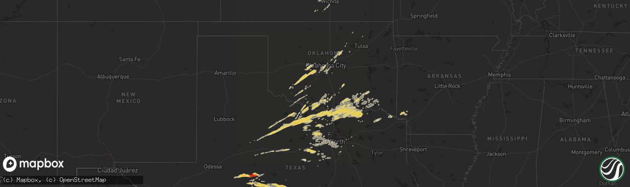
Hail Map on October 13, 2012
The weather event on October 13, 2012 includes Hail map. 7 states and 400 cities were impacted and suffered possible damage. The total estimated number of properties impacted is 0.
Want more than just the map?
Turn this storm into a full workflow.
- Owner + property data so you know who to knock
- OnDemand branded weather history reports to win the "did we even have hail?" argument
- RoofTrace estimate so reps stop guessing numbers at the door
Bought this map? Upgrade within 7 days and we'll credit the $230. (10-15 min setup call)
Hail
0
Estimated number of impacted properties by a 1.00" hail or larger1,877
Estimated number of impacted properties by a 1.75" hail or larger0
Estimated number of impacted properties by a 2.50" hail or largerStorm reports
Texas
| Date | Description |
|---|---|
| 10/13/20126:50 PM CDT | Tornado reported by 2 sources no details yet |
| 10/13/20126:29 PM CDT | Report from a certified weather observer from dyess afb |
| 10/13/20126:29 PM CDT | Report from a certified weather observer from dyess afb |
| 10/13/20126:25 PM CDT | Near bufallo heights |
| 10/13/20126:23 PM CDT | Quarter size hail on the south side of abilene |
| 10/13/20126:10 PM CDT | Golfball hail reported with broken limbs and broken sky lights to home. |
| 10/13/20126:06 PM CDT | Several power poles were knocked down in the view area where highway 277 intersects county road 209 and fm 1235 |
| 10/13/20125:07 PM CDT | A local report indicates 1.00 inch wind near 12 SE BARNHART |
| 10/13/20124:20 PM CDT | Power poles down near hwy 148/2332. |
| 10/13/20124:12 PM CDT | Large overhead doors blown into large red barn. Cattle barn open on south side blown away tearing welds from metal poles cemented into ground. Cemented metal poles on s |
| 10/13/20124:10 PM CDT | Hail was accompanied by wind gusts near 50 mph |
| 10/13/20123:25 PM CDT | Roof damage to home just west of highway 277. A large cattle trailer was also moved approximately 30 yards. |
| 10/13/20122:45 PM CDT | Accompanied by winds up to 60 mph |
| 10/13/20122:45 PM CDT | A local report indicates 60 MPH wind near 2 E ROCHESTER |
| 10/13/20122:30 AM CDT | Some small trees blown down. |
| 10/13/20121:20 AM CDT | A very large shed was blown over near lake buchanan. |
| 10/13/201212:45 AM CDT | A local report indicates 1.00 inch wind near VALLEY SPRING |
| 10/13/201212:45 AM CDT | Trees and phone lines down in clarksville and bogoda. |
| 10/13/201212:10 AM CDT | 4 inch diameter limbs down south side of town |
| 10/12/20129:45 PM CDT | Estimated 60 mph wind gust and pea sized hail near whitesboro |
| 10/12/20129:05 PM CDT | Wind gust 60 to 65 mph at hwy 377 and dixie rd |
| 10/12/20129:05 PM CDT | 60 to 65 mph wind gust at hwy 377 and dixie rd |
| 10/12/20129:00 PM CDT | Quarter size hail reported on south side of town |
| 10/12/20128:40 PM CDT | Quarter size hail reported by off duty nws employee |
| 10/12/20127:37 PM CDT | Spotter reported rain wrapped tornado to the tx dps. |
| 10/12/20127:35 PM CDT | Quarter size hail reported at koa campground |
| 10/12/20127:33 PM CDT | Highway 277 approx 4 miles north of eldorado |
| 10/12/20127:28 PM CDT | Power poles down along highway 277 |
| 10/12/20127:25 PM CDT | A local report indicates 1.00 inch wind near 7 NNW ELDORADO |
| 10/12/20127:23 PM CDT | Sheriff reported golfball size hail north of eldorado. |
| 10/12/20127:19 PM CDT | Rain wrapped tornado moving ne at 15 mph located 4 miles west of the spotter who was located 7 miles nw of dimebox. |
Oklahoma
| Date | Description |
|---|---|
| 10/13/20126:34 PM CDT | A local report indicates 72 MPH wind near 7 E CENTRAILIA |
| 10/13/20126:30 PM CDT | A local report indicates 65 MPH wind near 4 NNE SULPHUR |
| 10/13/20125:53 PM CDT | A local report indicates 61 MPH wind near 3 S HEALDTON |
| 10/13/20125:45 PM CDT | A local report indicates 80 MPH wind near 1 N RINGLING |
| 10/13/20125:30 PM CDT | Flag pole downed by strong winds. |
| 10/13/20125:30 PM CDT | Power pole down off highway 70 from high winds |
| 10/13/20125:24 PM CDT | 4 inch diameter limbs down...time estimated by radar |
| 10/13/20125:04 PM CDT | A local report indicates 70 MPH wind near 2 S WYNONA |
| 10/13/20124:20 PM CDT | Power poles blown down |
| 10/13/20122:00 PM CDT | Power lines down in altus. Part of atwoods sign damaged in altus. |
| 10/12/201210:06 PM CDT | Several reports of a barn like structure in the middle of a road in achille were relayed to the durant police department. |
| 10/12/20129:50 PM CDT | Several large trees down |
| 10/12/20129:50 PM CDT | Several trees down |
| 10/12/20129:32 PM CDT | Spotter just east of talihina reporting sustained winds of 50 mph with gusts over 60 mph. |
| 10/12/20129:15 PM CDT | Several trees were blown down across the street from the durant police department. Multiple power poles are also down across portions of bryan county. |
| 10/12/20129:08 PM CDT | Large trees down |
| 10/12/20129:05 PM CDT | A local report indicates 1.00 inch wind near EUBANKS |
| 10/12/20128:31 PM CDT | 4-5 inch diameter limb down in kiowa...time estimated by radar |
| 10/12/20128:15 PM CDT | A local report indicates 1.00 inch wind near 1 SW KINGSTON |
| 10/12/20128:12 PM CDT | Spotter reported 65 mph wind gust at hwy 69 and interstate 40. |
| 10/12/20128:05 PM CDT | A local report indicates 80 MPH wind near 4 SW LEHIGH |
| 10/12/20128:00 PM CDT | Dead trees were blown over |
Kansas
| Date | Description |
|---|---|
| 10/13/20125:27 PM CDT | Delayed report...storm chaser reported 1.00 hail via spotter network |
| 10/13/20125:23 PM CDT | A local report indicates 65 MPH wind near SSE MINNEAPOLIS |
| 10/13/20125:22 PM CDT | Sheriff reported a power line down from the strong winds in minneapolis. |
| 10/13/20125:15 PM CDT | A local report indicates 1.00 inch wind near 4 NE DELPHOS |
| 10/13/20125:13 PM CDT | A local report indicates 1.00 inch wind near MOUNT HOPE |
| 10/13/20124:36 PM CDT | A local report indicates 1.00 inch wind near ELLSWORTH |
| 10/12/201211:35 PM CDT | A local report indicates 1.00 inch wind near BELOIT |
| 10/12/201210:55 PM CDT | A local report indicates 1.00 inch wind near BURR OAK |
| 10/12/20127:35 PM CDT | Wind gust estimated 60 to 70mph. Large diameter tree branches down in frankfort. |
| 10/12/20127:00 PM CDT | Roof blown off barn near highway 166 and highway 69 |
Kentucky
| Date | Description |
|---|---|
| 10/13/20126:45 AM CDT | Several metal businesses have parts of their roofs gone. The scoreboard at high school football field has damage and is partially blown over. Several trees and power li |
| 10/13/20126:35 AM CDT | *** 1 inj *** ef1 tornado. Top speed 105 mph. Average width 130 yards. Path length 2.25 miles. Minor damage to two dozen homes...mainly shingles...siding...and fascia. |
Arkansas
| Date | Description |
|---|---|
| 10/13/20121:35 AM CDT | Several trees reported down along a line from wilton to fulton...near millwood lake. |
| 10/13/20121:30 AM CDT | A local report indicates 1.50 inch wind near WILTON |
| 10/13/20121:30 AM CDT | A tree snapped and fell through the texarkana country club pool house |
| 10/13/20121:30 AM CDT | Large tree limb fell and damaged powerlines and a street light. |
| 10/13/20121:30 AM CDT | Several tree limbs down around wilton |
| 10/13/20121:30 AM CDT | At least 20 trees have been reported down along the north and northeast side of ashdown. |
| 10/13/20121:15 AM CDT | At least 4 trees reported down on the west side of foreman. |
| 10/12/201211:10 PM CDT | A tree was downed onto highway 103...and was blocking the road. |
| 10/12/201211:05 PM CDT | Large tree limbs were down on area roads. |
| 10/12/201211:01 PM CDT | Emergency management reported thunderstorm wind gust of 60 mph south of ozark. |
| 10/12/201210:48 PM CDT | Power lines were downed in booneville. |
| 10/12/201210:45 PM CDT | A downed tree blocked highway 10. |
| 10/12/201210:40 PM CDT | Large limbs down |
| 10/12/201210:35 PM CDT | Several trees blown down |
| 10/12/20129:49 PM CDT | Report of trees downed near intersection of hwy 62 and hwy 72 southwest of garfield. Trees blocking hwy 62. |
| 10/12/20129:46 PM CDT | Trees and a mobile home damaged. |
| 10/12/20129:46 PM CDT | Wind measured at the rogers airport |
| 10/12/20129:40 PM CDT | Three structures damaged in rogers...with trees down. |
| 10/12/20129:37 PM CDT | Damage associated with a tornado was found on an nws storm survey to be near the pinnacle hills commercial area right off of i-540. Time estimated by radar. More detail |
Missouri
| Date | Description |
|---|---|
| 10/12/20129:15 PM CDT | Public report relayed by local media that a large tree was blown down off hwy a near hardwood road five miles south of marshfield. Time was estimated. |
| 10/12/20128:53 PM CDT | A brief ef-0 tornado with winds estimated up to 80 mph touched down in rural neighborhood on the southwest side of willard off state hwy ab and farm road 94. Several tr |
| 10/12/20128:47 PM CDT | Gusts on the west side of republic. |
| 10/12/20128:44 PM CDT | Small shed and two greenhouses destroyed. |
| 10/12/20128:37 PM CDT | A poorly constructed barn and outbuildings were destroyed and debris was thrown in a fanned out direction to the northeast about 100 yards. |
| 10/12/20128:31 PM CDT | A national weather service storm survey revealed that straight line winds estimated at 70 mph damaged portions of a mobile home and snapped off a tree top. |
| 10/12/20128:20 PM CDT | Trained weather spotter with the volunteer fire dept estimated winds up to 70 mph. Reported lots of small limbs down and leaf debris. |
Cities Impacted by Hail Map on October 13, 2012
- Antlers, OK
- Daisy, OK
- Clayton, OK
- Jermyn, TX
- Buchanan Dam, TX
- Bridgeport, TX
- Springtown, TX
- Perrin, TX
- Whitt, TX
- Paradise, TX
- Poolville, TX
- Baileyville, KS
- Seneca, KS
- Haskell, TX
- Throckmorton, TX
- Filley, NE
- Diller, NE
- Steele City, NE
- Wilton, AR
- Ashdown, AR
- Alleene, AR
- Ladonia, TX
- Walnut Springs, TX
- Wichita Falls, TX
- Temple, OK
- Randlett, OK
- Hinton, OK
- El Reno, OK
- Calumet, OK
- Havensville, KS
- Soldier, KS
- Burnet, TX
- Denison, TX
- Colbert, OK
- Hendrix, OK
- Bokchito, OK
- Durant, OK
- Lorraine, KS
- Brookville, KS
- Ellsworth, KS
- Minneapolis, KS
- Beverly, KS
- Bennington, KS
- Kanopolis, KS
- Lincoln, KS
- Tescott, KS
- Holyrood, KS
- Salina, KS
- Eldorado, TX
- San Angelo, TX
- Saint Jo, TX
- Muenster, TX
- Miltonvale, KS
- Valley View, TX
- Whitesboro, TX
- Gainesville, TX
- Coleman, OK
- Milburn, OK
- Tishomingo, OK
- Ryan, OK
- Henrietta, TX
- Petrolia, TX
- Bonham, TX
- Lexington, TX
- Mankato, KS
- De Kalb, TX
- Claflin, KS
- Hoisington, KS
- Dorrance, KS
- Wilson, KS
- Bertram, TX
- Bluffton, TX
- Tow, TX
- Cherokee, TX
- San Saba, TX
- Melvin, TX
- Llano, TX
- Valley Spring, TX
- Marble Falls, TX
- Eden, TX
- Voca, TX
- Brady, TX
- Kingsland, TX
- Pontotoc, TX
- Covington, TX
- Blum, TX
- Davis, OK
- Forestburg, TX
- Waterville, KS
- Randolph, KS
- Leonardville, KS
- Barnes, KS
- Christoval, TX
- Mertzon, TX
- Stephenville, TX
- Bluff Dale, TX
- Sweetwater, TX
- Nolan, TX
- Onaga, KS
- Madill, OK
- Menard, TX
- Ozona, TX
- Fort McKavett, TX
- Sabetha, KS
- Oneida, KS
- Bern, KS
- Pocasset, OK
- Anadarko, OK
- Minco, OK
- Haysville, KS
- Clearwater, KS
- Peck, KS
- Jacksboro, TX
- Bowie, TX
- Newcastle, TX
- Holliday, TX
- Windthorst, TX
- Bellevue, TX
- Olney, TX
- Gracemont, OK
- Roosevelt, OK
- Chickasha, OK
- Lawton, OK
- Apache, OK
- Carnegie, OK
- Fort Cobb, OK
- Mountain View, OK
- Deport, TX
- Pattonville, TX
- Paris, TX
- Brock, NE
- Nebraska City, NE
- Talmage, NE
- Kingston, OK
- Rattan, OK
- Oklahoma City, OK
- Delphos, KS
- Glasco, KS
- Alvord, TX
- Chico, TX
- Red Cloud, NE
- Atoka, OK
- Caddo, OK
- Caney, OK
- Tolar, TX
- Glen Rose, TX
- Wayne, OK
- Binger, OK
- Wilson, OK
- Berryton, KS
- Waurika, OK
- Spencerville, OK
- Elgin, OK
- Tryon, OK
- Agra, OK
- Cushing, OK
- Loveland, OK
- Faxon, OK
- Chattanooga, OK
- Cache, OK
- Rule, TX
- Stamford, TX
- Ada, OK
- Sanger, TX
- Odell, NE
- Leon, OK
- Wellston, OK
- Luther, OK
- Harrah, OK
- Cook, NE
- Tecumseh, NE
- Garden Plain, KS
- Cheney, KS
- Mount Hope, KS
- Andale, KS
- Haven, KS
- Abilene, TX
- Ringling, OK
- Dodd City, TX
- Ivanhoe, TX
- Marietta, OK
- Lebanon, OK
- Sherman, TX
- Sadler, TX
- Thackerville, OK
- Calera, OK
- Bells, TX
- Telephone, TX
- Pottsboro, TX
- Windom, TX
- Gordonville, TX
- Savoy, TX
- Ravenna, TX
- Cartwright, OK
- Honey Grove, TX
- Mead, OK
- Vancourt, TX
- Hext, TX
- Cisco, TX
- Baird, TX
- Norman, OK
- Fort Sill, OK
- Nocona, TX
- Montague, TX
- Mustang, OK
- Waxahachie, TX
- Blue Rapids, KS
- Cleburne, TX
- Granbury, TX
- Nemo, TX
- Rainbow, TX
- Purcell, OK
- Paoli, OK
- Kennedale, TX
- Arlington, TX
- Bogata, TX
- Blue Springs, NE
- Santo, TX
- Collinsville, TX
- Seymour, TX
- Boswell, OK
- Bennington, OK
- Clay Center, KS
- Dublin, TX
- Kopperl, TX
- Sterling City, TX
- Midlothian, TX
- Venus, TX
- Burleson, TX
- Grand Prairie, TX
- Mansfield, TX
- Cedar Hill, TX
- Fort Worth, TX
- Aurora, KS
- Concordia, KS
- Lincoln, TX
- Paige, TX
- Lane, OK
- Rochester, TX
- Harper, KS
- Burr Oak, KS
- Imogene, IA
- Essex, IA
- Soper, OK
- Hugo, OK
- Caldwell, TX
- Weatherford, TX
- Amber, OK
- Tuttle, OK
- Bryson, TX
- Dime Box, TX
- Conway Springs, KS
- Detroit, TX
- Clarksville, TX
- Maryneal, TX
- Stringtown, OK
- Lipan, TX
- Healdton, OK
- De Leon, TX
- Centralia, KS
- Vermillion, KS
- Mexia, TX
- Ardmore, OK
- Lone Grove, OK
- Carlsbad, TX
- Miles, TX
- Superior, NE
- Kaufman, TX
- Roscoe, TX
- Sulphur, OK
- Lewiston, NE
- Sterling, NE
- Virginia, NE
- Liberty, NE
- Beatrice, NE
- Burchard, NE
- Crab Orchard, NE
- Ranger, TX
- Cuba, KS
- Clyde, TX
- Moran, TX
- Springer, OK
- Exeter, NE
- Mountain Park, OK
- Tipton, OK
- Snyder, OK
- Carbondale, KS
- Fletcher, OK
- Howe, TX
- Johnson, NE
- Dunbar, NE
- Wymore, NE
- Steinauer, NE
- Syracuse, NE
- Lorton, NE
- Burneyville, OK
- Scotland, TX
- Lecompton, KS
- Foreman, AR
- Ingram, TX
- Hunt, TX
- Grandfield, OK
- Devol, OK
- Walters, OK
- Olsburg, KS
- Mason, TX
- Hamlin, TX
- Era, TX
- Mannsville, OK
- Roby, TX
- McCaulley, TX
- Kenefic, OK
- Rotan, TX
- Archer City, TX
- Esbon, KS
- Guide Rock, NE
- Lebanon, KS
- Dawson, NE
- Frankfort, KS
- Loving, TX
- Fort Towson, OK
- Lockesburg, AR
- Beloit, KS
- Wheatland, OK
- Newcastle, OK
- Blanchard, OK
- Graham, TX
- Cleveland, OK
- Jennings, OK
- Goree, TX
- Coalgate, OK
- Milano, TX
- Millsap, TX
- Yukon, OK
- Yale, OK
- Justin, TX
- Red Oak, TX
- Lancaster, TX
- Axtell, KS
- Beattie, KS
- Bristow, OK
- Junction, TX
- Decatur, TX
- Burrton, KS
- Sedgwick, KS
- Lyons, KS
- Geneseo, KS
- Mountain Home, TX
- Lookeba, OK
- Nelson, NE
- Carney, OK
- Tecumseh, KS
- Chandler, OK
- Perkins, OK
- Choctaw, OK
- Electra, TX
- Harrold, TX
- Meridian, TX
- Wapanucka, OK
- Bushton, KS
- Longford, KS
- Merkel, TX
- Arcadia, OK
- Jones, OK
- Wynona, OK
- Pawhuska, OK
- Sumner, TX
- Byers, TX
- Loco, OK
- Ratliff City, OK
- Duncan, OK
- Graham, OK
- Azle, TX
- Haslet, TX
- Roff, OK
- Avery, TX
- Green, KS
- Wichita, KS
- Palmer, KS
- Morganville, KS
- Clifton, KS
- Ramona, OK
- Fitzhugh, OK
- Cameron, TX
- Mineral Wells, TX
- Boyd, TX
- Aledo, TX
- Naval Air Station Jrb, TX
- Gordon, TX
- Mingus, TX
- Hamburg, IA
- Mesquite, TX
- Rosston, TX
- Saint Joseph, MO
- Rockwall, TX
- Royse City, TX
- O'Brien, TX
- Munday, TX
- Weinert, TX
- Liberty Hill, TX