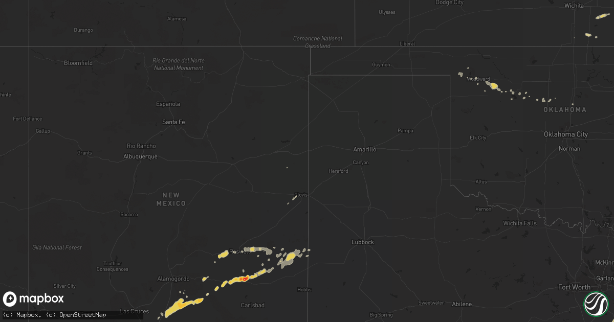
Hail Map on October 11, 2012
Get this storm
October 11 map
$229
one time, instant access
Download today. No call, no setup
Keep the $229
Bought the map and want the full workflow? Apply the entire $229 to a subscription within 7 days. None of it is wasted.
Every map, not just this one
This buys you this map. Subscription and you get every map we run, in the markets you choose from a few cities to whole states to nationwide. Plus real-time alerts the moment a storm fires.
Contact data
Name, contact info, occupancy, even credit band for addresses in the footprint. You go from where it hit to who to call.
Become the source they trust
Unlimited branding weather history reports on demand. You already have the documented answer ready for the property owner, and you are the one who showed up with it.
Property data and RoofTrace estimates
Pull up any address you have got, its value and the exact code rules for that jurisdiction, straight from One Click Code. Then RoofTrace estimates the squares, pitch, and roof value, priced the way you price.
States Impacted by Hail Map on October 11, 2012
Storm reports
Nevada
| Date | Description |
|---|---|
| 10/10/201210:40 PM CDT | Dime to quarter size hail was reported on hollywood boulevard in east las vegas. The windshield on one car was cracked. |
New Mexico
| Date | Description |
|---|---|
| 10/11/20124:02 AM CDT | A local report indicates 1.75 inch wind near 2 NE ARTESIA |
| 10/11/20124:00 AM CDT | Baseball size hail. Highway 285 and state road 2.damage originated there and continued north towards the county line. Roof and car damage. |
| 10/11/20123:45 AM CDT | A local report indicates 1.00 inch wind near 3 NNE ARTESIA |
California
| Date | Description |
|---|---|
| 10/10/20127:23 PM CDT | A local report indicates 1.00 inch wind near 11 S PAHRUMP W7LAS |
Missouri
| Date | Description |
|---|---|
| 10/11/20124:43 AM CDT | A local report indicates 1.00 inch wind near REPUBLIC |
Arizona
| Date | Description |
|---|---|
| 10/11/20129:00 AM CDT | Trained spotter in topock reported quarter sized hail. The hail lasted about 10 minutes. |
Cities Impacted by Hail Map on October 11, 2012
- Golden City, MO
- Lockwood, MO
- Liberal, MO
- Lamar, MO
- Roswell, NM
- Las Vegas, NV
- Nellis Afb, NV
- Okeene, OK
- Hope, NM
- Cloudcroft, NM
- Corsicana, TX
- Rice, TX
- Henderson, NV
- Artesia, NM
- North Las Vegas, NV
- Needles, CA
- Lake Arthur, NM
- Latham, KS
- Atlanta, KS
- Hagerman, NM
- Powell, TX
- Kemp, TX
- Kerens, TX
- Chatfield, TX
- Erie, KS
- Savonburg, KS
- Stark, KS
- Mooreland, OK
- Miller, MO
- Tonto Basin, AZ
- Chester, OK
- Uniontown, KS
- Sharon, OK
- Woodward, OK
- Winfield, KS
- Delaware, OK
- S Coffeyville, OK
- Wann, OK
- Coffeyville, KS
- Payson, AZ
- Clovis, NM
- Tatum, NM
- Portales, NM
- Steelville, MO
- La Russell, MO
- Ash Grove, MO
- South Greenfield, MO
- Mount Vernon, MO
- Everton, MO
- Murray, KY
- McClure, IL
- Nowata, OK
- Timberon, NM
- Hurricane, UT
- Chanute, KS
- Jean, NV
- Baker, CA
- Billings, MO
- Republic, MO
- Seiling, OK
- Hennessey, OK
- Independence, KS
- Lone Pine, CA
- Tecopa, CA
- Picacho, NM
- Millersville, MO
- Oak Ridge, MO
- Jackson, MO
- Oronogo, MO
- Young, AZ
- Mayhill, NM
- Buffalo, OK
- Amargosa Valley, NV
- Kingman, AZ
- Cuba, MO
- Cape Girardeau, MO
- Mutual, OK
- Golden Valley, AZ
- Friedheim, MO
- Fargo, OK
- Marionville, MO
- Bois D Arc, MO
- Douglass, KS
- Longdale, OK
- Fairview, OK
- New Concord, KY
- Jasper, MO
- Lenapah, OK
- Dearing, KS
- Caney, KS
- Overton, NV
- Bullhead City, AZ
- Fort Mohave, AZ
- Mulhall, OK
- Isabella, OK
- Lovington, NM
- Sedgewickville, MO
- Globe, AZ